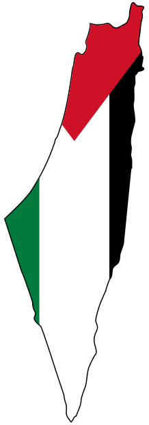
Tulkarm before the Nakba: orchards, Kadoorie and the railway
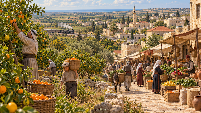
Tulkarm before the Nakba was a town that faced the plain as much as it leaned on the hills. Fields and citrus groves (bayyarat) surrounded it; in its streets villagers met merchants, students and officials; and its railway station linked it to roads far beyond. The sea lay only about fifteen kilometres away, and the town grew where the coast met Nablus and its eastern villages. [1][2]
In Tulkarm, the Kadoorie Agricultural School made the land a classroom, and at al-Fadiliyya the sons of the town and villages completed their secondary education. [3][4]
Then came the Nakba. The town remained outside the control of Israeli forces in 1948, but those forces expelled the people of villages in its district, such as Miska and Qaqun, and the 1949 armistice then took the lands of the western plain, putting the armistice line on the town’s edge. Refugees from Haifa, Jaffa and Caesarea arrived, and the Tulkarm and Nur Shams camps were built for them. [5][6][9][11][23]
Contents
- Tulkarm before the Nakba at a glance
- The name: from “Tur Karm” to Tulkarm
- Location: where the coastal plain meets the Nablus hills
- From village to district seat
- Tulkarm’s population before the Nakba
- Farming: citrus, watermelons, grain and olives
- Kadoorie: when education went into the field
- Industry and crafts
- Markets: where town and countryside met
- The railway: Tulkarm in Palestine’s network
- Houses and architecture
- Customs, hospitality and cafés
- Women: education and national memory
- Education: al-Fadiliyya and the schools of town and village
- Health
- Culture and literature: Abu Salma
- The Great Revolt: Tulkarm and its countryside against the Mandate
- The Nakba: the expulsion of the villages
- The 1949 armistice: land taken with ink
- The Tulkarm and Nur Shams camps
- What changed in Tulkarm after the Nakba?
- From the Nakba to occupation: Tulkarm and its camps after 1967
- Frequently asked questions about Tulkarm before the Nakba
Tulkarm before the Nakba at a glance
| Item | Details |
|---|---|
| Location | Where the coastal plain meets the Nablus hills, about 15 km from the sea |
| Administrative role | Seat of the Bani Sa‘b district from 1892 |
| Town population | 3,349 (1922), 5,368 (1931), 8,090 (1945) |
| Main economic activities | Citrus, watermelons, vegetables, grain and olives; trade |
| Institutions | Kadoorie Agricultural School (1930), al-Fadiliyya, the girls’ school, the government hospital |
| In the Nakba | Villages of the district depopulated; western plain lands taken in the 1949 armistice |
| Camps | Tulkarm (1950) and Nur Shams (1952) |
| Occupation of the town | June 1967 |
Population figures are for the town alone, not the villages of the district or the camps set up after the Nakba. [1][2][3][4][5][6][23]
The name: from “Tur Karm” to Tulkarm
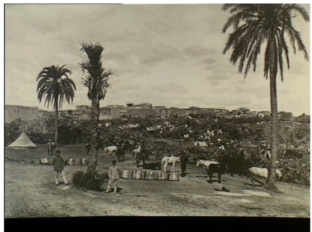
Riwaq links the name Tulkarm to the form “Tur Karm”, “mountain of vineyards”, which became “Tul Karm” and then merged into the familiar name, preserving a link between high ground and vineyards. [7]
Read also: Tulkarm, its photographs and depopulated villages.
Location: where the coastal plain meets the Nablus hills
Tulkarm lies at the transition between the Palestinian coastal plain and the highlands to the east, making it a market for the produce of different environments and a passage between coast and interior; roads and the railway made it a link in a wider network. [1][2]
From village to district seat
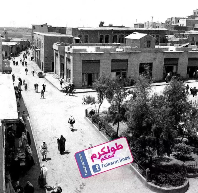
Tulkarm’s designation as the seat of the Bani Sa‘b district in 1892 drove its administrative and urban growth: government offices, courts and police brought villagers to town, needing transport, lodging, food and trade. [1][7]
The tie with the villages ran both ways: the town drew crops, workers, customers and students, and the countryside found services there not available in every village, from Shuwayka, Dhinnaba and Anabta to Qaqun and Saffarin. [3]
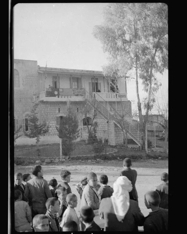
Tulkarm’s population before the Nakba
The town’s population more than doubled under the Mandate, according to WAFA, as Tulkarm grew in building, education and trade before the Nakba changed the direction of that growth. [1]
| Year | Town population |
|---|---|
| 1922 | 3,349 |
| 1931 | 5,368 |
| 1945 | 8,090 |
Farming: citrus, watermelons, grain and olives
Farming around Tulkarm followed land and water: citrus, watermelons and vegetables on the western plains, grain and olives elsewhere in the district. Watermelons and citrus reached markets across Palestine and Transjordan. [2]
Bayyarat Hannun is an example of the communities that grew with citrus farming; in Palestinian usage a bayyara is a citrus grove. In Miska, water and wells allowed citrus alongside grain, vegetables and watermelons, according to Walid Khalidi. [8][9]
Umm Khalid was known for wide watermelon fields from the nineteenth century, and Qaqun combined farming, a market and a position on the roads near Tulkarm. [10][11]
Read also: Agriculture in Palestine before the Nakba; Life in the Palestinian village.
Kadoorie: when education went into the field
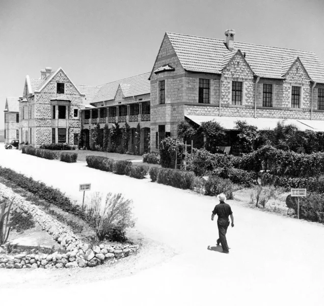
The Kadoorie Agricultural School was founded in 1930 and began teaching in January 1931. It combined theory with practical training, with boarding, teaching facilities and a farm, linking study to production. [4][12]
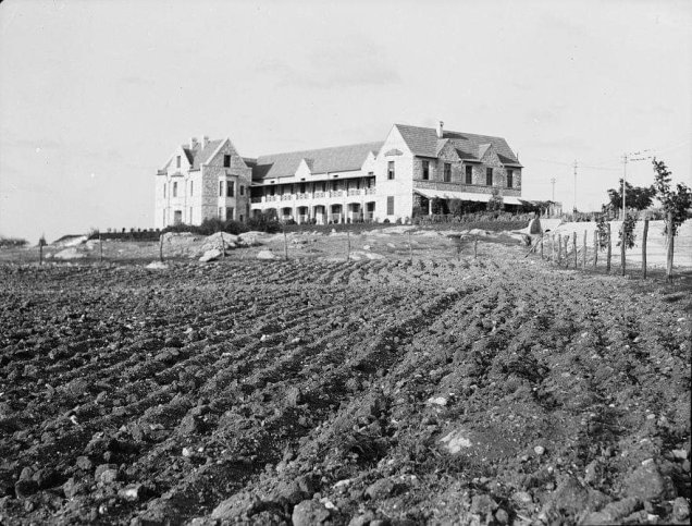
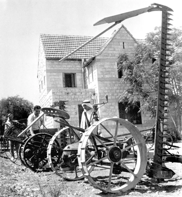
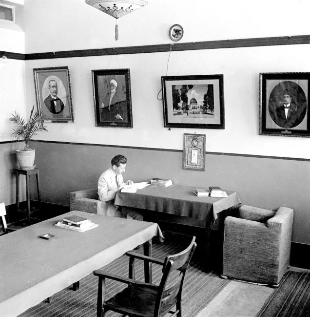
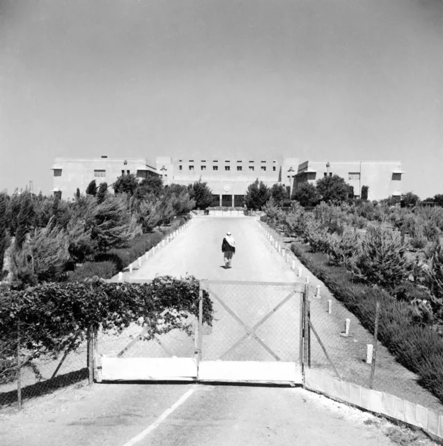
Archival photographs show the school’s fields and machinery, and students working with milk as part of training in animal husbandry. In 1945–46 it had 62 students. [3][13]
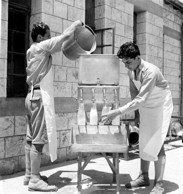
The school was a small community of students, teachers and workers, as photographs of the teachers’ room in 1940 and of the buildings and gardens in 1937 show. [13]
Industry and crafts
Like the rest of Palestine, Tulkarm and its surroundings had olive presses, mills, workshops and home crafts linking rural production with people’s needs. The Palestinian Encyclopedia mentions a carpet factory in the town before the Nakba. [2][14]
Read also: Palestinian industries before the Nakba.
Markets: where town and countryside met
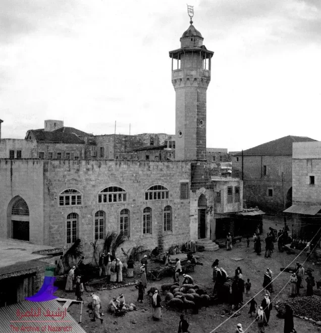
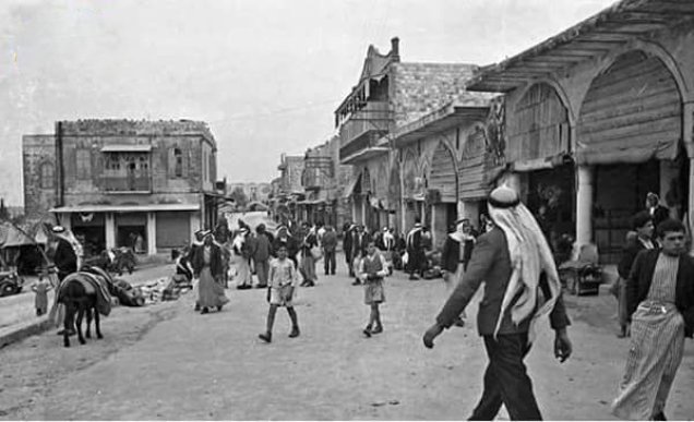
A 1931 photograph of the old mosque and market shows worship, trade and crowds side by side. The market turned the variety of environments into exchange, linking producers, merchants, transport and the coastal towns. [13][15]
Read also: Markets and trade in Palestine before 1948.
The railway: Tulkarm in Palestine’s network
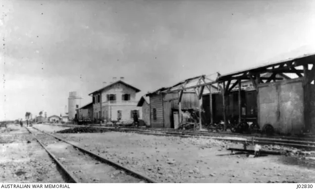
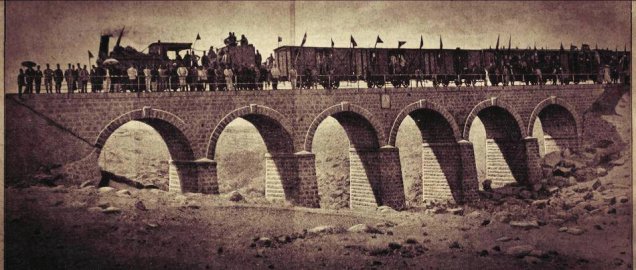
The railway connected Tulkarm with coastal and inland routes, and a photograph of its station is dated 2 January 1917. Riwaq notes the influence of the Haifa–Sinai line on the town’s buildings and roofs. [2][7][13]
Houses and architecture
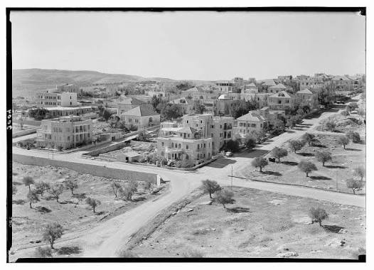
A 1996 Riwaq survey counted hundreds of old buildings in Tulkarm, most of them single-storey, with varied roofs and construction; Riwaq reads the frequent use of iron in roofs as a sign of the town’s expansion in the early twentieth century. [7]
Customs, hospitality and cafés
Tulkarm and its countryside belonged to the Palestinian cultural world, with customs built around family, neighbours and seasons: coffee for guests, folk song at celebrations, embroidery, and shared joys and sorrows. [16]
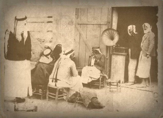
The Tulkarm gallery preserves a photograph of a popular café in 1925, a reminder that town life included places to meet and trade news. [13]
Read also: Palestinian weddings before the Nakba.
Women: education and national memory
Before the Nakba Tulkarm had a girls’ school with about 700 pupils in 1944–45. Oral history studies reveal the roles of women from its countryside in the Great Revolt, among them Halima Muhammad al-Hajj Muhammad, sister of the commander Abd al-Rahim al-Hajj Muhammad, whose part, and that of other women, in supplying rebels, carrying messages and protecting fighters is examined by the researcher Faiha Abdulhadi. [3][17]
Education: al-Fadiliyya and the schools of town and village
The Rushdiyya school was among the district’s leading schools in the Ottoman period, drawing village students. Under the Mandate, al-Fadiliyya became a full secondary school with boarding for rural students, alongside elementary schooling, the girls’ school and Kadoorie. [3]
| School | Year | Pupils |
|---|---|---|
| Boys’ schools: elementary and al-Fadiliyya | 1944–1945 | About 1,300 |
| Girls’ school | 1944–1945 | About 700 |
| Kadoorie Agricultural School | 1945–1946 | 62 |
The district had schools in Qaqun, Shuwayka, Anabta, Attil, Deir al-Ghusun and elsewhere, and local people helped fund them and pay some teachers. [3]
Read also: Palestinian education before 1948.
Health
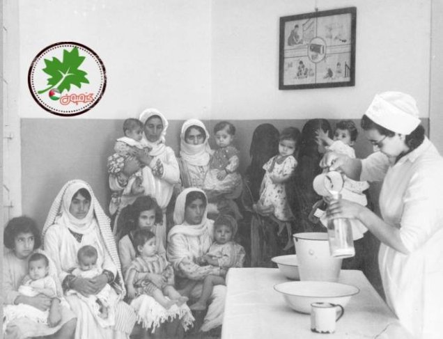
The roots of Tulkarm Government Hospital, known today as Martyr Thabet Thabet Hospital, go back to the Ottoman period, according to the Palestinian Ministry of Health. [18]
Read also: Health in Palestine before the Nakba.
Culture and literature: Abu Salma
Abd al-Karim al-Karmi, known as Abu Salma, was born in Tulkarm in 1909, worked as a teacher, took refuge in Damascus in the Nakba, and became one of the Palestinian poets who joined national liberation with longing for the homeland. [19]
Read also: Palestinian poets before the Nakba.
The Great Revolt: Tulkarm and its countryside against the Mandate
Among the foremost commanders of the 1936–1939 revolt was Abd al-Rahim al-Hajj Muhammad of Dhinnaba, next to Tulkarm, who organised the revolt and led the Triangle region until he was killed in 1939. [20]
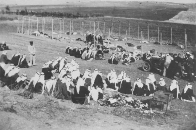
The Mandate authorities, for their part, seized the Kadoorie School during the revolt and turned it into a detention camp for Palestinians in 1938: a place built to teach farming became a place of imprisonment. [4][13]
The Nakba: the expulsion of the villages
Tulkarm remained outside the control of Israeli forces in the 1948 war, but those forces expelled the people of villages in its district:
- Miska: attacked by Zionist forces, its people expelled on 20–21 April 1948; it had a mosque, a school and water sources. [9]
- Qaqun: attacked by Zionist forces in June 1948 and its people expelled; it combined farming, a market and a school. [11]
- Wadi al-Hawarith: a long struggle over its land preceded the Nakba, followed by attacks, expulsion and destruction in 1948. [22]
Read also: Umm Khalid; Bayyarat Hannun; Kafr Saba; Depopulated Palestinian villages; Massacres.
The 1949 armistice: land taken with ink
Tulkarm’s losses did not end when the fighting stopped. In the 1949 armistice agreement with Jordan at Rhodes, parts of the three towns that make up the greater Triangle, Nablus, Tulkarm and Jenin, were severed and placed under Israeli control; the armistice line ran along Tulkarm’s western edge, cutting the town off from part of its land and plain. [2][23]
Khirbat Khuraysh shows that expulsion did not stop with the war: the village passed under Israeli control in 1949, and its people were expelled later. [21]
The Tulkarm and Nur Shams camps
Refugees reached Tulkarm during the war, and UNRWA later set up two camps on its edges. [5][6]
| Camp | Founded (UNRWA) | Origins |
|---|---|---|
| Tulkarm camp | 1950 | Refugees from towns and villages of the Haifa, Jaffa and Caesarea areas |
| Nur Shams camp | 1952 | Refugees who moved from the Jenin area after a snowstorm destroyed their tents |
Read also: Palestinian refugee camps.
What changed in Tulkarm after the Nakba?
| Area | Before the Nakba | What the Nakba did |
|---|---|---|
| Land | Fields and groves joined to the western plain | Land taken by the armistice line; villagers expelled |
| Trade and transport | Movement between coast, town and interior | The road to the coast cut |
| Population | A growing town | Refugees received; two camps set up |
| Society | Kinship tied to the villages | Families scattered; village memory carried into town and camps |
The table summarises what the sections above show about the Nakba’s impact on the town. [2][5][6][23]
From the Nakba to occupation: Tulkarm and its camps after 1967
Israel occupied Tulkarm with the West Bank in 1967. [2]
In January and February 2025 the occupation army launched Operation “Iron Wall”, expelling the people of the Tulkarm and Nur Shams camps, along with Jenin camp, more than 33,000 refugees, and barring their return. By October 2025, 48% of the buildings in Nur Shams and 36% in Tulkarm camp had been destroyed or damaged. Human Rights Watch described the expulsion as a war crime, a crime against humanity and ethnic cleansing. [24][25]
So the refugees of Haifa, Jaffa and Caesarea were expelled a second time, more than seven decades after their first Nakba.
Frequently asked questions about Tulkarm before the Nakba
Where does the name Tulkarm come from?
From “Tur Karm”, “mountain of vineyards”, which became Tulkarm. [7]
What was Tulkarm’s population before the Nakba?
About 8,090 in 1945, not counting the villages of the district. [1]
What was Tulkarm’s farming known for?
Citrus, watermelons and vegetables on the plain; grain and olives in the district. [2][9][10]
When was Kadoorie School founded?
In 1930; teaching began in January 1931. It was an agricultural school before it became a university. [4][12]
Was Tulkarm occupied in 1948?
No. It stayed outside the control of Israeli forces, but lost its western plain lands in the 1949 armistice, and was occupied in 1967. [2][23]
Who were Tulkarm’s notable figures before the Nakba?
The poet Abd al-Karim al-Karmi (Abu Salma) and the revolt commander Abd al-Rahim al-Hajj Muhammad of nearby Dhinnaba. [19][20]
When were the Tulkarm and Nur Shams camps set up?
Tulkarm camp in 1950 and Nur Shams in 1952, according to UNRWA. [5][6]
Read also on Palestinuna
- Tulkarm archive and photographs
- Tulkarm camp
- Nur Shams camp
- Depopulated villages
- Zionist massacres
- Palestine before the Nakba
Sources and references
- Palestinian National Information Center – WAFA, “Tulkarm” (in Arabic).
- Palestinian Encyclopedia, “Tulkarm (city)” (in Arabic).
- Palestinian National Information Center – WAFA, “Education under the British Mandate,” Tulkarm district section, citing Mustafa Murad al-Dabbagh (in Arabic).
- Palestine Technical University – Kadoorie, “History of the University” (in Arabic).
- UNRWA, “Tulkarm Camp”.
- UNRWA, “Nur Shams Camp”.
- Riwaq, “Register of Historic Buildings: Tulkarm” (in Arabic).
- Palestinuna, “Bayyarat Hannun”.
- Institute for Palestine Studies – PalQuest, “Miska,” from Walid Khalidi’s All That Remains (in Arabic).
- Palestinuna, “Umm Khalid”.
- Palestinuna, “Qaqun”.
- Palestine Technical University – Kadoorie, “About the University” (in Arabic).
- Palestinuna, “Tulkarm photo gallery”.
- Palestinian National Information Center – WAFA, “The Palestinian Economy under the British Mandate” (in Arabic).
- Palestinuna, “Markets and Trade in Palestine before 1948”.
- Palestinian National Information Center – WAFA, “National List of Palestinian Intangible Cultural Heritage” (in Arabic).
- Faiha Abdulhadi, “Halima Muhammad al-Hajj Muhammad: Entering the Space of Memory,” Nawa, 2015 (in Arabic).
- Palestinian Ministry of Health, “Tulkarm Government Hospital: 2016 Review” (in Arabic).
- Palestinian National Information Center – WAFA, “Abd al-Karim al-Karmi (Abu Salma)” (in Arabic).
- Palestinian Encyclopedia, “Abd al-Rahim al-Hajj Muhammad” (in Arabic).
- Palestinuna, “Khirbat Khuraysh”.
- Palestinuna, “Wadi al-Hawarith”.
- “The Triangle Region between Settlement and Exchange,” Al Jazeera Net, 31 May 2011 (in Arabic).
- “UN Report Documents the Occupation’s Displacement of over 33,000 Palestinians from Northern West Bank Camps,” Qatar News Agency, 4 September 2026 (in Arabic).
- Human Rights Watch, “West Bank: Israel’s Emptying of Refugee Camps a Crime against Humanity,” 20 November 2025.
More from the archive
 Download Our Palestine App
The whole archive in the palm of your hand: depopulated villages, the Nakba, the massacres and Al-Aqsa — free, with no ads to erase the story.

Comments
No comments yet — be the first to write one.
Add your comment
Name and email are optional. Comments appear after review.