
The depopulated village of Iqrit / District of Akka (Acre)

About the depopulated village of Iqrit
- District
- Akka (Acre)
- Date Iqrit was occupied
- 31 October 1948
- Population in 1948
- 570
- Military operation
- Operation Hiram
- Brigade that carried it out
- The Oded Brigade
- Distance from the governorate centre
- 25.5 (km) Northeast of Acre
- Elevation above sea level
- 550 m
- Cause of displacement
- Expulsion by Zionist troops
- Extent of destruction
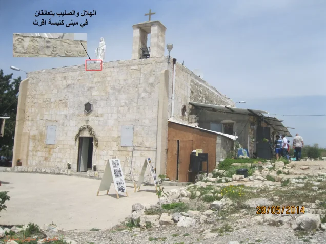
- Iqrit was mostly destroyed with the exception of the village church. However, it requires renovations, any volunteers guys!
- Ethnic cleansing
- In November 1948, Iqrit was completely ethnically cleansed.
- Settlements built on the built-up area of Iqrit after 1948
- Granot Hagalil, Goren
- Refugees' migration routes
- Some of the refugees were bused to Lebanon, to al-Rashedyah refugee camp, and the rest were bused al-Rama, 20 km south.
Hover a dot to read the village name, or click to open its card.
Borders of the depopulated village of Iqrit
Iqrit: A Depopulated Palestinian Village in the Acre District
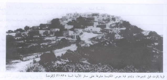
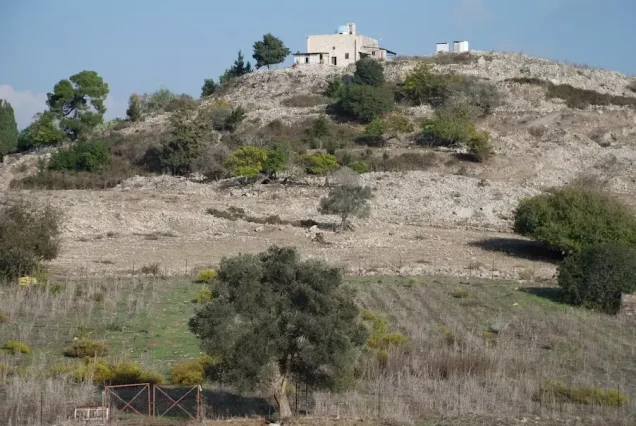
Iqrit was a depopulated Palestinian village in the Acre District, located approximately 25.5 kilometers from Acre on a steep hill a few kilometers from the Lebanese border, at an average elevation of about 550 meters above sea level. The village overlooked rugged terrain to the east and Wadi al-Bassa, descending toward the Mediterranean coast, to the west.
The Government of Palestine's 1944/1945 statistics recorded 490 inhabitants, including 460 Christians and 30 Muslims, and a total land area of 24,722 dunums. The 'Oded Brigade occupied Iqrit on 31 October 1948 at the end of Operation Hiram, but the villagers remained in their homes after the occupation. Several days later they were ordered to leave temporarily and were promised that they would return. They were never permitted to resettle the village, and in Christmas 1951 the Israeli army demolished its houses despite an earlier court ruling that there was no legal obstacle preventing the villagers from returning.
Location of Iqrit
- Iqrit was approximately 25.5 kilometers from Acre according to PalQuest.
- Its average elevation was about 550 meters above sea level.
- The village stood on a steep hill only a few kilometers from the Lebanese border.
- It overlooked rugged terrain to the east and Wadi al-Bassa to the west.
- A secondary road connected the village with the coastal highway between Acre and Ra's al-Naqura.
- Tarbikha was one of the principal villages to its north, while Fassuta and Dayr al-Qasi lay in the eastern area, Mi'ilya to the south, and Khirbat 'Iribbin to the west.
Iqrit Through History
Settlement at the site of Iqrit may date back to the Canaanite period. Walid Khalidi records a tradition that the Canaanites erected a statue of Melqart, the deity associated with Tyre, at the site. This is presented as a possible historical association rather than a conclusively established archaeological identification.
During the Crusader period, the village was occupied and referred to as Acref. It suffered destruction during the Crusades but was subsequently rebuilt.
In 1596, Iqrit was recorded in the nahiya of Tibnin within the liwa' of Safad and had an estimated population of approximately 374. Its inhabitants paid taxes on goats, beehives, and a press used for processing either olives or grapes.
By the late nineteenth century, the population was estimated at about 100. The village buildings were constructed of stone, there was a church, and fig and olive trees were cultivated around the tell.
Iqrit and the Palestine–Lebanon Boundary
Iqrit was one of the northern border villages whose administrative status was affected by the post-First World War demarcation of Palestine and Lebanon.
When the British and French finalized the boundary between Palestine and Lebanon in 1923, Iqrit was incorporated into Palestine.
For this reason, Iqrit does not appear as a separate village in the 1922 Census of Palestine, which preceded the final incorporation of the area into the Palestinian administration. The village does appear in the 1931 census.
Population of Iqrit
The 1931 Census of Palestine recorded 339 inhabitants in Iqrit living in 50 houses.
By the Government of Palestine's 1944/1945 statistics, the population had increased to 490, comprising 460 Christians and 30 Muslims.
The Christian majority was associated principally with the Greek Catholic Church, while a Muslim minority also lived in the village.
The figures of 568 inhabitants for 1948 and 3,491 refugees for 1998 published by Palestine Remembered are later demographic estimates rather than official Government of Palestine censuses.
Population of Iqrit
- 1596About 374Historical estimate based on Ottoman records
- Late 19th centuryAbout 100Historical estimate
- 1931339Official census
- 1944/1945490Government of Palestine statistics: 460 Christians and 30 Muslims
- 1948568Later estimate published by Palestine Remembered
- 19983,491Later refugee-population estimate published by Palestine Remembered
Number of Houses in Iqrit
The 1931 Census of Palestine recorded 50 houses in Iqrit.
The figure of 83 houses for 1948 published by Palestine Remembered is a later estimate rather than the result of an official census conducted that year.
Number of Houses in Iqrit
- 193150Official census
- 194883Later estimate published by Palestine Remembered
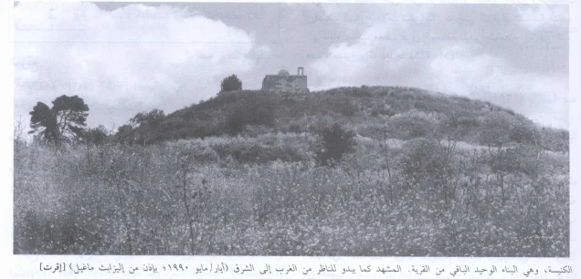
The Church of Iqrit
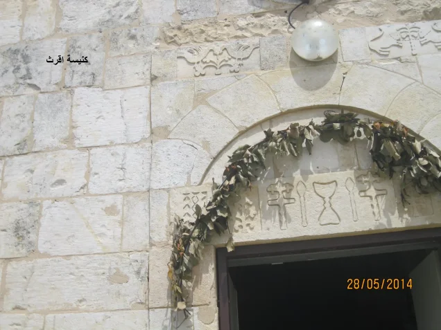
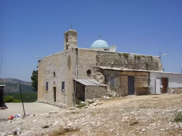
The church was one of Iqrit's principal landmarks and the center of much of the religious and social life of its Christian population.
The Iqrit Community Association and Palestinian Villages Encyclopedia record that the surviving church was constructed in 1875 on the site of an earlier church built in 1635, which itself had replaced an older church of unknown date.
The church stands on the highest part of the village hill and was one of the few structures to survive the demolition of Iqrit in 1951.
Education in Iqrit
The Greek Catholic Archdiocese established and administered a private elementary school in Iqrit.
The school served village children before the Nakba, although the principal sources used here do not provide a sufficiently documented founding year or enrollment figure.
Iqrit's Lands and Differences Between the Sources
Two important sets of figures exist for the area of Iqrit's lands and should not be conflated.
According to documentation by Dr. Ibrahim Rizq 'Atallah based on a cadastral map confirmed in Acre in February 1935, Iqrit's lands were divided into fifteen sections totaling 24,591 dunums.
The same source states that the 1928 property-tax assessment listed 16,264 dunums, in addition to 8,327 dunums whose boundaries were disputed with Fassuta, Mi'ilya, and Tarshiha, producing the total of 24,591 dunums.
The Government of Palestine's 1944/1945 statistics give a slightly different total of 24,722 dunums. This latter figure is used in the official ownership and land-use tables below because it corresponds to the statistical year concerned.
Land Ownership in Iqrit
The Government of Palestine's 1944/1945 statistics recorded a total of 24,722 dunums for Iqrit and no Jewish land ownership.
The Arabic Palestine Remembered table uses the categories “Palestinian,” “Transferred to Zionists,” and “Masha'.” These terms are retained below as that source's terminology. The official Government of Palestine categories for the same figures were “Arab” and “Public.”
Land Ownership in Iqrit, 1944/1945, Using Palestine Remembered Terminology
- Palestinian21,711 dunums88%
- Transferred to Zionists0 dunums0%
- Masha' (source terminology)3,011 dunums12%
Land Use in Iqrit in 1944/1945
A total of 2,346 dunums was cultivated or classified as cultivable, all of it recorded as Arab land.
Cereals occupied 1,888 dunums, while plantations and irrigable land covered 458 dunums.
Non-cultivable land totaled 22,308 dunums, including 19,297 dunums of Arab land and 3,011 dunums of public land. The built-up area covered another 68 dunums of Arab land.
Land Use in Iqrit According to the 1944/1945 Statistics
- Arab
- Jewish
- Public
- Plantations and Irrigable Land458 dunums
- Cereals1,888 dunums
- Built-up Area68 dunums
- Non-Cultivable Land22,308 dunums
Approximately 80 dunums of the plantation and irrigable category were planted with olive trees. The olive figure is therefore a subset of the plantation category and should not be added again to the total agricultural area.
Economic Life in Iqrit
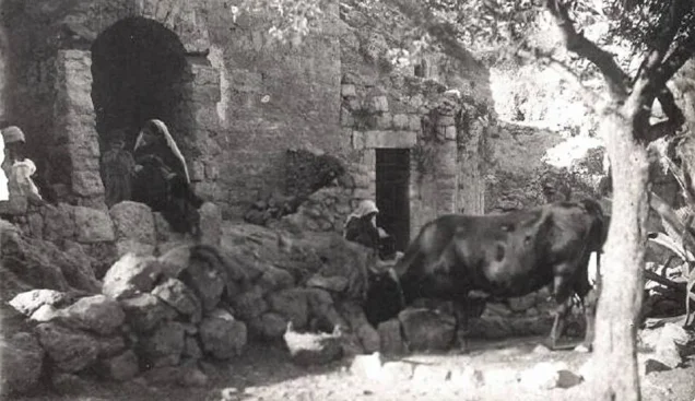
The people of Iqrit depended on agriculture and animal husbandry. Crops included wheat, barley, olives, figs, grapes, tobacco, and other produce.
Much of the village's mountainous land was wooded, particularly with oak and pine trees.
Agriculture depended substantially on rainfall, while springs, wells, and cisterns supplied water for the inhabitants and some agricultural activity.
Archaeological Remains in Iqrit
Iqrit stood on an archaeological tell containing evidence of earlier settlement.
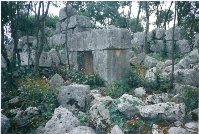
Recorded remains included mosaic floors, the remains of a wine press, rock-cut tombs, water cisterns, and flint implements.
Other archaeological sites and khirbas in and around the village contained remains of buildings, foundations, columns, presses, tombs, and cisterns.
Operation Hiram
The occupation of Iqrit was connected with Operation Hiram, a large-scale Israeli offensive carried out in Upper Galilee between 28 and 31 October 1948.
The operation targeted the last large Arab-held area in Upper Galilee and involved the Sheva', Carmeli, Golani, and 'Oded Brigades.
During the final phase of the offensive, Israeli forces were ordered to extend their control along the Lebanese border. The 'Oded Brigade advanced along the road parallel to the frontier and captured several villages, including Iqrit and Tarbikha.
The Occupation of Iqrit on 31 October 1948
The 'Oded Brigade occupied Iqrit on 31 October 1948, the final day of Operation Hiram.
Iqrit differed from many Palestinian villages emptied during the same offensive. The account cited by Walid Khalidi states that the village surrendered to the Israeli army and that its inhabitants remained in their homes after the occupation.
Arab Liberation Army forces capable of contesting the advance were no longer present in the village area, having withdrawn toward Lebanon as Operation Hiram approached its conclusion.
Details originating in Israeli military accounts are presented here through the Palestinian intermediary sources Walid Khalidi and PalQuest rather than through independent reliance on Israeli sources.
The Displacement of Iqrit and the Promise of Return
The inhabitants of Iqrit were not displaced on the day their village was occupied. Several days later, the Israeli army ordered the residents to leave their homes, claiming that the evacuation was temporary and required for security reasons.
According to Palestinian lawyer and researcher Hanna Dib Nakkara, the order was given on 5 November 1948. The villagers were told that they would be away for only two weeks while military operations in the area were completed.
Nakkara records that the inhabitants refused to cross the Lebanese border. They were advised to take only what they required for the short period, and the army even supplied locks for the houses and left the keys with the villagers, reinforcing the promise that they would shortly return.
Within the following three days, the villagers were evacuated to the Palestinian village of al-Rama in central Galilee.
Walid Khalidi, relying on other evidence, records that some Iqrit residents ended up in Lebanon while others were transported by Israeli trucks to al-Rama. The difference between these accounts is preserved rather than combined into a single narrative.
The Prevention of the Villagers' Return
Military operations ended and the Lebanon–Israel Armistice Agreement was signed on 23 March 1949, but the people of Iqrit were still prevented from returning despite the promise made to them.
For more than two years, the villagers submitted requests, correspondence, delegations, and appeals to Israeli authorities demanding permission to return, but their efforts were rejected or ignored.
Many of Iqrit's inhabitants thus became internally displaced Palestinians, particularly those who remained in al-Rama and other towns and villages of Galilee.
The 1951 Court Ruling in Favor of the Villagers
After administrative efforts failed, the people of Iqrit petitioned the Supreme Court in case 64/51.
On 31 July 1951, the court ruled that there was no legal obstacle preventing the petitioners from returning to their village.
Despite the ruling, the authorities did not permit its implementation. The villagers repeatedly approached the Military Governor and Ministry of Defense but continued to be denied return.
New orders were subsequently issued under security-zone regulations, and the villagers again challenged the restrictions through legal proceedings.
The Destruction of Iqrit at Christmas 1951
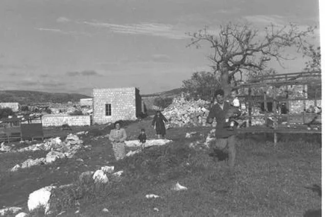
While the villagers' legal case was still pending, the Israeli army demolished the houses of Iqrit during Christmas 1951. The church and cemetery were left standing.
Sources differ slightly over the precise date. Hanna Dib Nakkara places the demolition on Christmas Day, 25 December, while other Palestinian legal documentation gives Christmas Eve, 24 December. It is therefore most precise to state that the village was demolished on 24–25 December 1951.
The destruction transformed the villagers' struggle from a demand to return to their standing homes into a decades-long campaign to rebuild Iqrit and return permanently to its lands.
The Continuing Struggle for Return
The people of Iqrit did not abandon their demand to return despite the destruction of their village and the continued prohibition on permanent resettlement.
Through court petitions, political advocacy, community organizing, and direct presence on village land, Iqrit—together with Kafr Bir'im—became one of the most prominent cases of internally displaced Palestinians seeking to return to their original villages.
The Iqrit Community Association was established in 2009 by the villagers' committee to provide an official legal and organizational framework for the campaign to return and rebuild Iqrit, preserve the church and cemetery, and maintain the community's connection to its land.
Israeli Settlements on and Around Iqrit's Lands
Walid Khalidi distinguishes between settlements established directly on Iqrit's lands and settlements situated along the boundary between Iqrit and Tarbikha:
- Goren: established in 1950 on Iqrit's lands west of the village site.
- Gornot ha-Galil: established in 1980 on Iqrit's lands.
- Shomera: established in 1949 on the boundary between Iqrit's lands and those of Tarbikha, northeast of the village site.
- Even Menachem: established in 1960 along the boundary between the lands of Iqrit and Tarbikha, east of the village site.
Iqrit After the Nakba
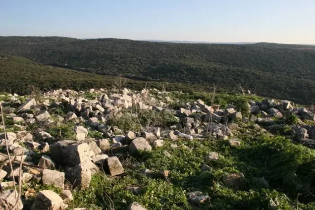
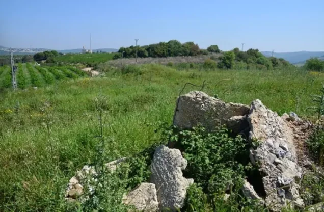
According to the historical field description recorded by Walid Khalidi for All That Remains, the Greek Catholic church was the principal surviving landmark, while the demolished houses had been reduced to stone rubble overgrown with fig and pomegranate trees and other vegetation.
That description reflects fieldwork from an earlier period and should not be treated as an up-to-date survey of the village site.
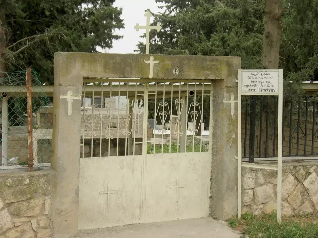
More recent documentation by the Iqrit Community Association shows that the church and cemetery remain central to the community's continuing presence on its land and are maintained by the villagers and their descendants.
Religious services and social ceremonies are held at the church, including weddings and baptisms, while members of the community continue to bury their dead in the village cemetery.
The people of Iqrit and their descendants continue to seek permanent return and the reconstruction of their village.
Sources
- PalQuestPalQuest – Interactive Encyclopedia of the Palestine Question: Iqrit
- PalQuestPalQuest – Interactive Encyclopedia of the Palestine Question: Operation Hiram
- PalQuestHanna Dib Nakkara, Israeli Land Seizure under Various Defense and Emergency Regulations – Journal of Palestine Studies / PalQuest
- Palestine RememberedPalestine Remembered: Iqrit – Acre District
- palqura.comPalestinian Villages Encyclopedia: Iqrit
- iqrit.orgIqrit Community Association
- adalah.orgAdalah: Iqrit and the Villagers' Campaign for Return
- pal48.psFilastunna: The Depopulated Palestinian Village of Iqrit
Photo gallery
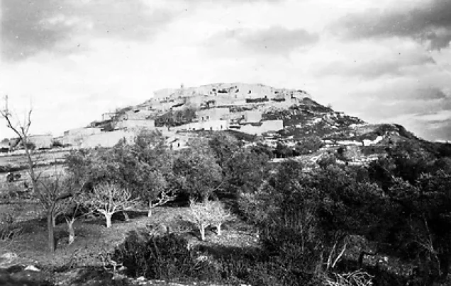
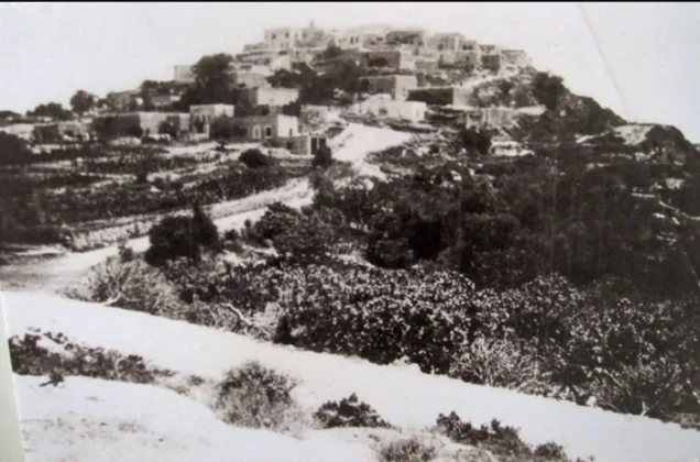
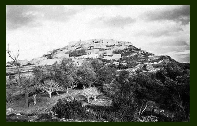
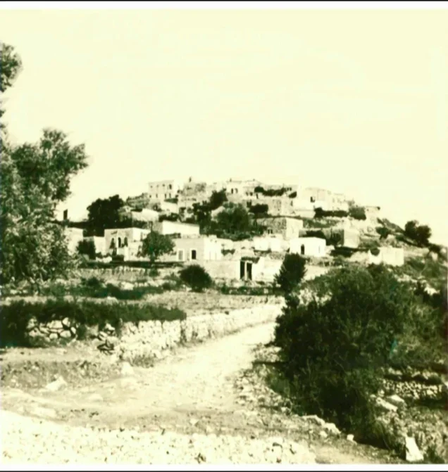

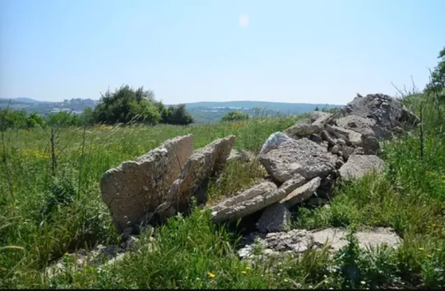
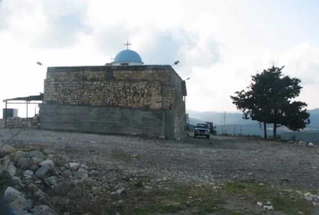
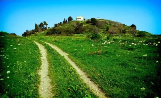
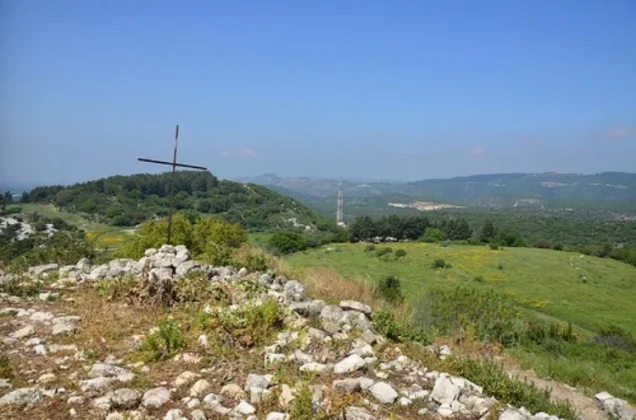
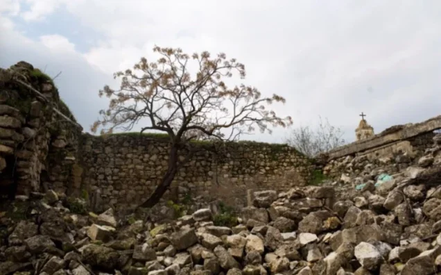
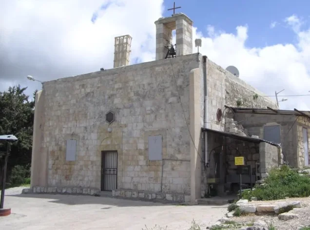
Photos from the village's people
Photos sent in by visitors and published after review.
Add a photo of this village
Log in to add photos of this village.
Other villages from Akka (Acre)
More from the archive



 Download Our Palestine App
The whole archive in the palm of your hand: depopulated villages, the Nakba, the massacres and Al-Aqsa — free, with no ads to erase the story.
Download Our Palestine App
The whole archive in the palm of your hand: depopulated villages, the Nakba, the massacres and Al-Aqsa — free, with no ads to erase the story.



Comments
No comments yet — be the first to write one.
Add your comment
Name and email are optional. Comments appear after review.