
The depopulated village of Umm al-Faraj / District of Akka (Acre)

Umm al-Faraj
About the depopulated village of Umm al-Faraj
- District
- Akka (Acre)
- Date Umm al-Faraj was occupied
- 21 May 1948
- Population in 1948
- 930
- Military operation
- Operation Ben-Ami
- Brigade that carried it out
- The Carmeli Brigade
- Distance from the governorate centre
- 10.5 (km) Northeast of Acre
- Elevation above sea level
- 30 m
- Cause of displacement
- Military assault by Zionist troops
- Extent of destruction
- Umm al-Faraj was mostly destroyed with the exception of its mosque.
- Ethnic cleansing
- Umm al-Faraj inhabitants were completely ethnically cleansed.
Hover a dot to read the village name, or click to open its card.
Borders of the depopulated village of Umm al-Faraj
Umm al-Faraj: A Depopulated Palestinian Village in the Acre District
Umm al-Faraj was a depopulated Palestinian village in the Acre District, located approximately 10.5 kilometers northeast of Acre on a flat part of the Acre plain, along the southern bank of Wadi al-Mafshukh. Its average elevation was approximately 30 meters above sea level.
The Government of Palestine's 1944/1945 statistics recorded a population of 800 and a total land area of 825 dunums. Umm al-Faraj was notable for its intensive citrus agriculture: 745 dunums were devoted to citrus and bananas. During the Nakba and the occupation of Palestine in 1948, the Haganah's Carmeli Brigade attacked the village on 20–21 May during the second stage of Operation Ben-Ami. Several Palestinian sources give 21 May as the specific date of occupation.
Key Facts About Umm al-Faraj
- Subdistrict: Acre.
- Distance from Acre: approximately 10.5 kilometers northeast.
- Average elevation: approximately 30 meters above sea level.
- Population in 1944/1945: 800.
- Estimated population in 1948: 928 according to Palestine Remembered.
- Total land area: 825 dunums.
- Date of occupation: 21 May 1948, following an attack on 20–21 May.
- Military operation: second stage of Operation Ben-Ami.
- Attacking formation: Carmeli Brigade of the Haganah.
- Post-Nakba settlement: part of Ben Ammi was established on village land in 1949.
Location of Umm al-Faraj
Umm al-Faraj stood on flat land in the Acre plain, on the southern bank of Wadi al-Mafshukh and approximately five kilometers from the wadi's outlet into the Mediterranean Sea.
The road connecting Tarshiha with the Nahariyya area and Acre passed through the village by way of al-Kabri and al-Nahr.
The surrounding alluvial soil was highly fertile and supported extensive citrus cultivation and orchards.
The Name and History of Umm al-Faraj
Crusader sources referred to the village as Le Fierge.
The Palestinian Encyclopedia preserves a local explanation connecting the modern name with a battle between Arab and Crusader forces in the area near al-Kabri, suggesting that “al-Faraj” became associated with the joy of an Arab victory.
The Palestinian Villages Encyclopedia offers a different interpretation, suggesting that the name may derive from the village's position in an opening or gap in the plain between the hills of al-Kabri and the Galilee highlands.
There is insufficient linguistic evidence to establish either explanation conclusively, and both are therefore presented as local historical interpretations.
The Built Environment of Umm al-Faraj
In the late nineteenth century, Umm al-Faraj was described as a stone-built village with a population of approximately 200, surrounded by fig, olive, mulberry, and pomegranate trees.
The older houses were closely clustered in an approximately circular pattern.
After 1936, newly constructed houses became more dispersed among the orchards, and a number were built of stone and cement.
The built-up area covered approximately 15 dunums according to the 1944/1945 statistics.
Population of Umm al-Faraj
An important discrepancy concerns the 1922 population. Several Palestinian secondary sources publish a figure of 377 inhabitants, but the official 1922 Census of Palestine records 322 inhabitants in Umm al-Faraj: 172 males and 150 females, all Muslims.
This article therefore uses the official figure of 322 for 1922.
In the 1931 census, the population had increased to 415, including 413 Muslims and two Christians, living in 94 houses.
The Government of Palestine's 1944/1945 statistics recorded 800 inhabitants, all Muslims.
The figures of 928 inhabitants for 1948 and 5,699 refugees for 1998 published by Palestine Remembered are later demographic estimates rather than official censuses.
Population of Umm al-Faraj
- Late 19th centuryAbout 200Historical estimate
- 1922322Official census; all Muslims
- 1931415Official census; 413 Muslims and two Christians
- 1944/1945800Government of Palestine statistics; all Muslims
- 1948928Later estimate published by Palestine Remembered
- 19985,699Later refugee-population estimate published by Palestine Remembered
Number of Houses in Umm al-Faraj
The 1931 Census of Palestine recorded 94 houses in Umm al-Faraj.
The figure of 210 houses for 1948 published by Palestine Remembered is a later estimate rather than the result of an official census conducted that year.
Number of Houses in Umm al-Faraj
- 193194Official census
- 1948210Later estimate published by Palestine Remembered
Water Sources in Umm al-Faraj
Abundant water and fertile alluvial soil contributed to the development of the village's orchards.
The Palestinian Encyclopedia records that Umm al-Faraj drew water from Birkat al-Fawwara and Birkat al-Tall in the lands of neighboring al-Nahr, as well as from local wells.
These resources helped irrigate citrus groves, vegetables, and other fruit trees that formed the foundation of the local economy.
Land Ownership in Umm al-Faraj
The Government of Palestine's 1944/1945 statistics recorded a total land area of 825 dunums for Umm al-Faraj, with no Jewish land ownership recorded.
Arab ownership accounted for 821 dunums, while 4 dunums were classified as public land.
The Arabic Palestine Remembered table uses the categories “Palestinian,” “Transferred to Zionists,” and “Masha'.” These terms are retained below as the terminology of that source.
Land Ownership in Umm al-Faraj, 1944/1945, Using Palestine Remembered Terminology
- Palestinian821 dunums100%
- Transferred to Zionists0 dunums0%
- Masha' (source terminology)4 dunums<1%
Land Use in Umm al-Faraj in 1944/1945
Umm al-Faraj was exceptionally intensively cultivated. Of its total 825 dunums, 805 dunums were cultivated or classified as cultivable, amounting to approximately 98 percent of the village lands.
Citrus and bananas alone occupied 745 dunums, approximately 92.5 percent of the cultivable land. Plantations and irrigable land covered another 42 dunums, while cereals occupied 18 dunums.
The built-up area covered 15 dunums. Only 5 dunums were classified as non-cultivable, consisting of one dunum of Arab land and four dunums of public land.
Land Use in Umm al-Faraj According to the 1944/1945 Statistics
- Arab
- Jewish
- Public
- Citrus and Bananas745 dunums
- Plantations and Irrigable Land42 dunums
- Cereals18 dunums
- Built-up Area15 dunums
- Non-Cultivable Land5 dunums
Economic Life in Umm al-Faraj
Agriculture formed the basis of the economy of Umm al-Faraj, with citrus and banana groves occupying the overwhelming majority of the village's cultivated land.
The villagers also cultivated olives, figs, mulberries, pomegranates, grapes, and vegetables, particularly in orchards surrounding the houses.
The exceptionally high proportion of cultivated land—approximately 98 percent of the total village area—illustrates the intensity with which the land was used before the Nakba.
Operation Ben-Ami
The occupation of Umm al-Faraj was connected with Operation Ben-Ami, carried out by the Haganah's Carmeli Brigade in western Galilee between 13 and 21 May 1948.
The offensive sought to seize the Palestinian coastal villages extending north from Acre toward the Lebanese border. Villages affected during the operation included al-Birwa, al-Bassa, al-Ghabisiyya, al-Kabri, al-Manshiyya, al-Nahr, al-Tall, al-Zib, al-Sumayriyya, and Umm al-Faraj.
During the second stage, the Carmeli Brigade advanced against villages north of Acre, including Umm al-Faraj, al-Nahr, and al-Kabri.
Military Orders Concerning Umm al-Faraj
On 19 May 1948, shortly before the attack on Umm al-Faraj, the commander of the Carmeli Brigade issued operational orders concerning al-Kabri, Umm al-Faraj, and al-Nahr.
According to Walid Khalidi and PalQuest, the orders called for the villages to be attacked and captured, for men to be killed, and for the villages to be destroyed and burned.
These details originate in Israeli documentation but are presented here solely through the Palestinian intermediary sources Walid Khalidi and PalQuest rather than through independent reliance on Israeli sources.
The Occupation of Umm al-Faraj on 21 May 1948
The Carmeli Brigade attacked Umm al-Faraj on 20–21 May 1948 during the second stage of Operation Ben-Ami.
Palestine Remembered and Palestinian local documentation give 21 May 1948 as the specific date on which the village was occupied.
The assault resulted in the displacement of most of the population and the destruction of much of the village. Khalidi records that Haganah engineering units razed most villages in the area either during the offensive itself or shortly afterward.
The principal source does not provide a sufficiently detailed Palestinian account to establish a specific separate massacre or a documented casualty figure in Umm al-Faraj, and this article therefore avoids making such a claim without additional evidence.
The Families Who Remained After the Occupation
Palestinian sources indicate that a limited number of families remained in Umm al-Faraj after the initial occupation, but they disagree about how long these families were able to stay.
The Palestinian Encyclopedia states that approximately twenty-five families remained and were pressured to surrender their lands and leave. It records that a military force expelled them in June 1948 after restrictions were imposed, and that houses were looted and largely demolished while crops were burned.
The Palestinian Villages Encyclopedia presents a different account, stating that approximately twenty-five families continued to resist removal until the middle of 1953, when water and transportation were cut off before they were forcibly removed to Acre and surrounding Palestinian communities.
Walid Khalidi's principal village entry does not resolve this chronological discrepancy. This article therefore treats the occupation and principal displacement in May 1948 as firmly established while leaving the final removal date of the remaining families as disputed among Palestinian sources.
Israeli Settlement on Umm al-Faraj's Lands
In 1949, part of the Israeli settlement of Ben Ammi was established on the lands of Umm al-Faraj.
The wording “part of the settlement” is important because Walid Khalidi does not state that the entire settlement was established within the traditional boundaries of Umm al-Faraj.
Agricultural use by Ben Ammi extended onto former village lands, including banana cultivation.
The Site of Umm al-Faraj After the Nakba
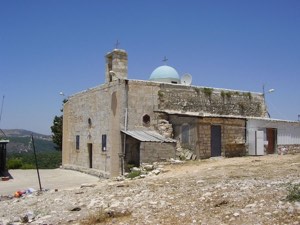
According to Walid Khalidi's historical field description in All That Remains, the stone mosque was the principal surviving village building. At the time of his survey, it was closed, deteriorating, and surrounded by tall wild grass.
Old trees that may have predated the Nakba were also visible, while the surrounding land was cultivated and included a banana grove belonging to Ben Ammi.
Khalidi's description is historical and no longer describes the mosque's later condition. Palestinian local documentation states that the mosque remained standing for years afterward but was demolished on 2 December 1997.
The mosque should therefore not be described as still standing today solely on the basis of the older field description in All That Remains.
Sources
- PalQuestPalQuest – Interactive Encyclopedia of the Palestine Question: Umm al-Faraj
- PalQuestPalQuest – Interactive Encyclopedia of the Palestine Question: Operation Ben-Ami
- Palestine RememberedPalestine Remembered: Umm al-Faraj – Acre District
- Palestine RememberedPalestine Remembered: Umm al-Faraj in Walid Khalidi's All That Remains
- palestinapedia.psPalestinian Encyclopedia: Umm al-Faraj
- palqura.comPalestinian Villages Encyclopedia: Umm al-Faraj
- pal48.psFilastunna: The Depopulated Village of Umm al-Faraj
- pcbs.gov.psPalestinian Central Bureau of Statistics: Historical Censuses and Reports
Photo gallery
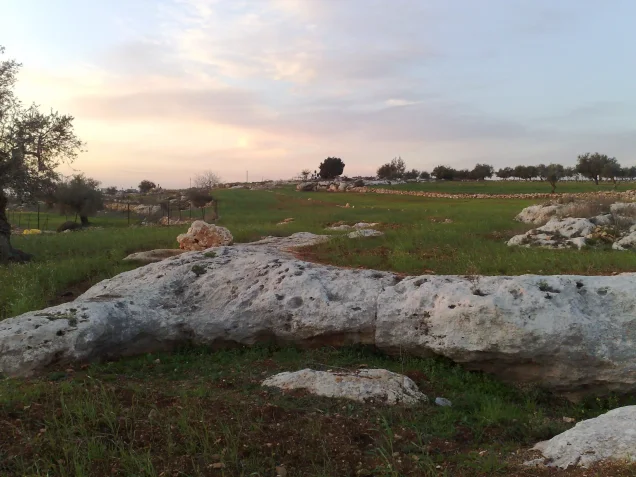
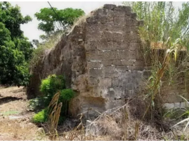
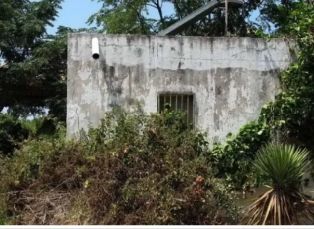

Photos from the village's people
Photos sent in by visitors and published after review.
Add a photo of this village
Log in to add photos of this village.
Other villages from Akka (Acre)
More from the archive



 Download Our Palestine App
The whole archive in the palm of your hand: depopulated villages, the Nakba, the massacres and Al-Aqsa — free, with no ads to erase the story.
Download Our Palestine App
The whole archive in the palm of your hand: depopulated villages, the Nakba, the massacres and Al-Aqsa — free, with no ads to erase the story.



Comments
No comments yet — be the first to write one.
Add your comment
Name and email are optional. Comments appear after review.