
The depopulated village of Hittin / District of Tiberias
About the depopulated village of Hittin
- District
- Tiberias
- Date Hittin was occupied
- 16 July 1948
- Population in 1948
- 1,380
- Military operation
- Operation Dekel
- Brigade that carried it out
- The Seventh Brigade
- Who defended the village
- Local militia & Arab Liberation Army
- Distance from the governorate centre
- 8 (km) Northwest of Tiberias
- Elevation above sea level
- 125 m
- Cause of displacement
- Military assault by Zionist troops
- Extent of destruction
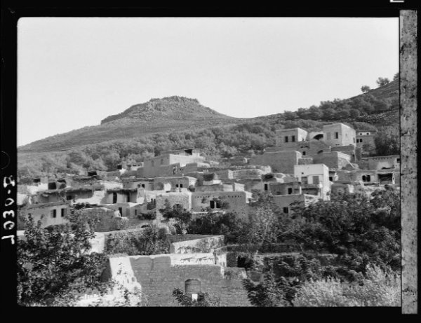
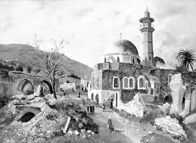
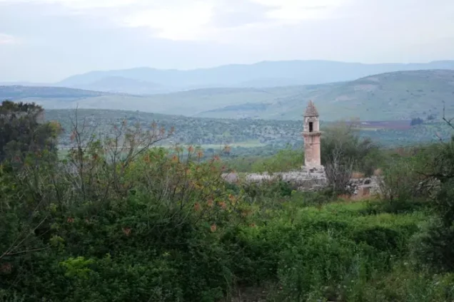
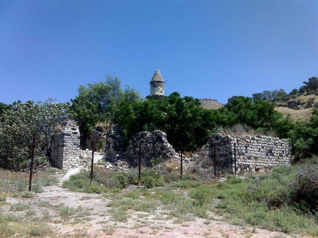
- Hittin was mostly destroyed with the exception few deserted houses, the shrine, and the village mosque remain standing.
- Ethnic cleansing
- Hittin inhabitants were completely ethnically cleansed.
- Settlements built on the built-up area of Hittin after 1948
- Arbel and Kfar Zeitim
- Refugees' migration routes
- Many of the villagers took refuge in Salama, an area between Dayr Hanna and al-Mughar. Later on, they were mostly ethnically cleansed to Lebanon.
Hover a dot to read the village name, or click to open its card.
Borders of the depopulated village of Hittin
Hittin: A Depopulated Palestinian Village in the Tiberias District
Hittin was a Palestinian village in the Tiberias District, located about 8 kilometres northwest of the city of Tiberias, at an average elevation of approximately 125 metres above sea level. It was historically renowned for the nearby plain where the Battle of Hittin took place in 1187, when Salah al-Din al-Ayyubi defeated the Crusader armies. During the Nakba and the occupation of Palestine in 1948, the inhabitants of Hittin were displaced following the attack on the village in the context of Operation Dekel in July 1948.
- Subdistrict
- Tiberias
- Distance from district center
- 8 km Northwest of Tiberias
- Average Elevation
- 125 meters above sea level
- Population in 1931
- 931 inhabitants - Official census
- Number of Houses in 1931
- 190 houses - Official census
- Population in 1944/1945
- 1,190 inhabitants - Government of Palestine statistics
- Estimated Population in 1948
- About 1,380 inhabitants - a later demographic estimate, not an official census
- Total Land Area in 1945
- 22,764 dunams
- Attack and Depopulation
- The first documented direct military involvement of Hittin's inhabitants during the Nakba took place on 9 June 1948, when fighters from the village participated in confronting Israeli forces withdrawing after an unsuccessful attack on the neighbouring village of Lubya. Testimonies collected by Palestinian historian Nafez Nazzal indicate that an armored unit accompanied by infantry later advanced toward Hittin from...
- Final Israeli Control
- 16 July 1948
- Military Operation
- Operation Dekel
- Military Unit
- The Seventh Brigade
- Cause of Depopulation
- Military assault by Zionist troops
- Settlements Documented on Village Lands
- Arbel and Kfar Zeitim
Location
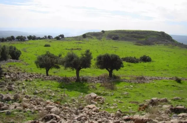
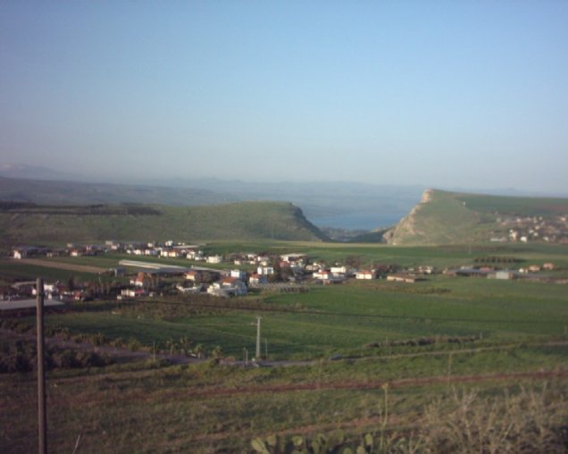
Hittin stood on both sides of a small valley at the northern foot of Mount Hittin and overlooked the strategically and commercially important Plain of Hittin.
The plain opened eastward toward the depressions surrounding Lake Tiberias and connected westward with the plains of Lower Galilee through mountain passes. This location made the area an important route for trade caravans and armies over many centuries.
The modern village was roughly triangular in shape, and its streets were relatively straight because of the level terrain on which much of the village was built.
Hittin Through History
Walid Khalidi suggests that Hittin may have stood on the site of the ancient Canaanite town of Siddim, mentioned in ancient sources. The site was later known in the third century BCE as Kfar Hittin, a name associated with wheat cultivation, and during the Roman period as Kfar Hittaya.
It should not be stated with certainty that the modern village represented a direct continuation of a Canaanite settlement called Hittin, since the sources present this connection as a possibility rather than an established fact.
In 1187, the famous Battle of Hittin took place on the surrounding plain. Salah al-Din al-Ayyubi defeated the Crusader armies there, paving the way for the recovery of large parts of Palestine, including Jerusalem later that same year.
Hittin was also associated with a number of scholars and notable figures during the Islamic periods. Arab historians and geographers referred to the village, including Yaqut al-Hamawi and al-Ansari al-Dimashqi, who was known as al-Shaykh al-Hittini.
In 1596, Hittin was a village in the Tiberias subdistrict of the Safad district, with a population of approximately 605. Its inhabitants paid taxes on wheat, barley, olives, goats, beehives, and other products.
By the late nineteenth century, Hittin was described as a stone-built village surrounded by fruit and olive trees, with an estimated population of about 400.
Architecture and Public Facilities
The centre of the village lay in its northwestern section and contained a small market, an elementary school, and a mosque. According to the principal sources reviewed, all of Hittin's inhabitants were Muslims.
The village elementary school was established around 1897 during the Ottoman period.
The shrine of the Prophet Shu'ayb was among the most important religious landmarks near the village. It stood on the southwestern outskirts of Hittin and held particular religious significance for members of the Druze community, who visited it annually.
The shrine included rooms for visitors and a prayer area, and a spring was located nearby.
Population
The population of Hittin was 889 in the 1922 census and increased to 931 in the 1931 census.
In the 1944/1945 Village Statistics, the population stood at 1,190.
The figure of approximately 1,380 inhabitants for 1948, published by Palestine Remembered, is a later estimate rather than an official Government of Palestine census. The same applies to the estimate of 8,477 refugees and descendants in 1998.
Population of Hittin
- 1596605Historical figure based on Ottoman records
- Late nineteenth centuryAbout 400Historical estimate
- 1922889Official census
- 1931931Official census
- 1944/19451,190Government of Palestine statistics
- 1948About 1,380Estimate published by Palestine Remembered
- 19988,477Estimate of refugees and their descendants
Number of Houses
The 1931 census recorded approximately 190 houses in Hittin. The figure of 281 houses for 1948, published by Palestine Remembered, is a later estimate.
Number of Houses in Hittin
- 1931190Official census
- 1948About 281Later estimate
Land of Hittin
According to the 1944/1945 statistics, the total land area of Hittin amounted to 22,764 dunams.
Arab ownership amounted to 22,086 dunams, Jewish ownership to 147 dunams, while 531 dunams were classified as public land.
Land Ownership in Hittin in 1944/1945
- Arab ownership22,086 dunums97%
- Jewish ownership147 dunums<1%
- Public land531 dunums2%
Agriculture and Economic Life
Agriculture formed the basis of Hittin's economy. Fertile soil, abundant rainfall, groundwater, springs, and wells contributed to a prosperous agricultural economy.
The villagers cultivated cereals, olives, and fruit trees and also raised livestock.
According to the 1944/1945 statistics, a total of 10,462 dunams were devoted to cereals, including 10,253 dunams of Arab-owned land, 23 dunams of Jewish-owned land, and 186 dunams of public land.
A total of 1,964 dunams were irrigated or used for plantations, including 1,936 Arab-owned dunams and 28 Jewish-owned dunams.
Palestine Remembered also reports approximately 200 dunams planted with olive trees. This figure has not been added as a separate category in the table below because the official PalQuest land-use table does not list olives separately within the 1944/1945 classification.
Land Use in Hittin in 1944/1945, in Dunams
- Arab
- Jewish
- Public
- Cereals10,462 dunums
- Irrigated and plantation land1,964 dunums
- Built-up area70 dunums
- Uncultivable land10,268 dunums
Archaeology and Historical Landmarks
Hittin was built over the remains of an older settlement, and evidence of earlier habitation was found throughout the village and its surroundings.
Nearby archaeological sites included Khirbat al-'Ayka, where Palestine Remembered records piles of stones, building foundations, a tower, and a cistern.
The Horns of Hittin and the Plain of Hittin are among the most important historical landmarks associated with the village because of the Battle of Hittin in 1187.
Claims that the village mosque was directly ordered to be built by Caliph Umar ibn al-Khattab or later restored by Salah al-Din have not been presented as established facts because sufficient documentation for these accounts was not found in the principal sources reviewed.
The Nakba and the Defense of Hittin
The first documented direct military involvement of Hittin's inhabitants during the Nakba took place on 9 June 1948, when fighters from the village participated in confronting Israeli forces withdrawing after an unsuccessful attack on the neighbouring village of Lubya.
Testimonies collected by Palestinian historian Nafez Nazzal indicate that an armored unit accompanied by infantry later advanced toward Hittin from the direction of Mitzpa. The defenders positioned themselves on the Horns of Hittin and succeeded in repelling the attack after several hours of fighting.
Operation Dekel and the Occupation of Hittin
The Military Operation
The final assault on Hittin took place in the context of Operation Dekel, which began on 8 July 1948 and continued until 18 July. The operation was aimed at taking control of large areas of Lower Galilee.
The Seventh, Golani, and Carmeli brigades participated in Operation Dekel as a whole. However, the material specifically concerning Hittin associates the direct attack on the village with the Seventh Brigade, also known as the Sheva Brigade.
The Military Unit
Units of the Seventh Brigade advanced toward Hittin after the end of the First Truce. Following the fall of Nazareth on 16 July, approximately 25 to 30 soldiers of the Arab Liberation Army stationed in Hittin began withdrawing from their positions.
Date of Displacement and Occupation
The sources differ slightly regarding the date of Hittin's occupation. Palestine Remembered records 16 July 1948 as the date of occupation.
Walid Khalidi's account and testimonies from villagers reproduced by PalQuest indicate that most inhabitants left during the night of 16–17 July, following the fall of Nazareth, and that the remaining defenders on the Horns of Hittin withdrew when armored forces advanced toward the village.
Based on this sequence, it is more accurate to state that the displacement and military occupation of Hittin occurred between 16 and 17 July 1948. Palestine Remembered records 16 July as the date of occupation, while the more detailed account suggests that complete military control followed shortly afterward.
Fate of the Population
Most of Hittin's inhabitants left during the night of 16–17 July 1948 and initially sought refuge in the village of Sallama, located between Dayr Hanna and al-Maghar.
After the occupation, a number of men from Hittin attempted to return to assess the possibility of recovering the village, but Israeli forces fired on them. Some villagers also remained on the outskirts for approximately a month in the hope of returning to their homes before eventually moving toward Lebanon.
The Palestinian community of Hittin was completely displaced, and its inhabitants were not permitted to return and re-establish their village.
Occupation and Depopulation Chronology
- 8 July 1948
The Military Operation
The final assault on Hittin took place in the context of Operation Dekel, which began on 8 July 1948 and continued until 18 July. The operation was aimed at taking control of large areas of Lower Galilee.
- 16 July 1948
Date of Displacement and Occupation
The sources differ slightly regarding the date of Hittin's occupation. Palestine Remembered records 16 July 1948 as the date of occupation.
Israeli Settlements Established on the Lands of Hittin
Arbel
The settlement of Arbel was established in 1949 north of the village site on lands belonging to Hittin.
Kfar Zeitim
Kfar Zeitim was established in 1950 northeast of the village site, also on lands belonging to Hittin.
Nearby Settlements Not Established on Village Lands
Kfar Hittim, established in 1936, and Mitzpa, established in 1908, are located near Hittin. Walid Khalidi, however, states that neither was established on the lands of the village itself.
- 1949Arbel
Established on the lands of Hittin
- 1950Kfar Zeitim
Established on the lands of Hittin
- 1936Kfar Hittim
Near the village but not on Hittin's lands according to Walid Khalidi
- 1908Mitzpa
Near the village but not on Hittin's lands according to Walid Khalidi
The Site of Hittin After the Nakba
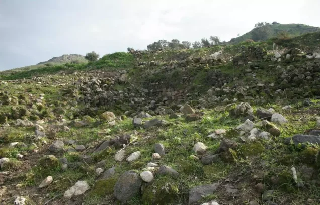
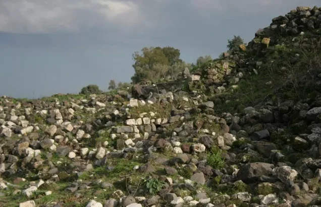
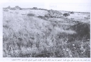
According to the field documentation published by Walid Khalidi, the village site became overgrown with grass, while piles of stones were scattered throughout the area. Vegetation also grew in the shallow watercourses crossing the site.
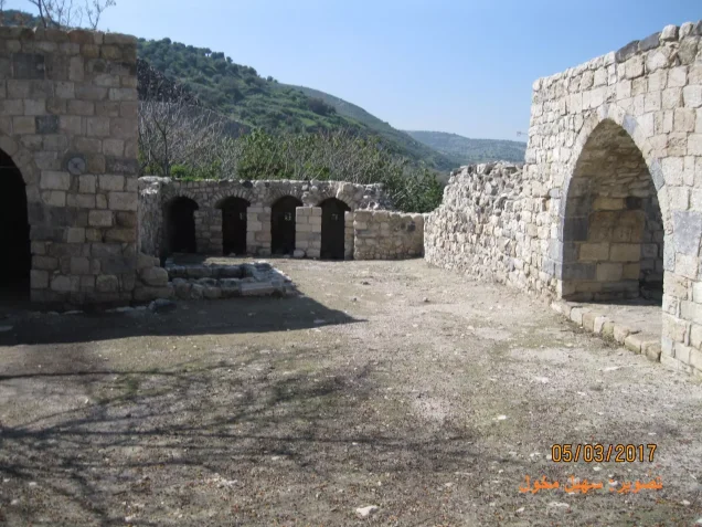
The village mosque remained standing but was abandoned. Its minaret was still intact at the time of Khalidi's documentation, although some of its arches were deteriorating.
Mulberry, fig, and eucalyptus trees, as well as cactus plants, grew around the site. The surrounding plain was used for agriculture, while the hilly lands were used for grazing.
The shrine of the Prophet Shu'ayb remains on the slope of a nearby hill and continues to hold particular religious significance for the Druze community.
This description is based primarily on the field documentation used by Walid Khalidi and should not necessarily be interpreted as a comprehensive field survey of the site in 2026.
Sources
- PalQuest – Interactive Encyclopedia of the Palestine Question: Hittin.
- PalQuest: Operation Dekel.
- Palestine Remembered: Hittin, Tiberias District.
- Walid Khalidi, All That Remains, entry on Hittin, as reproduced by PalQuest and Palestine Remembered.
- Nafez Nazzal, The Palestinian Exodus from Galilee, 1948, Institute for Palestine Studies, Beirut, 1978, as cited by Walid Khalidi in accounts of the defense of Hittin and the displacement of its inhabitants.
- Government of Palestine, Department of Statistics, Village Statistics, 1945.
- Palestine censuses of 1922 and 1931.
``` seo_keywords: Hittin, Hattin, Palestinian villages, depopulated Palestinian villages, Tiberias District, Nakba, Nakba 1948, Operation Dekel, Seventh Brigade, Sheva Brigade, Battle of Hattin, Salah al-Din, Arbel, Kfar Zeitim, Prophet Shu'ayb seo_description: Hittin was a Palestinian village in the Tiberias District, famous for the 1187 Battle of Hattin and depopulated during Operation Dekel in July 1948.
Photo gallery








Photos from the village's people
Photos sent in by visitors and published after review.
Add a photo of this village
Log in to add photos of this village.
Other villages from Tiberias
More from the archive


 Download Our Palestine App
The whole archive in the palm of your hand: depopulated villages, the Nakba, the massacres and Al-Aqsa — free, with no ads to erase the story.
Download Our Palestine App
The whole archive in the palm of your hand: depopulated villages, the Nakba, the massacres and Al-Aqsa — free, with no ads to erase the story.



Comments
No comments yet — be the first to write one.
Add your comment
Name and email are optional. Comments appear after review.