
The depopulated village of Hadatha / District of Tiberias
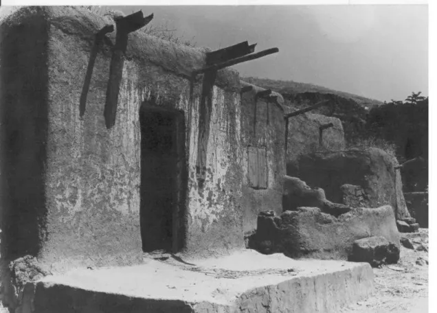
About the depopulated village of Hadatha
- District
- Tiberias
- Date Hadatha was occupied
- 12 May 1948
- Population in 1948
- 603
- Brigade that carried it out
- Golani Brigade
- Distance from the governorate centre
- 12.5 km from Tiberias
- Elevation above sea level
- 225 m
- Cause of displacement
- Fear of attack by Zionist forces during the Golani Brigade's advance in the Lower Galilee, according to the History of the Haganah as cited by Khalidi; this account contradicts the Israeli intelligence report's claim that the village was evacuated on Arab orders
- Extent of destruction
- Hadatha was completely obliterated and defaced.
- Ethnic cleansing
- Hadatha inhabitants were completely ethnically cleansed.
- Settlements built on the built-up area of Hadatha after 1948
- There are no Israeli settlements on village land, according to Khalidi
Hover a dot to read the village name, or click to open its card.
Borders of the depopulated village of Hadatha
Hadatha: A Depopulated Palestinian Village in the Tiberias District
Hadatha was a depopulated Palestinian village in the Tiberias District, located approximately 12.5 kilometers southwest of Tiberias at an average elevation of about 225 meters above sea level. The village stood between two small wadis on either side of a gently sloping rocky hill, within a drainage basin whose streams eventually fed Wadi al-Bira, a tributary of the Jordan River.
- Subdistrict
- Tiberias
- Distance from district center
- 12.5 km from Tiberias
- Average Elevation
- 225 m above sea level
- Population in 1931
- 368
- Number of Houses in 1931
- 75
- Population in 1944/1945
- 520
- Estimated Population in 1948
- About 603 – a later demographic estimate, not an official census
- Total Land Area in 1945
- 10,310 dunams
- Attack and Depopulation
- An Israeli intelligence report claims that the village was evacuated on 6 April 1948 on Arab orders, but the History of the Haganah, as cited by Khalidi, states that units of the Golani Brigade occupied it together with Sirin, 'Awlam and Ma'dhar on 12 May 1948 and that its inhabitants fled in fear, which implies that their exodus resulted from the military operation.
- Final Israeli Control
- 12 May 1948, according to the History of the Haganah as cited by Khalidi
- Military Unit
- Units of the Golani Brigade, according to the History of the Haganah as cited by Khalidi
- Cause of Depopulation
- Fear of attack by Zionist forces during the Golani Brigade's advance in the Lower Galilee, according to the History of the Haganah as cited by Khalidi; this account contradicts the Israeli intelligence report's claim that the village was evacuated on Arab orders
- Settlements Documented on Village Lands
- There are no Israeli settlements on village land, according to Khalidi
The Government of Palestine's 1944/1945 statistics recorded 520 inhabitants, all Muslims, and a total land area of 10,310 dunums. During the Nakba and the occupation of Palestine in 1948, accounts differ over when the inhabitants first left. The more clearly documented military event was the entry of Golani Brigade units into Hadatha on 12 May 1948, during the wider Zionist conquest of the Lower Galilee and on the same day that Baysan fell.
Location of Hadatha
- Hadatha was located approximately 12.5 kilometers southwest of Tiberias.
- Its average elevation was about 225 meters above sea level.
- It lay approximately 10 kilometers east of Mount Tabor.
- The village stood between two small wadis on either side of a gently sloping rocky hill.
- Numerous seasonal streams carried runoff from the surrounding heights into a basin that drained into Wadi al-Bira, a tributary of the Jordan River.
- A spring east of the village supplied the inhabitants with fresh drinking water.
- A secondary road connected Hadatha with Kafr Kama, which was itself linked to a highway leading to Samakh at the southern end of Lake Tiberias.
Neighboring Villages
Hadatha lay among several Palestinian communities in the Lower Galilee. Kafr Sabt was to the north, Ma'dhar to the west, 'Awlam to the south, and al-'Ubaydiyya to the east.
Sirin, in the Baysan District, also lay within the wider area to the southeast and shared a closely connected military fate with Hadatha, 'Awlam, and Ma'dhar in 1948.
Hadatha in the Ottoman Period
In 1596, Hadatha was a village in the nahiya of Tiberias within the liwa' of Safad and had an estimated population of approximately 121.
Its inhabitants paid taxes on wheat and barley as well as goats, beehives, and other forms of production.
The Built Environment of Hadatha
In the late nineteenth century, Hadatha was described as a stone-built village situated on a hilltop. Walid Khalidi records an estimated population of approximately 150 at the time, whose inhabitants cultivated grapes, figs, and olives.
During the British Mandate, the village developed a roughly triangular layout, and its houses extended northwestward along the road leading to Kafr Kama.
The built-up area covered approximately 38 dunums according to the 1944/1945 statistics.
Population of Hadatha
The 1922 Census of Palestine recorded 333 inhabitants in Hadatha, all Muslims.
In the 1931 census, the population increased to 368: 366 Muslims, one Christian, and one Druze, living in 75 houses.
The Government of Palestine's 1944/1945 statistics recorded 520 inhabitants, all classified as Muslims.
The figures of 603 inhabitants for 1948 and 3,704 refugees for 1998 published by Palestine Remembered are later demographic estimates rather than official Government of Palestine censuses.
Population of Hadatha
- 1596121Historical estimate based on Ottoman records
- Late 19th centuryAbout 150Historical estimate recorded by Walid Khalidi
- 1922333Official census; all Muslims
- 1931368Official census: 366 Muslims, one Christian, and one Druze
- 1944/1945520Government of Palestine statistics; all Muslims
- 1948603Later estimate published by Palestine Remembered
- 19983,704Later refugee-population estimate published by Palestine Remembered
Number of Houses in Hadatha
The 1931 census recorded 75 houses in Hadatha.
The figure of 122 houses for 1948 published by Palestine Remembered is a later estimate rather than an official census conducted in that year.
Number of Houses in Hadatha
- 193175Official census
- 1948122Later estimate published by Palestine Remembered
Education in Hadatha
An elementary school was established in Hadatha in 1897 during the Ottoman period, but it was closed during the British Mandate.
Palestinian local sources state that boys were subsequently taught in a kuttab. Nimr al-Mahmud is remembered as one of the local teachers, while pupils wishing to continue their education traveled to Tiberias or Nazareth.
The Mosque and Religious Life
Palestinian local documentation records that the villagers built a mosque in Hadatha and that the community was overwhelmingly Sunni Muslim.
The same local account states that there was no permanently resident learned preacher in the village, and religious life therefore relied largely on members of the local community.
Land Ownership in Hadatha
The total land area recorded for Hadatha in the 1944/1945 statistics was 10,310 dunums. The official statistics recorded no Jewish land ownership in the village.
The Arabic Palestine Remembered table uses the categories “Palestinian,” “Transferred to Zionists,” and “Masha'.” These terms are preserved below to reflect that source's terminology. The official Government of Palestine figures classify the same lands as Arab and Public.
Land Ownership in Hadatha, 1944/1945, Using the Terminology of Palestine Remembered
- Palestinian8,621 dunums84%
- Transferred to Zionists0 dunums0%
- Masha' (source terminology)1,689 dunums16%
Land Use in Hadatha in 1944/1945
A total of 8,578 dunums was cultivated or classified as cultivable, all of it Arab land.
Cereals occupied 8,379 dunums, while plantations and irrigable land covered another 199 dunums.
Non-cultivable land totaled 1,694 dunums, consisting of 5 dunums of Arab land and 1,689 dunums of public land. The built-up area occupied another 38 dunums of Arab land.
Land Use in Hadatha According to the 1944/1945 Statistics
- Arab
- Jewish
- Public
- Plantations and Irrigable Land199 dunums
- Cereals8,379 dunums
- Built-up Area38 dunums
- Non-Cultivable Land1,694 dunums
Palestine Remembered separately records approximately 226 dunums planted with olive trees. This is presented as supplementary agricultural information and is not added again to the official land-use total, since the olive area may overlap with other agricultural categories.
Economic Life in Hadatha
Hadatha's economy depended primarily on agriculture. Cereals, particularly wheat and barley, occupied the overwhelming majority of its cultivated land.
The villagers also cultivated olives, vegetables, grapes, and figs. Olive trees were concentrated mainly on the higher ground north and east of the village, while vegetables were grown east, west, and south of the built-up area.
Goat raising and beekeeping were also traditional components of the local economy and are documented as early as the Ottoman period.
Archaeological Remains in Hadatha
Hadatha occupied a site containing archaeological remains indicative of earlier settlement.
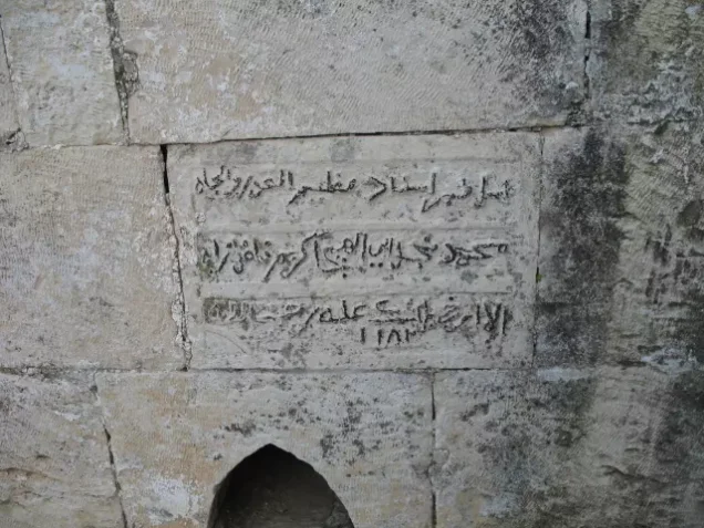
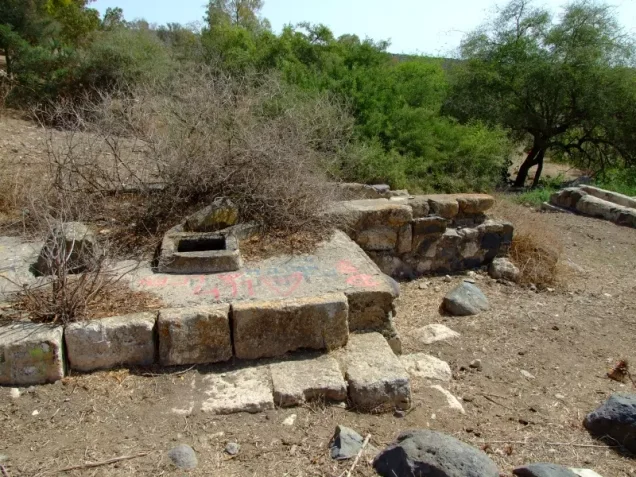
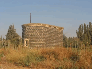
The principal documented remains included a vaulted stone structure built over a spring and the remains of an old press.
The Disputed Account of an April 1948 Evacuation
Sources provide conflicting accounts of when and under what circumstances the inhabitants of Hadatha left, and no single version can be accepted without qualification.
Walid Khalidi and PalQuest cite an Israeli intelligence claim that Hadatha, Sirin, 'Awlam, and Ma'dhar were evacuated on 6 April 1948 following Arab orders.
There is, however, a discrepancy even over the alleged source of those orders. Khalidi's Hadatha entry describes the Israeli claim as referring to orders from the Arab Higher Committee, whereas PalQuest's published transcription of the Israeli intelligence report dated 30 June lists “Transjordan government orders” as the cause of evacuation for the four villages.
This internal contradiction makes the claim of a complete evacuation on 6 April insufficient on its own to establish the circumstances of Hadatha's depopulation.
The Occupation of Hadatha on 12 May 1948
A second account, cited by Walid Khalidi from the History of the Haganah, provides a later date directly associated with military occupation.
On 12 May 1948, units of the Golani Brigade entered Hadatha alongside Sirin, 'Awlam, and Ma'dhar, on the same day that the Palestinian town of Baysan fell.
The account cited by Khalidi states that the inhabitants of the four villages left out of fear of the advancing Jewish forces, suggesting a direct relationship between the military offensive and the displacement.
PalQuest's broader chronology likewise places the occupation of Hadatha, 'Awlam, and Ma'dhar within the Zionist conquest of the Lower Galilee on 12 May, during the wider offensive across eastern Galilee and the Baysan Valley.
For this reason, 12 May 1948 is used here as the best-documented date of Hadatha's military occupation, while allowing for the possibility that some inhabitants had left earlier because the sources remain contradictory.
Occupation and Depopulation Chronology
- 6 April 1948
Evacuation claimed by an Israeli intelligence account
An Israeli intelligence report, as cited by Khalidi, claims that Hadatha, Sirin, 'Awlam and Ma'dhar were evacuated on this date on orders from the Arab Higher Committee, whereas the text of the Israeli intelligence report dated 30 June 1948, as published by PalQuest, attributes the full evacuation of the four villages to 'Transjordan government orders'. Khalidi points out that this account is inconsistent with that of the History of the Haganah.
- 12 May 1948
Final occupation and depopulation of the village
Hadatha, Sirin, 'Awlam and Ma'dhar fell to units of the Golani Brigade, according to the History of the Haganah as cited by Khalidi, which adds that the inhabitants of these villages fled in fear and that with this attack 'the lower Galilee was empty of Arabs'. PalQuest's chronology places the occupation of 'Awlam, Hadatha and Ma'dhar within the Haganah offensive in eastern Galilee that captured Baysan on 12 May.
Hadatha and Operation Gideon
The occupation of Hadatha on 12 May coincided with Operation Gideon, carried out by the Golani Brigade between 10 and 15 May to seize the Baysan Valley and displace its Palestinian population.
However, PalQuest's dedicated Operation Gideon page does not list Hadatha among the specifically identified villages directly affected by that operation, while its broader chronology places Hadatha within the simultaneous wider offensive in the Lower Galilee.
It is therefore more precise to state that Hadatha was occupied by Golani during the broader offensive taking place alongside Operation Gideon rather than categorically labeling its capture as part of Operation Gideon itself.
A Palestinian Oral Account of the Displacement
Palestinian researcher Muhammad 'Aql records oral testimonies from displaced people from Hadatha stating that Golani units found a number of inhabitants still in the village when they entered it, including approximately twenty men as well as women and children.
According to these testimonies, the men were detained while the women and children were expelled from the village. The local account also states that Israeli aircraft bombed houses in Hadatha.
These testimonies are significant because they conflict with the claim that the village had been completely empty since 6 April, but they remain Palestinian oral accounts and are presented as such.
Israeli Settlements and the Lands of Hadatha
According to Walid Khalidi and PalQuest, no Israeli settlement was established on the lands of Hadatha itself.
Kefar Qish, founded in 1946 close to the village, was established on land belonging to neighboring Ma'dhar rather than on Hadatha's lands.
The Site of Hadatha After the Nakba
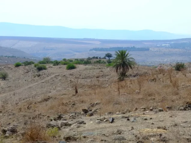
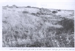
According to Walid Khalidi's field description, stone rubble was the principal surviving indication of the former village.
The fenced site was used as a cattle pasture, while mulberry and fig trees and cactuses grew among the ruins.
The surrounding lands were cultivated by residents of Kefar Qish with vegetables and almond trees, and parts of the lower wadis were also fenced.
This description is based on fieldwork conducted for Walid Khalidi's All That Remains and should not necessarily be treated as an updated field survey of the site today.
Sources
- PalQuestPalQuest – Interactive Encyclopedia of the Palestine Question: Hadatha
- PalQuestPalQuest: Israeli Intelligence Report on the Depopulation of Palestine, 30 June 1948
- PalQuestPalQuest: Operation Gideon
- Palestine RememberedPalestine Remembered: Hadatha – Tiberias District
- Palestine RememberedPalestine Remembered: Hadatha in Walid Khalidi's All That Remains
- Palestine RememberedPalestine Remembered: Muhammad 'Aql, The Depopulated Village of Hadatha
- pal48.psFilastunna: The Depopulated Village of Hadatha
Photo gallery


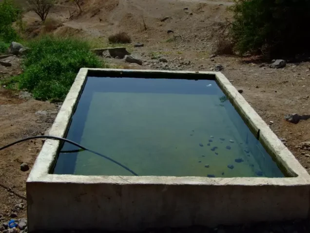
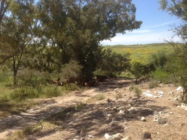


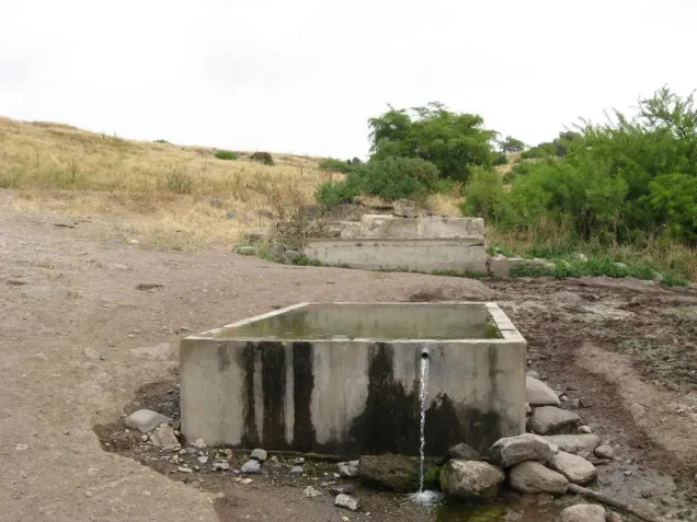
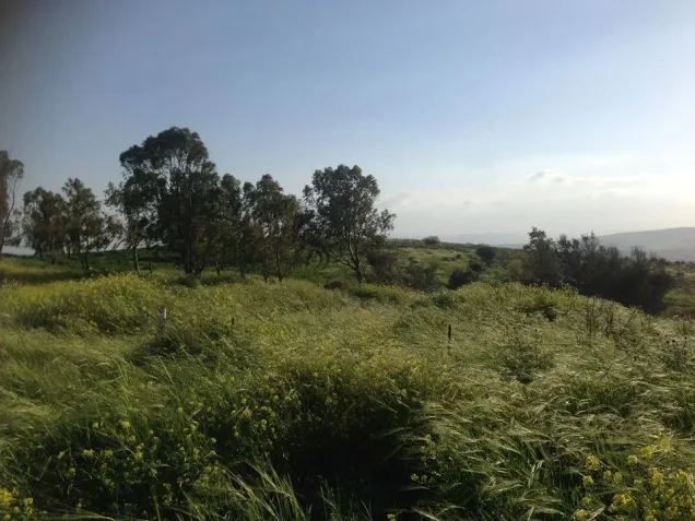


Photos from the village's people
Photos sent in by visitors and published after review.
Add a photo of this village
Log in to add photos of this village.
Other villages from Tiberias
More from the archive


 Download Our Palestine App
The whole archive in the palm of your hand: depopulated villages, the Nakba, the massacres and Al-Aqsa — free, with no ads to erase the story.
Download Our Palestine App
The whole archive in the palm of your hand: depopulated villages, the Nakba, the massacres and Al-Aqsa — free, with no ads to erase the story.



Comments
No comments yet — be the first to write one.
Add your comment
Name and email are optional. Comments appear after review.