Hebron before the Nakba: grapes, glass, markets, refuge
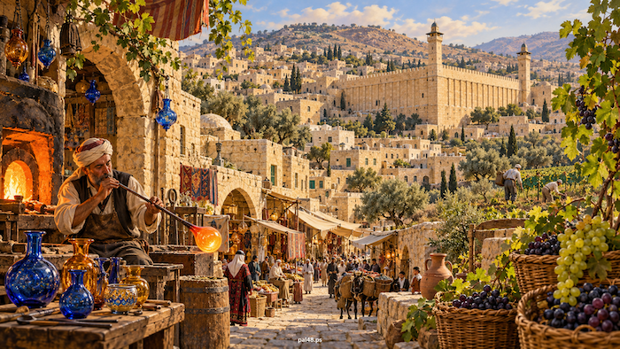
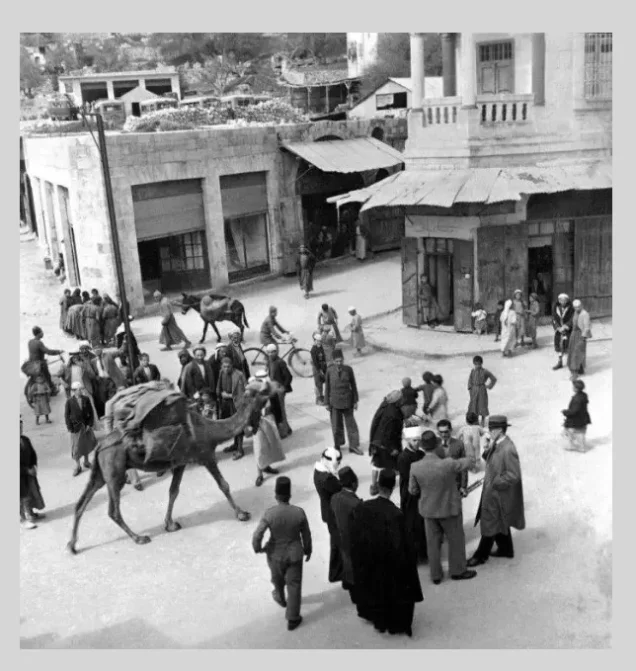
In Hebron before the Nakba, the grape season ran from the vineyard to the home and the market: grapes were eaten fresh, dried into raisins, and boiled into dibs (grape molasses) and malban (grape-paste sweets). In the Old City, glass furnaces turned out jugs, lamps and bracelets, while the markets tied the city to the villages of the hills, the plain and the desert. Hebron was a city of worship and work, surrounded by wide farmland, with schools, clinics and institutions that fed the needy. [2][5][7]
Then came the Nakba of 1948. The city of Hebron stayed outside the control of Israeli forces, but those forces occupied villages in the west and north-west of its district, committed one of the worst massacres of the Nakba at al-Dawayima, and expelled the villagers and barred their return. Refugees poured into the city and the surrounding villages, and Hebron became both a city whose people stayed and a refuge for those uprooted from their homes and land. [17][18][20][21]
This article tells the story of the city and its surroundings in the late Ottoman period and under the British Mandate: farming, industry, markets, homes and customs, education and health, and then what expulsion did to the city and its district.
Contents
- Hebron before the Nakba at a glance
- Why is it called al-Khalil?
- A city around the Ibrahimi Mosque
- Vines and rain: farming in the Hebron hills
- Grapes as provisions and industry
- The glassblowers’ furnaces: Hebron glass in daily life
- Pottery, leather and weaving
- Markets: linking the hills and the plain
- Women, work and dress
- Customs, weddings and mutual aid
- The Ibrahimi Takiyya: feeding people as part of city life
- Education: government schools and community initiatives
- Girls’ education: the experience of Khadija Qatina
- Health: the hospital, clinics and access
- Medicine during the revolt
- The Nakba: the city stayed, its villages were occupied
- The al-Dawayima massacre west of Hebron
- Hebron receives the refugees
- How the Nakba changed Hebron’s economy and services
- Hebron between Egypt and Jordan, 1948–1967
- From the Nakba to occupation: Hebron after 1967
- Frequently asked questions
Hebron before the Nakba at a glance
| Item | Details |
|---|---|
| Location | South of Jerusalem, in the hills of southern Palestine |
| Elevation | About 950 metres above sea level |
| City population, 1922 | 16,577 |
| City population, 1945 | 24,560 |
| Urban fabric | Quarters, courtyard houses (ahwash) and markets clustered around the Ibrahimi Mosque |
| Main economic activities | Grapes and grape products; glass, pottery, leather and trade |
| In the Nakba | Villages of the district occupied and their people expelled; the al-Dawayima massacre on 29 October 1948; refugees received |
| Occupation of the city | June 1967 |
The population figures are for the city of Hebron only, not the villages of its district. The Mandate-era Hebron district does not match the borders of today’s Hebron governorate. [1][2][4][13][18][28]
Why is it called al-Khalil?
The city’s Arabic name is tied to the Prophet Abraham (Ibrahim), known as Khalil al-Rahman, “the Friend of the Merciful”. The city was called Khalil al-Rahman, which was later shortened to al-Khalil. [1][4]
The Hebron Rehabilitation Committee lists “Hebron” and “Qaryat Arba” among its historical names, and gives several possible explanations for them. [4] The occupation later borrowed the second name for the settlement of “Kiryat Arba”, which it built on the edge of the city in 1968. [28]
A city around the Ibrahimi Mosque
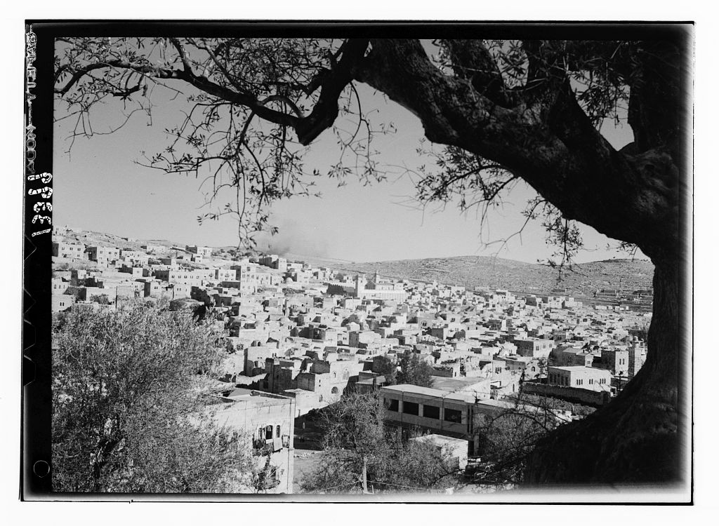
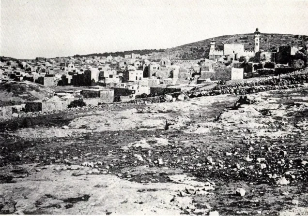
The Ibrahimi Mosque was the religious and urban centre of the city: the lanes of the quarters led to it, and markets, Sufi lodges, the takiyya and public buildings surrounded it. A UNESCO study shows that Hebron preserved a clear Mamluk fabric, to which the Ottoman period added layers of building and expansion. [2]
Within this fabric, rooms were grouped around small courtyards known as ahwash (sing. hosh). Each quarter held houses, passages and shared facilities, and connected to neighbouring quarters through alleys and arches. A hosh was not a detached house in the modern sense, but a space joining closely built dwellings, bound together by ties of kinship and neighbourliness. [2]
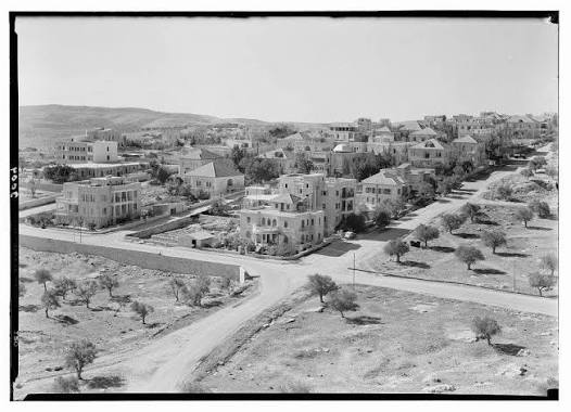
The city’s quarters included al-Qazzazin, al-Sawakna, Bani Dar and al-Mashariqa, and its neighbourhoods included Sheikh Ali al-Bakka, Qaitun and Bab al-Zawiya. The internal streets were laid out around access to the mosque, before the city spread beyond its oldest core. [3]

Vines and rain: farming in the Hebron hills
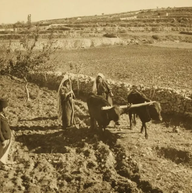
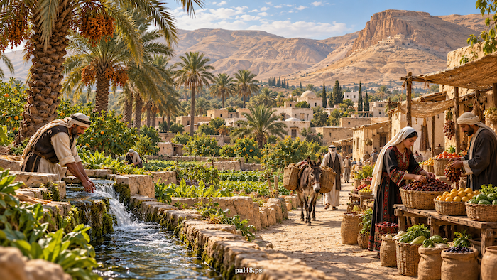
The altitude and climate of the Hebron hills favoured vines and fruit trees, including almonds, apricots and plums. Vineyards and orchards were part of people’s livelihoods and fed the city’s trade and food crafts. [4]
But farming was not the same across the district. Vines and trees dominated the highlands, while grain spread across the western slopes. In Ajjur, for example, about 25,227 dunums were planted with grain in 1944/45, against 2,428 dunums of irrigated land and orchards. Livestock, especially goats, came second to farming in economic importance. [6]
So while Hebron’s name evokes grapes, the economy of its district also included wheat, olives, livestock and village crafts. The villages were not merely the city’s hinterland; they were centres of production, with their own markets, schools and life. [6][17]
Read also on our site: Agriculture in Palestine before the Nakba.
Grapes as provisions and industry
The grape season did not end with selling the fruit. Hebron was known for making dibs, malban and raisins, turning a perishable crop into food that could be stored and traded after the season. Ma’an Development Center cites a 1937 agricultural journal listing the Zaini, Ainuni, Dabouqi and Hamdani among the region’s known grape varieties. [5]
Local accounts preserve an image of exchange between the hills and the coast: grapes were carried by camel from the al-Shuyukh area to the villages of Gaza and traded for grain, linking regions that produced different goods and needed one another. [5]
The glassblowers’ furnaces: Hebron glass in daily life
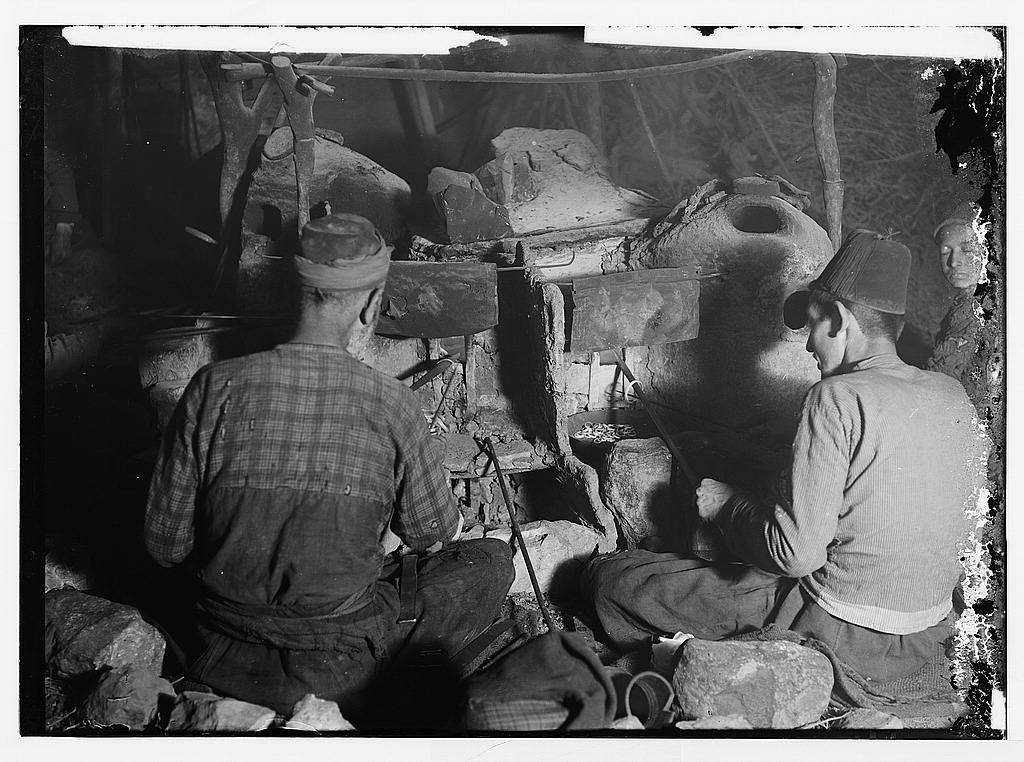
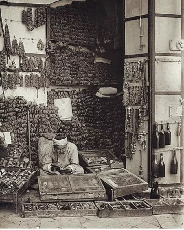
In the Old City, the al-Qazzazin (glassmakers’) quarter took its name from the craft it was famous for. Craftsmen shaped glass by blowing it beside the melting furnace, producing objects for use and adornment: cups, jugs and lamps, bracelets, rings and prayer beads. [7][8]
In the mid-nineteenth century the city had seven glass workshops, according to the Palestinian Ministry of Tourism and Antiquities, and their products reached Jerusalem, Nablus and Cairo and were exported through the port of Jaffa. [7]
The craft was knowledge passed down within families, and by the early twentieth century it was almost confined to the al-Natsheh family, according to the Hebron Rehabilitation Committee. Hebron glass, often displayed today as an ornament, also served everyday purposes in people’s homes. [8]
Read also on our site: Palestinian industries before the Nakba.
Pottery, leather and weaving
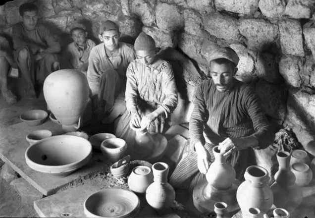
Alongside glass, Hebron made the jars and earthenware the household needed. The craft was associated with the al-Fakhouri family, whose workshops stood in parts of the Old City. The painted glazed ceramics known today appeared in the city only in the second half of the twentieth century. [8]
Tanning turned the hides of livestock into usable material, in a chain linking herding and slaughter to the leather crafts. WAFA documents more than a century of tanning handed down in the city, and a field study for the Heinrich Böll Foundation describes surviving traditional tanneries and methods of treating hides. [9][10]
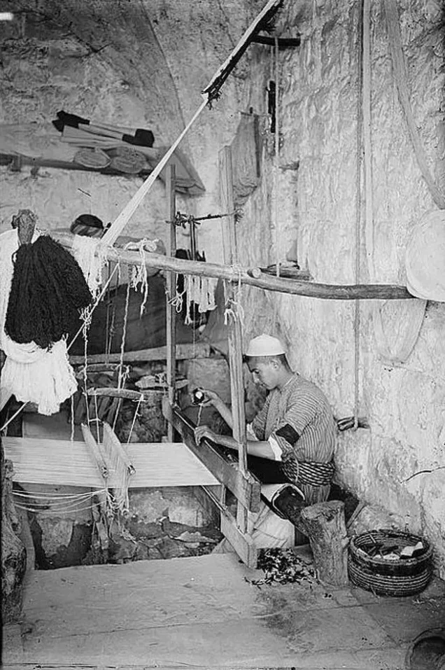
Spinning and weaving relied on sheep’s wool, goat hair and camel hair, materials supplied by the countryside and the desert. [8]
Markets: linking the hills and the plain
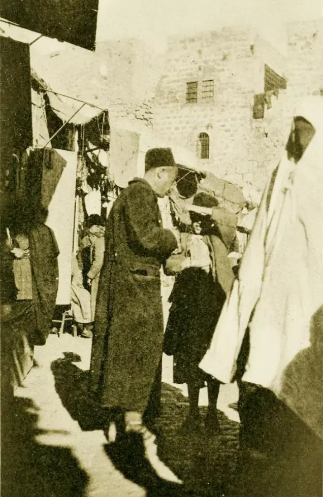
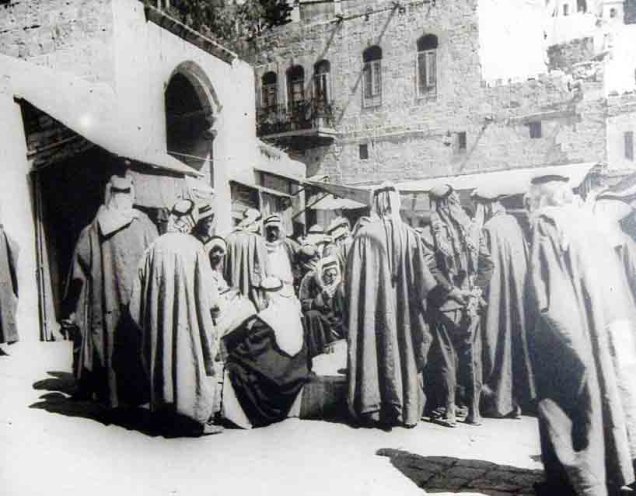
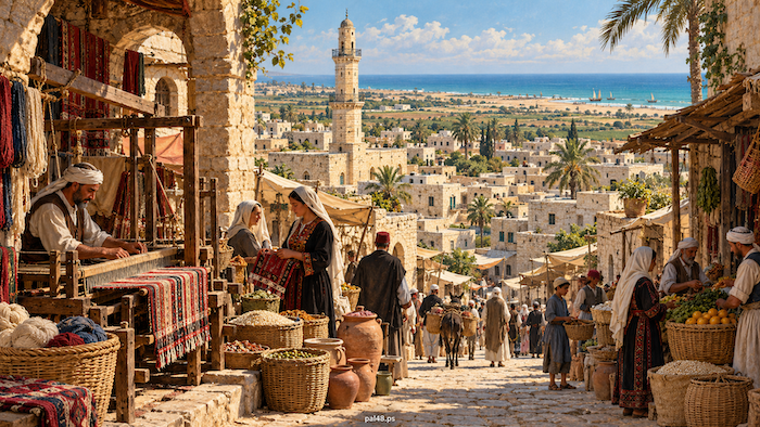
Trade routes connected Hebron with southern Palestine, Sinai, Transjordan and northern Arabia, and its markets and caravanserais were part of the infrastructure that received merchants, goods and visitors. [2]
The villages had markets of their own. Ajjur held a Friday market east of the village, drawing traders from various towns and villages. Bayt Jibrin had a weekly Tuesday market serving the village and its surroundings. [6][17]
The Friday market at al-Dawayima was known as “Souq al-Barrayn” (the market of the two lands), a reference to the produce of the plain and the hills sold there: grain, livestock and village goods moving between neighbouring environments, until the occupation cut these links by expelling the villagers. [18]
Women, work and dress
No picture of Hebron’s economy is complete without women. In the material heritage of the Hebron region, embroidery is bound up with farm work, the home and the market. The Tiraz centre displays historic garments from the region, including a dress from Dayr Samit dating from around 1928 and a headdress (ghudfa) from around 1925 embroidered with vine motifs. [11]
The centre also preserves the story of Fatima Musa from al-Qubayba, who with her mother bartered eggs for silk thread and cloth at the market in al-Faluja: a small episode that shows how women took part in economic exchange and in making clothes. [11]
There was no single dress for all the women of the district; the thobe differed from village to village, between work and festive wear, and according to what families could afford in cloth and thread. Studies of dress document the variety of garments in Dura, Yatta, al-Samu’, al-Dhahiriya, Mughallis and elsewhere. [12]
Read also on our site: The Palestinian thobe by city and Palestinian women before the Nakba.
Customs, weddings and mutual aid
Kinship and neighbourliness were present in joy, grief and work. A published local account of Bayt Nattif before the Nakba describes the wedding procession, singing, ululation, dabke, feasts and nuqut (gifts of money to the couple), as well as cooking for bereaved families and helping one another with farming and the harvest. [14]
These details come from the memory of one village, but they show such occasions as social work shared by a wide community, dividing the duties of hospitality, help and giving. Society was not equal in wealth or in access to education: school records reveal repeated requests to exempt children of poor families from fees. [14][16]
Read also on our site: The Palestinian wedding and its customs.
The Ibrahimi Takiyya: feeding people as part of city life
Hospitality in Hebron was tied to the Ibrahimi Takiyya, also known as the Takiyya of Salah al-Din, which provided food to the poor and to visitors. A study by the historian Shawkat Ramadan Hujjeh examines its social and economic history and the role of endowments (waqf) and donations in keeping it running. [15][22]
In 1936 the Takiyya served about 74,472 meals of soup over eleven months and about 16,500 meals in Ramadan, according to a local researcher quoted by Al Jazeera Net, which also notes its role in feeding people during the Nakba of 1948. [22]
Education: government schools and community initiatives
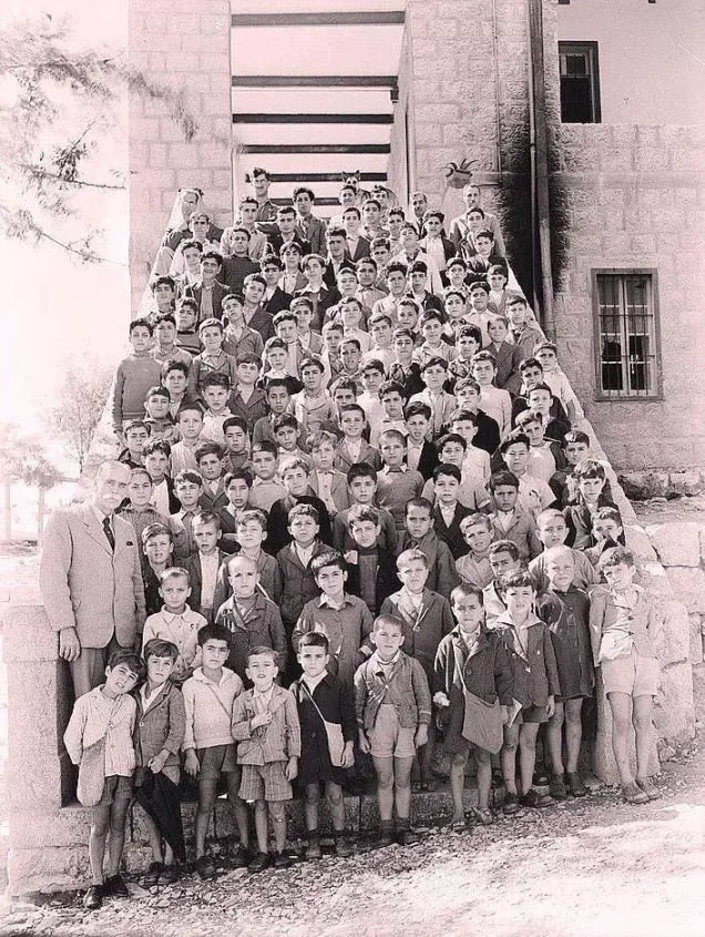
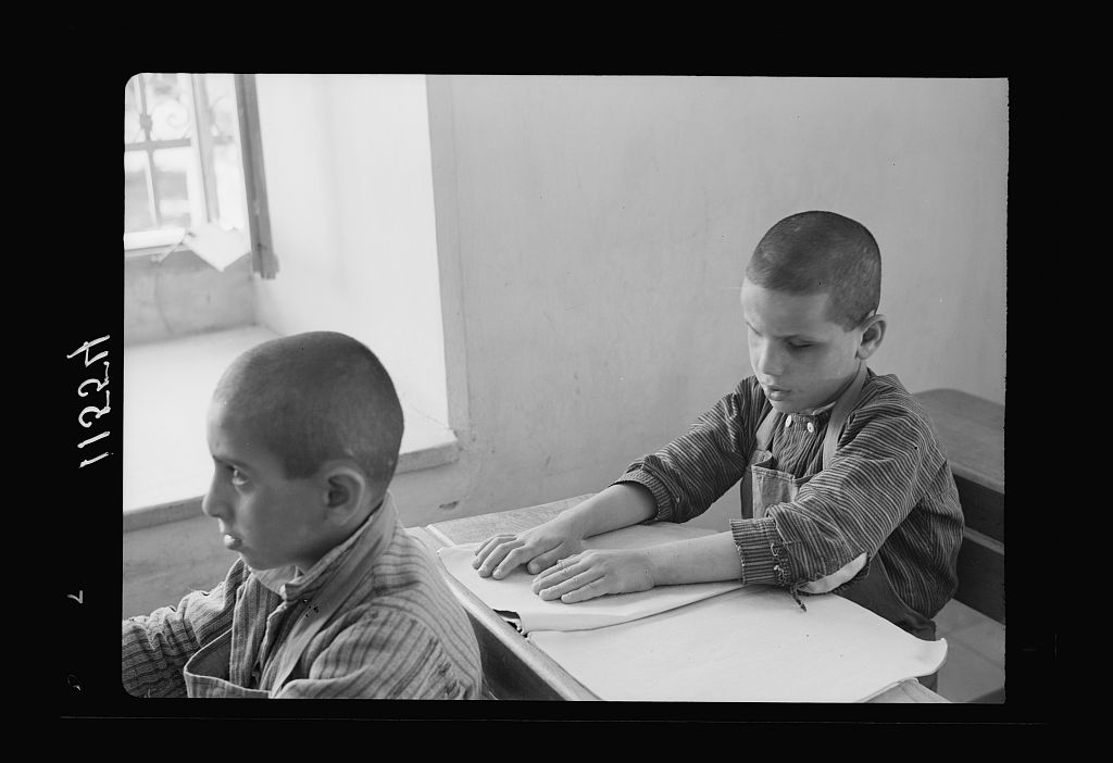
Hebron had formal schooling before the Nakba: its Rushdiyya school was founded in 1883, and schools expanded under the Mandate. In the 1942/43 school year the city had Hebron Elementary and Hebron Secondary, the Municipal School, the Girls’ School and the Ala’iyya School for the Blind, founded in 1937. [13]
That year the city’s schools had about 1,934 boys and 727 girls, with approximate enrolment rates of 60% for boys and 25% for girls of school-age children, a wide gap between the sexes. [13]
In the villages of the district there were 25 government schools of varying levels by the end of the Mandate. The people of the district raised 44,000 Palestinian pounds to build a boarding secondary school in Dura, where work began in 1946. [13]
Families did not rely on government schools alone: a study by Yasser Hussein Saleh documents the community-run al-Hidaya, al-Islah, al-Najah and al-Nahda schools, funded by local contributions and by the Supreme Muslim Council. [16]

Read also on our site: Palestinian education before 1948.
Girls’ education: the experience of Khadija Qatina
The educator Khadija Ramzi Qatina opened a private girls’ school in the 1927/28 school year, the first community girls’ school in the city. By 1933/34 it had sixty-two pupils, including four young boys. [16]
Her experience reveals an important side of women’s history in Hebron: a woman founding an educational institution, women teaching in it, and families sending their daughters. It also shows that the spread of girls’ education was gradual, limited by scarce resources and few higher grades. [16]
Health: the hospital, clinics and access
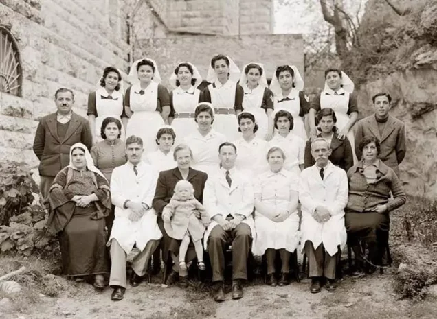
Hebron had modern medical services before 1948, but they fell clearly short. The historian Chris Sandal-Wilson documents an Anglican mission hospital from the 1890s, with twenty beds in its early years, alongside a government dispensary and other clinics. After expansion, the hospital reopened in 1929 as St Luke’s. [19]
Among those working in the city was the Egyptian doctor Ahmad Abd al-Al, government physician for the city and district, whose correspondence in 1929 revealed the pressure of patients and the inadequacy of services. In the 1930s Dr Elliot Forster ran the hospital and set up clinics in nearby villages. [19]
In the countryside, the Bayt Nattif account mentions a doctor with a clinic in Bayt Jibrin who visited the village two days a week. [14]
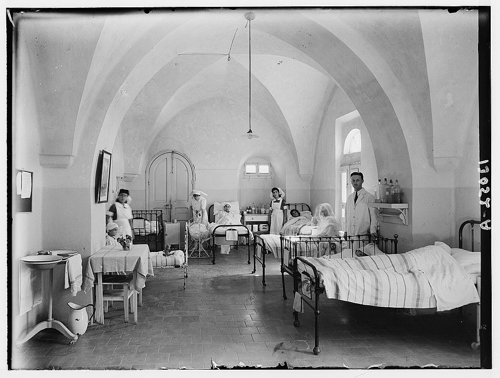
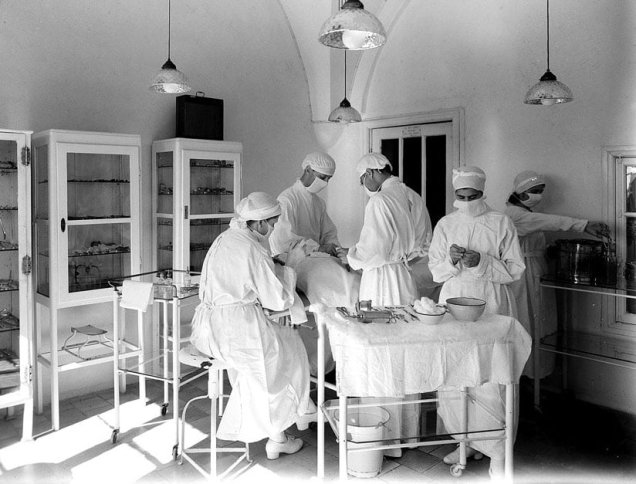
Archival photographs from 1944 show the women’s ward and the operating theatre of Hebron’s hospital. [23]
Read also on our site: Medicine and health in Palestine before the Nakba.
Medicine during the revolt
Access to treatment was never separate from colonial rule. During the 1936–1939 revolt, checkpoints, road closures and collective punishments imposed by the British Mandate authorities weakened people’s access to health care, while families treated their own wounded and rebels tried to set up medical services in the hills. [19]
The Nakba: the city stayed, its villages were occupied
The city of Hebron did not fall to Israeli forces in 1948, but that did not shield its district from the Nakba. Those forces occupied villages in the west and north-west of the district, expelled their inhabitants, and then barred them from returning home. [6][17][18][24]
| Village | What the occupation did |
|---|---|
| Ajjur | Attacked by Israeli forces in July 1948 and occupied on 23 October; the remaining inhabitants were expelled |
| Bayt Jibrin | Occupied by Israeli forces on 27 October 1948, after it was shelled and its people fled |
| al-Dawayima | Occupied by Israeli forces on 29 October 1948, who committed a massacre there |
| Zakariyya | Occupied in 1948; the occupation expelled its remaining inhabitants on 9 June 1950 |
The case of Zakariyya shows that expulsion did not end with the fighting of 1948: some villagers stayed on after their village was occupied, and were driven out two years later. [24]
The al-Dawayima massacre west of Hebron
Al-Dawayima was a farming village with an important market and 3,710 inhabitants in 1945. On 29 October 1948 it was attacked by the 89th Battalion of the Israeli army’s Eighth Brigade, which committed a massacre against its people, killing civilians in their homes, in the mosque and in places where they had taken shelter. [18]
Estimates of the dead vary. Reports to the Hebron police station spoke of about 200 killed, most of them elderly people unable to flee. The village headman (mukhtar), Hassan Mahmoud Hdeib, who witnessed the massacre, gave the Jordanian military governor a list of 455 names, noting further victims who were never recorded. The US consul in Jerusalem put the toll at between 500 and 1,000. [26]
Survivors scattered to villages and camps in the West Bank and to Jordan, including the al-Arroub and al-Fawwar camps. [18]
Read also on our site: The al-Dawayima massacre and the depopulated village of al-Dawayima.
Hebron receives the refugees
The effects of expulsion reached the Hebron area during the war itself. A UN statement dated 14 September 1948 mentions a gathering of refugees in Hebron among the sites visited by UN medical experts. [25]
The al-Fawwar and al-Arroub camps were set up in 1949. According to UNRWA, the people of al-Fawwar come from 18 villages in the Gaza, Hebron and Beersheba areas, and those of al-Arroub from 33 villages in the Ramle, Hebron and Gaza areas. [20][21]
Communities thus grew up around the city of people stripped of their land and livelihoods by expulsion, in need of shelter, schooling, health care and work, and still holding on to their villages and their right to return.
How the Nakba changed Hebron’s economy and services
Expulsion severed the web of relationships that bound the city to its district: a village that grew grain and hosted a weekly market, another that raised livestock and practised crafts, and a city that traded goods and services with both. When the occupation expelled the people of villages such as Ajjur, Bayt Jibrin and al-Dawayima, they lost their homes and land, and the region lost parts of its economic and social space. [6][17][18]
In education, expelling a village with a school meant uprooting the school community itself, while the city and the villages receiving refugees faced new educational and health needs, and schools, clinics and relief became essential parts of life in exile. [6][20][21][25]
Hebron between Egypt and Jordan, 1948–1967
During the 1948 war, Egyptian forces entered the southern sector of Palestine, including Hebron, from 20 May 1948 and made the city one of their headquarters, while the Jordanian Salih al-Majali was appointed its military governor in June of that year. The city remained under dual Egyptian and Jordanian rule until Egyptian troops left the country on 30 April 1949. [27]
Hebron then came under Jordanian administration in 1950, and remained so until the Israeli army occupied it in June 1967. [28]
From the Nakba to occupation: Hebron after 1967
A few months after the city was occupied, in early 1968, a group of 73 settlers led by Rabbi Moshe Levinger checked into the al-Nahr al-Khalid hotel in Hebron, claiming to be there for Passover, then refused to leave, creating the first settlement outpost in the city. [29] That same year the occupation established the settlement of Kiryat Arba on the edge of the Old City. [28]
On 25 February 1994 the settler Baruch Goldstein opened fire on worshippers in the Ibrahimi Mosque during the dawn prayer, killing 29 and wounding others. [28][29] Instead of holding the settlers to account, the occupation divided the mosque, giving Jews about 56% of its area. Then the Hebron Protocol of 15 January 1997 split the city into H1 (about 80%), under the Palestinian Authority, and H2 (about 20%), including the Old City and the mosque, under Israeli security control. [29]
Today Hebron carries two memories: that of the city that stayed in 1948 and took in the refugees, and that of an Old City besieged by settlement since 1967.
Read also on our site: Hebron and its depopulated villages.
Frequently asked questions
Was Hebron occupied in 1948?
No. The city stayed outside the control of Israeli forces in 1948 and was occupied in June 1967. But villages of its district, including Ajjur, Bayt Jibrin and al-Dawayima, were occupied and their people expelled in the Nakba. [17][18][28]
Why is Hebron called al-Khalil?
After the Prophet Abraham, known as Khalil al-Rahman, “the Friend of the Merciful”. The city was called Khalil al-Rahman, later shortened to al-Khalil. [1][4]
What was Hebron’s population before the Nakba?
About 24,560 in 1945, up from 16,577 in 1922, not counting the villages of the district. [1]
What was Hebron known for before the Nakba?
For grapes and grape products such as dibs, malban and raisins; for glass, pottery and leather; and for spinning, weaving and trade. [4][5][7][8]
Did girls go to school in Hebron before the Nakba?
Yes. There was a government girls’ school and a private one founded by Khadija Qatina in 1927/28, but girls’ enrolment was only about 25% in 1942/43. [13][16]
When did the al-Dawayima massacre take place?
On 29 October 1948, when the Israeli army’s 89th Battalion attacked the village of al-Dawayima west of Hebron. The village headman submitted a list of 455 names of those killed. [18][26]
How did the al-Fawwar and al-Arroub camps come about?
They were set up in 1949 to shelter refugees driven by the occupation from their villages in the Hebron, Gaza, Beersheba and Ramle areas. [20][21]
Read also on Palestinuna
- Hebron and its depopulated villages
- Depopulated Palestinian villages
- Zionist massacres
- Palestinian refugee camps
- The Palestinian Nakba
- Palestine before the Nakba
Sources and references
- Palestinian National Information Center – WAFA, “Hebron” (in Arabic).
- UNESCO, “Hebron/Al-Khalil Old Town”.
- Hebron Rehabilitation Committee, “The Urban Character of the Old City” (in Arabic).
- Hebron Rehabilitation Committee, “The City of Hebron” (in Arabic).
- Omar Asi, “A Journey with Grapes from the Heart of the Desert to Gaza, Hebron and the Far Galilee,” Ma’an Development Center, 2022 (in Arabic).
- Institute for Palestine Studies – PalQuest, “Ajjur,” from All That Remains (in Arabic).
- Palestinian Ministry of Tourism and Antiquities, Virtual Museum, “Glassmaking”.
- Hebron Rehabilitation Committee, “Trades and Handicrafts” (in Arabic).
- WAFA, “Leather Tanning” (in Arabic).
- Lina Ismail and Mona Dajani, “Abu Ahmad al-Muhtasib: Traditional Sheepskin Tanning,” Heinrich Böll Foundation, 2021.
- Tiraz Centre, “The Embroidery Heritage of Hebron,” Google Arts & Culture.
- Palestinian Heritage Encyclopedia, “Women’s Traditional Dress in Hebron Governorate” (in Arabic).
- Palestinian National Information Center – WAFA, “Education under the British Mandate,” Hebron district section (in Arabic).
- “An Overview of Bayt Nattif and Its Social Life before the Nakba,” local account published on Palestine Remembered (in Arabic).
- Shawkat Ramadan Hujjeh, “The Historical Development of the Ibrahimi Takiyya in Hebron and Its Social and Economic Role,” Al-Hiwar al-Mutawassiti, 2018 (in Arabic).
- Yasser Hussein Saleh, “Community Schools in Hebron under the British Mandate, 1920–1948,” Journal of Al-Quds Open University, no. 66, 2025 (in Arabic).
- Institute for Palestine Studies – PalQuest, “Bayt Jibrin” (in Arabic).
- Sanaa Hammoudi, “The al-Dawayima Massacre, 29 October 1948,” Institute for Palestine Studies – PalQuest (in Arabic).
- Chris Sandal-Wilson, “The Colonial Clinic in Conflict: Towards a Medical History of the Palestinian Great Revolt, 1936–1939,” Culture, Medicine, and Psychiatry.
- UNRWA, “Al-Fawwar Refugee Camp” (in Arabic).
- UNRWA, “Al-Arroub Refugee Camp” (in Arabic).
- Al Jazeera Net, “Hebron’s People Preserve the Takiyya of Salah al-Din,” 2009 (in Arabic).
- Library of Congress, photograph of the women’s ward in Hebron hospital, Matson Collection.
- Institute for Palestine Studies – PalQuest, “Zakariyya” (in Arabic).
- United Nations, statement on a visit by medical experts to refugee sites, 14 September 1948.
- Maryam al-Sayegh, “Memorials in Britain Tell of the Forgotten al-Dawayima Massacre,” Al Jazeera Net, 16 May 2024 (in Arabic).
- Kimberly Katz, “Hebron between Jordan and Egypt: An Uncertain Transition Resulting from the 1948 Palestine War,” Urban History, 2019.
- Al Jazeera Encyclopedia, “Hebron” (in Arabic).
- Abdul Wahab al-Morsi, “West Bank Settlement Began in Hebron, and Annexation May Begin There Too,” Al Jazeera Net, 27 February 2025 (in Arabic).
More from the archive
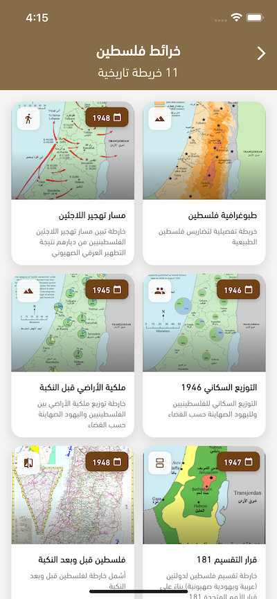
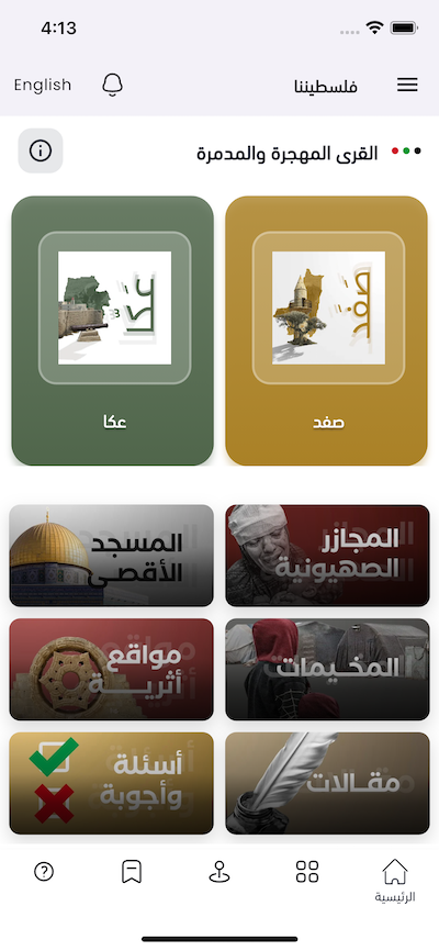
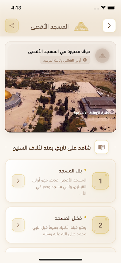
 Download Our Palestine App
The whole archive in the palm of your hand: depopulated villages, the Nakba, the massacres and Al-Aqsa — free, with no ads to erase the story.
Comments
No comments yet — be the first to write one.
Add your comment
Name and email are optional. Comments appear after review.