
The depopulated village of Al-Khureiba / District of Haifa
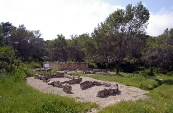
Al-Khureiba
About the depopulated village of Al-Khureiba
- District
- Haifa
- Date Al-Khureiba was occupied
- 01 April 1948
- Cause of displacement
- Military assault by Zionist troops
- Extent of destruction
- Destruction, rubble identified
- Settlements built on the built-up area of Al-Khureiba after 1948
- Haifa University
Hover a dot to read the village name, or click to open its card.
al-Khureiba – Historical Palestinian Locality in the Haifa Subdistrict
Al-Khureiba, also recorded as Khirbat al-Khareiba, was a historical Palestinian locality and land unit in the Haifa Subdistrict on the slopes of Mount Carmel, in the area between the lands of al-Tira, 'Isfiya, Daliyat al-Karmil, and Yajur.
Al-Khureiba differs substantially from most Palestinian villages depopulated during the 1948 war. British Mandate records do not record a resident population there in either the 1931 census or the 1945 Village Statistics, although al-Khureiba continued to exist as a separately named geographic and land unit covering a substantial area.
Palestinian local documentation further describes the locality as having become ruined or uninhabited before 1948. The history of al-Khureiba must therefore distinguish between earlier Palestinian residence at the site, the departure of its inhabitants before the Nakba, and the later legal and statistical status of its lands.
Basic Information
| Field | Information |
|---|---|
| Name | al-Khureiba / Khirbat al-Khareiba |
| Arabic name | الخُرَيْبَة / خربة الخريبة |
| Subdistrict | Haifa |
| Region | Mount Carmel |
| Location | On the slopes of Mount Carmel near Haifa, east of the lands of al-Tira and in the wider area of 'Isfiya, Daliyat al-Karmil, and Yajur |
| Distance from Haifa | No independently documented figure was located in the principal sources consulted |
| Elevation | No reliable independent figure located |
| Population in 1931 | No population or occupied houses were recorded in the official census |
| Population in 1945 | No population was recorded in Village Statistics 1945 |
| Population in 1948 | No documented independent figure; Palestinian local sources indicate that the settlement had become uninhabited before the Nakba |
| Total land area in 1945 | 7,907 dunums |
| Date of depopulation | Before 1948; the precise date is not independently established |
| Military occupation date | Not established; this article does not accept the automatically listed date of 1 April 1948 as verified history |
| Military operation | No independently documented operation associated with the depopulation of an inhabited al-Khureiba in 1948 |
| Military unit | Not documented |
| Cause of depopulation | Not known with precision; Palestinian local documentation indicates departure before the Nakba |
Name and Nature of the Locality
Mandate records use the forms al-Khureiba and Khirbat al-Khareiba. The Arabic term khurayba is a diminutive of khirba, or “ruin,” but the name should not be taken to mean that the site had never been inhabited. Palestinian local memory records families who resided and farmed there.
At the same time, the official statistical record demonstrates that al-Khureiba was not treated during the 1930s and 1940s as a substantial inhabited village comparable with other rural communities of the Haifa Subdistrict.
Location and Boundaries
Al-Khureiba lay on the slopes of Mount Carmel near Haifa. Palestinian village documentation places it among the lands of al-Tira, 'Isfiya, Daliyat al-Karmil, Yajur, and Balad al-Shaykh.
A Palestinian historical study of al-Tira identifies al-Khureiba as lying along the eastern boundary of al-Tira's lands, while other Palestinian sources place the locality near the area occupied today by the University of Haifa.
No sufficiently reliable independent distance from the center of Haifa was located, so no estimated figure is inserted.
Families and Earlier Inhabitants
The Palestinian Villages Encyclopedia identifies the Qusayni and Abu Daher families among those associated with al-Khureiba. Another Palestinian compilation additionally lists the Samara family.
The same village encyclopedia preserves a local account that Druze inhabitants lived at al-Khureiba during the eighteenth century before moving to nearby 'Isfiya.
These accounts represent Palestinian local historical documentation rather than official population statistics.
Population in the Official Records
| Year | Population | Documentation |
|---|---|---|
| 1922 | No independently verified figure | No separate figure located that can safely be assigned to al-Khureiba |
| 1931 | No figure recorded | The official Haifa Subdistrict table lists “Khirbat al Khareiba,” but the occupied-house and population fields are blank |
| 1945 | No figure recorded | Village Statistics 1945 retains al-Khureiba as a land unit but records no population |
| 1948 | No independently documented figure | Palestinian local documentation describes the locality as having become uninhabited before 1948 |
No 1948 population should therefore be reconstructed from the size of the landholding or from populations of neighboring villages.
Number of Houses
The 1931 Census does not record any occupied houses for Khirbat al-Khareiba. No reliable independent official house count for the later period was located.
A house total for 1931 or 1948 should therefore not be invented.
Land Ownership, 1945
Despite having no recorded population in 1945, al-Khureiba remained a separately tabulated land unit covering 7,907 dunums.
- Palestinian0 dunums0%
- Transferred to Zionists3,911 dunums49%
- Public3,996 dunums51%
The original Government of Palestine table used the categories Arab, Jewish, and Public. It recorded no land in the Arab category, 3,911 dunums in the Jewish category, and 3,996 dunums as public land.
The figures balance exactly: 3,911 + 3,996 = 7,907 dunums.
Land Use, 1944/45
- Palestinian
- Transferred to Zionists
- Public
- Cereals3,831 dunums
- Built-up area0 dunums
- Non-cultivable land4,076 dunums
No separate citrus, banana, plantation, or irrigable-land category is recorded for al-Khureiba in the table, and no built-up area is listed.
The figures balance exactly: 3,831 + 80 + 3,996 = 7,907 dunums.
Transfer of Land Ownership
The 1945 statistics firmly establish that no part of al-Khureiba's land was then registered in the official Arab ownership category. The official table classified 3,911 dunums as Jewish-owned and 3,996 dunums as public land.
A Palestinian community contribution published by Palestine Remembered states that approximately 4,000 dunums of al-Khureiba land changed hands in 1937 in connection with the settlement of debts and properties belonging to the Khoury family.
Because an original deed for this transaction was not located among the principal Palestinian sources consulted, the 1937 account is retained as an attributed Palestinian source claim, while the official 1945 figures remain the basis of the ownership table.
al-Khureiba in the 1940 Land Transfers Regulations
The 1940 Land Transfers Regulations list al-Khureiba by name among the villages of the Haifa Subdistrict. The entry confirms that it remained a recognized geographical and land unit within the Mandatory administrative system even though the census tables did not record a resident population.
Economy
Palestinian local sources describe the economy of al-Khureiba's former inhabitants as agricultural.
The land-use statistics confirm the significance of cereal cultivation within the land unit: 3,831 dunums were classified as cereal land in 1944/45.
Because no population was recorded at al-Khureiba in 1945, however, it should not automatically be assumed that this cultivation was being carried out by Palestinians residing within the locality at that date.
Education and Services
No independent documentation of a school, mosque, administrative building, or medical facility at al-Khureiba during the Mandate period was located in the principal sources consulted.
No such institution is therefore added without supporting evidence.
Water
Palestinian local documentation preserves the name Bir al-Khureiba, the “well of al-Khureiba,” as a landmark in the area. One Palestinian community source states that the well remained visible when the site was documented.
No reliable information was located concerning the date of construction, capacity, or historical management of the well.
Archaeological Remains
The Palestinian Villages Encyclopedia records burials and cisterns at the site.
The source does not provide a secure archaeological dating, so these remains are not assigned to the Roman, Byzantine, or any other period without additional specialist evidence.
Depopulation Before 1948
The Palestinian Villages Encyclopedia classifies al-Khureiba as having been destroyed before 1948, while other Palestinian local documentation states that families associated with the locality had left before the Nakba.
The available principal sources do not provide one independently verified date for the departure of the final residents. A community item refers to 1946, but no primary document was located that would justify treating 1946 as a conclusively established date.
The most accurate formulation is therefore that al-Khureiba had become uninhabited before 1948, while the precise date and immediate circumstances of the final departure remain uncertain.
Was al-Khureiba Occupied on 1 April 1948?
An automated field on Palestine Remembered gives 1 April 1948 as an occupation date and classifies the exodus as resulting from direct military assault.
This classification conflicts with the available official statistical record: the 1931 census recorded no residents or occupied houses at Khirbat al-Khareiba, and Village Statistics 1945 likewise recorded no population. Palestinian local documentation also characterizes the locality as uninhabited before the Nakba.
No independent account by Walid Khalidi, PalQuest, or another principal Palestinian historical source was located documenting a military assault on a resident population of al-Khureiba on 1 April 1948.
This article therefore does not treat that date as a verified occupation date and does not assign a military operation, brigade, or battalion without supporting documentation.
Military Operation and Unit
No independently documented military operation associated with the depopulation of al-Khureiba was located, nor was a brigade or battalion identified as having captured an inhabited village there in 1948.
In accordance with the project's non-invention rule, the military operation and unit remain listed as undocumented rather than borrowed from neighboring Haifa villages.
Destruction
Palestinian local sources indicate that al-Khureiba had already become ruined before 1948. The precise date and mechanism by which its residential structures disappeared are not independently established in the principal sources available.
Its destruction should therefore not automatically be attributed to a military action in April 1948.
Israeli Settlements and Later Development on al-Khureiba's Lands
The Palestinian sources consulted do not identify an Israeli settlement established on al-Khureiba's lands before 1948.
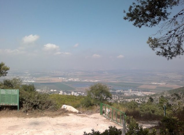
For the later period, Palestinian local documentation places the University of Haifa and a number of parks and modern facilities within or immediately adjacent to the historical land area of al-Khureiba.
The sources differ in whether the university itself should be described as occupying the exact former built-up site or a broader portion of the locality's lands. The more cautious formulation is therefore that the University of Haifa and modern facilities occupy parts of or lie within the historical al-Khureiba land area, while a precise cadastral determination would require detailed land-settlement maps.
al-Khureiba Today
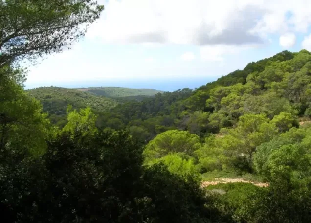
According to Palestinian local documentation, the landscape of al-Khureiba has been extensively transformed and now forms part of the modern built and wooded environment of Mount Carmel.
The Palestinian Villages Encyclopedia places the University of Haifa and a number of parks within al-Khureiba's historical lands, while another Palestinian source places the former locality near the university and records the continued presence of Bir al-Khureiba.
Local documentation also records burials and cisterns associated with the site.
No comprehensive Palestinian archaeological and cadastral field survey from 2026 was located in the sources reviewed. The present description should therefore be understood as accumulated Palestinian community documentation rather than a comprehensive current field verification of every surviving feature and boundary.
Sources
- PalQuest – Land Transfers Regulations, 1940: al-Khureiba listed in the Haifa Subdistrict
- Sabil – Sami Hadawi, Village Statistics 1945: population and total land area
- Sabil – Village Statistics 1945: al-Khureiba land use
- Sabil – Village Statistics 1945: built-up and non-cultivable land
- Census of Palestine 1931 – Haifa Subdistrict table listing Khirbat al-Khareiba
- Palestinian Villages Encyclopedia – al-Khureiba, Haifa
- Palestine Remembered – al-Khureiba, Haifa Subdistrict
- Palestine Remembered – Palestinian community material concerning al-Khureiba lands and the Khoury family
- Falastinuna – Palestinian local documentation of al-Khureiba, its families, and Bir al-Khureiba
- Abbas Nimer – Ottoman-era history of al-Tira and its boundary with al-Khureiba
Photo gallery
Photos from the village's people
Photos sent in by visitors and published after review.
Add a photo of this village
Log in to add photos of this village.
Other villages from Haifa
More from the archive


 Download Our Palestine App
The whole archive in the palm of your hand: depopulated villages, the Nakba, the massacres and Al-Aqsa — free, with no ads to erase the story.
Download Our Palestine App
The whole archive in the palm of your hand: depopulated villages, the Nakba, the massacres and Al-Aqsa — free, with no ads to erase the story.



Comments
No comments yet — be the first to write one.
Add your comment
Name and email are optional. Comments appear after review.