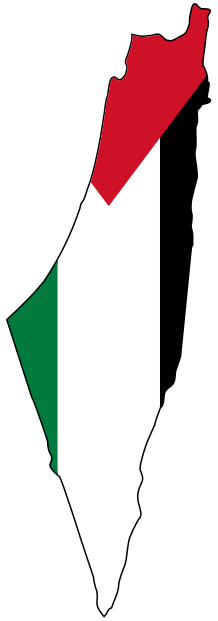
Gaza before the Nakba: markets, the sea, schools, hospitals
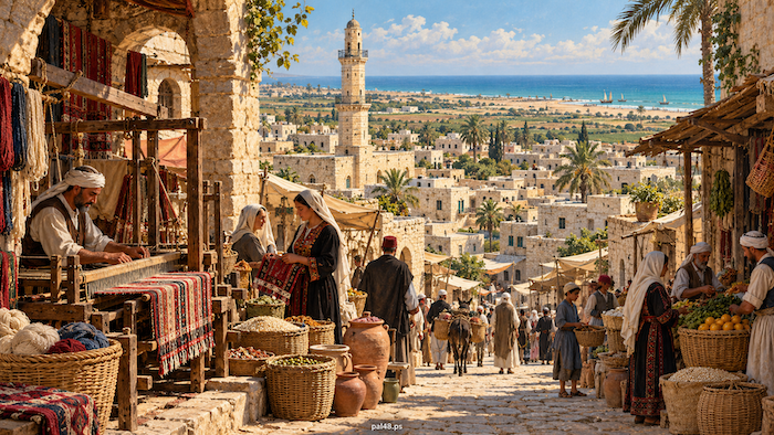
This article is part of the Palestine before the Nakba series.
Before Gaza became a byword for camps, siege and genocide, it was a Palestinian city with markets, schools, hospitals and a municipality, a countryside reaching to al-Majdal, Isdud, al-Faluja and Beersheba, and roads opening southern Palestine to Egypt and the centre of the country. Cloth came off the loom, sesame went into the press, pupils went to school and crops moved from village to market. [1][2][3]
Then came the Nakba. Zionist forces expelled the people of the district’s villages and towns, from Isdud, Hamama and al-Jura to Bayt Daras and al-Faluja, and more than 200,000 refugees crowded into the coastal strip that became the “Gaza Strip”, alongside some 80,000 original inhabitants. [4]
Contents
- Gaza before the Nakba at a glance
- The name: Gaza of Hashem
- Location: southern Palestine’s gateway to Egypt and the interior
- Gaza’s population: a growing city
- Quarters and houses
- The municipality and services
- Farming: barley, citrus and sesame
- Industry and crafts: loom, press and pottery
- Trade and markets
- The railway, the sea and fishing
- The Great Omari Mosque
- Sayed Hashem Mosque and St Porphyrius Church
- Customs and society
- Women
- Education: schools, secondary classes and libraries
- Health: the Ahli Arab and al-Shifa hospitals
- Culture and reading
- 1948: Gaza takes in those who lost their villages
- The depopulated villages
- The camps
- The 1956 occupation and the Khan Yunis and Rafah massacres
- From the Nakba to genocide
- Frequently asked questions about Gaza before the Nakba
Gaza before the Nakba at a glance
| Item | Details |
|---|---|
| Gaza city population | About 17,426 (1922); about 34,170 (1945) |
| Gaza district, late Mandate | The towns of Gaza and al-Majdal and 54 villages |
| Municipality | Founded in 1893 |
| Main quarters | al-Daraj, al-Zaytun, al-Shuja‘iyya, al-Tuffah |
| Landmarks | The Great Omari Mosque, Sayed Hashem Mosque, St Porphyrius Church, the Qaysariyya market |
| Hospitals | Ahli Arab (1882), al-Shifa (1946) |
| In the Nakba | More than 200,000 refugees in the Strip, against some 80,000 residents |
| After the Nakba | Egyptian administration; occupation 1956–1957; occupation from 1967 |
Population figures are for Gaza city alone. The Mandate-era Gaza district was far larger than the “Gaza Strip” that took shape after the 1948 war. [5][3][6][2][7][8][9][4][10]
The name: Gaza of Hashem
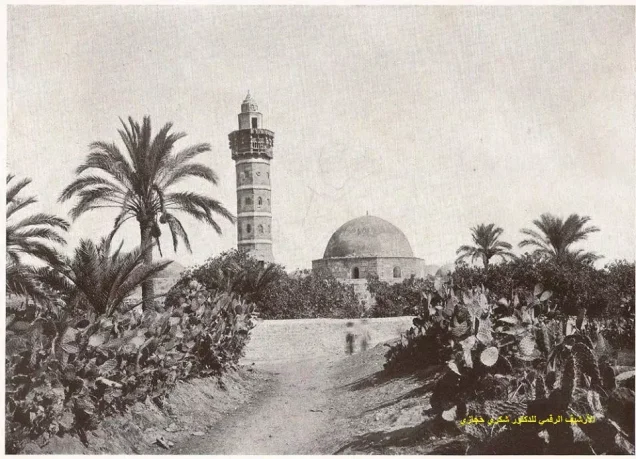
Gaza is an ancient name, recorded in similar forms across the languages of successive eras. The title “Gaza of Hashem” refers to Hashem ibn Abd Manaf, great-grandfather of the Prophet Muhammad, who according to tradition died in Gaza on a trading journey; the Sayed Hashem Mosque preserves the link. [1][7]
Read also: Gaza city, its photographs and villages.
Location: southern Palestine’s gateway to Egypt and the interior
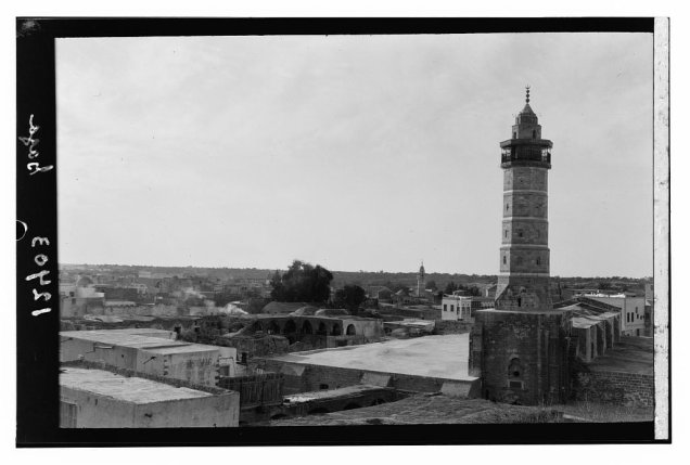
Old Gaza stood on a hill some distance from the shore, before spreading beyond its historic core. Its position on the roads between Egypt and Syria gave it lasting commercial weight: travellers from the south passed through it to the towns of Palestine, and those from the interior found a market and a link to the coast. [1][2]
Gaza’s population: a growing city
Gaza city’s population nearly doubled under the Mandate, from about 17,426 in the 1922 census to about 34,170 in 1945. [5]
Quarters and houses
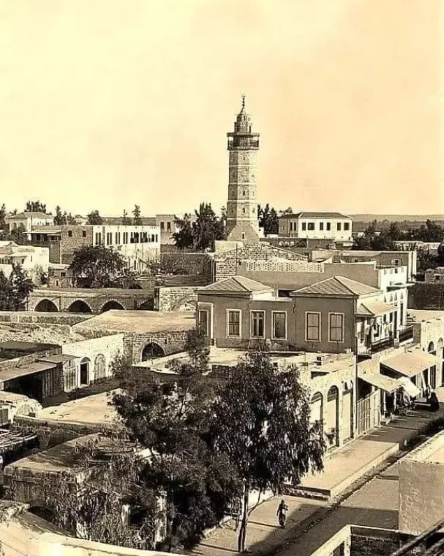
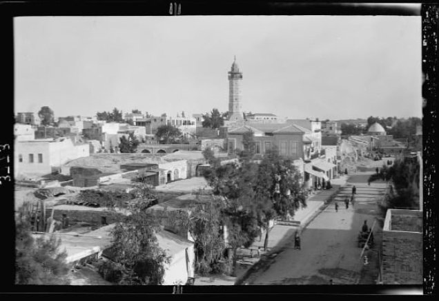
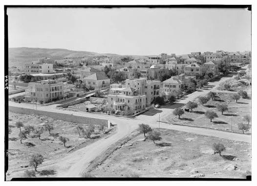
Gaza’s historic quarters included al-Daraj, al-Zaytun, al-Shuja‘iyya and al-Tuffah, the old core and its extensions, while westward growth toward the dunes developed in the last decades of the Mandate. Photographs show minarets over closely packed roofs, with commercial and administrative buildings, schools and roads. [2][11]
The municipality and services
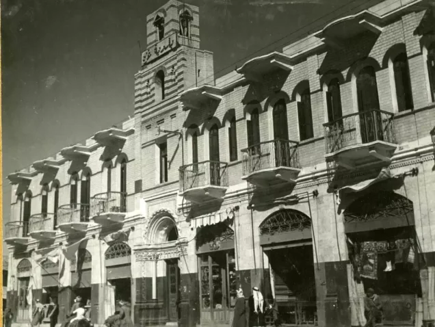
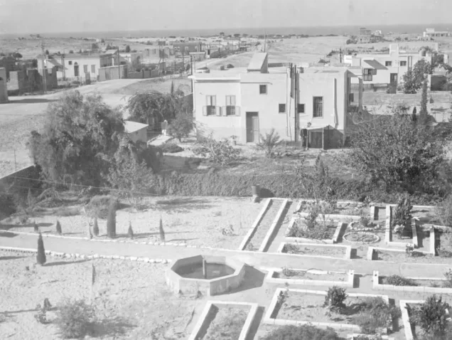
Gaza Municipality was founded in 1893, with al-Hajj Mustafa Muhammad al-Alami as its first head. Under the Mandate Fahmi al-Husseini led it after the 1928 elections and was re-elected in 1934. Photographs from 1933 show the municipal building and park. [6][11]
Farming: barley, citrus and sesame
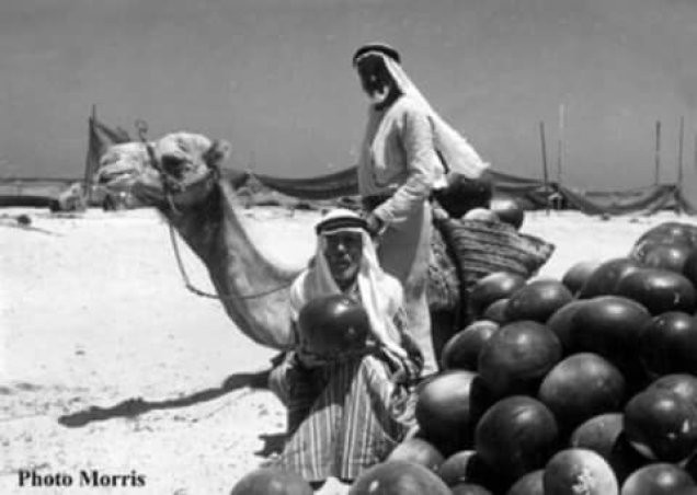
Barley was among Gaza’s crops exported to England in the 1930s, and citrus farming flourished in the same period before its exports suffered in the Second World War. [2]
Farming in the district varied with soil and water: Bayt Daras had grain, citrus and orchards, while crops differed in Hamama, Hirbiya, Isdud and the rest of the countryside. [12]
Read also: Agriculture in Palestine before the Nakba; Life in the Palestinian village.
Industry and crafts: loom, press and pottery
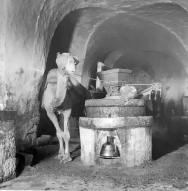
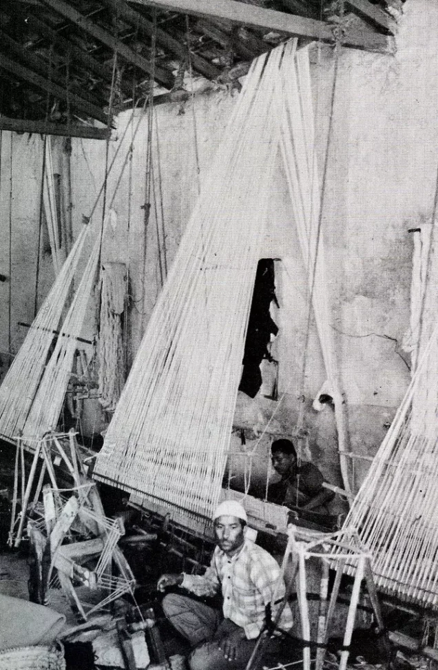
Archival photographs show a sesame oil press in 1900 and weaving in the early twentieth century. Pottery, used for vessels, storage and building, was among the traditional crafts, according to the Gaza Municipality guide. In the district, al-Majdal was one of southern Palestine’s leading weaving centres. [11][13][14]
Read also: al-Majdal and Asqalan before the Nakba; Palestinian industries before the Nakba.
Trade and markets
Gaza was a market linking the interior with the coast; one of its main arteries was Omar al-Mukhtar Street, shown in photographs from 1940 and 1945. [11]
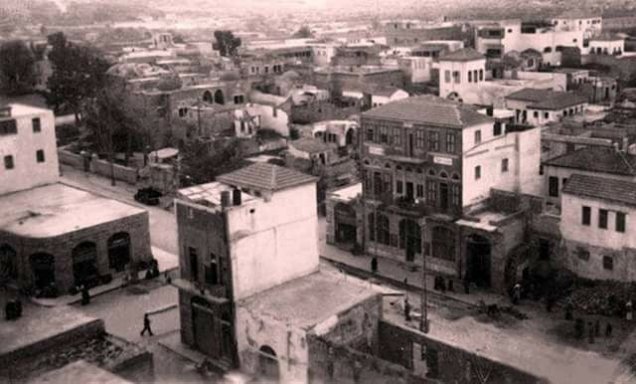
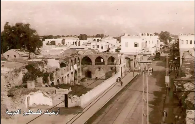
The Qaysariyya market, known as the gold market, adjoins the Great Omari Mosque in al-Daraj: a historic covered market of facing shops tied to Mamluk architecture. It was damaged by occupation bombardment during the genocide. [15][16]
Read also: Markets and trade in Palestine before 1948.
The railway, the sea and fishing
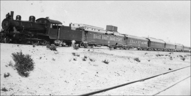
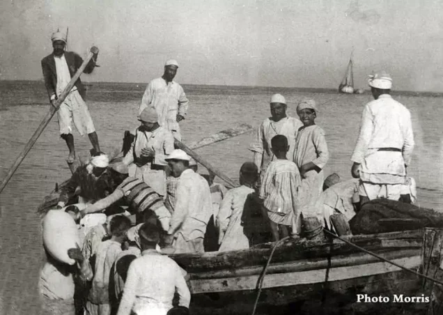
A photograph of Gaza station in November 1930 shows a train and carriages in the network linking the city to Egypt and the towns of Palestine. Its coast was fished before the Nakba, and afterwards Gaza took in fishermen expelled by the occupation from other coastal towns and villages, such as al-Jura. [2][11][17]
Read also: Fishing on Palestine’s shores before the Nakba.
The Great Omari Mosque
The Great Omari Mosque was one of Gaza’s foremost landmarks and centres of religious and scholarly life. Badly damaged in the First World War, it was restored by the Supreme Muslim Council in 1926. [1]
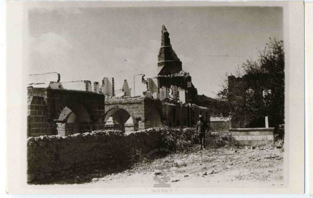
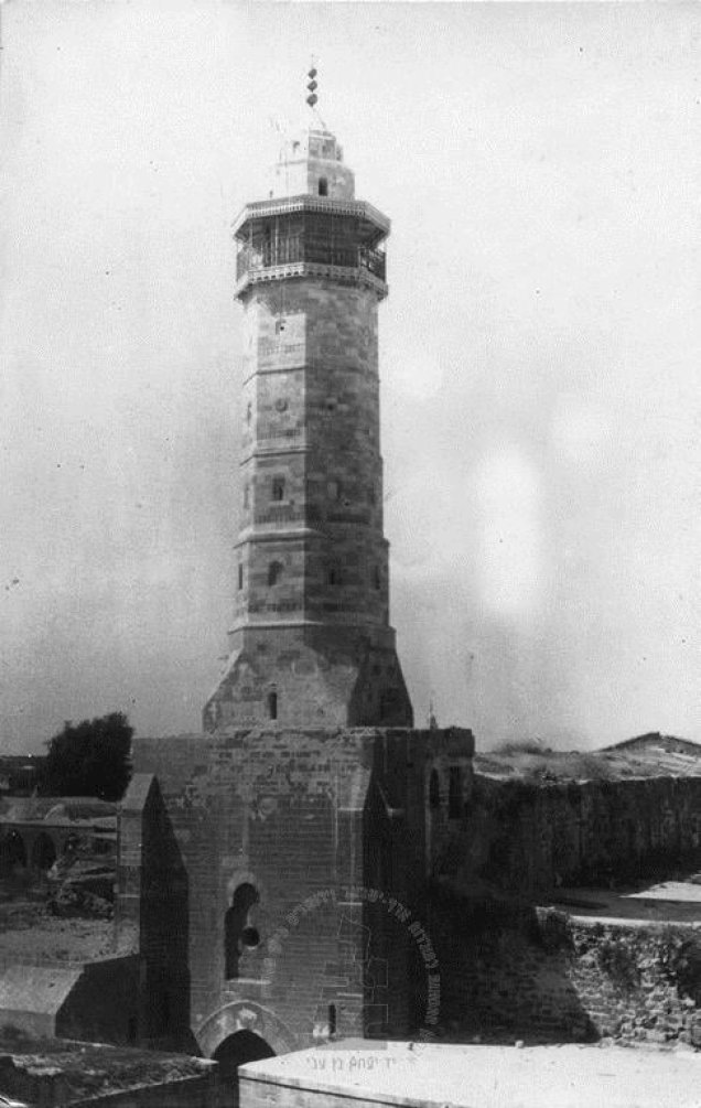
On 8 December 2023 the occupation army bombed it, destroying it almost entirely. [18][16]
Sayed Hashem Mosque and St Porphyrius Church
Sayed Hashem Mosque appears in old photographs of Gaza as a landmark of the city’s memory, and St Porphyrius Church in al-Zaytun was part of the history and life of Gaza’s Christian community. [7][19]
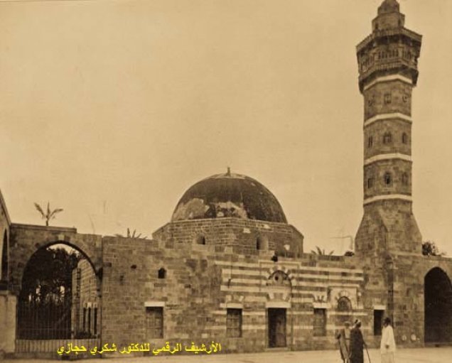
In December 2023 Sayed Hashem Mosque was heavily damaged by bombardment, and on 19 October 2023 the occupation struck St Porphyrius Church, where displaced people were sheltering, killing more than 20 of them. [16][18]
Read also: Gaza’s heritage: the Omari Mosque, the Pasha’s Palace and the Central Archive.
Customs and society
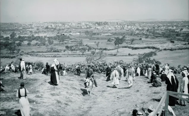
Life in Gaza brought together family, neighbours, hospitality, weddings and public occasions, within a Palestinian heritage of coffee, folk song and embroidery. The gallery holds a photograph of a gathering for a religious occasion in April 1943. [20][11]
A documentary study of the Gaza Sharia court records under the Mandate reveals social inequality, marriage ties shaped by wealth, and a wide presence of charity and endowments. [21]
Read also: Palestinian weddings before the Nakba; Popular seasonal festivals.
Women
Sharia court records show women active in endowments, charity and some areas of economic life, and also a gap between rights in law and in practice, including cases of women denied their inheritance. School records confirm that there were female pupils and teachers in Gaza before the Nakba. [21][3]
Read also: Palestinian women before the Nakba.
Education: schools, secondary classes and libraries
Before the Nakba Gaza had government, community and municipal schools. Imam al-Shafi‘i school became a full secondary school in 1947–48, with 794 pupils and 26 teachers at the start of 1948. [3]
| School | Pupils on 1 January 1948 |
|---|---|
| Imam al-Shafi‘i | 794 boys |
| Hashem ibn Abd Manaf | 566 boys |
| al-Zaytun | 343 boys |
| al-Shuja‘iyya | 435 boys |
| Gaza Girls’ School | 464 girls |
| Gaza Girls’ Elementary Branch | 232 girls |
Schools had libraries and a boarding section for students from outside the city, alongside non-government schools such as Gaza College and al-Falah Islamic School, and the local education committee helped pay costs and teachers’ salaries. Education in Gaza thus predated the UNRWA schools that came after the Nakba to serve the refugees. [3][22]
Read also: Palestinian education before 1948.
Health: the Ahli Arab and al-Shifa hospitals
The Ahli Arab Hospital was founded in 1882; its main building went up in 1907, was damaged in the First World War and rebuilt, and Baptists ran it from 1951. Al-Shifa Hospital was founded in 1946. [8][23][9]
On 17 October 2023 the occupation struck the courtyard of the Ahli Arab Hospital, where displaced people had taken shelter, killing more than 500 Palestinians. On 18 March 2024 the occupation army besieged the al-Shifa complex; when it withdrew on 1 April it left the buildings burned and out of service, and hundreds of bodies were found inside and around it. [24][25]
Read also: Medicine and health in Palestine before the Nakba.
Culture and reading
The life of the poet Mu‘in Bseiso illustrates a generation raised in Gaza’s cultural milieu: he studied at Gaza College, began publishing in the Jaffa magazine al-Hurriyya in 1946, and then studied in Cairo. [26][27]
Read also: Libraries, newspapers and printing before the Nakba; Art, cinema, theatre and radio.
1948: Gaza takes in those who lost their villages
On 15 May 1948 Egyptian forces entered Gaza, and after the war the city remained within the strip placed under Egyptian administration, while Israeli forces occupied most of its district and expelled its people. [4][11]
More than 200,000 refugees fled to the Strip, many of them sheltering in homes, schools, mosques and open spaces before relief and camps were organised. [4]
The depopulated villages
Zionist forces expelled the people of the Gaza district’s villages and towns, among them Bayt Daras, a farming village with a school and mosques, where those forces committed a massacre in 1948, as well as Isdud and Hamama. [12][28]
Al-Faluja was a road junction, market and school centre linking Gaza with Hebron and the interior. The people of al-Jura, Hirbiya and Barbara brought to Gaza their skills at sea and on the land and the memory of their villages. [29][17]
Read also: The depopulated villages of the Gaza district; Zionist massacres.
The camps
The Gaza Strip’s camps took shape after the 1948 exodus, among them Beach camp, which began as a refugee gathering in 1948 and was organised later. Not all refugees lived in camps; many settled in houses in towns and villages. UNRWA began operating in 1950. [30][4][31]
Read also: Palestinian refugee camps.
The 1956 occupation and the Khan Yunis and Rafah massacres
The Israeli army occupied the Gaza Strip during the Tripartite Aggression, after the ceasefire of 2 November 1956, and stayed until March 1957. On 3 November 1956 it committed a massacre in Khan Yunis camp, killing more than 250 Palestinians; on 12 November it killed about 275 civilians in the same camp and more than 100 in Rafah camp. [10]
Israel occupied the Strip again in 1967. [4]
From the Nakba to genocide
Since October 2023 the occupation has waged a genocidal war on Gaza, killing more than 73,000 Palestinians, according to the Palestinian Central Bureau of Statistics. It has destroyed 208 of the Strip’s 325 heritage sites, according to the Government Media Office, among them many of the landmarks described in this article: the Great Omari Mosque, Sayed Hashem Mosque, the Pasha’s Palace, the Qaysariyya market, St Porphyrius Church, the Ahli Arab Hospital and the al-Shifa complex. [32][16]
Gaza thus carries two memories: that of the city that lived before 1948 and took in the refugees, and that of those refugees’ descendants, who today face new displacement and genocide without giving up their right of return.
Frequently asked questions about Gaza before the Nakba
Why is Gaza called “Gaza of Hashem”?
After Hashem ibn Abd Manaf, great-grandfather of the Prophet Muhammad, who according to tradition died there on a trading journey. [7]
What was Gaza city’s population before the Nakba?
About 34,170 in 1945 and about 17,426 in 1922. [5]
Was Gaza city the same as today’s Gaza Strip?
No. The city is an urban centre, the Gaza district was a wider administrative unit, and the Strip took shape after the 1948 war. [3][4]
Did Gaza have hospitals before 1948?
Yes: the Ahli Arab Hospital from 1882 and al-Shifa Hospital from 1946. [8][9]
How many refugees reached the Gaza Strip in the Nakba?
More than 200,000, against some 80,000 original residents. [4]
Did Israel occupy Gaza in 1948?
No. It came under Egyptian administration; the Israeli army occupied it in 1956–57, committing the Khan Yunis and Rafah massacres, and again in 1967. [4][10]
What happened to Gaza’s historic landmarks?
Since 2023 the occupation has destroyed about 208 of 325 heritage sites, including the Great Omari Mosque and the Pasha’s Palace. [16]
Read also on Palestinuna
- Gaza’s heritage
- Villages of the Gaza district
- Zionist massacres
- Palestinian refugee camps
- The Nakba
- Palestine before the Nakba
Sources and references
- Palestinian National Information Center – WAFA, “Gaza” (in Arabic).
- Palestinian Encyclopedia, “Gaza (city)” (in Arabic).
- Palestinian National Information Center – WAFA, “Education under the British Mandate,” Gaza district section, citing Mustafa Murad al-Dabbagh (in Arabic).
- Taysir Muhaisen, “Palestinian Refugees in the Gaza Strip, 1948–1967,” Interactive Encyclopedia of the Palestine Question.
- University of Palestine, “Palestinian Cities,” Gaza section (in Arabic).
- Gaza Municipality, “Historical Background”.
- Gaza Municipality, “Archaeological Landmarks”.
- American Friends of the Episcopal Diocese of Jerusalem, “Ahli Arab Hospital”.
- Palestinian Ministry of Health, “Al-Shifa Hospital” (in Arabic).
- “The Khan Yunis Massacre of 1956,” Arabi Post, 11 November 2023 (in Arabic).
- Palestinuna, “Gaza photo gallery”.
- Palestinuna, “Bayt Daras”.
- Gaza Municipality, “Gaza City Tourist Guide,” 2023.
- Palestinuna, “al-Majdal and Asqalan before the Nakba”.
- “Al-Qaysariyya Market,” heritage exhibit on Google Arts & Culture.
- “In Two Years, Israel Destroys Gaza’s Historic Landmarks,” Al Jazeera Net, 6 October 2025 (in Arabic).
- Palestinuna, “Fishing before the Nakba”.
- “Historic Sites Destroyed by the Israeli Aggression on Gaza,” Al Jazeera Encyclopedia, 6 January 2024 (in Arabic).
- Higher Presidential Committee for Church Affairs in Palestine, “Church of Saint Porphyrius” (in Arabic).
- Palestinian National Information Center – WAFA, “National List of Palestinian Intangible Cultural Heritage” (in Arabic).
- “Social Conditions in Gaza City under British Occupation, 1918–1948: A Documentary Study from the Sharia Court Records,” Dar al-Manduma (in Arabic).
- Palestinian National Information Center – WAFA, “Education in the Gaza Strip, 1948–1967” (in Arabic).
- Jerusalem and the Middle East Church Association, “The Ahli Hospital in Gaza,” Bible Lands, Winter 2015.
- “The Baptist Hospital in Gaza: Founded by the Church, Site of Israel’s Largest Massacre,” Al Jazeera Encyclopedia, 18 October 2023 (in Arabic).
- “Occupation Army Withdraws from al-Shifa; Hundreds of Bodies Found,” Al Jazeera Net, 1 April 2024 (in Arabic).
- Palestinian National Information Center – WAFA, “38 Years since the Death of the Poet Mu‘in Bseiso” (in Arabic).
- Centre for Arab Unity Studies, review of “Gaza: A Social History under British Colonialism” (in Arabic).
- Palestinuna, “The Bayt Daras massacre”.
- Palestinuna, “al-Faluja”.
- UNRWA Spain, “Beach Camp” (in Spanish).
- UNRWA, “Palestine Refugees”.
- Palestinian Central Bureau of Statistics, report on the 78th anniversary of the Nakba, May 2026 (in Arabic).
More from the archive
 Download Our Palestine App
The whole archive in the palm of your hand: depopulated villages, the Nakba, the massacres and Al-Aqsa — free, with no ads to erase the story.
Comments
No comments yet — be the first to write one.
Add your comment
Name and email are optional. Comments appear after review.