
The depopulated village of Kafr Saba / District of Tulkarm
Subdistrict: Tulkarm Subdistrict
Estimated population of Kafr Saba in 1948: Approximately 1,470 Palestinians
Date of occupation and depopulation: 13 May 1948
Military unit: Alexandroni Brigade of the Haganah
Jewish settlement established on part of Kafr Saba’s lands before 1948: Kfar Sava
Israeli localities and neighbourhoods subsequently established or expanded over Kafr Saba’s lands: Beit Berl, Neve Yamin, the eastern neighbourhoods of Kfar Sava—including Kaplan, Givat Eshkol, Hadarim, Neve Hadarim, Beit Venof, Ganei Hasharon and Ge'ulim—and parts of the Kfar Sava industrial area. Some neighbourhood names reported by local sources could not be independently matched to the boundaries of the former village lands.
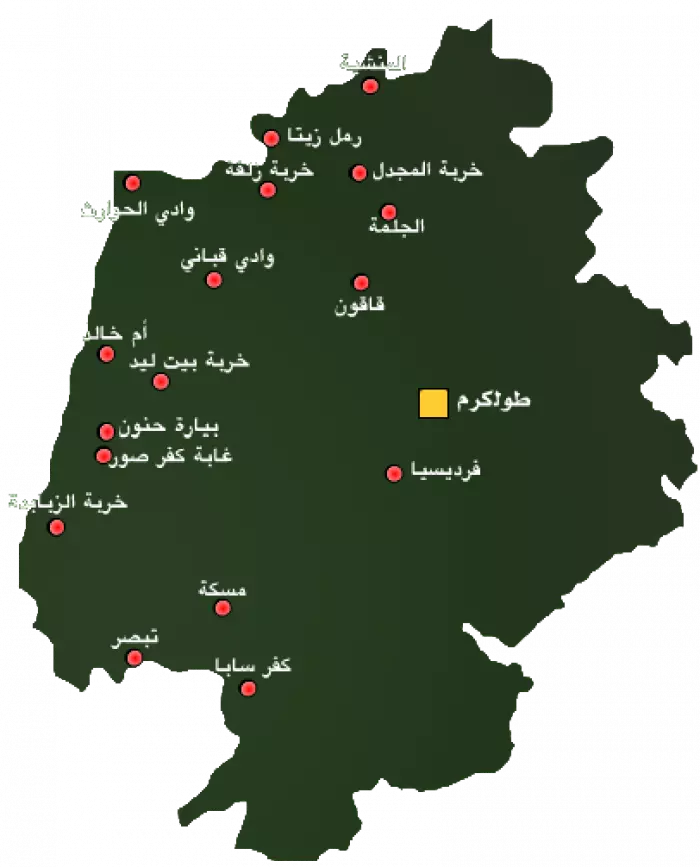
Kafr Saba was a Palestinian village in the Tulkarm Subdistrict. It was located on the coastal plain, approximately 16.5 kilometres southwest of Tulkarm and about 3 kilometres southeast of Qalqilya.
The village stood on flat terrain surrounded by areas of sandy soil. Olive groves could be seen to the north. Several springs were situated to the east and northeast, one of which supplied the villagers with drinking water.
Kafr Saba’s residents were Muslims. The village had a mosque, two religious shrines and an elementary school. Its inhabitants cultivated wheat, watermelons, cucumbers, vegetables, citrus fruit, bananas and olives.
Boundaries and Neighbouring Villages
Kafr Saba was surrounded by the following Palestinian villages and towns:
- North and northeast: Qalqilya.
- Northwest: Miska.
- West: Tabsur (Khirbat Azzun).
- South: Biyar Adas.
- Southeast: Jaljuliyya.
Architectural Character of Kafr Saba
In the late nineteenth century, Kafr Saba was described as a village built of stone and adobe brick on a low hill, with an estimated population of approximately 800. The village had a mosque and was surrounded by sandy terrain, while olive groves were visible to the north.
Several springs lay to the east and northeast, and one supplied the village with drinking water. Kafr Saba had a roughly square plan. During the British Mandate, the village expanded, with new houses extending towards the Yafa–Tulkarm road over land that was not used for agriculture. Additional agricultural land was brought under cultivation west of the village.
Population of Kafr Saba
The British Mandate census of 1922 recorded 546 residents in Kafr Saba. By 1931, the population had reached 765, while the 1945 Village Statistics recorded 1,270 Palestinian residents.
The village’s population immediately before its depopulation in 1948 has been retrospectively estimated at approximately 1,470. Some sources give the slightly higher figure of 1,473. Since no new official village census was conducted in 1948, these figures should be treated as projections rather than exact census totals.
Palestine Remembered estimated the number of refugees from Kafr Saba and their descendants at approximately 9,047 in 1998. This was a retrospective demographic estimate and not an official census of a single resident population.
Historical Population of Kafr Saba
| Year | Recorded or estimated population | Notes |
|---|---|---|
| Late nineteenth century | Approximately 800 | Contemporary survey estimate. |
| 1922 | 546 | Recorded in the British Mandate census. |
| 1931 | 765 | The published population figure included Arab al-Ubaydat. |
| 1945 | 1,270 | Recorded in the British Mandate’s Village Statistics. |
| 1948 | Approximately 1,470–1,473 | Projected estimate rather than a new official census. Estimates vary slightly between sources. |
| 1998 | Approximately 9,047 refugees and descendants | A retrospective estimate published by Palestine Remembered. |
Number of Houses in Kafr Saba
| Year | Number of houses | Notes |
|---|---|---|
| 1931 | 169 | The official figure includes the dwellings associated with Arab al-Ubaydat. |
| 1948 | Not conclusively verified | Later sources provide estimates, but no comparable official 1948 housing census has been identified. |
Economic Life in Kafr Saba
- The villagers cultivated wheat, watermelons, cucumbers and other vegetables.
- Citrus fruit and bananas were important commercial crops, while cereals occupied the largest cultivated area.
- In 1944/45, 1,026 dunams of Palestinian-owned land were allocated to citrus and bananas, 4,600 dunams to cereal cultivation and 355 dunams to irrigated agriculture or orchards. Approximately 30 dunams were planted with olive trees.
Land Ownership in Kafr Saba, 1944/45
| Ownership category | Area (dunams)* |
|---|---|
| Palestinian ownership | 6,019 |
| Jewish ownership | 3,144 |
| Public land | 525 |
| Total | 9,688 |
* One dunam equals approximately 1,000 square metres.
Land Use in Kafr Saba, 1944/45
| Land-use category | Palestinian ownership (dunams)* | Jewish ownership (dunams)* | Public land (dunams)* | Total (dunams)* |
|---|---|---|---|---|
| Citrus and banana cultivation | 1,026 | 1,199 | 0 | 2,225 |
| Irrigated land and orchards | 355 | 224 | 0 | 579 |
| Olive cultivation, included within the preceding category | 30 | 0 | 0 | 30 |
| Cereal cultivation | 4,600 | 1,675 | 62 | 6,337 |
| Built-up area | 26 | 0 | 0 | 26 |
| Cultivable land | 5,981 | 3,098 | 62 | 9,141 |
| Uncultivated land | 12 | 46 | 463 | 521 |
* One dunam equals approximately 1,000 square metres.
Education in Kafr Saba
Elementary education had developed in the Bani Sa'b region during the late Ottoman period. Local teachers associated with the traditional kuttab system taught Qur'anic recitation and memorisation, reading, arithmetic and the Prophetic traditions.
Local historical accounts date the establishment of a lower elementary kuttab in Kafr Saba to 1311 AH, corresponding approximately to 1893/94, and state that it had about 55 pupils. During the British Mandate, the village school reopened or was reorganised in 1930. It initially offered instruction through the fourth grade and was subsequently expanded through the sixth grade. These detailed dates and enrolment figures come from local historical accounts and could not all be independently confirmed in the principal village-statistics sources.
The Mosque, Sufi Lodges and Religious Shrines
Kafr Saba had a large old mosque built of stone with a vaulted roof and a spacious courtyard containing an area for ablution. Congregational Friday prayers and prayers for the two major Islamic festivals were held there.
Local accounts identify Shaykh Abd al-Rahman Arabasi as the mosque’s imam before the Nakba and Shaykh Ali Ghunaym as its muezzin. According to those accounts, both performed their duties without a salary.
The village also had two Sufi lodges, or zawiyas, associated with the al-Najjar and al-Balasima families. Two prominent shrines were dedicated to al-Nabi Yamin and al-Nabi Yahya. The shrine of al-Nabi Yamin had been recorded in historical accounts as early as 1730.
Roads and Transportation
Kafr Saba was connected with Tulkarm by a paved road that joined the main Yafa–Tulkarm highway, which passed approximately 2.5 kilometres east of the village. Paved and unpaved secondary roads linked it to surrounding Palestinian villages and towns.
The Haifa–al-Lydd railway line passed approximately 1.5 kilometres east of Kafr Saba and formed part of the boundary between the village’s lands and those of Qalqilya. A secondary road linked the village directly with Qalqilya, approximately 3 kilometres to the northwest.
Occupation and Depopulation of Kafr Saba
Kafr Saba lay north of Tel Aviv in an area where Jewish settlements had become increasingly concentrated. In December 1947, representatives of the Palestinian village and neighbouring Jewish communities reportedly met and pledged to preserve peaceful relations.
Nevertheless, the Haganah General Staff adopted a policy of clearing the area’s Palestinian population before 15 May 1948. The Alexandroni Brigade was assigned the task of occupying Kafr Saba.
An initial Haganah attack took place on 10 May 1948. Arab Liberation Army records state that this attack was repelled and that villagers who had begun to leave in panic were ordered to return. Arab Liberation Army commander Fawzi al-Qawuqji interpreted the first attack as an attempt to survey defensive positions and possibly prepare for an advance towards Qalqilya.
The Alexandroni Brigade launched a second attack on 13 May. Israeli historian Benny Morris identifies this as the date on which Haganah forces occupied Kafr Saba. Arab Liberation Army records indicate that fighting continued after the initial advance. The available sources do not conclusively establish whether every resident fled during the fighting or whether some were directly expelled; the villagers probably fled or were expelled following the second attack. Their arrival in Qalqilya contributed to the temporary evacuation of that town.
Israeli Settlements on the Lands of Kafr Saba
The Jewish settlement of Kfar Sava was founded in 1903 southwest of the Palestinian village. By 1948, it had a population of more than 5,000. It subsequently expanded over a substantial part of Kafr Saba’s lands and incorporated the village site into new residential and industrial districts.
Beit Berl was established in 1947 northwest of the village site on land belonging to Kafr Saba. Neve Yamin was established in 1949 east of the village site, around the shrine of al-Nabi Yamin, from which the settlement took its name.
The village site was later absorbed into the eastern neighbourhoods and industrial zone of Kfar Sava. Local sources associate areas including Kaplan, Givat Eshkol, Hadarim, Neve Hadarim, Beit Venof, Ganei Hasharon and Ge'ulim with the former village lands. However, the precise correspondence between every modern neighbourhood boundary and the cadastral boundaries of Kafr Saba requires detailed historical-map analysis.
Nir Eliyahu, established in 1950 approximately 1 kilometre northeast of the village site, stands on land belonging to neighbouring Qalqilya rather than Kafr Saba.
Kafr Saba Today
The village site has been incorporated into residential quarters and an industrial area of Kfar Sava. Some Palestinian houses survived the destruction and are now used as commercial buildings.
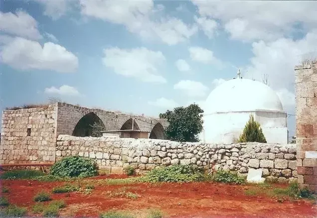
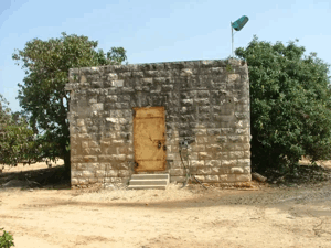
The two religious shrines, the former school and remnants of the village cemetery remain. The shrines have arched entrances and are surmounted by domes. Agricultural land surrounding the former village site is cultivated by Israelis.
Sources
- Interactive Encyclopedia of the Palestine Question (PalQuest), “Kafr Saba”. The entry draws substantially on Walid Khalidi’s All That Remains.
- Our Palestine, “Village of Kafr Saba”.
- Palestine Remembered, “Village Statistics of 1945”.
- Walid Khalidi, ed., All That Remains: The Palestinian Villages Occupied and Depopulated by Israel in 1948, Institute for Palestine Studies, 1992.
- United Nations Information System on the Question of Palestine, “Acquisition of Land in Palestine”.
- Government of Palestine, Census of Palestine, 1922.
- Government of Palestine, Census of Palestine, 1931.
- Government of Palestine, Department of Statistics, Village Statistics, April 1945.
- Fawzi al-Qawuqji, memoirs and operational reports for 1948, published in the Journal of Palestine Studies.
- Benny Morris, The Birth of the Palestinian Refugee Problem, 1947–1949, Cambridge University Press.
Photo gallery


Photos from the village's people
Photos sent in by visitors and published after review.
Add a photo of this village
Log in to add photos of this village.
Other villages from Tulkarm
 Download Our Palestine App
The whole archive in the palm of your hand: depopulated villages, the Nakba, the massacres and Al-Aqsa — free, with no ads to erase the story.
Download Our Palestine App
The whole archive in the palm of your hand: depopulated villages, the Nakba, the massacres and Al-Aqsa — free, with no ads to erase the story.



Comments
No comments yet — be the first to write one.
Add your comment
Name and email are optional. Comments appear after review.