
The depopulated village of Al-Safiriyya / District of Jaffa

Al-Safiriyya
About the depopulated village of Al-Safiriyya
- District
- Jaffa
- Date Al-Safiriyya was occupied
- 20 May 1948
- Population in 1948
- 3,561
- Military operation
- Operation Bi'ur Hametz
- Brigade that carried it out
- Probably the Alexandroni Brigade if the village was occupied during Operation Hametz (Khalidi); no unit is named in the account of its capture on 20 May 1948
- Who defended the village
- Local militia & Arab Liberation Army
- Distance from the governorate centre
- 11 km from Jaffa
- Elevation above sea level
- 25 m
- Cause of displacement
- Expulsion by Zionist troops
- Extent of destruction
- On the 13th of September 1948, the village was mostly destroyed with the exception of few houses and the two village schools.
- Ethnic cleansing
- al-Safiriyya inhabitants were completely ethnically cleansed.
- Settlements built on the built-up area of Al-Safiriyya after 1948
- Tzafriyya and Kefar Chabad (both 1949), Achi'ezer (1950) and Tochelet (1951); Shafrir (1949) has been absorbed by these and by the suburbs of Ri'shon le-Tziyyon
Hover a dot to read the village name, or click to open its card.
Borders of the depopulated village of Al-Safiriyya
al-Safiriyya: A Depopulated Palestinian Village in the Jaffa District
Al-Safiriyya was a depopulated Palestinian village in the Jaffa District, situated approximately 11 kilometers east of Jaffa on flat terrain in the central coastal plain, at an average elevation of about 25 meters above sea level.
- Subdistrict
- Jaffa
- Distance from district center
- 11 km from Jaffa
- Average Elevation
- 25 m above sea level
- Population in 1931
- 2,040
- Number of Houses in 1931
- 489
- Population in 1944/1945
- 3,070
- Estimated Population in 1948
- About 3,561 – a later demographic estimate, not an official census
- Total Land Area in 1945
- 12,842 dunams
- Attack and Depopulation
- A United Press dispatch reported that Israeli occupation forces took the village on 20 May 1948, at the same time as Irgun attacks on the city of Ramla, while the Palestinian historian 'Arif al-'Arif relates that it was occupied almost a month earlier, at the same time as the neighbouring villages of Yazur and Bayt Dajan, which were attacked during Operation Hametz. The available sources do not describe how its inhabitants left, but the village was certainly under Israeli control by September 1948.
- Final Israeli Control
- Sources differ: probably late April 1948, according to 'Arif al-'Arif, who relates that it was occupied almost a month before 20 May together with Yazur and Bayt Dajan during Operation Hametz; or 20 May 1948, according to a United Press dispatch. The village was certainly under Israeli control by September 1948
- Military Operation
- Operation Hametz – PalQuest lists al-Safiriyya among the villages affected by the operation and among its targets south of the railway; its capture during the operation, however, rests on 'Arif al-'Arif's account, while the dispatch of 20 May 1948 places its capture after the operation ended on 13 May 1948
- Military Unit
- The sources do not identify the unit that occupied the village; if it was occupied during Operation Hametz in late April 1948, the attacking units were probably from the Alexandroni Brigade, according to Khalidi. The United Press dispatch, as cited by Khalidi, names no unit, stating only that the capture of the village on 20 May coincided with Irgun attacks on Ramla.
- Settlements Documented on Village Lands
- Tzafriyya and Kefar Chabad (both built in 1949), Achi'ezer (founded in 1950) and Tochelet (founded in 1951); Shafrir, established in 1949, has been absorbed by these settlements and by the suburbs of Ri'shon le-Tziyyon
The Government of Palestine's 1944/1945 statistics recorded 3,070 inhabitants and a total land area of 12,842 dunums. Al-Safiriyya was one of the major agricultural villages of the Jaffa hinterland and was especially known for tomato and citrus cultivation. During the Nakba and the occupation of Palestine in 1948, the village was occupied and depopulated. Sources disagree over the exact date: Palestinian historian 'Arif al-'Arif places its capture in late April during Operation Hametz, while a contemporary United Press report states that Israeli forces took the village on 20 May 1948.
Key Facts About al-Safiriyya
- District: Jaffa.
- Distance from Jaffa: approximately 11 kilometers east.
- Average elevation: approximately 25 meters above sea level.
- Population in 1944/1945: 3,070.
- Estimated population in 1948: 3,561 according to Palestine Remembered.
- Total land area: 12,842 dunums.
- Occupation and depopulation: disputed between late April and 20 May 1948.
- Military unit: not conclusively established; Walid Khalidi considers the Alexandroni Brigade the probable force if al-'Arif's Operation Hametz chronology is accepted.
Location of al-Safiriyya
Al-Safiriyya stood on flat ground in the central coastal plain, east of Jaffa and within the important area between Jaffa, Lydda, and Ramla.
A secondary road linked the village with the main Jaffa–Ramla road. It also lay close to the railway between Jaffa and Lydda and near Lydda Airport.
The built-up area covered approximately 95 dunums out of a total village land area of 12,842 dunums.
Neighboring Villages and Localities
Al-Safiriyya lay among several Palestinian villages and urban centers of the coastal plain, including:
- Saqiya to the north.
- Kafr 'Ana to the northeast.
- al-Khayriyya to the northwest.
- Bayt Dajan to the west.
- Sarafand al-'Amar to the south.
- Lydda to the southeast.
- Lydda Airport east of the village area.
Al-Safiriyya Through History
During the Byzantine period, the locality was known as Sapharea and lay within the region associated with Diospolis, or Lydda.
The Crusaders later referred to the village as Saphyria.
In the early Islamic period, the Muslim scholar and ascetic Hani' al-Kindi was buried at al-Safiriyya. Historical sources record that the Umayyad caliph 'Umar ibn 'Abd al-'Aziz offered him the governorship of Palestine, which he declined.
In 1596, al-Safiriyya was a village in the nahiya of Ramla within the liwa' of Gaza. Walid Khalidi gives an estimated population of approximately 292. The villagers paid taxes on wheat, barley, fruit, sesame, goats, beehives, and vineyards.
The Built Environment of al-Safiriyya
In the late nineteenth century, al-Safiriyya was described as an adobe-built village, with olive trees planted on land south of the settlement.
During the British Mandate, the villagers continued to build their adobe houses close together, creating a relatively dense built-up settlement.
The built-up area covered approximately 95 dunums in the 1944/1945 statistics.
Population of al-Safiriyya
The 1922 Census of Palestine recorded 1,306 inhabitants in al-Safiriyya, all Muslims.
In the 1931 census, the population had risen to 2,040 inhabitants living in 489 houses.
The Government of Palestine's 1944/1945 statistics recorded 3,070 inhabitants. Khalidi and PalQuest describe the village population during the Mandate as Muslim.
The figures of 3,561 inhabitants for 1948 and 21,870 refugees for 1998 published by Palestine Remembered are later estimates rather than official Government of Palestine censuses.
Population of al-Safiriyya
- 1596About 292Historical estimate based on Ottoman records
- 19221,306Official census; all Muslims
- 19312,040Official census
- 1944/19453,070Government of Palestine statistics
- 19483,561Later estimate published by Palestine Remembered
- 199821,870Later refugee-population estimate published by Palestine Remembered
Number of Houses in al-Safiriyya
The 1931 Census of Palestine recorded 489 houses in al-Safiriyya.
The figure of 853 houses for 1948 published by Palestine Remembered is a later estimate rather than the result of an official census conducted that year.
Number of Houses in al-Safiriyya
- 1931489Official census
- 1948853Later estimate published by Palestine Remembered
Education in al-Safiriyya
Al-Safiriyya had two elementary schools, one for boys and one for girls.
The boys' school opened in 1920 and had approximately 348 pupils by the mid-1940s. About 11 dunums of land were attached to the school for agricultural training.
Palestinian local documentation records that by the 1945–1946 school year it had developed into a complete elementary school through the seventh grade. It had eight teachers, a library, and land used for practical agricultural education.
According to Khalidi and PalQuest, the girls' school was established in 1945 and had 45 pupils. A Palestinian local source gives 1946, a discrepancy that may reflect the school year or the date when regular classes began.
Land Ownership in al-Safiriyya
The total land area recorded for al-Safiriyya in the 1944/1945 statistics was 12,842 dunums.
The Arabic Palestine Remembered table uses the terms “Palestinian,” “Transferred to Zionists,” and “Masha'.” They are retained below as the source's terminology. The official Government of Palestine categories were “Arab,” “Jewish,” and “Public.”
Land Ownership in al-Safiriyya, 1944/1945, Using Palestine Remembered Terminology
- Palestinian10,545 dunums82%
- Transferred to Zionists1,722 dunums13%
- Masha' (source terminology)575 dunums4%
Land Use in al-Safiriyya in 1944/1945
A total of 12,001 dunums was cultivated or classified as cultivable, consisting of 10,279 dunums of Arab land and 1,722 dunums of Jewish land.
Citrus and bananas occupied 4,951 dunums, including 3,539 dunums of Arab land and 1,412 dunums of Jewish land. Plantations and irrigable land covered 3,732 dunums, while cereals occupied 3,318 dunums.
Land Use in al-Safiriyya According to the 1944/1945 Statistics
- Arab
- Jewish
- Public
- Citrus and Bananas4,951 dunums
- Plantations and Irrigable Land3,732 dunums
- Cereals3,318 dunums
- Built-up Area95 dunums
- Non-Cultivable Land746 dunums
Palestine Remembered separately records 25 dunums planted with olive trees. This figure is treated as supplementary agricultural information and is not added again to the official land-use total because it may overlap with the plantation category.
Economic Life in al-Safiriyya
Agriculture formed the foundation of al-Safiriyya's economy. According to Walid Khalidi, the village was the largest producer of tomatoes in the Jaffa sub-district.
Orange and other citrus cultivation was also extensive, alongside bananas, cereals, vegetables, and fruit orchards.
The large area of irrigated land and orchards reflects the importance of intensive agriculture to the village economy, while its proximity to Jaffa, Lydda, Ramla, roads, and railway lines facilitated the marketing of agricultural produce.
Football and Sporting Life
Al-Safiriyya had a football team during the British Mandate period, and Palestinian sources preserve photographs of the village team dating from around 1940.
Local Palestinian documentation states that the al-Safiriyya sports club competed in second-division football within the active Palestinian sporting scene centered on Jaffa and other cities.
The club's exact founding date is not securely documented in the principal sources used here and is therefore not stated as a confirmed date.
Archaeological Remains
Visible archaeological remains in al-Safiriyya indicated that the site had been inhabited in earlier periods.
Nearby Khirbat Subtara was an artificial mound bordered by water reservoirs on its eastern and western sides.
Palestinian local documentation also records remains from Canaanite, Roman, and Byzantine periods in parts of the village lands, including columns, stone remains, and architectural fragments.
Operation Hametz
Al-Safiriyya was among the villages targeted during Operation Hametz, an offensive launched by the Haganah in late April and early May 1948 to isolate Palestinian Jaffa from its eastern hinterland.
PalQuest dates Operation Hametz from 24 April to 13 May 1948 and identifies the Alexandroni, Kiryati, and Giv'ati Brigades as participating formations.
The immediate objective was to capture the large Palestinian villages situated on both sides of the railway connecting Jaffa with the interior, thereby cutting Jaffa off from the surrounding Palestinian countryside.
Al-Safiriyya, Bayt Dajan, and Yazur were among the villages south of the railway identified as targets of the operation.
The Dispute Over the Date of al-Safiriyya's Occupation
The sources do not agree on a single definitive date for the occupation of al-Safiriyya.
A contemporary United Press dispatch reported that Israeli forces captured the village on 20 May 1948 and stated that its occupation coincided with Irgun attacks against the city of Ramla.
Palestinian historian 'Arif al-'Arif, however, wrote that al-Safiriyya had been captured almost a month earlier, at approximately the same time as nearby Yazur and Bayt Dajan during Operation Hametz.
The article therefore records the occupation as having taken place sometime between late April and 20 May 1948, with the precise date remaining disputed in the available sources.
Which Military Unit Captured al-Safiriyya?
The attacking formation cannot be established with certainty independently of the disputed chronology.
Walid Khalidi states that if al-Safiriyya was indeed captured in late April together with Yazur and Bayt Dajan, as 'Arif al-'Arif maintained, then the attacking troops were probably from the Alexandroni Brigade.
Operation Hametz itself involved the Alexandroni, Kiryati, and Giv'ati Brigades, whose responsibilities were divided among different sectors around Jaffa.
The United Press account referring to 20 May does not, in Khalidi's presentation, identify the specific brigade that entered al-Safiriyya.
The Alexandroni attribution is therefore presented as Khalidi's probability tied to the earlier Operation Hametz chronology rather than as a conclusively established fact.
The Displacement of al-Safiriyya's Inhabitants
The Zionist advance through Jaffa's hinterland, the occupation of surrounding Palestinian villages, and the increasing isolation of Jaffa produced large-scale displacement during the spring of 1948.
Al-Safiriyya was part of this eastern and southeastern belt of Palestinian villages, and its military occupation ultimately resulted in the depopulation of the village.
The principal sources do not provide one sufficiently detailed account reconstructing the departure route of every family. The article therefore does not attribute one specific expulsion order or a single displacement route to a particular unit without additional evidence.
Occupation and Depopulation Chronology
- 29 April 1948
Beginning of the military operation
The Haganah launched Operation Hametz, which PalQuest dates from 24 April to 13 May 1948, with units from the Alexandroni, Kiryati and Giv'ati Brigades, aiming to seize the villages on both sides of the railway linking Jaffa to its Arab hinterland and to isolate the city. Al-Safiriyya, together with Yazur and Bayt Dajan, was among the villages south of the railway targeted by the operation.
- Probably late April 1948, or 20 May 1948 (sources differ)
Final occupation
The Palestinian historian 'Arif al-'Arif relates that the village was occupied almost a month before 20 May, at the same time as Yazur and Bayt Dajan were taken during Operation Hametz, and Khalidi considers that the attacking units were then probably from the Alexandroni Brigade. A United Press dispatch, however, reported that Israeli occupation forces took al-Safiriyya on 20 May 1948, at the same time as Irgun attacks on the city of Ramla.
- 13 September 1948
Decision to destroy the village
Israeli Prime Minister David Ben-Gurion asked the cabinet for permission to destroy al-Safiriyya together with thirteen nearby villages; according to Israeli historian Benny Morris, as cited by Khalidi, he was careful to make the request in the name of the commander of the central front rather than in his own name, and permission was granted.
- 1949
Settlement on village lands
The settlements of Tzafriyya and Kefar Chabad were built on village lands; the settlement of Shafrir, established the same year, was later absorbed by the settlements on the village lands and by the suburbs of Ri'shon le-Tziyyon.
- 1950–1951
Settlement on village lands
The settlements of Achi'ezer, founded in 1950, and Tochelet, founded in 1951, were established on village lands.
The Decision to Demolish al-Safiriyya
By September 1948, al-Safiriyya was unquestionably under Israeli control.
Walid Khalidi and PalQuest, citing Israeli historian Benny Morris, record that on 13 September David Ben-Gurion requested government authorization to demolish al-Safiriyya together with thirteen other Palestinian villages.
The request was formally submitted in the name of the commander of the central front, and authorization was granted.
These details are presented through the Palestinian intermediary source Khalidi/PalQuest rather than through independent reliance on Morris.
Settlements Established on the Lands of al-Safiriyya
Walid Khalidi and PalQuest identify four principal Israeli settlements on the lands of al-Safiriyya, as well as an earlier settlement that was later absorbed into surrounding development:
- Tzafriyya: established in 1949 on al-Safiriyya's lands.
- Kefar Chabad: established in 1949 on al-Safiriyya's lands.
- Achi'ezer: founded in 1950 according to PalQuest.
- Tochelet: founded in 1951.
- Shafrir: established in 1949 and later absorbed into these settlements and the suburbs of Rishon LeZion.
Palestinian local sources also associate parts of later Rishon LeZion suburban expansion with the village lands, but Khalidi does not treat these neighborhoods as additional separately founded settlements comparable to the four listed above.
The Site of al-Safiriyya After the Nakba
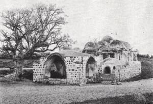
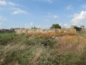
According to Walid Khalidi's field description, the village's two schools remained standing. They were long rectangular concrete buildings with rectangular doors and windows and had been refurbished.
Several houses also remained, some built of adobe brick and others of concrete. At the time of the survey, some were deserted while others were inhabited by Jewish families.
The surviving houses were architecturally simple, with rectangular doors and windows and mostly flat roofs.
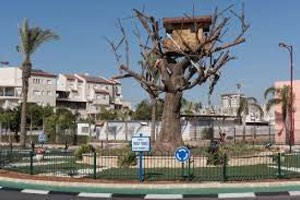
Cactuses and various trees lined an old village road, while sycamore and cypress trees were scattered across the site.
Modern construction covered portions of the surrounding land, while other parts were under cultivation.
This description is based on fieldwork conducted for Walid Khalidi's All That Remains and should not necessarily be treated as an updated field survey of the site today.
Sources
- PalQuestPalQuest – Interactive Encyclopedia of the Palestine Question: al-Safiriyya
- PalQuestPalQuest – Interactive Encyclopedia of the Palestine Question: Operation Hametz
- Palestine RememberedPalestine Remembered: al-Safiriyya – Jaffa District
- Palestine RememberedPalestine Remembered: al-Safiriyya in Walid Khalidi's All That Remains
- palqura.comPalestinian Villages Encyclopedia: al-Safiriyya
- pal48.psFilastunna: The Depopulated Village of al-Safiriyya
- pcbs.gov.psPalestinian Central Bureau of Statistics: Historical Censuses of Palestine
Photo gallery


Photos from the village's people
Photos sent in by visitors and published after review.
Add a photo of this village
Log in to add photos of this village.
Other villages from Jaffa
More from the archive
 Download Our Palestine App
The whole archive in the palm of your hand: depopulated villages, the Nakba, the massacres and Al-Aqsa — free, with no ads to erase the story.
Download Our Palestine App
The whole archive in the palm of your hand: depopulated villages, the Nakba, the massacres and Al-Aqsa — free, with no ads to erase the story.



Comments
No comments yet — be the first to write one.
Add your comment
Name and email are optional. Comments appear after review.