
The depopulated village of Sarafand Al-Amar / District of Ramla

Sarafand Al-Amar
About the depopulated village of Sarafand Al-Amar
- District
- Ramla
- Date Sarafand Al-Amar was occupied
- 19 May 1948
- Population in 1948
- 2,262
- Military operation
- Operation Barak
- Brigade that carried it out
- Probably the Second Battalion of the Givati Brigade, according to Khalidi
- Distance from the governorate centre
- 5 km northwest of Ramla
- Elevation above sea level
- 50 m
- Cause of displacement
- Direct military assault by Israeli occupation forces; the inhabitants probably fled or were evicted when the village was occupied, according to Khalidi
- Extent of destruction
- Currently, Sarafand al-'Amar contains Israeli's largest army base. The village was mostly destroyed with exception to six houses remain standing to this date.
- Ethnic cleansing
- Sarafand al-'Amar inhabitants were completely ethnically cleansed.
- Settlements built on the built-up area of Sarafand Al-Amar after 1948
- Tzerifin, established in 1949 on the ruins of the village and including an army camp; and Nir Tzevi, established in 1954 on village land
Hover a dot to read the village name, or click to open its card.
Borders of the depopulated village of Sarafand Al-Amar
Sarafand al-'Amar: A Depopulated Palestinian Village in the Ramla District
Sarafand al-'Amar, also known as Sarafand al-Kubra, was a depopulated Palestinian village in the Ramla District. It was located approximately 5 kilometers northwest of Ramla on flat terrain in Palestine's central coastal plain, at an average elevation of about 50 meters above sea level.
- Subdistrict
- Ramla
- Distance from district center
- 5 km northwest of Ramla
- Average Elevation
- 50 m above sea level
- Population in 1931
- 1,183
- Number of Houses in 1931
- 265
- Population in 1944/1945
- 1,950 – 1,910 Muslims and 40 Christians
- Estimated Population in 1948
- About 2,262 – a later demographic estimate, not an official census
- Total Land Area in 1945
- 13,267 dunams
- Attack and Depopulation
- On 15 April 1948 Haganah sappers raided the village and blew up a three-storey building, killing 16 people according to the British authorities (39 according to the attackers). The village was probably occupied on the night of 19–20 May 1948 by the Second Battalion of the Givati Brigade in the context of Operation Barak, and its inhabitants probably fled or were evicted at the same time, according to Khalidi.
- Final Israeli Control
- Probably the night of 19–20 May 1948, according to Khalidi
- Military Operation
- Operation Barak
- Military Unit
- Probably the Second Battalion of the Givati Brigade, according to Khalidi
- Cause of Depopulation
- Direct military assault by Israeli occupation forces; the inhabitants probably fled or were evicted when the village was occupied, according to Khalidi
- Settlements Documented on Village Lands
- Tzerifin, established in 1949 on the ruins of the village and including an army camp; and Nir Tzevi, established in 1954 on village land
The Government of Palestine's 1944/1945 statistics recorded a population of 1,950 and a total land area of 13,267 dunums. During the Nakba and the occupation of Palestine in 1948, Israeli forces probably captured Sarafand al-'Amar on the night of 19–20 May in the context of Operation Barak. The attacking force is identified as the Second Battalion of the Giv'ati Brigade. The Palestinian inhabitants were displaced and most of the village was subsequently destroyed.
Location of Sarafand al-'Amar
- The village was located approximately 5 kilometers northwest of Ramla.
- Its average elevation was about 50 meters above sea level.
- It stood on flat terrain in the central coastal plain, west of the main Ramla–Jaffa road.
- It was also known as Sarafand al-Kubra to distinguish it from nearby Sarafand al-Sughra, later known as Sarafand al-Kharab.
Sarafand al-'Amar Through History
In 1596, Sarafand was a village in the nahiya of Ramla within the liwa' of Gaza and had an estimated population of 358. Its inhabitants paid taxes on wheat, barley, sesame, fruit, goats, beehives, and orchards.
Later historical accounts distinguished between Sarafand al-'Amar and Sarafand al-Kharab. The Egyptian Sufi traveler Mustafa As'ad al-Luqaymi referred to a shrine associated with Luqman al-Hakim at Sarafand, while Edward Robinson recorded in the nineteenth century that two villages bore the name Sarafand, one inhabited and the other deserted.
Archaeological evidence at Sarafand al-'Amar indicates settlement at the site during the Roman and Byzantine periods.
Sarafand al-'Amar During the British Mandate
Sarafand al-'Amar gained additional importance during the British Mandate when the British established a major military base nearby, described by Walid Khalidi as the largest British military base in the Middle East at the time.
The British authorities also constructed a prison in the area that was used to detain Palestinian nationalist activists.
The village itself had a rectangular layout, and most of its houses were built of adobe. It also contained a popular shrine associated with Luqman al-Hakim.
Population of Sarafand al-'Amar
The 1922 census recorded 862 inhabitants in Sarafand al-'Amar. The population increased to 1,183 in the 1931 census, when 265 houses were recorded.
The Government of Palestine's 1944/1945 statistics recorded 1,950 inhabitants, consisting of 1,910 Muslims and 40 Christians.
The figures of 2,262 inhabitants for 1948 and 13,891 refugees for 1998 published by Palestine Remembered are later estimates and are not official Government of Palestine censuses.
Population of Sarafand al-'Amar
- 1596358Historical estimate based on Ottoman records
- 1922862Official census under the British Mandate
- 19311,183Official census under the British Mandate
- 1944/19451,950Government of Palestine statistics: 1,910 Muslims and 40 Christians
- 19482,262Estimate published by Palestine Remembered
- 199813,891Estimated refugee population published by Palestine Remembered
Number of Houses in Sarafand al-'Amar
The 1931 census recorded 265 houses in Sarafand al-'Amar. The figure of 506 houses for 1948 published by Palestine Remembered is a later estimate rather than an official Government of Palestine census figure.
Number of Houses in Sarafand al-'Amar
- 1931265Official census
- 1948506Estimate published by Palestine Remembered
Education and Public Facilities
Sarafand al-'Amar had two elementary schools, one for boys and another for girls. The boys' school was established in 1921 and became a complete elementary school during the 1946/1947 academic year, when enrollment reached 292 pupils.
Fourteen dunums of land were attached to the boys' school for agricultural training.
The girls' school was founded in 1947 and had 50 pupils.
Adjacent to the village were the al-Raja' Orphanage, established for the children of Palestinians killed during the 1936–1939 Great Palestinian Revolt, a government hospital, and an agricultural station.
Land Ownership in Sarafand al-'Amar
The total land area recorded for Sarafand al-'Amar in the 1944/1945 statistics was 13,267 dunums.
The Arabic Palestine Remembered table uses the categories “Palestinian,” “Transferred to Zionists,” and “Masha'.” These terms are preserved below to reflect the wording of that source. The Government of Palestine statistics, as reproduced by PalQuest, classify the corresponding categories as “Arab,” “Jewish,” and “Public.”
Land Ownership in Sarafand al-'Amar, 1944/1945, Using the Terminology of Palestine Remembered
- Palestinian9,223 dunums70%
- Transferred to Zionists761 dunums6%
- Masha' / Communal3,283 dunums25%
Land Use in Sarafand al-'Amar in 1944/1945
Citrus was one of the village's principal crops. Citrus and bananas covered a total of 3,770 dunums, including 3,509 dunums of Arab land and 261 dunums of Jewish land.
Cereal cultivation covered 7,230 dunums: 4,012 dunums of Arab land, 500 dunums of Jewish land, and 2,718 dunums of public land. Plantations and irrigable land covered another 1,665 dunums of Arab land.
Land Use in Sarafand al-'Amar According to the 1944/1945 Statistics
- Arab
- Jewish
- Public
- Citrus and Bananas3,770 dunums
- Plantations and Irrigable Land1,665 dunums
- Cereals7,230 dunums
- Built-up Area36 dunums
- Non-Cultivable Land566 dunums
Palestine Remembered additionally records 120 dunums planted with olive trees. This figure should be understood as part of the agricultural categories above rather than as a separate area to be added again to the land-use total.
Economic Life in Sarafand al-'Amar
Agriculture was the principal economic activity in Sarafand al-'Amar. Citrus and bananas were especially important, alongside cereals, orchards, fruit trees, and olives.
The orchards were irrigated with water from artesian wells, while other crops were largely rainfed. The artesian wells also provided drinking water for the inhabitants.
Attacks Before the Occupation of Sarafand al-'Amar
Sarafand al-'Amar and its surrounding area were subjected to a series of attacks during the first months of 1948.
On the morning of 2 January 1948, Arab workers at the British military base in Sarafand discovered twelve timed explosive charges set to detonate at noon, when the workers would have been lining up to collect their weekly wages. The Palestinian newspaper Filastin reported that Jewish workers had not appeared for work that day and interpreted this as an indication that they had received advance warning from the Zionist groups responsible for planting the charges.
Palestinian documentation also records another incident on 19 January 1948, when occupants of a Jewish vehicle passed an Arab coffeehouse in the Sarafand area and opened fire, killing one man and wounding six others.
The Haganah Raid of 15 April 1948
On 15 April 1948, a Haganah demolition unit raided Sarafand al-'Amar, penetrated the Arab area, and destroyed a three-story building.
According to contemporary reports cited by Walid Khalidi, the British authorities stated that 16 people were killed beneath the rubble and 12 were wounded.
The attacking force, however, claimed that the building was being used by fighters affiliated with Shaykh Hasan Salama and asserted that 39 people had been killed. Because the accounts differ, both figures are identified with their respective sources rather than presenting the attackers' figure as a confirmed casualty total.
The Sarafand Military Base in May 1948
As the British Mandate ended in mid-May 1948, an Arab force was permitted to take over the Sarafand military base, which covered approximately 500 acres.
PalQuest, through Walid Khalidi's account, states that the base was handed to Arab forces on 14 May and was seized by Zionist forces approximately five days later in a two-pronged attack from the north and southeast.
These details are reproduced here through the Palestinian source Khalidi/PalQuest, which itself cites contemporary press and Israeli military accounts; Israeli sources have not been used independently.
Operation Barak
The occupation of Sarafand al-'Amar was associated with Operation Barak, a Zionist military offensive conducted primarily by the Giv'ati Brigade in the areas south and west of Ramla during May 1948 as part of Plan Dalet.
The main phase of Operation Barak began on 9 May. PalQuest records that the Giv'ati Brigade expanded its area of control west of Ramla and Lydda and that a second stage of the offensive began following the British withdrawal after 15 May.
For this reason, the PalQuest entry on Sarafand al-'Amar places the village's capture on the night of 19–20 May within the context of Operation Barak, even though the chronological table for the operation lists its principal phase as 9–13 May.
The Occupation of Sarafand al-'Amar and the Displacement of Its Inhabitants During the Nakba
Walid Khalidi considers it probable that Sarafand al-'Amar was captured on the night of 19–20 May 1948 by the Second Battalion of the Giv'ati Brigade in the context of Operation Barak.
Palestine Remembered gives 20 May 1948 as the occupation date and likewise identifies the Second Battalion of the Giv'ati Brigade as the attacking unit. This is effectively consistent with Khalidi's dating of the capture to the night of 19–20 May.
The sources do not establish conclusively whether all of the villagers fled during the assault or whether some were expelled after the village was occupied. The most accurate formulation is therefore that the attack and occupation resulted in the depopulation of Sarafand al-'Amar during the Nakba, while the precise circumstances under which every inhabitant left remain uncertain.
Occupation and Depopulation Chronology
- 2 January 1948
Attempted bombing at the Sarafand army camp
Arab workers at the large British army camp at Sarafand discovered twelve timed charges set to explode at noon, when they would have been lined up to collect their weekly wages; the newspaper Filastin noted that none of the Jewish workers had reported to work that day, implying that they had been warned by the Zionist groups responsible.
- 15 April 1948
Raid on the village
A party of Haganah sappers penetrated 'deep in Arab territory', according to the New York Times, and blew up a three-storey building. The British authorities stated that 16 people were killed in its ruins and 12 wounded, while the attackers claimed that the building was used by fighters under Shaykh Hasan Salama and that 39 people were killed.
- 9 May 1948
Beginning of the military operation
The Haganah's Givati Brigade launched Operation Barak to 'clear' the southern and western ends of its zone of control before 15 May, targeting the villages south and west of Ramla; PalQuest lists Sarafand al-'Amar among the villages affected by it.
- 14 May 1948
Handover of the Sarafand camp to Arab forces
As the British army withdrew, it allowed Arab forces to take over the military base near the village, which covered about 500 acres; according to the History of the War of Independence as cited by Khalidi, it was handed over to them on 14 May.
- About 19 May 1948 (five days after the handover)
Seizure of the Sarafand camp
The 'small, semi-regular' Arab unit in the camp was driven out by a two-pronged attack from the north and southeast, its defences having been prepared only for an attack from the settlement of Rishon le-Tziyyon to the west, according to the History of the War of Independence as cited by Khalidi.
- Probably the night of 19–20 May 1948
Final occupation
The village was probably occupied by the Second Battalion of the Givati Brigade, which places its occupation within the scope of Operation Barak, according to Khalidi, and its inhabitants probably fled or were evicted at the same time.
- 1949
Settlement on village lands
Israel established the settlement of Tzerifin, which includes an army camp, on the ruins of the village.
- 1954
Settlement on village lands
The settlement of Nir Tzevi was established on village land.
Settlements Established on the Lands of Sarafand al-'Amar
Two settlements were established on the lands of Sarafand al-'Amar after the Nakba:
- Tzrifin: established in 1949 on the ruins of the village and containing a military camp.
- Nir Tzvi: established in 1954 on village land.
Talmei Menashe, established nearby in 1953, was not built on the lands of Sarafand al-'Amar. According to Walid Khalidi and PalQuest, it was established on the lands of the depopulated Palestinian village of Abu al-Fadl.
The Site of Sarafand al-'Amar After the Nakba
According to Walid Khalidi's field description, the former village site became part of a closed military area containing a large military camp and an air base.
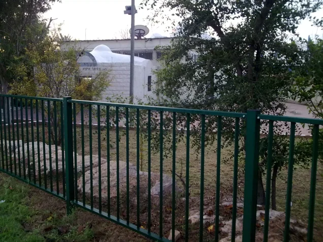
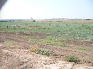
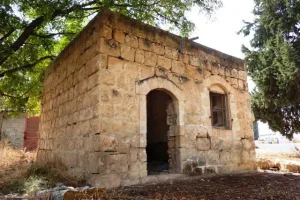
Khalidi recorded six surviving village houses. Most were abandoned, while one or two were occupied. The former village school also stood abandoned, with cactuses growing in its front yard, while surrounding lands were cultivated.
This description is based on fieldwork conducted for All That Remains and should not necessarily be treated as a field survey updated to the present day.
Sources
- PalQuestPalQuest – Interactive Encyclopedia of the Palestine Question: Sarafand al-'Amar
- PalQuestPalQuest – Interactive Encyclopedia of the Palestine Question: Operation Barak
- Institute for Palestine StudiesInstitute for Palestine Studies: Walid Khalidi, All That Remains
- Palestine RememberedPalestine Remembered: Sarafand al-'Amar – Ramla District
- pcbs.gov.psGovernment of Palestine: Census of Palestine, 1922 – copy hosted by the Palestinian Central Bureau of Statistics
- Palestine RememberedGovernment of Palestine: Census of Palestine, 1931
- palqura.comPalestinian Villages Encyclopedia: Sarafand al-'Amar – local documentation of attacks and village history
Photo gallery



Photos from the village's people
Photos sent in by visitors and published after review.
Add a photo of this village
Log in to add photos of this village.
Other villages from Ramla
More from the archive



 Download Our Palestine App
The whole archive in the palm of your hand: depopulated villages, the Nakba, the massacres and Al-Aqsa — free, with no ads to erase the story.
Download Our Palestine App
The whole archive in the palm of your hand: depopulated villages, the Nakba, the massacres and Al-Aqsa — free, with no ads to erase the story.



Comments
No comments yet — be the first to write one.
Add your comment
Name and email are optional. Comments appear after review.