
The depopulated village of Al-Maghar / District of Ramla
Al-Maghar
About the depopulated village of Al-Maghar
- District
- Ramla
- Date Al-Maghar was occupied
- 15 May 1948
- Population in 1948
- 2,020
- Military operation
- Operation Barak
- Brigade that carried it out
- Givati Brigade
- Distance from the governorate centre
- 12 (km) Southwest of al-Ramla
- Elevation above sea level
- 50 m
- Cause of displacement
- Military assault by Zionist troops
- Extent of destruction
- On June 10th 1948, the Jewish Army started leveling the village based on an order of Yosef Weitz (a Jewish National Fund official). However, few houses remain standing which were mostly looted by Israeli Jewish settlers.
- Ethnic cleansing
- al-Maghar inhabitants were completely ethnically cleansed.
- Settlements built on the built-up area of Al-Maghar after 1948
- Beyt El'azari
Hover a dot to read the village name, or click to open its card.
Borders of the depopulated village of Al-Maghar
al-Maghar: A Depopulated Palestinian Village in the Ramla District
al-Maghar was a Palestinian village in the Ramla District, located approximately 12 km southwest of Ramla on three low hills in the central coastal plain, at an average elevation of about 50 metres above sea level. Its inhabitants were displaced during the Nakba and the occupation of Palestine in 1948. The Haganah's Giv'ati Brigade invaded the village in May 1948 in the context of Operation Barak, and the Jewish National Fund subsequently initiated the systematic destruction of the village in June.
Location of al-Maghar
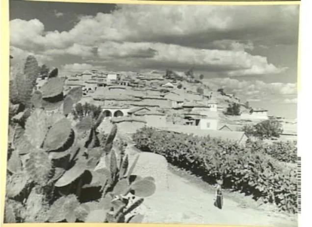
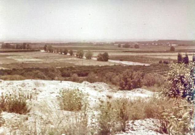
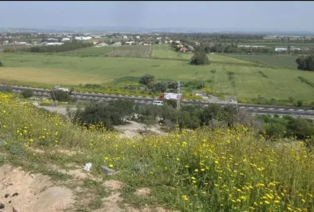
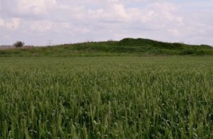
al-Maghar stood on three slightly elevated hills in an otherwise generally flat area of the central coastal plain.
The village was approximately 12 km southwest of Ramla and had an average elevation of about 50 metres above sea level.
It stood on a highway leading northeast toward Ramla. The military airfield at 'Aqir was situated several kilometres to the east, while Wadi al-Maghar bordered the village lands to the south.
Roads and tracks connected al-Maghar with neighbouring Palestinian villages, including 'Aqir, Zarnuqa, Yibna, Bashshit, Qatra, Shahma, and al-Mukhayzin.
Name and History of al-Maghar
The Arabic name al-Maghar is associated with the word for cave or grotto.
Archaeological remains at the site indicate ancient habitation. One of the three hills on which the village stood contained remains thought to date to the Canaanite period.
During the early Islamic period, al-Maghar served as a seasonal camping ground for the Arab tribe of Lakhm.
The geographer Yaqut al-Hamawi, who died in 1229, described al-Maghar as a village of the Ramla area and stated that the eighth-century Muslim jurist Abu al-Hasan Muhammad al-Maghari had been born there.
In 1596, al-Maghar was a village in the nahiya of Gaza within the liwa of Gaza, with an estimated population of approximately 121. The villagers paid taxes on wheat, barley, sesame, and fruit.
Architecture of al-Maghar
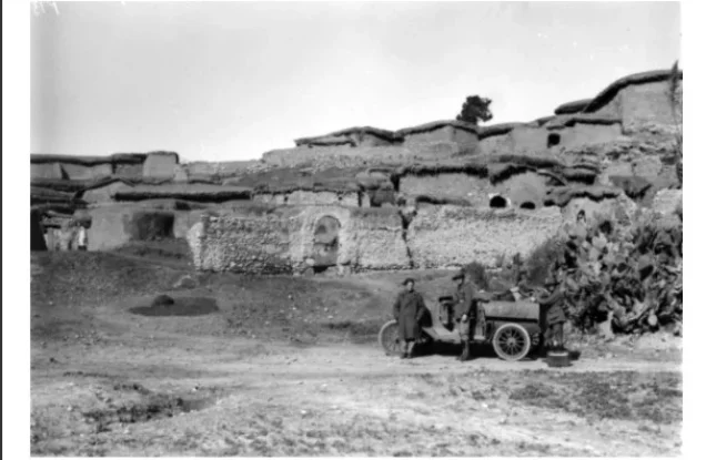
In the late nineteenth century, al-Maghar was an adobe-built village situated on the southern slope of one of its hills and surrounded by pastureland and fig orchards.
During the first half of the twentieth century, houses were constructed of mud, cement, and stone. They were arranged in clusters of closely spaced dwellings extending toward Wadi al-Maghar and along the tracks that crossed the village.
During the British Mandate, construction expanded onto the northern and southern hills flanking the original built-up core and along the road leading toward nearby Yibna.
Most inhabitants were Muslim. The village had a mosque and several small shops.
Education in al-Maghar
The villagers invested approximately 5,000 Palestinian pounds in establishing an elementary school on twenty-two dunums of land.
Khalidi's PalQuest entry records approximately 190 pupils enrolled in the mid-1940s.
Palestine Remembered gives a different figure of 170 pupils in 1945. The detailed Khalidi entry does not provide a specific founding year, so the claim that the school opened in 1930 is not presented here as established fact.
Economic Life in al-Maghar
The village had abundant groundwater and fertile soil, and agriculture was the principal source of livelihood.
The villagers cultivated rainfed cereals, particularly wheat and barley, as well as irrigated vegetables and fruit.
Citrus cultivation was important, while fig and olive orchards and other crops were also present.
In 1944/45, a total of 1,966 dunums was devoted to citrus and bananas: 1,772 Palestinian dunums and 194 dunums in the ownership category “Transferred to Zionists.”
Eighty-six Palestinian dunums were irrigated or used for plantations, including 22 dunums planted with olive trees.
A total of 11,692 dunums was devoted to cereals.
Land Ownership in al-Maghar
The total registered land area of al-Maghar was 15,390 dunums in the 1944/45 statistics.
Land ownership in al-Maghar, 1944/45, using the terminology of Palestine Remembered
- Palestinian11,252 dunums73%
- Transferred to Zionists2,659 dunums17%
- Communal1,479 dunums10%
Land Use in al-Maghar, 1944/45
Land use in al-Maghar, separating ownership categories according to PalQuest's detailed statistics
- Palestinian
- Transferred to Zionists
- Communal/Public
- Citrus and bananas1,966 dunums
- Plantations and irrigable land86 dunums
- Cereals11,692 dunums
- Built-up area31 dunums
- Non-cultivable land1,615 dunums
A total of 13,744 dunums, approximately 89 percent of the village lands, was cultivated or cultivable: 10,933 Palestinian dunums, 2,625 dunums in the category “Transferred to Zionists,” and 186 communal/public dunums.
Built-up and non-cultivable land together amounted to 1,646 dunums, or approximately 11 percent of the total.
Palestine Remembered places 9,261 dunums of cereal land in its Palestinian column. PalQuest's detailed table shows that this combines 9,075 Arab dunums and 186 public dunums. Likewise, the 1,581 dunums listed as Palestinian non-arable land combine 288 Arab dunums with 1,293 public dunums. The communal/public category is therefore separated above.
The 22 dunums of olive groves form part of the 86 dunums classified as plantations and irrigable land and should not be added again to the total cultivable area.
Population of al-Maghar
Population of al-Maghar in selected years
- 1596121Estimate derived from Ottoman records
- 1922966Official British Mandate census
- 19311,211Official British Mandate census
- 1944/451,740Official statistics
- 19482,018Later estimate published by Palestine Remembered
- Estimated refugees in 199812,395Later estimate published by Palestine Remembered
Number of Houses in al-Maghar
Number of houses in al-Maghar
- 1931255Official British Mandate census figure
- 1948424Later estimate published by Palestine Remembered
Archaeological Remains in al-Maghar
The site contained archaeological remains indicating ancient occupation. One of the three hills on which the village stood held remains thought to date to the Canaanite period.
Palestine Remembered also records a mound of ruins, pottery fragments, wells, and rock-cut tombs.
The details concerning the wells and rock-cut tombs are attributed specifically to Palestine Remembered, while Khalidi's PalQuest entry confirms the broader presence of ancient archaeological remains.
Attacks on al-Maghar before its Occupation
al-Maghar was attacked on 10 February 1948, according to a communiqué issued by Arab militia forces in the Jaffa area under Hasan Salama.
The communiqué, published in the Palestinian newspaper Filastin, stated that a Jewish convoy approached the village and fired at villagers from both sides of the road, but it provided no casualty figures.
A second attack occurred on 29 March 1948. Details emerged after British police found the wreckage of an armored vehicle that had exploded during the attack. The bodies of six Jewish soldiers were recovered, while no Arab casualties were reported.
Occupation and Depopulation of al-Maghar during the Nakba
The Haganah's Giv'ati Brigade invaded al-Maghar in May 1948 in the context of Operation Barak, which targeted Palestinian villages south and west of Ramla and across parts of the southern and central coastal plain.
Khalidi's PalQuest entry gives 15 May 1948 as the date of the invasion, while Palestine Remembered's statistical summary lists 18 May.
PalQuest's Operation Barak entry states that the initial stage began on 9 May and that the Haganah launched a second stage after the British withdrawal on 15 May, with operations by the Giv'ati and Negev Brigades continuing in southern Palestine through the end of the month.
This article therefore uses 15 May as the village-specific date provided in Khalidi's detailed account while explicitly preserving the 18 May date given by Palestine Remembered.
The New York Times, as cited by Khalidi, reported that Jewish forces advancing south seized what it described as the “Arab fortress” at al-Maghar, which commanded the road toward the Negev.
Khalidi's dedicated village entry does not provide a detailed independent account of the route taken by all of the villagers after displacement. Palestine Remembered categorizes the exodus as resulting from direct military assault.
- First documented attack: 10 February 1948.
- Second documented attack: 29 March 1948.
- Occupation date in Khalidi/PalQuest: 15 May 1948.
- Date listed by Palestine Remembered: 18 May 1948.
- Military operation: Operation Barak.
- Attacking unit: the Haganah's Giv'ati Brigade.
- Fate of the inhabitants: the Palestinian population was displaced during the Nakba in the course of the military assault and occupation of the area.
Destruction of al-Maghar
Systematic arrangements to destroy al-Maghar were made in June 1948 following the occupation of the village.
Walid Khalidi cites Israeli historian Benny Morris as reporting that on 10 June, senior Jewish National Fund official Yosef Weitz sent two employees through the coastal plain to determine which depopulated villages should be destroyed and which should be settled by Jews.
One of those employees informed Weitz that arrangements had been completed for the destruction of al-Maghar to begin the following day, 11 June.
On 14 June, Weitz received a progress report on the demolition, and on 15 June he visited the village while three tractors were completing its destruction.
The Israeli sources mentioned above are not used independently here. These details are included only because they are reproduced and assessed within the approved Palestinian reference.
Settlement Established on the Lands of al-Maghar
Beyt El'azari was established in 1948 on the lands of al-Maghar.
al-Maghar Today
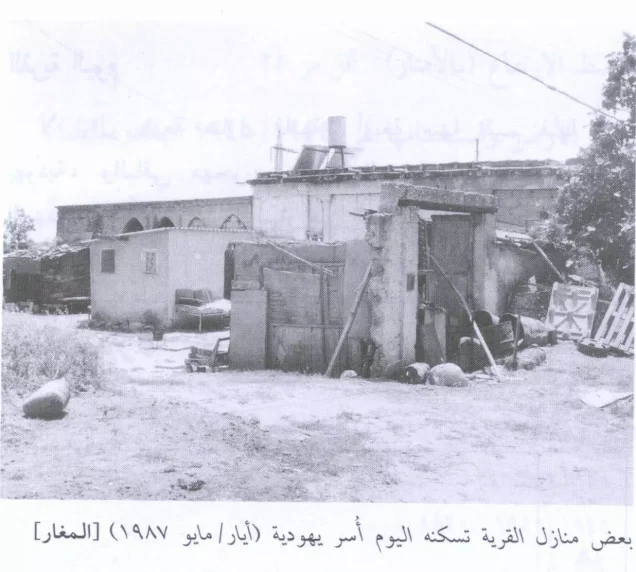
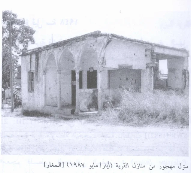
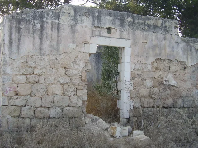
According to the field description published by Walid Khalidi in All That Remains, several village houses remained standing after the destruction of al-Maghar.
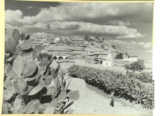
At the time of the field documentation, four of those houses were occupied by Jewish families, while the others were deserted. Sections of walls from demolished houses also remained, and cactus plants grew on the site.
These details should be understood as a historical description of the site's condition during the fieldwork later published in Khalidi's 1992 volume, not as evidence that the same houses remain occupied in exactly the same way in 2026.
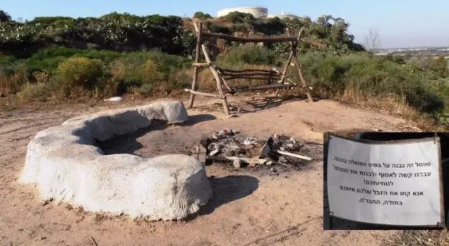
Palestine Remembered contains later user-contributed photographs and videos, including material added in August 2026 concerning the lands of al-Maghar. The site itself cautions that such contributions express the views of their contributors and that their accuracy is not guaranteed.
The approved sources used here therefore do not provide a sufficiently comprehensive, independent, and systematic contemporary field survey to verify the precise condition of every surviving structure and parcel of al-Maghar in 2026.
Sources
- PalQuestPalQuest – Interactive Encyclopedia of the Palestine Question: al-Maghar
- PalQuestPalQuest – Operation Barak
- Palestine RememberedPalestine Remembered – al-Maghar, Ramla District
- Palestine RememberedPalestine Remembered – al-Maghar entry from All That Remains
- Institute for Palestine StudiesInstitute for Palestine Studies – All That Remains, Walid Khalidi
Photo gallery



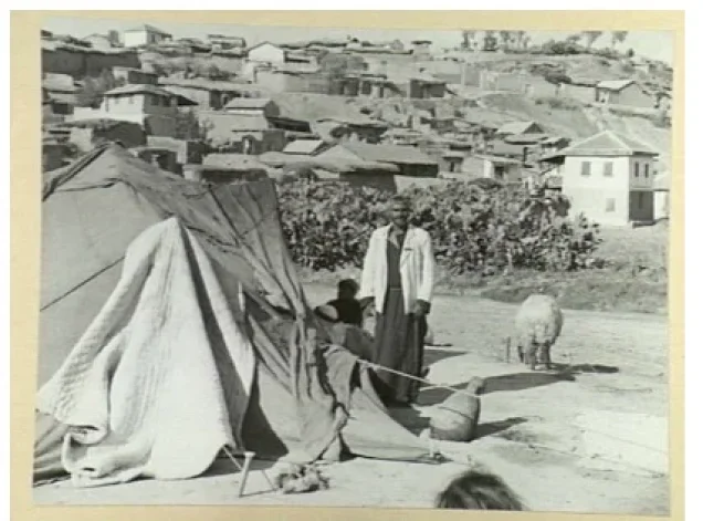
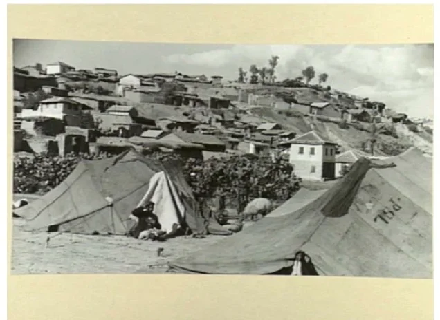


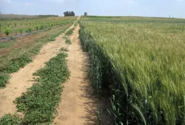
Photos from the village's people
Photos sent in by visitors and published after review.
Add a photo of this village
Log in to add photos of this village.
Other villages from Ramla

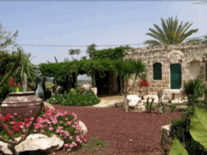
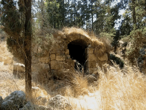
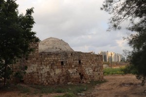
More from the archive


 Download Our Palestine App
The whole archive in the palm of your hand: depopulated villages, the Nakba, the massacres and Al-Aqsa — free, with no ads to erase the story.
Download Our Palestine App
The whole archive in the palm of your hand: depopulated villages, the Nakba, the massacres and Al-Aqsa — free, with no ads to erase the story.



Comments
No comments yet — be the first to write one.
Add your comment
Name and email are optional. Comments appear after review.