
The depopulated village of al-Burj / District of Ramla
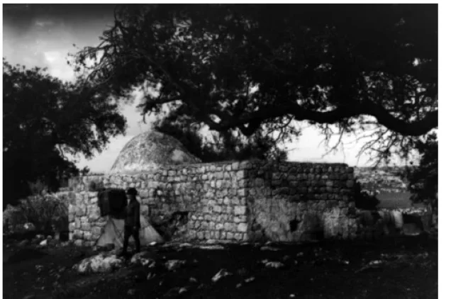
al-Burj
About the depopulated village of al-Burj
- District
- Ramla
- Date al-Burj was occupied
- 15 July 1948
- Population in 1948
- 560
- Military operation
- Operation Dani
- Who defended the village
- Jordanian Army
- Distance from the governorate centre
- 14 (km) East of al-Ramla
- Elevation above sea level
- 275 m
- Cause of displacement
- Military assault by Zionist troops
- Extent of destruction
- al-Burj was mostly destroyed with the exception of one crumbling house remain standing.
- Ethnic cleansing
- al-Burj inhabitants were completely ethnically cleansed.
Hover a dot to read the village name, or click to open its card.
Borders of the depopulated village of al-Burj
al-Burj – Depopulated Palestinian Village of Ramla
Al-Burj was a Palestinian village in the Ramla Subdistrict and the Lydda administrative district during the British Mandate. It stood on a rocky site in the western foothills of the Ramallah highlands overlooking the central coastal plain, approximately 14 kilometers east of Ramla and at an average elevation of about 275 meters above sea level.
A network of narrow roads linked the village with the Ramla-Ramallah highway, which passed a short distance southeast of the site, and with neighboring villages including Barfiliya, Bayt Sira, Safa, Bir Ma'in, Shilta, and Bayt Shanna.
The population reached 480 in the official 1944/45 statistics, and the village lands covered 4,708 dunums. Agriculture and livestock raising were the principal livelihoods, with cereals, vegetables, fruit, and olives among the crops.
Israeli forces occupied al-Burj on 15 July 1948 during the second phase of Operation Dani. The following day, the Transjordanian Arab Legion launched a counterattack with infantry and armored vehicles. The battle lasted several hours but ended with the Arab force withdrawing and al-Burj remaining under Israeli control.
Basic Information
| Field | Information |
|---|---|
| Name | al-Burj |
| Arabic name | البُرْج |
| Subdistrict | Ramla |
| Administrative district | Lydda |
| Location | Western foothills of the Ramallah highlands, east of Ramla |
| Distance from Ramla | Approximately 14 km east |
| Average elevation | Approximately 275 m; the Palestine Encyclopedia gives about 325 m |
| Population in 1922 | 344, all Muslims |
| Population in 1931 | 370 |
| Houses in 1931 | 92 |
| Population in 1944/45 | 480 |
| 1948 population estimate | 557 – later estimate, not an official census |
| Total land area | 4,708 dunums |
| Occupation date | 15 July 1948 |
| Arab Legion counterattack | 16 July 1948 |
| Military operation | Operation Dani – second phase |
| Military unit | Israeli forces participating in Operation Dani; no village-specific brigade or battalion is conclusively identified in Khalidi's al-Burj entry |
| Defending/counterattacking force | Transjordanian Arab Legion |
| Cause of depopulation | Depopulation in the context of military assault and battle; the precise mechanism of the villagers' departure is not conclusively recorded |
| Destruction | Near-total destruction; one crumbling house remained in Khalidi's field description |
| Settlement associated with village lands | Kefar Rut, founded in 1977 northeast of the site; also attributed to Shilta's lands in Khalidi's documentation |
Name and Castle Arnold
Walid Khalidi suggests that the name al-Burj may derive from the Greek word pyrgos, meaning a tower or elevated lookout structure.
He associates the name with the nearby Crusader fort known as Castle Arnold.
The nineteenth-century Survey of Western Palestine described al-Burj as a small hilltop village surrounded by open fields and recorded the remains of the Crusader fortress nearby.
Palestinian local documentation also refers to the archaeological locality as Qal'at al-Tantura and records ruined tower remains and mosaic paving.
Location and Geography
Al-Burj occupied a rocky position along the western lower slopes of the Ramallah highlands and overlooked the central coastal plain to the west.
The Ramla-Ramallah highway passed a short distance southeast of the village and was connected to it by narrow local roads.
Barfiliya lay to the west, Bayt Sira and Safa toward the east, Bir Ma'in to the south, Shilta to the north, and Bayt Shanna toward the southwest.
Palestinian local sources additionally place Bil'in and Bayt Liqya within the broader surrounding landscape.
Built Environment
The original village layout was semi-circular, but construction expanded southward during the British Mandate.
Some houses were built of adobe brick, while others were constructed of stone.
The built-up area covered twelve dunums in the 1944/45 statistics.
The 1931 census recorded ninety-two occupied houses.
Population
- 1922344Official Mandate census; all Muslims
- 1931370Official census; 92 houses
- 1944/45480Official Mandate-period population figure
- 1948557Later demographic estimate, not an official 1948 census
Later estimates of refugees and descendants differ. Palestine Remembered gives 3,419 for 1998, while another Palestinian secondary source gives 4,950. Neither figure is treated here as an official contemporary census.
Land Ownership, 1944/45
- Palestinian4,705 dunums100%
- Transferred to Zionists0 dunums0%
- Public3 dunums<1%
The figures balance exactly: 4,705 + 3 = 4,708 dunums.
No land was recorded in the Jewish ownership category in the 1945 statistics.
Land Use, 1944/45
- Palestinian
- Public
- Cereals2,631 dunums
- Plantations and irrigable land6 dunums
- Built-up area12 dunums
- Non-cultivable land2,059 dunums
The land-use categories reconcile exactly with the total village land area.
Olive Groves
Palestine Remembered separately records approximately sixty dunums of olive trees.
This figure does not appear as an additional independent category in PalQuest's detailed Mandate land-use table.
It is therefore treated as a secondary agricultural subcategory and is not added again to the 4,708-dunum total.
Economy and Agriculture
Agriculture and livestock raising formed the main economic base of the village.
Cereal cultivation dominated land use, covering 2,631 dunums in 1944/45.
The villagers also cultivated fruit trees, vegetables, and olives.
Palestinian local documentation records wheat, barley, beans, chickpeas, lentils, sesame, figs, grapes, almonds, and other crops.
Lydda and Ramla served as important markets for village agricultural and livestock products.
Livestock
Animal husbandry was an important part of village life.
Local Palestinian documentation records sheep and cattle as well as horses, mules, donkeys, and camels used for transport and agricultural work.
Poultry, pigeons, and beehives were also remembered locally.
Water
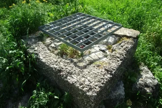
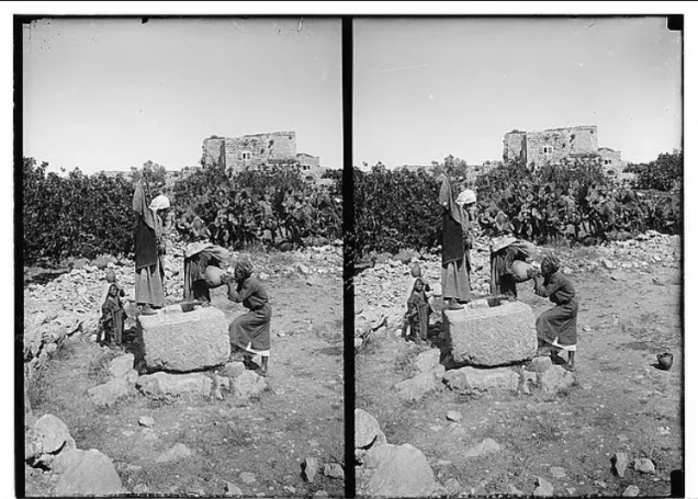
A water tank on the eastern side of al-Burj supplied the inhabitants with drinking water.
Palestinian community documentation additionally records numerous wells and seasonal watercourses across the village lands.
These seasonal water sources were used in places for vegetables and summer crops.
Education
Until 1947, al-Burj did not have its own modern elementary school, and some children attended the school at nearby Bir Ma'in.
The villagers financed and built an elementary school that was completed in 1947.
Its initial enrollment was approximately thirty-five boys.
Local documentation states that the school initially had one teacher whose salary was paid by the villagers, while traditional kuttab education had existed previously.
Mosque and Shrines
Khalidi's short village profile does not discuss a mosque, but Palestinian local documentation records a small old stone mosque where Friday and congregational prayers were held. It reportedly had a courtyard and a water well.
The same local documentation records several shrines: Maqam al-Maghazin, the shrine of al-Waliyya Zaynat, Maqam al-Shaykh Ahmad, and Maqam al-Khutaba / al-Shaykh 'Ali.
These details are retained as Palestinian community documentation rather than as material directly recorded in Khalidi's brief village entry.
Archaeology
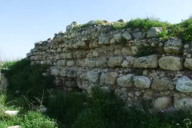
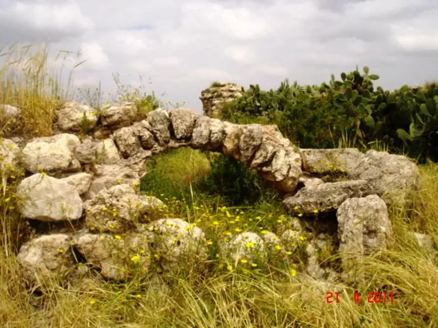
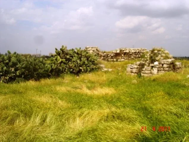
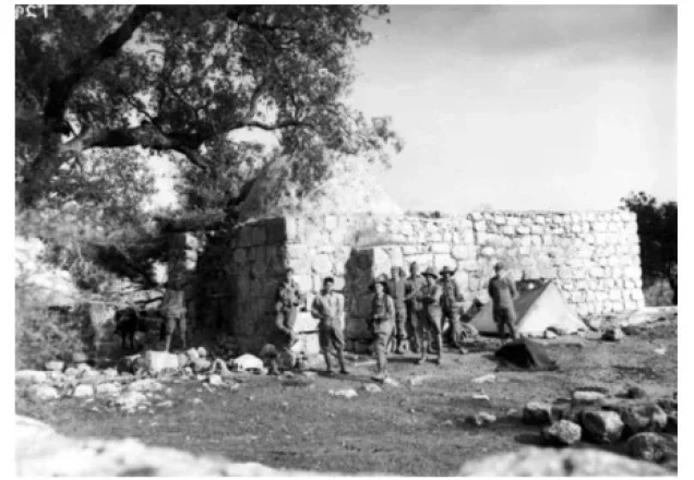
The Crusader fortress is the most prominent archaeological feature associated with al-Burj.
The Survey of Western Palestine recorded remains of an old castle near the village, which researchers associated with Castle Arnold.
Palestinian sources additionally record a ruined tower, mosaic paving, and the site locally known as Qal'at al-Tantura.
Not every visible remain should automatically be assigned to the Crusader period without more detailed archaeological investigation.
Operation Dani
Operation Dani began on 9 July 1948 and continued until 18 July.
The first phase, from 9 to 12 July, focused on the conquest of Lydda and Ramla.
During the second phase, from 13 to 18 July, Israeli forces advanced eastward toward the Latrun-Ramallah road and positions held by the Transjordanian Arab Legion.
Al-Burj was captured during this second phase.
Occupation of al-Burj – 15 July 1948
Israeli forces occupied al-Burj on 15 July 1948.
Barfiliya, Salbit, and Bir Ma'in were occupied at approximately the same time as Israeli forces pushed eastward after the fall of Lydda and Ramla.
The area formed part of the military axis leading toward the Latrun-Ramallah road and positions held by the Arab Legion.
Which Military Unit Occupied al-Burj?
Khalidi's village-specific account does not name a brigade or battalion, referring only to the Israeli army.
The Operation Dani narrative states that the Har'el Brigade was assigned during the second phase to seize villages farther east.
A Palestinian community encyclopedia instead attributes the capture of al-Burj to elements of Giv'ati and an armored formation.
Because these attributions are not consistent, this article does not convert either into a definitive village-level identification.
The most accurate formulation is: Israeli forces participating in the second phase of Operation Dani; no specific brigade or battalion is conclusively documented for al-Burj itself.
Arab Legion Counterattack – 16 July 1948
On the day after the occupation, the Transjordanian Arab Legion attempted to recapture al-Burj.
The force included two infantry platoons and an armored column of approximately ten armored vehicles.
The armored vehicles advanced close to the village houses before coming under anti-tank fire.
The battle lasted approximately four hours and ended with the Arab force withdrawing.
Palestinian historian 'Arif al-'Arif nevertheless states that the attempt to retake al-Burj succeeded in blocking further Israeli advance along this axis.
Conflicting Casualty Figures
Sources differ substantially over casualties in the 16 July battle.
The Israeli account reproduced by Khalidi reports thirty Arab dead and fifty wounded, compared with three Israeli dead and seven wounded.
'Arif al-'Arif gives a much lower Arab toll: seven killed, six missing and presumed dead, and three wounded.
The disparity is too large to reconcile confidently, so both figures are preserved as attributed accounts rather than merged into a single total.
Cause of Depopulation
Palestine Remembered classifies the cause of al-Burj's depopulation as direct military assault.
Khalidi documents the occupation and the subsequent battle but does not provide a detailed account of what happened to the civilian population at the moment the village fell.
The surviving evidence therefore does not establish whether all inhabitants fled before or during the fighting, were expelled after entry, or experienced a combination of circumstances.
The most cautious formulation is: depopulation in the course of the military assault and occupation during Operation Dani; the precise mechanism of the villagers' departure remains unresolved.
Destruction
Most of al-Burj's built environment was destroyed after the Palestinian community was displaced.
Some secondary summaries call the village completely destroyed, but Khalidi's later field survey documented one crumbling house still standing on the hilltop.
The most accurate description is therefore: near-total destruction of the village, with one ruined house surviving in the historical field description.
Ethnic Cleansing in Source Classification
Palestine Remembered classifies al-Burj using the term “complete ethnic cleansing.” The expression is retained here only as an attributed source classification.
The more specifically documented facts are the military occupation of the village on 15 July 1948, the unsuccessful Arab Legion counterattack the following day, disappearance of the Palestinian village community, absence of permanent collective return, and destruction of most of the built environment.
Occupation Chronology
| Date | Event |
|---|---|
| 9 July 1948 | Operation Dani begins. |
| 9–12 July 1948 | The first phase results in the capture of Lydda and Ramla. |
| 13 July 1948 | The second phase begins, with Israeli forces advancing east toward the Latrun-Ramallah axis. |
| 15 July 1948 | Israeli forces occupy al-Burj together with Salbit, Barfiliya, and Bir Ma'in. |
| 16 July 1948 | The Arab Legion launches a counterattack with two infantry platoons and approximately ten armored vehicles; after a four-hour battle the force withdraws. |
| 16 July 1948 | 'Arif al-'Arif states that the battle nevertheless halted the Israeli advance along this axis. |
| 18 July 1948 | Operation Dani ends as the second truce begins. |
| Later period | Most of the village is destroyed; one crumbling house survives in Khalidi's field survey. |
| 1977 | Kefar Rut is established northeast of the former village site. |
Israeli Settlements Established on al-Burj's Lands
Walid Khalidi and PalQuest identify the agricultural settlement of Kefar Rut northeast of the village site as lying on al-Burj's lands.
PalQuest's separate Shilta entry states that Kefar Rut was established in 1977 and also lists it as lying on Shilta's village lands.
The most accurate formulation is therefore that Kefar Rut is associated with al-Burj's lands in Khalidi's al-Burj entry, while the same documentation also attributes part of its location to Shilta's lands; the cadastral association is therefore not exclusive to one former village.
al-Burj Today
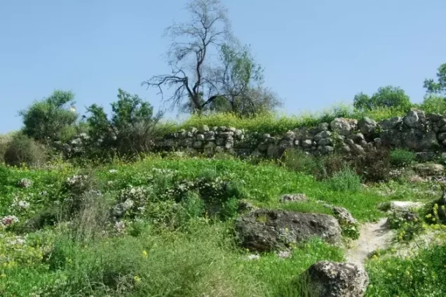
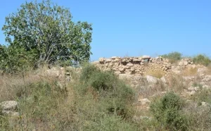
According to the field description used by Walid Khalidi before the publication of All That Remains in 1992, only one crumbling house on the hilltop remained from the Palestinian village.
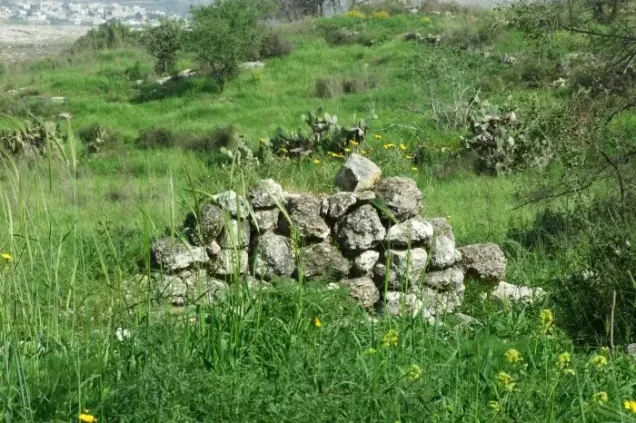
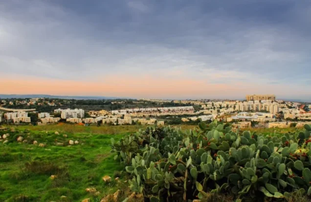
Cactus and wild vegetation grew across the former village site.
The neighboring settlement used parts of the village lands for greenhouse agriculture.
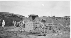
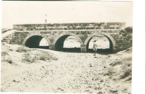
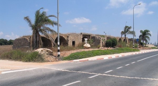
Palestine Remembered and Palestinian community documentation contain later photographs and visits recording the castle remains, wells, cactus growth, surviving house, and wider landscape.
These later materials are useful community documentation but do not constitute a comprehensive archaeological or cadastral survey. Khalidi's description likewise represents historical fieldwork from before 1992 rather than a complete direct survey of all former al-Burj lands in 2026.
Sources
Photo gallery


Photos from the village's people
Photos sent in by visitors and published after review.
Add a photo of this village
Log in to add photos of this village.
Other villages from Ramla
More from the archive


 Download Our Palestine App
The whole archive in the palm of your hand: depopulated villages, the Nakba, the massacres and Al-Aqsa — free, with no ads to erase the story.
Download Our Palestine App
The whole archive in the palm of your hand: depopulated villages, the Nakba, the massacres and Al-Aqsa — free, with no ads to erase the story.



Comments
No comments yet — be the first to write one.
Add your comment
Name and email are optional. Comments appear after review.