
The depopulated village of Abu al-Fadl (Arab al-Satariyya) / District of Ramla
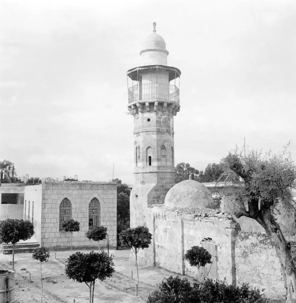
Abu al-Fadl (Arab al-Satariyya)
About the depopulated village of Abu al-Fadl (Arab al-Satariyya)
- District
- Ramla
- Date Abu al-Fadl (Arab al-Satariyya) was occupied
- 12 July 1948
- Population in 1948
- 590
- Military operation
- Operation Barak
- Brigade that carried it out
- Harel Brigade، Givati Brigade
- Distance from the governorate centre
- 4 (km) Northwest of al-Ramla
- Elevation above sea level
- 75 m
- Cause of displacement
- Influence of fall of, or exoduce from, neighboring town
- Extent of destruction
- Abu Fadl was mostly destroyed, and only five of its houses remain standing.
- Ethnic cleansing
- Mostly terrorized out after the attack on Bir Salim on the May 9th, 1948.
Hover a dot to read the village name, or click to open its card.
Borders of the depopulated village of Abu al-Fadl (Arab al-Satariyya)
Abu al-Fadl (Arab al-Satariyya) – Depopulated Palestinian Village of the Ramla Subdistrict
Abu al-Fadl, also known as Arab al-Satariyya or al-Sawtariyya, was a Palestinian locality in the Ramla Subdistrict. It stood on flat land in the central coastal plain, approximately four kilometers northwest of Ramla and at an average elevation of about 75 meters above sea level.
The Rafah–Haifa railway crossed the southern part of the village lands. Abu al-Fadl lay close to Ramla, Lydda, Sarafand al-'Amar, Bir Salim, and Sarafand al-Kharab, within one of the agriculturally productive areas of the central Palestinian coastal plain.
- Subdistrict
- Ramla
- Other Names
- Arab al-Satariyya, al-Sawtariyya, Es Sautariya
- Type of Locality
- Agricultural hamlet/farm with houses dispersed through cultivated land
- Distance from Ramla
- Approximately 4 km northwest
- Average Elevation
- Approximately 75 meters
- Population in 1931
- 1,565 under the name Es Sautariya – all Muslims
- Population in 1944/1945
- 510 – Arab Muslims
- Estimated Population in 1948
- 592 according to Salman Abu Sitta – a later estimate, not an official census
- Total Land Area in 1945
- 2,870 dunums
- First Major Displacement Phase
- 9 May 1948, in the context of Operation Barak and the fall or evacuation of a neighboring locality
- Probable Final Occupation
- 12–13 July 1948 during Operation Dani
- Military Unit
- No single unit is conclusively identified for the final capture; Giv'ati is documented in the May phase, while several brigades participated in Operation Dani
- Settlements on Village Land
- Sitriyya – 1949; Talmey Menashe – 1953
Name and Arab al-Satariyya
The locality was known as Abu al-Fadl, while its inhabitants were also called Arab Abu al-Fadl or Arab al-Satariyya. The official 1931 census recorded the population under the name Es Sautariya.
Walid Khalidi records that the Bedouins who settled there had originally come from the Khan Yunis area in southern Palestine.
Later Palestinian tribal traditions provide more elaborate accounts of Satariyya origins and migration, but such genealogical traditions vary and are not treated here as official documentary lineage.
Origin of the Name
The village lands were described as an Islamic waqf associated with al-Fadl ibn al-'Abbas.
Khalidi suggests that the locality was probably named after him. Because the source itself uses a qualified formulation, the explanation is presented as probable rather than certain.
Location
Abu al-Fadl stood on flat terrain in the central coastal plain close to Lydda and Ramla.
The Rafah–Haifa railway crossed the southern part of its lands, connecting the locality to the wider transportation network between southern, central, and northern Palestine.
The village was approximately four kilometers northwest of Ramla and about 75 meters above sea level.
Neighboring Localities
The Abu al-Fadl lands were surrounded by several important localities:
- Sarafand al-'Amar to the north.
- Lydda to the northeast.
- Ramla to the east and southeast.
- Bir Salim to the south.
- Sarafand al-Kharab to the west and northwest.
Be'er Ya'akov stood nearby to the west but was not established on Abu al-Fadl land.
Settlement Pattern
The Palestine Index Gazetteer classified Abu al-Fadl as a hamlet or agricultural farm.
The villagers' houses were dispersed across the agricultural lands rather than concentrated in a very compact village core, reflecting the community's Bedouin origins and gradual transition toward settled farming.
The built-up area covered approximately 42 dunums in 1945.
Population in 1931
The official 1931 Census of Palestine recorded Es Sautariya as follows:
| Total | 1,565 |
|---|---|
| Category | Number |
| Males | 712 |
| Females | 853 |
All residents recorded in the census were Muslims.
Population in 1944/1945
The 1944/45 statistics give a population of 510 for Abu al-Fadl, all Arab Muslims.
This creates a large difference between the 1,565 recorded for Es Sautariya in 1931 and the 510 recorded for Abu al-Fadl in 1945.
The principal sources used here do not explain that discrepancy directly, and it should not automatically be interpreted as a documented natural population decline.
A difference in the statistical boundaries of the wider Satariyya population and the later Abu al-Fadl locality, together with population movement, may have contributed, but this remains an interpretation rather than an established fact.
Estimated Population in 1948
Salman Abu Sitta's Register gives an estimated 592 inhabitants for Abu al-Fadl in 1948.
This is a retrospective demographic estimate rather than an official census carried out in 1948.
- 19311,565Official census under Es Sautariya
- 1944/1945510Mandate statistics for Abu al-Fadl
- 1948592Later estimate in Salman Abu Sitta's Register
- Refugees and Descendants, 19983,633Later demographic estimate in Abu Sitta's Register
Land Ownership in 1945
Abu al-Fadl had a total land area of 2,870 dunums.
- Palestinian2,717 dunums95%
- Transferred to Zionists0 dunums0%
- Communal/Public153 dunums5%
The original Mandate statistics used the categories Arab, Jewish, and Public: 2,717 dunums were Arab-owned, none were recorded in the Jewish category, and 153 dunums were public.
Land Use in 1945
- Citrus and Bananas818 dunums15%
- Plantations and Irrigable Land822 dunums15%
- Cereals1,035 dunums19%
- Total Cultivable Land2,675 dunums48%
- Built-up Area42 dunums<1%
- Non-Cultivable Land153 dunums3%
Approximately 93 percent of the village land was classified as cultivated or cultivable, demonstrating the central importance of agriculture to the community.
Economic Life
The inhabitants depended primarily on rain-fed and irrigated agriculture.
Important crops included:
- Citrus.
- Olives.
- Vegetables.
- Cereals.
Livestock raising also remained important, reflecting the community's Bedouin roots alongside its increasing agricultural settlement.
Education and Services
The principal Khalidi entry used for this article does not document a separate village school at Abu al-Fadl before the Nakba.
No school name or student total is therefore added without stronger evidence. The village's proximity to Ramla, Lydda, and other large coastal-plain localities nevertheless provided comparatively close access to regional markets and services.
May 1948: Operation Barak
One account links the villagers' first major dispersal to Operation Barak in May 1948.
According to this account, residents dispersed on 9 May 1948 after the fall or evacuation of a nearby locality, probably Bir Salim.
The Giv'ati Brigade was conducting military operations in the coastal area west of Lydda and Ramla during this phase.
The 9 May date is therefore best treated as an early displacement or dispersal stage rather than an unquestionably established final occupation date.
Probable Final Occupation during Operation Dani
Walid Khalidi concludes that Abu al-Fadl was more probably finally occupied on 12–13 July 1948.
This assessment is based on a Haganah map of Operation Dani indicating that the village was among the localities overrun during the July offensive in the Lydda–Ramla region.
Operation Dani began on 9 July and continued until 18 July 1948, making it the largest Israeli offensive during the Ten Days between the first and second truces.
Lydda and Ramla were occupied during its first phase, after which Israeli forces expanded into surrounding villages and rural areas.
Military Unit
The principal sources do not identify one brigade conclusively as the force that finally occupied Abu al-Fadl.
The two stages should be distinguished:
- May phase: the Giv'ati Brigade is documented operating west of Lydda and Ramla during Operation Barak and is associated with the account of the 9 May dispersal.
- July phase: Operation Dani involved the Har'el, Yiftach, Eighth Armored, Kiryati, Alexandroni and other formations, but the village-specific source does not identify which one entered Abu al-Fadl.
The most accurate formulation is therefore: Giv'ati is associated with the first displacement phase, while the executing unit in the probable final July occupation remains uncertain.
Occupation and Displacement Chronology
- Until 1948
Pre-Nakba Community
An agricultural Arab al-Satariyya community whose houses were dispersed among orchards and fields near Ramla and Lydda.
- May 1948
Operation Barak
Giv'ati conducted operations in the coastal area west of Lydda and Ramla.
- 9 May 1948
Initial Dispersal
One account states that the inhabitants dispersed after the fall or evacuation of a neighboring locality, probably Bir Salim.
- 9 July 1948
Beginning of Operation Dani
A major offensive began to seize Lydda, Ramla, and surrounding routes and localities.
- 12 July 1948
Occupation of Ramla
Israeli forces occupied Ramla and expanded into the surrounding countryside.
- 12–13 July 1948
Probable Final Occupation of Abu al-Fadl
Khalidi, relying on the Haganah map and circumstantial military evidence, considers this the most probable final occupation phase.
- 18 July 1948
End of Operation Dani
The operation ended after a major transformation of control in the Lydda–Ramla region.
Cause of Displacement
The displacement of Abu al-Fadl appears to have unfolded in more than one stage.
In May, the fall or evacuation of neighboring communities and Giv'ati military operations contributed to the dispersal of part of the population.
In July, the probable final occupation during Operation Dani ended the remaining Palestinian presence in the village.
Khalidi further suggests that if Israeli conduct at Abu al-Fadl resembled events in nearby Lydda, remaining villagers were likely expelled eastward after the occupation.
The most supportable description is therefore initial displacement under military pressure and the impact of neighboring depopulation, followed by final occupation and the removal of remaining residents during Operation Dani.
Extent of Destruction
Most of Abu al-Fadl's buildings were destroyed after its depopulation.
In Khalidi's historical field description, only approximately five original village houses remained standing.
No official numerical destruction percentage has been documented, so no unsupported percentage is supplied.
Israeli Settlements on Abu al-Fadl Land
Major post-Nakba changes occurred on the village lands:
- Sitriyya: established in 1949 in connection with the removal of Abu al-Fadl from the map. Khalidi notes that its original location is uncertain and that its later site lies approximately five kilometers south of the former village site.
- Talmey Menashe: established in May 1953 on Abu al-Fadl village land.
Parts of Talmey Menashe were later absorbed into the suburbs of Rishon LeZion, and the settlement lost much of its separate identity.
Be'er Ya'akov, established in 1907 approximately one kilometer west of the site, was not on Abu al-Fadl land.
Nir Tzevi, established in 1954 to the north, was built on land belonging to Sarafand al-'Amar rather than Abu al-Fadl.
Abu al-Fadl Today
The available site description derives from historical field research incorporated into Walid Khalidi's All That Remains and is not a direct 2026 field verification.
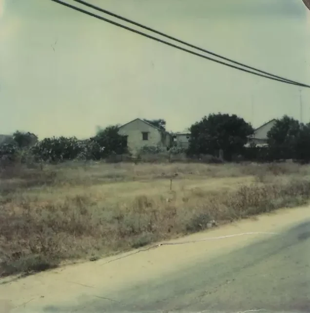
At the time of that documentation, only about five original village houses remained standing, deserted and close to collapse.
One stood at the edge of a citrus grove, built of cement blocks with rectangular doors and windows and a sloping tiled roof. Another three-room house stood within a citrus grove.
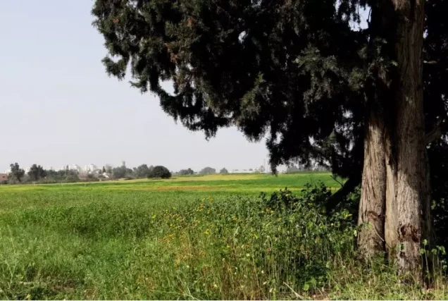
Cypress trees, castor-oil plants, and cactuses remained at the site, while Israeli buildings had been constructed nearby and the surrounding lands were cultivated.
Sources
- PalQuest – Interactive Encyclopedia of the Palestine Question: Abu al-Fadl
- PalQuest – Operation Dani
- PalQuest – Operation Barak
- Institute for Palestine Studies – Walid Khalidi, All That Remains
- Palestine Remembered – Abu al-Fadl entry from All That Remains
- Palestine Remembered – Abu al-Fadl / al-Satariyya: Population and Land Statistics
- Government of Palestine – Census of Palestine, 1931: Es Sautariya
- Salman Abu Sitta – Register of Depopulated Palestinian Localities: Abu al-Fadl (Sautariyya)
Photo gallery
Photos from the village's people
Photos sent in by visitors and published after review.
Add a photo of this village
Log in to add photos of this village.
Other villages from Ramla
More from the archive



 Download Our Palestine App
The whole archive in the palm of your hand: depopulated villages, the Nakba, the massacres and Al-Aqsa — free, with no ads to erase the story.
Download Our Palestine App
The whole archive in the palm of your hand: depopulated villages, the Nakba, the massacres and Al-Aqsa — free, with no ads to erase the story.



Comments
No comments yet — be the first to write one.
Add your comment
Name and email are optional. Comments appear after review.