
The depopulated village of Wadi Hunayn / District of Ramla
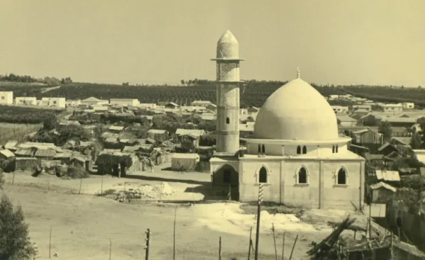
Wadi Hunayn
About the depopulated village of Wadi Hunayn
- District
- Ramla
- Date Wadi Hunayn was occupied
- 17 April 1948
- Population in 1948
- 1,879
- Military operation
- Operation Nachshon
- Distance from the governorate centre
- 9 (km) West of al-Ramla
- Elevation above sea level
- 50 m
- Cause of displacement
- Influence of fall of, or exoduce from, neighboring town
- Extent of destruction
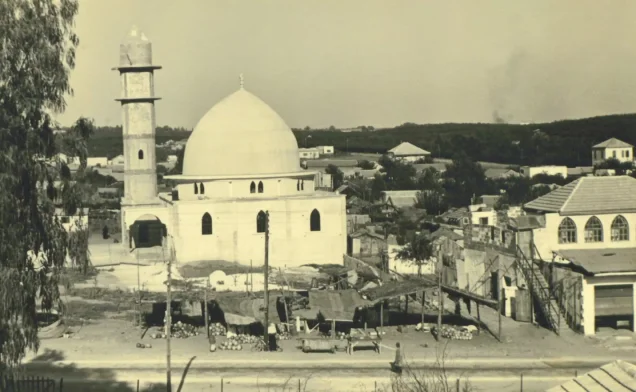
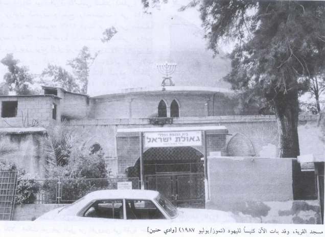
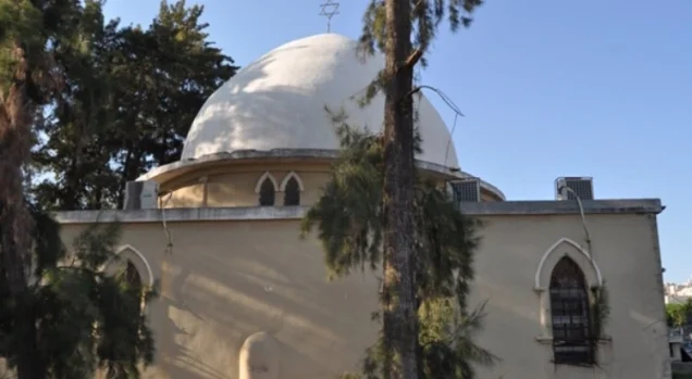
- Wadi Hunayn was mostly destroyed with exception of few of its houses and Mosque (now functions as a synagogue).
- Ethnic cleansing
- Wadi Hunayn inhabitants were completely ethnically cleansed.
Hover a dot to read the village name, or click to open its card.
Borders of the depopulated village of Wadi Hunayn
Wadi Hunayn – Depopulated Palestinian Village of the Ramla Subdistrict
Wadi Hunayn was a Palestinian village in the Ramla Subdistrict. It stood on flat terrain in the central coastal plain approximately 9 km west of Ramla and about 50 metres above sea level.
The village lay directly on the main road connecting Ramla with Jaffa and other coastal towns, while the Lydda–Jaffa railway ran approximately 1.5 km east of the village. A network of roads also linked Wadi Hunayn with surrounding Palestinian communities.
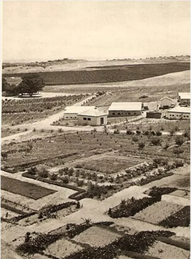
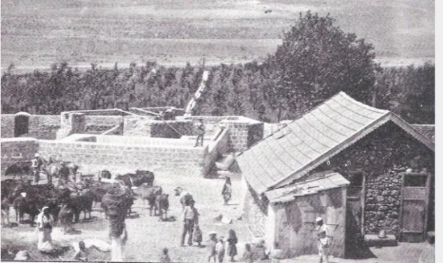
Wadi Hunayn developed a prosperous agricultural economy centered on citrus cultivation, which expanded rapidly during the early twentieth century. Its history also became closely intertwined with the Zionist settlement of Nes Tziyyona, founded in 1883 on land purchased from Wadi Hunayn, directly across the road from the Palestinian village.
Name of Wadi Hunayn
The principal Palestinian sources record the village as Wadi Hunayn.
Walid Khalidi relays a local tradition that members of the Qada'a tribe settled the locality in the early Islamic period and named it after their former home, Wadi Hunayn in Hadramawt, Yemen.
This should be understood as a traditional account of the name's origin rather than as an independently documented contemporary record of the village's initial settlement.
Location
Wadi Hunayn stood on flat terrain in the central coastal plain approximately 9 km west of Ramla at an average elevation of about 50 metres above sea level.
The main Ramla–Jaffa road passed through the village area, while several roads connected it with neighboring Palestinian communities.
The Lydda–Jaffa railway line ran approximately 1.5 km east of the village.
Sarafand al-Kharab lay to the north, Sarafand al-'Amar to the northeast, Bir Salim to the east, al-Qubayba to the south, and the coastal lands toward al-Nabi Rubin to the west.
Village Layout
Wadi Hunayn's houses were scattered irregularly across the flat village site.
Homes were constructed of mud, stone, or cement. A mosque and several small shops stood in the center of the village.
The built-up community expanded as the growing citrus economy attracted Palestinian agricultural workers from other parts of the country, some of whom settled permanently in Wadi Hunayn.
Population of Wadi Hunayn
The 1944/45 statistics require special care because the Government of Palestine combined Wadi Hunayn and Nes Tziyyona in one statistical unit.
- 1922195Independent official census figure for Wadi Hunayn.
- 1931280Independent official census; the population lived in 55 houses.
- 1944/451,620 Arabs + 1,760 JewsThe official statistical unit combined Wadi Hunayn and Nes Tziyyona, for a total of 3,380. The 1,620 figure represents the Arab component associated with Wadi Hunayn.
- 19481,879 PalestiniansLater Palestine Remembered estimate, not an official census.
- 199811,540 refugeesLater estimate of refugees originating from the village and their descendants.
The combined total of 3,380 should therefore not be presented as the population of Wadi Hunayn alone because it included the Jewish population of Nes Tziyyona.
Number of Houses
- 193155Official Government of Palestine census figure.
- 1948369Later Palestine Remembered estimate, not an official house count.
Land Ownership – Wadi Hunayn and Nes Tziyyona
The 1944/45 statistics do not provide a cadastral unit separating Wadi Hunayn entirely from Nes Tziyyona. The combined statistical unit contained 5,401 dunums.
Using the ownership terminology employed by Palestine Remembered, while explicitly noting that these are combined-unit figures, the distribution was:
- Palestinian1,998 dunums18%
- Transferred to Zionists3,211 dunums30%
- Communal/Public192 dunums2%
- Combined Total5,401 dunums50%
This corresponds to the official categories of 1,998 Arab dunums, 3,211 Jewish dunums, and 192 Public dunums.
The 5,401-dunum figure should not be presented as an independently separated Wadi Hunayn village-land total without noting that the official statistical unit also included Nes Tziyyona.
Land Use in 1944/45
The published land-use figures likewise refer to the combined Wadi Hunayn–Nes Tziyyona statistical unit:
- Arab
- Jewish
- Citrus and Bananas3,916 dunums
- Plantations and Irrigable Land100 dunums
- Cereals716 dunums
- Total Cultivable Land4,732 dunums
Cultivated or cultivable land therefore accounted for approximately 88 percent of the combined statistical unit.
The summarized PalQuest table does not display a documented ownership breakdown for the remaining 669 dunums into built-up and non-cultivable categories. No speculative allocation is therefore created here.
Economic Life in Wadi Hunayn
Agriculture, and citrus cultivation in particular, formed the core of Wadi Hunayn's economy.
The coastal citrus industry west of the village expanded rapidly during the first decade of the twentieth century and attracted Palestinian workers from different parts of the country, some of whom settled permanently in Wadi Hunayn.
Both Arab-owned orchards and groves owned by residents of Nes Tziyyona provided agricultural employment. Wadi Hunayn residents worked in the orchards and marketed their citrus and other produce in urban markets.
In 1944/45, 1,827 Arab dunums were devoted to citrus and bananas, 134 dunums to cereals, and 19 dunums to plantations and irrigable cultivation.
Citrus Agriculture
Citrus was Wadi Hunayn's principal commercial crop.
The village's flat, fertile coastal soils supported extensive orchards, which were irrigated by numerous artesian wells drilled in and around the locality.
The citrus economy transformed Wadi Hunayn into an important agricultural center during the first half of the twentieth century, drawing labor, capital, and new residents.
Wadi Hunayn and Nes Tziyyona Before the Nakba
The Zionist settlement of Nes Tziyyona was established in 1883 on land purchased from Wadi Hunayn, on the western side of the Gaza–Jaffa coastal road.
Only the road separated the settlement from the Palestinian village, and the citrus labor market created substantial everyday economic interaction between the two communities.
Khalidi notes that Nes Tziyyona's willingness to employ Palestinian labor was criticized by leading Zionists because it conflicted with wider policies seeking to exclude non-Jewish labor from Zionist enterprises.
The Wadi Hunayn–Nes Tziyyona area consequently developed an unusually close pattern of residential and economic proximity, even while the two communities remained politically and socially distinct.
Water Resources
The intensive citrus economy relied on numerous artesian wells drilled in and around Wadi Hunayn.
Groundwater irrigation enabled the cultivation of extensive citrus orchards and other plantations and was one of the principal foundations of the village's agricultural prosperity.
The Mosque
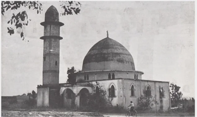
Wadi Hunayn had a mosque in the center of the village near several small shops.
Khalidi's detailed village entry does not document a church, despite an automated Palestine Remembered field suggesting one. No church is therefore listed without independent village-specific evidence.
Education
Wadi Hunayn did not have an independent elementary school in the mid-1940s.
All sixty-five pupils from the village attended the elementary school in nearby Sarafand al-Kharab.
The Sarafand al-Kharab school had been founded in 1920 and later developed into a full elementary school with approximately 258 pupils in the mid-1940s. Students from Wadi Hunayn accounted for roughly one quarter of its enrollment.
The abbreviated database field stating that Wadi Hunayn itself had a boys' school therefore requires correction.
The Nakba and Growing Military Pressure
The area around Wadi Hunayn experienced rapidly increasing Zionist military activity during April 1948.
To the east, the Haganah carried out Operation Nachshon in an effort to open the Tel Aviv–Jerusalem road. The Deir Yasin massacre occurred on 9 April, while the second half of April saw increasing pressure on Palestinian communities in the coastal plain and the encirclement of Jaffa.
The Wadi Hunayn village entry, however, does not document a direct military assault on the village on 17 April.
Departure of Wadi Hunayn's Inhabitants – 17 April 1948
Walid Khalidi, citing Benny Morris, states that the inhabitants left Wadi Hunayn on 17 April 1948 under the influence of the capture or evacuation of a neighboring locality.
The identity of that neighboring locality remains unclear. Khalidi himself notes that no major Zionist military operation is known to have taken place immediately around Wadi Hunayn on that date.
17 April should therefore be treated as the reported date of population departure, not as an independently established date of military occupation.
Was Wadi Hunayn Depopulated During Operation Nachshon?
PalQuest's Operation Nachshon page lists Wadi Hunayn among the localities affected by the operation, and Palestine Remembered assigns Operation Nachshon to the village in an abbreviated field.
Operation Nachshon, however, ran from 3 to 15 April 1948, while the detailed village account dates the departure of Wadi Hunayn's inhabitants to 17 April.
The same village entry states that the Giv'ati Brigade had already concluded Operation Nachshon and that the nearest clearly documented threat lay farther east in the Jerusalem corridor.
Operation Nachshon is therefore best treated as part of the broader military and psychological context affecting Wadi Hunayn rather than as a securely documented village-specific operation that captured the village on 17 April.
Sarafand al-Kharab and the Coastal Clearing Campaign
Nearby Sarafand al-Kharab was reportedly evacuated on 20 April 1948 because its residents feared a Zionist attack.
Khalidi suggests that, if these dates are accurate, Wadi Hunayn and Sarafand al-Kharab may both have been threatened during the Haganah's wider clearing campaign in the coastal plain during April and early May, or during the encirclement of Jaffa in the second half of April.
Military Unit
The Wadi Hunayn village entry does not identify a brigade or battalion that entered the village on a documented date.
The Giv'ati and Har'el Brigades participated in Operation Nachshon, but their participation in the wider operation does not establish either as the village-specific force that occupied Wadi Hunayn.
The most precise formulation is therefore: reported population departure: 17 April 1948; exact date of military entry: unknown; village-specific occupying unit: not independently documented; military context: the end of Operation Nachshon followed by the broader coastal clearing campaign and the encirclement of Jaffa.
Occupation and Depopulation Chronology
- 3 April 1948
Beginning of Operation Nachshon
The Haganah began a major offensive to secure the Tel Aviv–Jerusalem road within the broader framework of Plan Dalet.
- 9 April 1948
Deir Yasin massacre
The massacre contributed to the atmosphere of fear affecting Palestinian communities, although it is not established as the sole direct cause of Wadi Hunayn's depopulation.
- 15 April 1948
End of Operation Nachshon
The formally named operation ended. PalQuest lists Wadi Hunayn among affected villages, but no village-specific assault is documented in the detailed entry.
- 17 April 1948
Departure of Wadi Hunayn's inhabitants
Khalidi reports that the villagers left under the influence of the fall or evacuation of an unidentified neighboring locality.
- 20 April 1948
Departure from nearby Sarafand al-Kharab
Its inhabitants reportedly left because they feared a Zionist attack, illustrating the growing pressure in the immediate region.
- Second half of April–early May 1948
Coastal clearing and encirclement of Jaffa
Haganah operations increasingly targeted Palestinian communities across the coastal plain; final consolidation of control over Wadi Hunayn may belong to this wider context.
- Exact date unknown
Final military entry
The principal village account does not establish a separate date or village-specific occupying unit.
Israeli Settlements on Wadi Hunayn Village Lands
Nes Tziyyona was established in 1883 on land purchased from Wadi Hunayn, on the western side of the Gaza–Jaffa coastal road.
As Nes Tziyyona expanded, some of its buildings were constructed on additional Wadi Hunayn village land.
Kefar Aharon was established in 1948 on Wadi Hunayn land and was later incorporated into Nes Tziyyona.
| Settlement | Founded | Relationship to Wadi Hunayn Land |
|---|---|---|
| Nes Tziyyona | 1883 | Established on land purchased from Wadi Hunayn before the Nakba and later expanded onto additional village land. |
| Kefar Aharon | 1948 | Established on Wadi Hunayn land and subsequently incorporated into Nes Tziyyona. |
Wadi Hunayn Today
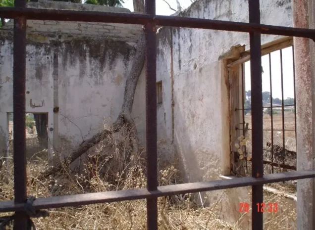
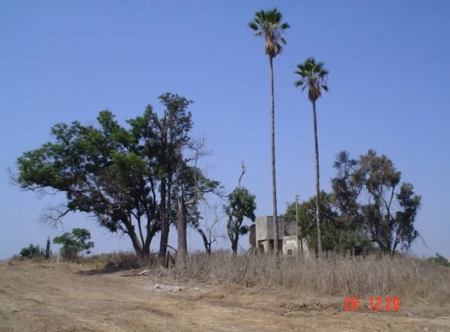
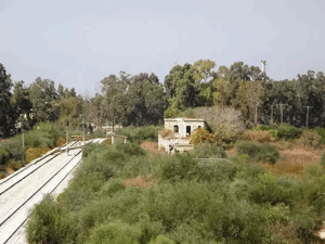
In the historical field description published by Walid Khalidi in All That Remains, approximately ten Palestinian houses survived after most of Wadi Hunayn had been destroyed.
The village mosque had, by the time of Khalidi's fieldwork, been converted into a synagogue called Gulat Yisra'el.
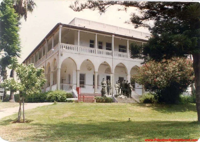
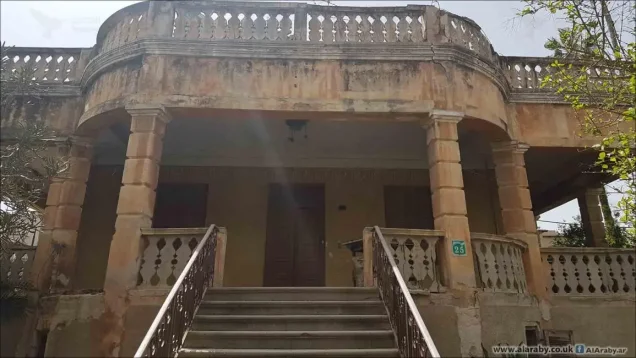
One surviving two-storey building belonging to Shaykh Sulayman al-Faruqi was occupied by Jewish families. The architecturally distinctive gable-roofed house of Ibn Hamid had been converted into a mental hospital.
The palatial house of Abu 'Umar Effendi was being used for unspecified Israeli military purposes, and photography of it was prohibited at the time of Khalidi's documentation.
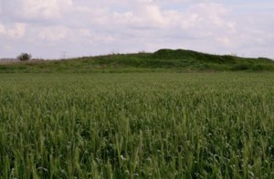
Castor-oil plants and groups of cypress and mulberry trees remained visible, while surrounding lands were cultivated.
Palestine Remembered dates one photograph of the former mosque in its converted use to 1987. Khalidi's description as a whole derives from fieldwork conducted before the publication of All That Remains in 1992 and does not constitute direct verification that the same buildings retain the same uses, or that the entire site remains unchanged, in 2026.
Sources
- PalQuest – Wadi Hunayn
- PalQuest – Operation Nachshon
- PalQuest – Sarafand al-Kharab, for the school and April 1948 regional context
- Palestine Remembered – Wadi Hunayn, Ramla
- Palestine Remembered – Wadi Hunayn historical community overview
- Institute for Palestine Studies – Walid Khalidi, All That Remains
- Palestine Village Statistics 1944/45 – digital reference
Photo gallery


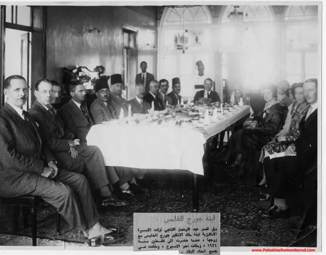









Photos from the village's people
Photos sent in by visitors and published after review.
Add a photo of this village
Log in to add photos of this village.
Other villages from Ramla

More from the archive



 Download Our Palestine App
The whole archive in the palm of your hand: depopulated villages, the Nakba, the massacres and Al-Aqsa — free, with no ads to erase the story.
Download Our Palestine App
The whole archive in the palm of your hand: depopulated villages, the Nakba, the massacres and Al-Aqsa — free, with no ads to erase the story.



Comments
No comments yet — be the first to write one.
Add your comment
Name and email are optional. Comments appear after review.