
The depopulated village of Jimzu / District of Ramla

About the depopulated village of Jimzu
- District
- Ramla
- Date Jimzu was occupied
- 10 July 1948
- Population in 1948
- 1,752
- Military operation
- Operation Dani
- Distance from the governorate centre
- 6.5 (km) East of al-Ramla
- Elevation above sea level
- 125 m
- Cause of displacement
- Military assault by Zionist troops
- Extent of destruction
- On September 13th, 1948, Jimzu was completely obliterated and only house walls and rubble left behind.
- Ethnic cleansing
- Jimzu inhabitants were completely ethnically cleansed.
- Settlements built on the built-up area of Jimzu after 1948
- Gimzo, established in 1950
Hover a dot to read the village name, or click to open its card.
Borders of the depopulated village of Jimzu
Jimzu – Depopulated Palestinian Village of Ramla
Jimzu was a Palestinian village in the Ramla Subdistrict, situated at the eastern edge of the central coastal plain approximately 6.5 kilometers from al-Ramla and close to the city of Lydda. The village occupied ground that rose slightly above the surrounding countryside and had an average elevation of approximately 125 meters according to PalQuest.
A secondary road connected Jimzu with Lydda, while another led to neighboring Khirbat al-Duhayriyya. Its position near the eastern and southeastern approaches to Lydda and al-Ramla gave the village particular military significance during Operation Dani in July 1948.
Jimzu had an officially estimated population of 1,510 in 1944/45 and a total land area of 9,681 dunums. Its economy was based primarily on agriculture and animal husbandry, particularly cereals, olives, fruit, and citrus.
Basic Information
| Field | Information |
|---|---|
| Name | Jimzu |
| Arabic name | جِمْزُو |
| Subdistrict | Ramla |
| Administrative district | Lydda |
| Region | Central coastal plain – Lydda-Ramla area |
| Distance from al-Ramla | Approximately 6.5 km according to PalQuest |
| Distance from Lydda | Approximately 4 km according to the Palestine Encyclopedia |
| Average elevation | Approximately 125 m according to PalQuest |
| Palestine Grid | 145/148 |
| Total land area | 9,681 dunums |
| Population in 1944/45 | 1,510 |
| Houses in 1931 | 268 |
| Occupation date | 10 July 1948; a brief reversal of control occurred on 11 July |
| Military operation | First phase of Operation Dani |
| Military unit | Yiftach Brigade |
| Cause of depopulation | Palestine Remembered: direct military assault; Khalidi states that the precise village-specific circumstances are unclear |
| Destruction | Extensive destruction; no single documented date establishes the complete destruction of the village |
| Post-1948 settlement | Gimzo, established on village land in 1950 |
Name and Earlier History
The name Jimzu is ancient and survived in closely related forms across several historical periods. Palestinian sources commonly associate the name with sycamore trees once found in the area, although other interpretations also exist. No single etymology should therefore be treated as conclusively established.
Walid Khalidi identifies the village site with the ancient town of Gimzo mentioned in historical religious sources and notes that the place is also referred to in Talmudic material from the Roman period.
In 1596 Jimzu belonged to the nahiya of Ramla in the liwa' of Gaza. Its population has been estimated at approximately 154 from Ottoman tax registers. The villagers paid taxes on wheat, barley, fruit, goats, beehives, and other agricultural production.
Jimzu in the Nineteenth Century
Edward Robinson visited Jimzu in 1838 and described it as a relatively large village.
A late nineteenth-century description placed Jimzu on the slope of a low hill, with adobe houses surrounded by cactus hedges and olive trees.
Before the Nakba, village houses were principally constructed of stone and mud, with newer building materials appearing as the village expanded.
Location and Neighboring Villages
Jimzu lay east of al-Ramla and close to Lydda in a transitional zone between the coastal plain and the western foothills of the Ramallah highlands.
Palestinian local documentation places Dayr Abu Salama to the north, Khirbat Zakariyya to the northeast, al-Midya to the east, Kharruba to the southeast, 'Innaba to the south and southwest, Daniyal to the west, and Khirbat al-Duhayriyya to the northwest.
Local roads connected Jimzu directly with Lydda, Khirbat al-Duhayriyya, and neighboring communities, integrating the village economically and socially with the Lydda-Ramla region.
Built Environment
The built-up area of Jimzu covered approximately 50 dunums in the 1944/45 statistics.
The village consisted mainly of mud and stone houses grouped relatively compactly on the slightly elevated site.
The Palestine Encyclopedia describes roughly three hundred houses in the later Mandate period, while the official 1931 census recorded 268 occupied houses.
Population
- 1596Approx. 154Estimate derived from an Ottoman fiscal register, not a modern census
- 1922897Official census figure; Palestine Remembered and a Palestinian village compilation give 898, a one-person discrepancy
- 19311,081Official Government of Palestine census
- 1944/451,510Official Mandate-period estimate
- 19481,752Later Palestine Remembered estimate, not an official census
- 199810,757Later estimate of refugees and descendants, not an official census
Number of Houses
- 1931268Official census figure
- 1948434Later Palestine Remembered estimate, not an official Mandate figure
Land Ownership, 1944/45
- Palestinian9,460 dunums98%
- Transferred to Zionists0 dunums0%
- Public221 dunums2%
The original Government of Palestine table used the categories Arab, Jewish, and Public. No land was recorded in the Jewish ownership category, while 221 dunums were public land.
The ownership figures balance exactly: 9,460 + 221 = 9,681 dunums.
An English Palestine Remembered summary displays 21 public dunums in one location, but this cannot reconcile with the village total. PalQuest and the corresponding Arabic data give the correct figure of 221 dunums.
Land Use, 1944/45
- Palestinian
- Public
- Citrus and bananas77 dunums
- Plantations and irrigable land1,605 dunums
- Cereals5,577 dunums
- Built-up area50 dunums
- Non-cultivable land2,372 dunums
The table balances exactly: 77 + 1,605 + 5,577 + 50 + 2,372 = 9,681 dunums.
Olive Cultivation
Of the 1,605 dunums classified as plantations and irrigable land, approximately 1,400 dunums were planted with olive trees.
The olive figure is a component of the plantation and irrigable category and must not be added again to the total land-use calculation.
Economy and Agriculture
Most residents of Jimzu worked in agriculture and livestock raising. Cereals formed the largest cultivated category, alongside olives, fruit, and citrus.
Palestinian local documentation also records livestock and beekeeping, while some villagers worked in nearby Lydda, al-Ramla, and Jaffa.
A Palestinian village-history source records three olive presses—associated with the 'Isa, al-Ziq, and Dhiba families—as well as a grain mill. These details derive from Palestinian community documentation.
Water
Jimzu's position near the eastern edge of the coastal plain provided access to groundwater resources.
The Palestine Encyclopedia records a well and old cisterns at the village site.
Education
Jimzu had an elementary boys' school founded in 1920.
By the mid-1940s, enrollment had reached approximately 175 pupils.
No independently documented girls' school was located in the principal sources consulted, so no second school is asserted.
Mosque, Shrine, and Sufi Zawiya
Walid Khalidi documents a mosque in Jimzu.
Palestinian local documentation adds that the mosque stood at the highest point of the village and consisted of two levels, with storage or rental rooms below whose proceeds helped support the waqf.
The same documentation records a Sufi zawiya associated with the Khalwatiyya tradition and a shrine of Shaykh Ahmad al-Jimzawi near the northeastern edge of the cemetery.
These additional details derive from Palestinian community documentation and are not all supplied at the same level of detail in Khalidi's concise village entry.
Archaeological Remains
Khalidi notes abundant material evidence of Jimzu's long history. Palestinian reference works additionally record an old well, cisterns, and archaeological remains in the surrounding lands.
This article does not assign every surviving feature to a specific archaeological period unless such a date is explicitly supported by the source.
Operation Dani
Operation Dani began on 9 July 1948 and continued until 18 July. It was the largest offensive launched during the Ten Days between the two truces.
Its first phase, from 9 to 12 July, aimed to encircle and capture Lydda and al-Ramla. The second phase focused on the Ramallah-al-Latrun road.
At the operational level, Har'el, Yiftach, the Eighth Armored Brigade, Kiryati, Alexandroni, and other forces participated. Their participation in the overall offensive should not be interpreted as proof that every brigade attacked Jimzu itself.
For Jimzu specifically, the village-level sources identify the Yiftach Brigade as the occupying formation.
Occupation of Jimzu – 10 July 1948
The Yiftach Brigade occupied Jimzu on 10 July 1948 during the first phase of Operation Dani.
The capture formed part of the military effort to encircle Lydda and al-Ramla and separate the two cities from their surrounding hinterland. Egyptian writer Muhammad 'Abd al-Mun'im reported that infantry forces entering Lydda on the following day came from the direction of Jimzu.
Contemporary reporting cited by Khalidi described the capture of Jimzu and neighboring villages as part of the enveloping movement against the two cities.
What Happened to the Population?
Palestine Remembered classifies the cause of depopulation as a direct military assault.
Khalidi's village-specific account is more cautious. It records that many villages in the area were depopulated during Operation Dani but states that the precise circumstances of what happened to Jimzu's population are unclear in the sources he used.
A Palestinian local-history source states that residents fled after news arrived of the fall of nearby 'Innaba and that troops fired at the fleeing population, killing ten villagers. No independent confirmation of the figure of ten was located in the Khalidi/PalQuest material for Jimzu, so it is retained as an attributed local Palestinian account rather than a conclusively established casualty total.
11 July: Temporary Reversal of Control
Israeli control of Jimzu after 10 July was briefly challenged.
PalQuest's history of the battle for Lydda records that on 11 July a Jordanian brigade commander sent a patrol to Jimzu. The patrol drove the Israeli force from the village and killed a number of its members.
The Jordanian patrol subsequently withdrew, after which Israeli forces returned and reoccupied Jimzu.
Thus 10 July remains the standard occupation date, but the events of 11 July show that military control was briefly interrupted before final Israeli control was consolidated.
Destruction
Jimzu was subsequently subjected to extensive destruction, but the chronology of demolition requires caution.
On 13 September 1948, David Ben-Gurion listed Jimzu among fourteen villages designated for partial destruction.
The source cited by Khalidi does not establish whether this order was actually carried out at Jimzu on that date. It is therefore inaccurate to state as established fact that the village was completely demolished on 13 September.
Later fieldwork nevertheless confirms that most village buildings disappeared, leaving scattered stones and crumbling walls.
Ethnic Cleansing in Source Classification
Palestine Remembered classifies Jimzu using the term “complete ethnic cleansing.” This phrase is retained here only as an attributed source classification.
The directly documented facts are the village's occupation by the Yiftach Brigade during Operation Dani, the disappearance of its Palestinian population during the military events, their inability to resume permanent residence in the village, and the later destruction of most of its built environment.
Occupation Chronology
| Date | Event |
|---|---|
| 9 July 1948 | Operation Dani begins, with its first phase directed at encircling and capturing Lydda and al-Ramla. |
| 10 July 1948 | The Yiftach Brigade occupies Jimzu during the first phase of Operation Dani. |
| 10 July 1948 | The village population is displaced amid the military assault; Khalidi's sources do not establish the precise circumstances of every resident's departure. |
| 11 July 1948 | A Jordanian patrol enters Jimzu and temporarily drives out the Israeli force stationed there. |
| 11 July or shortly thereafter | The Jordanian patrol withdraws and Israeli forces return and reoccupy Jimzu, consolidating control of the village. |
| 13 September 1948 | Jimzu is included among fourteen villages proposed by David Ben-Gurion for partial destruction; the source does not confirm implementation at Jimzu on that date. |
| After occupation | Most of the village's built environment is destroyed; the exact chronology of demolition is not fully documented. |
| 1950 | The settlement of Gimzo is established on Jimzu's village lands. |
Israeli Settlements on Jimzu's Lands
The settlement of Gimzo was established on Jimzu's village lands in 1950.
This is the settlement specifically identified by Khalidi and PalQuest as having been established on the village lands. Other nearby localities should not be added to this category solely because of geographical proximity.
Jimzu Today
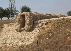
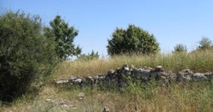
According to the field description used by Walid Khalidi before the publication of All That Remains in 1992, only scattered stones and sections of crumbling walls remained from the village houses.
Shrubs and thorny vegetation covered the site, while plants associated with the former Palestinian agricultural landscape remained, including Christ's-thorn, cactus, foxtail, and abandoned olive trees.
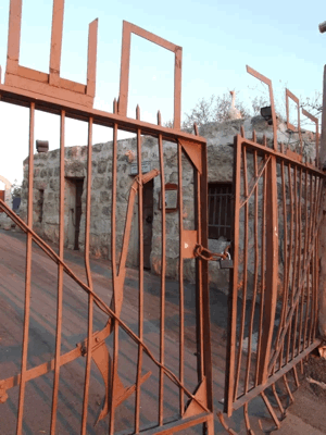
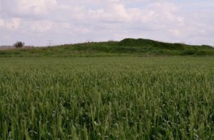
Palestine Remembered contains later Palestinian community documentation, including photographs from 2009 showing ruins and the area around the post-1948 settlement of Gimzo. This constitutes community documentation rather than a comprehensive archaeological or cadastral survey.
Khalidi's description derives from fieldwork conducted before the 1992 publication of All That Remains. It should therefore be understood as documented historical field evidence rather than a comprehensive direct verification of Jimzu's condition in 2026.
Sources
- PalQuest – Interactive Encyclopedia of the Palestine Question: Jimzu
- PalQuest – Operation Dani
- PalQuest – Lydda, 9–13 July 1948: the Jordanian patrol at Jimzu
- Palestine Remembered – Jimzu, Ramla Subdistrict
- Palestine Remembered – Jimzu entry from Walid Khalidi's All That Remains
- Palestinian Villages Encyclopedia – Jimzu
- Palestine Encyclopedia – Jimzu
- Palestinian Central Bureau of Statistics – Historical Census Reports
Photo gallery


Photos from the village's people
Photos sent in by visitors and published after review.
Add a photo of this village
Log in to add photos of this village.
More from the archive



 Download Our Palestine App
The whole archive in the palm of your hand: depopulated villages, the Nakba, the massacres and Al-Aqsa — free, with no ads to erase the story.
Download Our Palestine App
The whole archive in the palm of your hand: depopulated villages, the Nakba, the massacres and Al-Aqsa — free, with no ads to erase the story.



Comments
No comments yet — be the first to write one.
Add your comment
Name and email are optional. Comments appear after review.