
The depopulated village of al-Tira (Tira Dandan) / District of Ramla

al-Tira (Tira Dandan)
About the depopulated village of al-Tira (Tira Dandan)
- District
- Ramla
- Date al-Tira (Tira Dandan) was occupied
- 10 July 1948
- Population in 1948
- 1,500
- Military operation
- Operation Dani
- Brigade that carried it out
- Alexandroni Brigade
- Distance from the governorate centre
- 12 (km) Northeast of al-Ramla
- Elevation above sea level
- 75 m
- Cause of displacement
- Military assault by Zionist troops
- Extent of destruction
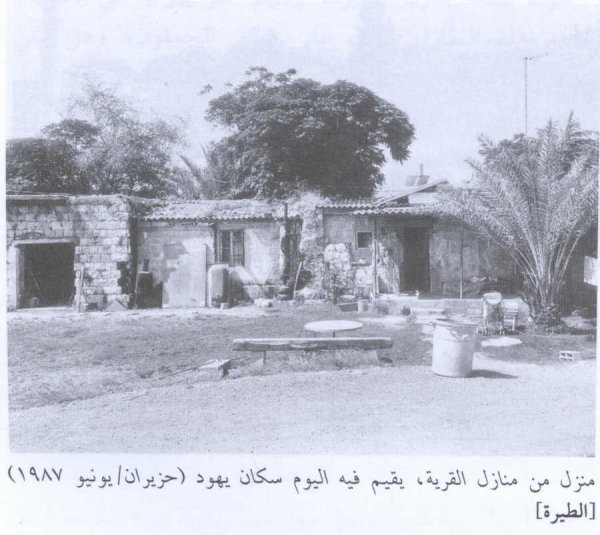
- al-Tira was mostly destroyed with the exception of few houses survived destruction. Some of those houses are deserted and some are being used by Israeli Jewish settlers.
- Ethnic cleansing
- al-Tira inhabitants were completely ethnically cleansed.
Hover a dot to read the village name, or click to open its card.
Borders of the depopulated village of al-Tira (Tira Dandan)
al-Tira (Tira Dandan) – Depopulated Palestinian Village of Ramla
Al-Tira, commonly known as Tira Dandan or Tira al-Ramla, was a Palestinian village in the Ramla Subdistrict and the Lydda administrative district during the British Mandate. It stood on several low limestone hills approximately 12 kilometers from Ramla and at an average elevation of about 75 meters above sea level.
Secondary roads connected the village with main routes leading to Ramla, Jaffa, Lydda, and other towns. Its economy depended on rain-fed agriculture, livestock raising, and trade, and the village hosted a daily livestock market attended by residents of neighboring communities.
The population reached 1,290 in the official 1944/45 statistics, while the village lands covered 6,956 dunums. Al-Tira had two mosques, an elementary school, several sources of drinking water, and archaeological remains reflecting an older history of settlement.
The village was subjected to a major attack on 10 May 1948 but was not occupied permanently at that time. Its final occupation occurred on the morning of 10 July 1948 during the first phase of Operation Dani, when a force drawn from the Alexandroni Brigade and the Eighth Armored Brigade seized al-Tira in order to isolate Lydda from the north.
Basic Information
| Field | Information |
|---|---|
| Name | al-Tira |
| Arabic name | الطيرة |
| Common names | Tira Dandan / Tira al-Ramla |
| Subdistrict | Ramla |
| Administrative district | Lydda |
| Distance from Ramla | Approximately 12 km; some geographical accounts give about 15 km by road |
| Average elevation | Approximately 75 m above sea level |
| Palestine Grid | 144/158 |
| Population in 1922 | 705 |
| Population in 1931 | 892 |
| Houses in 1931 | 225 |
| Population in 1944/45 | 1,290 |
| 1948 population estimate | 1,496 – later estimate, not an official census |
| Total land area | 6,956 dunums |
| First documented major attack | 10 May 1948 |
| Final occupation date | 10 July 1948 |
| Military operation | Operation Dani – first phase |
| Occupying force | Force drawn from the Alexandroni Brigade and Eighth Armored Brigade |
| Demolition order | Yiftach and Eighth brigades ordered to demolish most houses while preserving a small number for a garrison |
| Cause of depopulation | Uncertain; Khalidi considers either flight under attack or expulsion upon the entry of troops |
| Extent of destruction | Most houses were demolished, but several stone buildings survived |
| Post-1948 settlements | Tirat Yehuda (1949), Giv'at Ko'ah (1950), Bareket (1952) |
Name and Tira Dandan
The principal historical name is al-Tira, while Tira Dandan became a common local form that distinguished the village from other Palestinian localities named al-Tira.
Walid Khalidi identifies the site with the Crusader-period locality Thaeria.
The origin of the additional name “Dandan” is less certain. Palestinian community tradition attributes it to a man named Dandan al-Ta'amri, said to have settled at the previously abandoned site after leaving the Ta'amra area near Bethlehem.
This account is preserved as local oral history rather than as a conclusively established historical etymology.
Ottoman Period
In 1596, al-Tira was recorded in the nahiya of Ramla within the Gaza administrative district.
Its population has been estimated at approximately 160. Taxes were levied on wheat, barley, fruit, goats, beehives, vineyards, and other agricultural production.
In the late nineteenth century, the Survey of Western Palestine described al-Tira as a medium-sized village built mainly of adobe on the edge of a plain.
Location and Geography
The village occupied several low limestone hills slightly above the surrounding land.
Its position lay near the transition between Palestine's coastal plain and the interior hills, allowing easy communication with Lydda, Ramla, Jaffa, and neighboring villages.
Palestinian local documentation places Qula to the north, Rantis to the east, al-Qubayba to the southeast, Dayr Tarif to the south, and Rantiya toward the west and northwest.
Built Environment
Village houses were constructed of adobe or of stone and cement.
The official 1931 census recorded 225 houses.
The built-up area covered 45 dunums in the 1944/45 land statistics.
Palestinian secondary estimates place the number of houses at about 377 in 1948, but this is not an official government house census.
Population
- 1596Approx. 160Estimate derived from the Ottoman tax register
- 1922705Official Government of Palestine census; Muslim population
- 1931892Official census; 225 houses
- 1944/451,290Official Mandate-period estimate
- 19481,496Later estimate, not an official census
- 19989,190Later Palestine Remembered estimate of refugees and descendants
Land Ownership, 1944/45
The original Government of Palestine categories were Arab, Jewish, and Public. No land was recorded in the Jewish category:
- Palestinian6,706 dunums96%
- Transferred to Zionists0 dunums0%
- Public250 dunums4%
The figures balance exactly: 6,706 + 250 = 6,956 dunums.
Land Use, 1944/45
- Palestinian
- Public
- Cereals5,551 dunums
- Plantations and irrigable land78 dunums
- Built-up area45 dunums
- Non-cultivable land1,282 dunums
The land-use categories reconcile exactly with the total village area.
Economy and Agriculture
The economy was based mainly on rain-fed agriculture and livestock raising.
Cereals dominated cultivated acreage, occupying 5,551 dunums in 1944/45, while 78 dunums were classified as plantations or irrigable land.
Palestinian local sources also record smaller areas of olives, figs, and vegetables.
Al-Tira hosted a daily livestock market that drew traders and villagers from neighboring communities and made the village a local center of animal trade.
Water
The villagers obtained drinking water from a principal well in the western corner of al-Tira and from smaller private wells.
They also used Hawd al-Waq', approximately two kilometers east of the village.
The stone-lined reservoir supplied water for livestock and domestic purposes.
Education
Al-Tira's elementary school was founded in 1922.
Khalidi, PalQuest, and the Palestinian Villages Encyclopedia record approximately 110 boys and 22 girls in the 1947/48 school year.
Some other Palestinian sources give 114 boys and 22 girls, producing a minor discrepancy of four male pupils.
Local documentation states that the school initially had one teacher and later three, with the village contributing the salaries of two. It also reportedly contained a library of approximately 170 books.
The Two Mosques
Al-Tira had two mosques.
The older was known as al-'Umari Mosque, possibly named for Caliph 'Umar ibn al-Khattab.
The second mosque was newer and larger.
The principal sources do not provide sufficiently secure construction dates for either building.
Archaeology
The village site contained numerous traces of earlier occupation.
Khalidi records old building foundations, rock-cut tombs, and fallen columns.
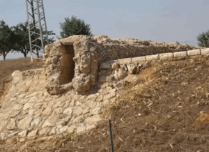
Palestinian local documentation adds an old well, an olive press, a water reservoir, caves, and additional rock-cut burial features.
Khalidi also identifies the village site with Crusader-period Thaeria, although the site's visible remains should not all be assigned automatically to the Crusader era.
The 10 May 1948 Attack
Al-Tira was attacked approximately two months before its final occupation.
On 10 May 1948, Arab Liberation Army commander Fawzi al-Qawuqji reported that a “violent” attack had been launched against the village following reconnaissance operations the previous day.
He informed his command that his units lacked sufficient ammunition but supplied little further information about the results.
The village nevertheless remained outside permanent Israeli control for another two months.
Operation Dani
Operation Dani began on 9 July 1948 and ended on 18 July.
It was the largest offensive conducted during the Ten Days between the two truces and unfolded in two phases.
The first phase, from 9 to 12 July, focused on encircling and capturing Lydda and Ramla. The second phase, from 13 to 18 July, extended toward the Ramallah-al-Latrun road.
Al-Tira was captured during the first phase because of its strategic position north of Lydda.
Final Occupation – 10 July 1948
Israeli forces occupied al-Tira on the morning of 10 July 1948.
The immediate operational purpose was to cut Lydda off from the north in preparation for the assault on the city.
Lydda itself fell later that day during the first phase of Operation Dani.
Military Unit
The village-specific account provides a more precise attribution than simply listing all brigades participating in Operation Dani.
The force that occupied al-Tira was drawn from the Alexandroni Brigade and the Eighth Armored Brigade.
Other formations participated in Operation Dani overall, including Har'el, Yiftach, and Kiryati units, but they should not all be listed as the direct occupying force at al-Tira.
Order to Demolish the Village
On the same day as the occupation, operational headquarters issued orders to demolish most of al-Tira's houses.
The order was directed to the Yiftach Brigade and the Eighth Armored Brigade and called for most houses to be blown up while a small number were preserved to accommodate a military garrison.
Neighboring 'Innaba was subjected to a similar order.
The demolition units should therefore be distinguished from the occupation force itself, which the village account identifies as elements of Alexandroni and the Eighth Brigade.
Cause of Depopulation
Khalidi does not establish conclusively what happened to the villagers at the moment of final occupation.
He presents two possibilities: that the inhabitants fled under the impact of the attack, or that they were expelled when troops entered.
The most accurate formulation is therefore: depopulation under military assault and/or expulsion upon entry, with the precise village-level sequence remaining unresolved.
Destruction
Most of al-Tira's built environment was demolished following the 10 July occupation order.
The village was not completely erased, however.
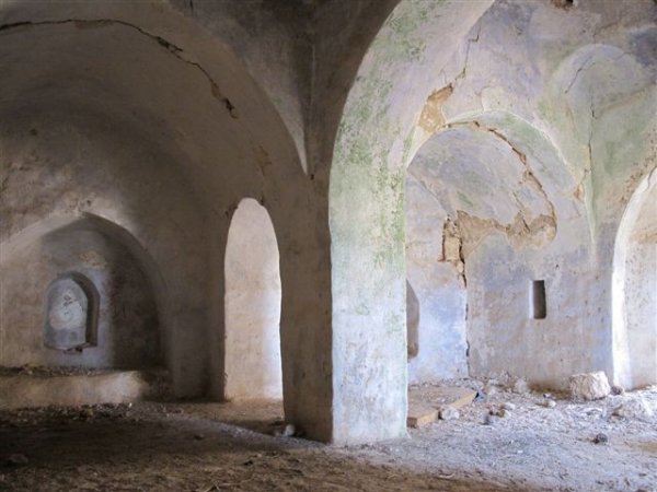
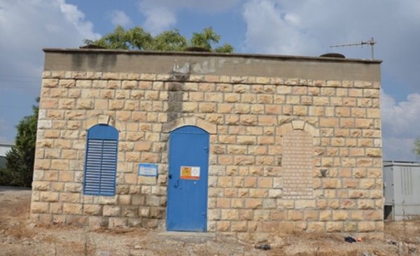
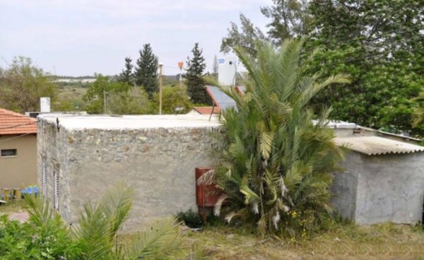
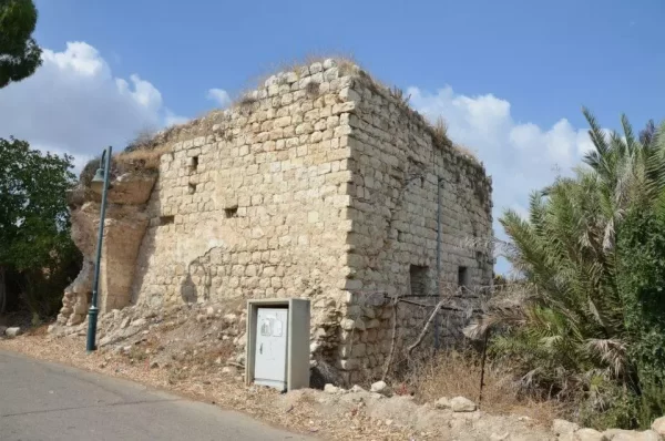
Khalidi's later fieldwork documented several surviving stone houses. Some stood empty, some were occupied, and others were being used as livestock stables.
“Completely destroyed” is therefore less precise than most houses destroyed, with several substantial stone buildings surviving.
Ethnic Cleansing in Source Classification
Palestine Remembered classifies al-Tira using the term “complete ethnic cleansing.” The phrase is retained here only as an attributed source classification.
The more specifically documented sequence consists of the May attack, final military occupation on 10 July, disappearance of the Palestinian community, uncertainty between flight and expulsion, an immediate order to demolish most houses, and the absence of a permanent collective return.
Occupation Chronology
| Date | Event |
|---|---|
| 9 May 1948 | Reconnaissance operations precede an attack on al-Tira. |
| 10 May 1948 | A major military assault is launched; Arab Liberation Army units are present, but the village is not permanently occupied. |
| 9 July 1948 | Operation Dani begins. |
| Morning of 10 July 1948 | A force drawn from the Alexandroni and Eighth Armored brigades occupies al-Tira to isolate Lydda from the north. |
| 10 July 1948 | Operational headquarters orders Yiftach and Eighth Brigade forces to demolish most village houses while preserving a few for a garrison. |
| 10 July 1948 | Lydda falls later the same day during the first phase of Operation Dani. |
| Later period | Most of the village is demolished, although several stone houses remain. |
| 1949 | Tirat Yehuda is established on al-Tira's lands. |
| 1950 | Giv'at Ko'ah is established on village lands. |
| 1952 | Bareket is established on village lands. |
Israeli Settlements Established on al-Tira's Lands
Walid Khalidi and PalQuest identify three Israeli settlements established on the lands of al-Tira after the Nakba.
Tirat Yehuda was established in 1949 approximately 1.5 kilometers south of the village site.
Giv'at Ko'ah was established on al-Tira's lands in 1950.
Bareket was established on village lands in 1952. Khalidi's field description records destroyed al-Tira houses within its area.
al-Tira Today
According to the field description used by Walid Khalidi before the publication of All That Remains in 1992, the village site was partly abandoned and stood beside a paved road.
Olive, date-palm, and fig trees grew across the site, while rubble from demolished houses remained visible.
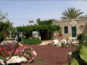
Several stone houses survived. Some stood empty, some were occupied, and others were used as livestock stables.
Khalidi described surviving houses with high arched windows, flat roofs, second stories, broad porches, stairways, and large arched entrances.
Some destroyed village houses were also still visible inside Bareket, while surrounding fields were planted with grapes and kiwi fruit.
This description derives from fieldwork conducted before the publication of Khalidi's book in 1992. It is therefore valuable historical documentation rather than a comprehensive direct survey of the entire village site in 2026.
Sources
- PalQuest – Interactive Encyclopedia of the Palestine Question: al-Tira, Ramla
- PalQuest – Operation Dani
- Palestine Remembered – al-Tira / Tira Dandan, Ramla Subdistrict
- Palestine Remembered – al-Tira entry from Walid Khalidi's All That Remains
- Palestinian Villages Encyclopedia – Tira Dandan / Tira al-Ramla
- Falastinuna – al-Tira / Tira Dandan
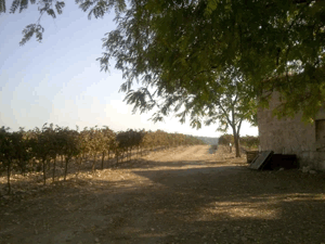
Photo gallery





Photos from the village's people
Photos sent in by visitors and published after review.
Add a photo of this village
Log in to add photos of this village.
More from the archive



 Download Our Palestine App
The whole archive in the palm of your hand: depopulated villages, the Nakba, the massacres and Al-Aqsa — free, with no ads to erase the story.
Download Our Palestine App
The whole archive in the palm of your hand: depopulated villages, the Nakba, the massacres and Al-Aqsa — free, with no ads to erase the story.



Comments
No comments yet — be the first to write one.
Add your comment
Name and email are optional. Comments appear after review.