
The depopulated village of Khirbat al-Buwayra / District of Ramla
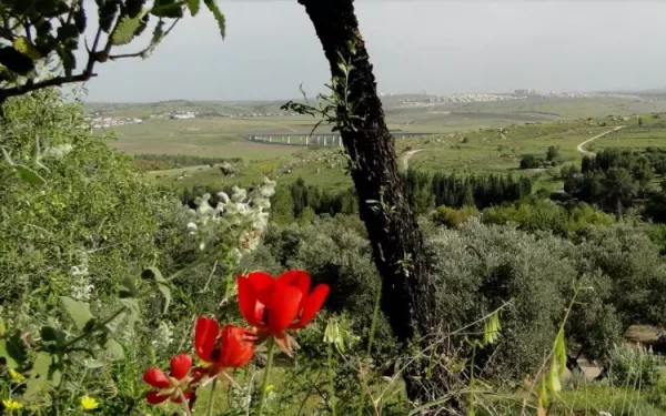
Khirbat al-Buwayra
About the depopulated village of Khirbat al-Buwayra
- District
- Ramla
- Date Khirbat al-Buwayra was occupied
- 15 July 1948
- Population in 1948
- 220
- Military operation
- Operation Dani
- Distance from the governorate centre
- 15 (km) Southeast of al-Ramla
- Elevation above sea level
- 250 m
- Cause of displacement
- Military assault by Zionist troops
- Extent of destruction
- Khirbat al-Buwayra was completely obliterated, and only house rubble left behind.
- Ethnic cleansing
- al-Buwayra, Khirbat inhabitants were completely ethnically cleansed.
Hover a dot to read the village name, or click to open its card.
Borders of the depopulated village of Khirbat al-Buwayra
Khirbat al-Buwayra – Depopulated Palestinian Village of the Ramla Subdistrict
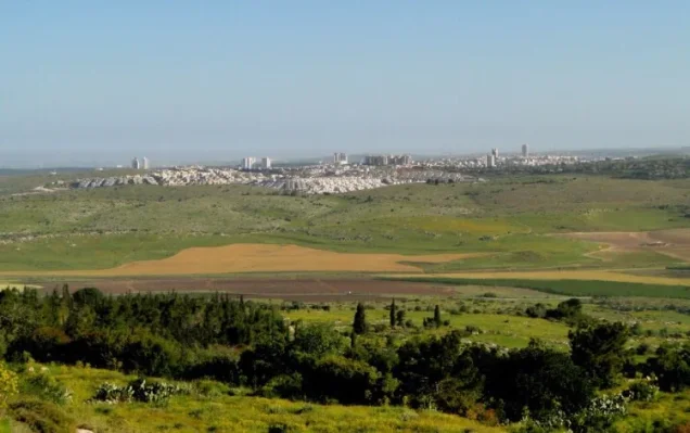
Khirbat al-Buwayra was a Palestinian village in the Ramla Subdistrict, approximately 15 kilometers southeast of al-Ramla. It stood on a hilltop and extended along both sides of a wadi surrounded by lower hills and valleys, at an average elevation of about 250 meters above sea level.
A dirt road linked the village with the Ramla–Ramallah road, which passed less than two kilometers to the east, while additional tracks connected it with neighboring villages. The locality gradually developed into a small agricultural village whose closely clustered stone-and-mud houses were separated by narrow lanes.
- Subdistrict
- Ramla
- Distance from al-Ramla
- Approximately 15 km southeast
- Average Elevation
- Approximately 250 meters
- Population in 1931
- 101
- Houses in 1931
- 17
- Population in 1944/1945
- 190
- Estimated Population in 1948
- 220 according to Salman Abu Sitta – a later estimate, not an official 1948 census
- Total Land Area
- 1,150 dunums
- Occupation / Depopulation Date
- Mid-July 1948; Abu Sitta's updated Register gives 14 July, while several Palestinian sources use 15 July
- Military Operation
- Second phase of Operation Dani
- Military Unit
- Not independently identified at village level; the Har'el Brigade was assigned the eastern axis during the second phase, but no village-specific account proves that it was the force that entered Khirbat al-Buwayra
- Cause of Displacement
- Military assault and the fall of villages along the eastern Operation Dani axis
- Extent of Destruction
- Most of the village was reduced to rubble; walls of one large house and several wells and agricultural features survived in the historical site description
- Israeli Settlements on Village Land
- None documented
Location
Khirbat al-Buwayra stood on a hilltop and spread along both banks of a wadi amid lower hills and valleys.
A dirt track connected it with the Ramla–Ramallah highway less than two kilometers to the east, while local roads linked it with neighboring communities.
The village occupied part of the eastern Ramla countryside leading toward al-Latrun and the western approaches to Ramallah.
Neighboring Localities
Khirbat al-Buwayra formed part of a dense network of villages and khirbas in eastern Ramla Subdistrict. Nearby localities included Bir Ma'in, Bayt Sira, Bayt Nuba, Bayt Shanna, Salbit, and Ajanjul, together with the villages of the al-Latrun area.
The armistice line subsequently drawn between Israel and Jordan passed close to the former village.
Development and Housing
Families came from the surrounding region to establish farms at Khirbat al-Buwayra and gradually built permanent houses there.
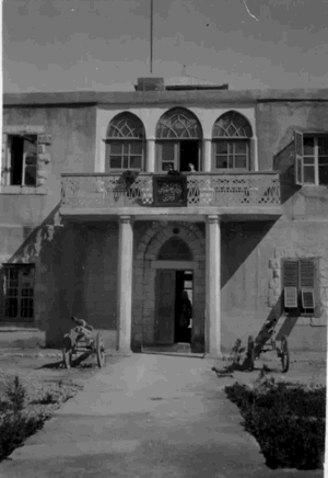
The houses were constructed of stone and mud, clustered relatively close together, and separated by narrow lanes.
All of the village's inhabitants were Muslims.
Population in 1931
The official 1931 Census of Palestine recorded 101 inhabitants at Khirbat al-Buwayra.
They lived in 17 houses.
| Year | Population | Houses | Nature of Figure |
|---|---|---|---|
| 1931 | 101 | 17 | Official Census of Palestine |
| 1944/1945 | 190 | Not available | Government of Palestine statistics |
| 1948 | 220 | Not available | Later estimate in Salman Abu Sitta's Register |
Population in 1944/1945
Khirbat al-Buwayra had approximately 190 Palestinian Arab inhabitants in 1944/45, all of them Muslims.
The figure indicates substantial growth from the 1931 census total.
Estimated Population in 1948
Salman Abu Sitta's Register gives an estimated 220 inhabitants for Khirbat al-Buwayra in 1948.
This is a retrospective demographic estimate and not an official census conducted in 1948.
Land Ownership in 1944/1945
The village possessed a total of 1,150 dunums.
- Arab / Palestinian1,150 dunums100%
- Jewish0 dunums0%
- Public0 dunums0%
The entire registered village land area was therefore recorded in the Arab category in the late-Mandate statistics.
Land Use in 1944/1945
- Cereals316 dunums21%
- Plantations and Irrigable Land31 dunums2%
- Of which Olive Groves25 dunums2%
- Total Cultivable Land347 dunums23%
- Non-Cultivable Land803 dunums53%
The 25 dunums of olive groves were a subset of the 31 dunums classified as plantations and irrigable land and should not be added to the total a second time.
Economic Life
The villagers relied primarily on agriculture and livestock raising.
They cultivated cereals, vegetables, and fruit. Some crops were rain-fed, while others were irrigated from wells scattered throughout the village lands.
Part of the village land was also used as grazing ground.
Water
The inhabitants obtained domestic water from a well within the village site.
Several additional wells were dispersed across the surrounding land and supplied water for irrigated plots and orchards.
These wells remained among the most visible features of the former village site in later field descriptions.
Olive Groves and Orchards
Thirty-one dunums were classified as irrigated or planted land, including approximately 25 dunums of olive groves.
Fruit and vegetables were also cultivated with water drawn from the village wells.
Archaeological Khirba
On the outskirts of the village was an older khirba carrying the same name.
It contained the foundations of a rectangular building equipped with cisterns, indicating earlier occupation of the site before the development of the modern Palestinian village.
Operation Dani
Operation Dani began on 9 July 1948 and continued until 18 July 1948.
It was the largest Israeli offensive of the “Ten Days” between the First and Second Truces.
The operation unfolded in two stages:
- First stage, 9–12 July: the occupation of Lydda and Ramla and surrounding localities.
- Second stage, 13–18 July: the advance eastward toward al-Latrun and Ramallah and efforts to control the Ramallah–al-Latrun road.
PalQuest explicitly lists Khirbat al-Buwayra among the localities affected by Operation Dani.
Occupation and Depopulation
After Lydda and Ramla had been occupied and their inhabitants expelled, Israeli forces pushed eastward toward al-Latrun during the second phase of Operation Dani.
Walid Khalidi considers it probable that Khirbat al-Buwayra was occupied during this advance in mid-July 1948.
No detailed independent account survives describing the precise entry of troops into the village or the departure of each family.
Salman Abu Sitta's updated Register gives 14 July 1948 and also describes the timing as “mid-Jul-1948,” while Palestine Remembered and several other Palestinian sources use 15 July 1948.
This article therefore uses the formulation 14–15 July 1948 / mid-July and preserves the difference between the sources.
Military Unit
Several brigades participated in Operation Dani at the operational level, including Har'el, Yiftach, the Eighth Armored Brigade, Kiryati, and Alexandroni, while PalQuest also lists Etziyyoni among the wider participating forces.
During the second phase, the Har'el Brigade was tasked with taking villages farther east on the al-Latrun axis.
Khalidi's village entry, however, explicitly states that no detailed account of the occupation of Khirbat al-Buwayra is available and does not identify a specific attacking brigade.
The most accurate formulation is therefore:
Executing military unit: not independently documented at village level; the Har'el Brigade was the principal force assigned to the eastern axis during the second phase of Operation Dani.
Occupation and Displacement Chronology
- Until July 1948
Pre-Nakba Village
A small agricultural village whose final official prewar population was 190, with a later 1948 estimate of 220.
- 9 July 1948
Beginning of Operation Dani
The major offensive aimed at Lydda, Ramla, and the approaches to Jerusalem began.
- 10–12 July 1948
Occupation of Lydda and Ramla
The two cities were occupied and most of their residents expelled, after which forces shifted eastward.
- 13 July 1948
Beginning of the Second Phase
The advance toward al-Latrun, Ramallah, and villages along the eastern axis began.
- 14–15 July 1948
Occupation and Depopulation of Khirbat al-Buwayra
The occupation occurred in mid-July; Abu Sitta gives 14 July while several other Palestinian sources give 15 July.
- 18 July 1948
End of Operation Dani
The attempt to capture al-Latrun failed, but numerous Palestinian villages had come under Israeli control.
Cause of Displacement
The displacement of Khirbat al-Buwayra's inhabitants was directly connected with the military advance during the second phase of Operation Dani.
The principal sources do not establish whether every resident fled during the fighting or whether some were expelled immediately after Israeli forces entered the village.
The most supportable description is therefore displacement as a result of military assault and the occupation of the village during Operation Dani.
Extent of Destruction
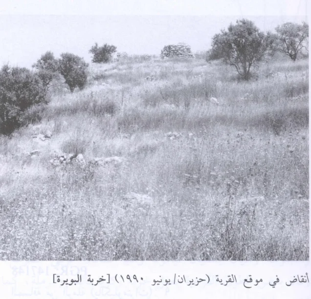
Khirbat al-Buwayra was reduced to rubble scattered across a broad area after the Nakba.
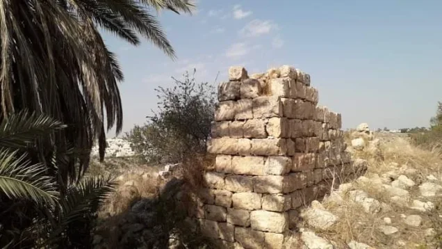
Walid Khalidi's field description records only the walls of one large house, built of relatively large stones, as still standing.
No reliable numerical destruction percentage is available, so the village is not assigned an unsupported figure such as “100 percent destroyed.”
Israeli Settlements on Village Land
No Israeli settlements are documented on the lands of Khirbat al-Buwayra by Walid Khalidi or PalQuest.
No neighboring settlement is therefore assigned to village land solely on the basis of geographic proximity.
Khirbat al-Buwayra Today
The available site description is based on historical field research incorporated into Walid Khalidi's All That Remains and does not constitute direct field verification in 2026.
According to that description, rubble from the village is scattered across a wide area, while portions of the walls of one large stone house remain standing.
The center of the site contains several wells and former private gardens divided by stone markers, some of which also serve as steps descending into the wadi.
Almond, fig, olive, and pine trees once grew in the center of the site, but a fire in 1989 destroyed many of them.
In Khalidi's last documented description, the former village site was being used as a military training area.
Sources
- PalQuest – Interactive Encyclopedia of the Palestine Question: Khirbat al-Buwayra
- PalQuest – Operation Dani
- Institute for Palestine Studies – Walid Khalidi, All That Remains
- Palestine Remembered – Khirbat al-Buwayra, Ramla
- Palestine Remembered – Khirbat al-Buwayra entry from All That Remains
- Salman Abu Sitta – Register of Depopulated Palestinian Localities: Khirbat al-Buwayra
Photo gallery

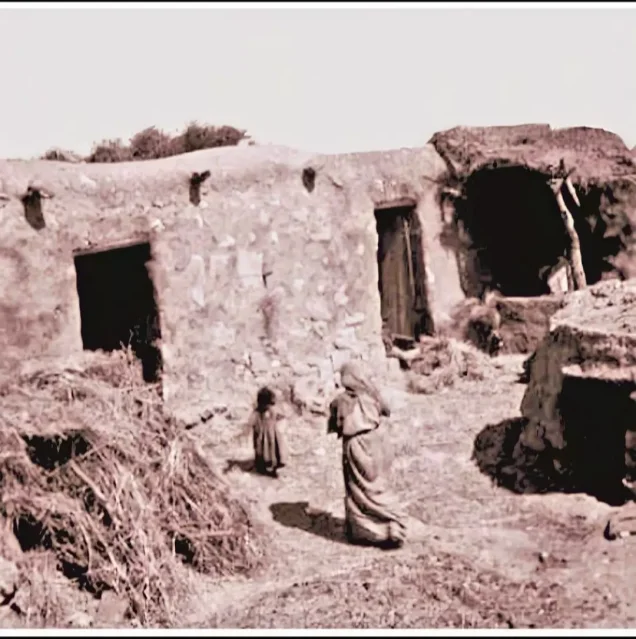
Photos from the village's people
Photos sent in by visitors and published after review.
Add a photo of this village
Log in to add photos of this village.
Other villages from Ramla
More from the archive



 Download Our Palestine App
The whole archive in the palm of your hand: depopulated villages, the Nakba, the massacres and Al-Aqsa — free, with no ads to erase the story.
Download Our Palestine App
The whole archive in the palm of your hand: depopulated villages, the Nakba, the massacres and Al-Aqsa — free, with no ads to erase the story.



Comments
No comments yet — be the first to write one.
Add your comment
Name and email are optional. Comments appear after review.