
The depopulated village of Bayt Nabala / District of Ramla

Bayt Nabala
About the depopulated village of Bayt Nabala
- District
- Ramla
- Date Bayt Nabala was occupied
- 12 July 1948
- Population in 1948
- 2,680
- Military operation
- Operation Dani
- Who defended the village
- Jordanian Army
- Distance from the governorate centre
- 10 (km) Northeast of al-Ramla
- Elevation above sea level
- 100 m
- Cause of displacement
- Abandonment based on Arab orders
- Extent of destruction
- On September 13th, 1948, Bayt Nabala was completely obliterated with the exception of its school, see Pictures section for details.
- Ethnic cleansing
- Bayt Nabala inhabitants were completely ethnically cleansed.
- Settlements built on the built-up area of Bayt Nabala after 1948
- Kefar Truman, Beyt Nechemya
- Refugees' migration routes
- Village refugees were scattered around Dayr Ammar, Ramallah City, Bayt Tillow, Rantiss, and al-Jalazoun refugee camps North of Ramallah.
Hover a dot to read the village name, or click to open its card.
Borders of the depopulated village of Bayt Nabala
Bayt Nabala: A Depopulated Palestinian Village in the Ramla District
Bayt Nabala was a Palestinian village in the Ramla District, located approximately 10 km northeast of Ramla on a rocky hill sloping toward the southwest and overlooking the plain around Lydda, at an average elevation of about 100 metres above sea level. Its inhabitants were displaced during the Nakba and the occupation of Palestine in 1948. The village became the scene of repeated fighting during the second phase of Operation Dani in July 1948 and came under final Israeli occupation before the second truce began on 18 July.
Geography of Bayt Nabala
Bayt Nabala stood on a rocky hill that sloped southwest and overlooked the Lydda plain. It was situated east of Lydda airport.
The village lay approximately 10 km northeast of Ramla and had an average elevation of about 100 metres above sea level.
It stood east of a main road leading toward Ramla, Jaffa, and other towns. A secondary railway line also connected Bayt Nabala with the Rafah–Haifa railway.
Additional secondary roads linked the village with neighbouring communities to the east and southeast.
Bayt Nabala during the Ottoman Period
In 1596, Bayt Nabala was a village in the nahiya of Ramla within the liwa of Gaza, with an estimated population of approximately 297.
The villagers paid taxes on wheat, barley, olives, fruit, goats, beehives, and a press used to process either olives or grapes.
By the late nineteenth century, Bayt Nabala was described as a medium-sized village situated at the edge of a plain.
Architecture of Bayt Nabala
During the British Mandate, the British established a military camp near the village.
Bayt Nabala had a rectangular grid layout. Secondary streets ran parallel to two main streets that intersected in the village centre.
A mosque, several shops, and an elementary school were clustered around this central intersection.
Most villagers were Muslim, and houses were constructed primarily of stone and mud.
Education in Bayt Nabala
An elementary school was established in Bayt Nabala in 1921.
During the 1946/47 school year, approximately 230 pupils attended the school.
Economic Life in Bayt Nabala
Agriculture was the principal source of livelihood.
The villagers cultivated cereals, especially wheat, as well as olives, grapes, figs, citrus fruit, and other crops.
Most agriculture was rainfed, while citrus orchards were irrigated from artesian wells.
In 1944/45, 226 dunums were devoted to citrus and bananas, 10,199 dunums to cereals, and 1,733 dunums were irrigated or used for plantations.
Palestine Remembered also records 2,680 dunums planted with olive trees. This olive area forms part of the agricultural and plantation figures and should not be added again to the total cultivable land.
Land Ownership in Bayt Nabala
The total registered land area of Bayt Nabala was 15,051 dunums in the 1944/45 statistics.
Land ownership in Bayt Nabala, 1944/45, using the terminology of Palestine Remembered
- Palestinian14,427 dunums96%
- Transferred to Zionists0 dunums0%
- Communal624 dunums4%
No land was recorded under the category “Transferred to Zionists” in the 1944/45 ownership data.
Land Use in Bayt Nabala, 1944/45
Land use in Bayt Nabala, separating ownership categories according to PalQuest's detailed statistics
- Palestinian
- Communal/Public
- Citrus and bananas226 dunums
- Plantations and irrigable land1,733 dunums
- Cereals10,199 dunums
- Built-up area124 dunums
- Non-cultivable land2,769 dunums
A total of 12,158 dunums, approximately 81 percent of the village lands, was cultivated or cultivable: 12,156 Palestinian dunums and 2 communal/public dunums.
Built-up and non-cultivable land together amounted to approximately 2,893 dunums, or about 19 percent of the total.
Palestine Remembered presents the cereal, built-up, and non-arable figures in a single Palestinian column, whereas PalQuest's detailed statistical table shows that small portions of those areas were classified as public land. Those categories are therefore separated above.
Population of Bayt Nabala
Population of Bayt Nabala in selected years
- 1596297Estimate derived from Ottoman records
- 19221,324Official British Mandate census
- 19311,758Official census; includes Kafr Jinnis
- 1944/452,310Official statistics
- 19482,680Later estimate published by Palestine Remembered
- Estimated refugees in 199816,456Later estimate published by Palestine Remembered
Number of Houses in Bayt Nabala
Number of houses in Bayt Nabala
- 1931471Includes Kafr Jinnis
No later estimated 1948 house figure is presented here as an official Mandate statistic.
Archaeological Sites around Bayt Nabala
Walid Khalidi records the presence of two khirbas south of the village.
The dedicated PalQuest entry does not provide their names or enough archaeological detail to support additional identifications, so no unverified names are added.
Operation Dani and the Fighting around Bayt Nabala
Bayt Nabala was explicitly mentioned in the operational orders for Operation Dani, the major Israeli offensive conducted between 9 and 18 July 1948.
After the capture of Lydda and Ramla, Bayt Nabala formed part of the Arab Legion's second defensive line. A company of approximately 120 to 150 Arab Legion soldiers was stationed there.
On 13 July, after the inhabitants of Lydda were expelled from their city, Israeli occupation soldiers directed many of them toward Bayt Nabala, which at that point was still held by Arab forces.
Occupation and Depopulation of Bayt Nabala during the Nakba
The struggle for Bayt Nabala unfolded over several days rather than in a single uncontested capture.
On 11 July 1948, the New York Times, as cited by Walid Khalidi, reported that an Israeli commando unit attacked the outskirts of the village in an attempt to prevent Arab forces from recapturing nearby Wilhelma.
On 12 July, subsequent reports stated that Arab forces retook Bayt Nabala. Arab Legion armored vehicles entered the village in an effort to establish artillery positions against the Israeli attacks on Lydda.
On 13 July, wire reports stated that Israeli occupation forces captured Bayt Nabala after stiff fighting in which tanks and armored vehicles on both sides were engaged.
On the following day, however, the village was described as a no man's land, although it was said to no longer pose a threat to Lydda and Ramla.
Later reports stated that Bayt Nabala had fallen under Israeli control before the second truce began on 18 July.
Accordingly, 13 July may be treated as the date of a documented Israeli capture during the fighting, but not necessarily as the moment of uncontested final control. The most careful formulation is that Bayt Nabala fell finally sometime between 13 and 18 July 1948, before the end of Operation Dani.
Palestine Remembered's summary table lists 13 May 1948 as the occupation date. This date is inconsistent with the July chronology of Operation Dani and with the detailed historical narrative reproduced on the same site. It is therefore not used here as the village's military occupation date.
Walid Khalidi cites Benny Morris as claiming that Bayt Nabala's residents were evacuated on Arab Legion orders on 13 May, roughly two months before the village's military occupation. Khalidi explicitly states that this claim cannot be confirmed, so it is not presented here as an established cause of the villagers' displacement.
- Military operation: Operation Dani.
- Operation dates: 9–18 July 1948.
- Arab defending force: an Arab Legion company of approximately 120–150 soldiers.
- First documented attack on the village outskirts: 11 July 1948.
- Arab recapture: 12 July 1948.
- Documented Israeli capture after stiff fighting: 13 July 1948.
- Status on 14 July: reported as no man's land.
- Final Israeli control: before the second truce began on 18 July.
- Village-specific Israeli unit: the principal approved sources do not identify a single brigade as solely responsible for the occupation of Bayt Nabala, although several brigades took part in Operation Dani.
- Fate of the inhabitants: the Palestinian population was displaced during the Nakba; the claim that they left on Arab orders in May remains unverified according to Khalidi.
Request to Destroy Bayt Nabala
On 13 September 1948, Israeli prime minister David Ben-Gurion formally requested authorization from the Israeli Ministerial Committee on Abandoned Property to destroy Bayt Nabala.
This date documents the request for demolition rather than proving that the entire village was destroyed on that exact day.
Most of the village's built-up area was subsequently destroyed, although sections of walls and a small number of structures remained.
Settlements Established on the Lands of Bayt Nabala
Two Israeli settlements were established on Bayt Nabala's lands after the Nakba:
- Kefar Truman: established in 1949 west of the village site and named after U.S. president Harry Truman.
- Beyt Nechemya: established in 1950 south of the village site.
Walid Khalidi and PalQuest identify both settlements as being located on Bayt Nabala's lands.
Bayt Nabala Today
According to the field description published by Walid Khalidi in All That Remains, the village site became overgrown with grass, tangled thorny vegetation, and cypress and fig trees.
The site lies east of the settlement of Beyt Nechemya and directly east of the road leading toward Lydda airport.
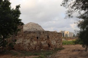
Remains of quarries and collapsed houses were visible around the edges of the site, while sections of walls from former village houses remained standing.
The surrounding lands were cultivated by nearby Israeli settlements.
Palestine Remembered contains later user-contributed documentation, including photographs from 2025 showing the village school and other surviving remains, as well as more recent filmed visits. These contributions do not constitute a comprehensive independent survey of the entire site.
The principal description above therefore relies on Khalidi's historical field documentation. The approved sources used here do not provide a sufficiently comprehensive and independent contemporary survey to verify the precise condition of every part of Bayt Nabala in 2026.
Sources
Photo gallery


Photos from the village's people
Photos sent in by visitors and published after review.
Add a photo of this village
Log in to add photos of this village.
Other villages from Ramla
More from the archive



 Download Our Palestine App
The whole archive in the palm of your hand: depopulated villages, the Nakba, the massacres and Al-Aqsa — free, with no ads to erase the story.
Download Our Palestine App
The whole archive in the palm of your hand: depopulated villages, the Nakba, the massacres and Al-Aqsa — free, with no ads to erase the story.



Comments
No comments yet — be the first to write one.
Add your comment
Name and email are optional. Comments appear after review.