
The depopulated village of Al-Latrun / District of Ramla

Al-Latrun
About the depopulated village of Al-Latrun
- District
- Ramla
- Date Al-Latrun was occupied
- 10 August 1948
- Population in 1948
- 220
- Military operation
- Operation Dani
- Distance from the governorate centre
- 14 (km) Southeast of al-Ramla
- Elevation above sea level
- 250 m
- Cause of displacement
- Military assault by Zionist troops
- Extent of destruction
- al-Latrun was mostly destroyed during the numerous attacks on its fort.
- Ethnic cleansing
- al-Latrun inhabitants were completely ethnically cleansed.
- Refugees' migration routes
- The former residents moved to neighboring 'Imwas. After the 1967 war, they were ethnically cleansed again, a very sad story!
Hover a dot to read the village name, or click to open its card.
Borders of the depopulated village of Al-Latrun
Al-Latrun – Depopulated Palestinian Village in Ramla Subdistrict
Al-Latrun was a Palestinian village in the Ramla subdistrict of the Lydda district. It stood on a strategically important hill at the junction of the Ramla–Jerusalem highway and roads leading toward Gaza and Ramallah, approximately 14 kilometers southeast of Ramla, at an average elevation of about 250 meters above sea level.
Its position at the western entrance to the Jerusalem corridor made Al-Latrun disproportionately important militarily. In 1948 the village and the surrounding salient became the scene of repeated and exceptionally intense fighting between Israeli forces and the Jordanian Arab Legion.
Al-Latrun had 190 inhabitants in the official 1944/45 statistics and a registered land area of 8,376 dunums. Walid Khalidi describes the population on the eve of the Nakba as predominantly Christian. Villagers cultivated cereals, beans, orchards, and other crops and benefited from the nearby Trappist monastery and local water resources.
Israeli forces did not succeed in establishing lasting control over Al-Latrun during the six principal assaults between May and July 1948. Under the 1949 Jordanian-Israeli armistice arrangements, Old Al-Latrun remained in the West Bank while New Al-Latrun lay within the Demilitarized Zone. The villagers moved to neighboring 'Imwas, and the houses of New Al-Latrun remained empty until the Israeli occupation of the area in June 1967, after which the houses were demolished.
Key Facts about Al-Latrun
| Field | Information |
|---|---|
| Name | Al-Latrun |
| Alternative form | Al-Atrun in some sources |
| Subdistrict | Ramla |
| Distance from Ramla | Approximately 14 km southeast |
| Average elevation | Approximately 250 m above sea level |
| Population, 1931 | 120 in 16 houses |
| Population, 1944/45 | 190 |
| Registered land area | 8,376 dunums |
| First temporary Israeli capture | 16–17 May 1948 – Giv'ati Brigade during Operation Makkabi |
| Final Israeli control in 1948 | Israeli forces did not establish lasting control over the village during the principal 1948 battles |
| Status after the 1949 armistice | Old Al-Latrun in the West Bank; New Al-Latrun in the Demilitarized Zone |
| Final Israeli occupation of the area | June 1967 |
| Cause of depopulation | Palestine Remembered classifies it as direct military assault; Khalidi records the villagers' move to 'Imwas without specifying a precise departure date |
| Destruction | The village suffered severe damage in 1948, but New Al-Latrun's houses remained empty until their destruction following the 1967 occupation |
| Settlement on village land | Neve Shalom – 1983 according to Khalidi |
Location of Al-Latrun
Al-Latrun stood on a hill where the Ramla–Jerusalem highway intersected with roads leading toward Gaza and Ramallah. Immediately north of the site ran an ancient Roman route from the Mediterranean coast through 'Imwas and into the Jerusalem hills.
This location made Al-Latrun a key point controlling one of the principal approaches from the coastal plain to Jerusalem. Its strategic significance in 1948 derived far more from geography than from the size of the village population.
Nearby villages and localities included 'Imwas, Dayr Ayyub, Bayt Jiz, Bayt Susin, Yalu, and Bayt Nuba.
The Name Al-Latrun
Walid Khalidi suggests that the name Al-Latrun may derive from the Old French phrase Le Toron des Chevaliers, “the Tower of the Knights,” referring to a Crusader castle built at the site between approximately 1150 and 1170.
Salah al-Din al-Ayyubi captured the castle in 1187.
Khalidi presents this derivation as a possibility rather than a conclusively established etymology.
Old and New Al-Latrun
Interviews conducted with monks who had arrived in the area before 1940 indicated that two residential sites were known as Al-Latrun.
Old Al-Latrun stood approximately 100 meters east of the monastery, while New Al-Latrun was built around 1940 some 400–500 meters south of it.
The monks had purchased the land and houses of Old Al-Latrun and, in exchange, constructed approximately twenty new houses for the villagers at the new site farther from the monastery.
This distinction is important for the post-1948 history of the village. Khalidi states that the houses of New Al-Latrun remained empty after the villagers moved to 'Imwas and were ultimately demolished after the area was occupied in 1967.
Al-Latrun in the Nineteenth Century
Migrants from neighboring villages moved to Al-Latrun during the governorship of Mustafa Thurayya Pasha between 1852 and 1862.
In the late nineteenth century, Al-Latrun was described as a small mud-brick village built within the walls of the old Crusader fortress.
The Trappist Monastery
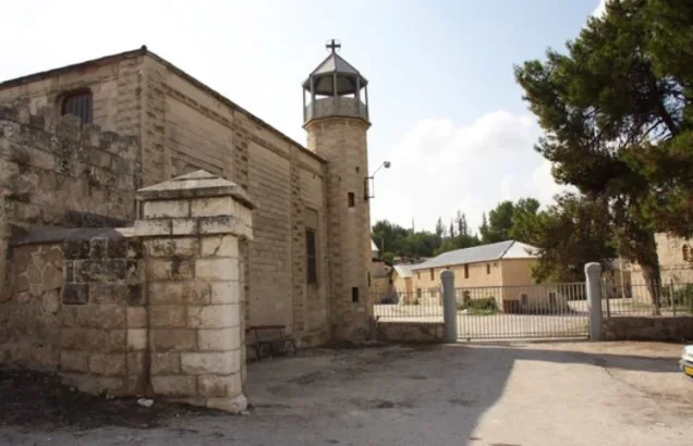
French Trappist monks established a monastery and agricultural school on a nearby slope in 1890. The monastery later became noted for its vineyards.
The agricultural school belonged to the monastic institution and should not be confused with a separately documented government village school.
The monastery also assisted the villagers in bringing drinking water through pipes from Bi'r al-Hilw, the “sweet well.”
Population of Al-Latrun
The demographic record requires attention to the separate statistical treatment of the village and monastery during the early Mandate period.
- 192259Official census figure for Al-Latrun village; all Muslims. Dayr Latrun was listed separately with 37 Christian males
- 1931120Official census; the village and monastery were counted together, in 16 houses
- 1944/45190Official Village Statistics; classified as Arab population
- 1948220Later estimate reported by Palestine Remembered, not an official census
- 19981,354 refugeesLater estimate of refugees and descendants reported by Palestine Remembered
Walid Khalidi describes the village population immediately before the Nakba as predominantly Christian.
This does not necessarily contradict the 1922 census, because the village population and the Christian monastic community were then recorded separately before being combined in later census reporting.
The 1948 and 1998 figures are later estimates and should not be attributed to British Mandatory Village Statistics.
Number of Houses
- 193116Official figure for the combined statistical locality including the monastery
- Around 194020 new housesHouses constructed by the monks for residents relocated from Old Al-Latrun; not a full official census of all structures
Land Ownership in Al-Latrun
The registered land area of Al-Latrun in 1944/45 totaled 8,376 dunums.
- Palestinian7,724 dunums92%
- Transferred to Zionists134 dunums2%
- Communal/Public518 dunums6%
The figures balance correctly: 7,724 + 134 + 518 = 8,376 dunums.
The original official categories were 7,724 Arab dunums, 134 Jewish dunums, and 518 Public dunums.
Land Use in 1944/45
- Arab
- Jewish
- Public
- Cereals6,705 dunums
- Plantations and irrigable land439 dunums
- Citrus and bananas7 dunums
- Built-up land4 dunums
- Non-cultivable land1,221 dunums
The figures balance exactly: 6,705 + 439 + 7 + 4 + 1,221 = 8,376 dunums.
Palestine Remembered's simplified table lists 6,571 dunums of cereals as Palestinian land, apparently combining the official 6,554 Arab dunums with 17 Public dunums. It also displays the entire 1,221 dunums of non-cultivable land without separating the 501 Public dunums. The official categories have therefore been retained here.
Palestine Remembered additionally lists 203 dunums planted with olives. This is a subcategory of cultivated/plantation land and should not be added again to the village's total land area.
Economic Life
Al-Latrun's villagers depended primarily on agriculture, especially cereals and beans.
In 1944/45, 6,705 dunums within the village's statistical boundaries were devoted to cereals, 439 dunums were irrigated or used for plantations, and 7 dunums were used for citrus and bananas.
The nearby Trappist monastery, its vineyards, and its agricultural school were also part of the local economic landscape.
Water Resources
The villagers obtained drinking water from Bi'r al-Hilw through a piped system installed with assistance from the Trappist monastery.
The existence of irrigated land and orchards also demonstrates the use of local water resources for agriculture.
Archaeological and Historical Remains
Al-Latrun contained the remains of the Crusader castle, rock-cut tombs, and a water channel.
Approximately two kilometers west of the village stood Khirbat Jadira, where a ruined tower, three large vaulted cisterns, and a rock-cut stone burial chamber were documented.
Al-Latrun's Military Importance
Al-Latrun was a small village demographically but a major strategic position because it controlled the principal western approach to Jerusalem.
Control of the salient allowed forces stationed there to threaten or block the main road between the coastal plain and Jerusalem. For this reason, Israeli forces repeatedly attempted to seize it after 15 May 1948.
The Jordanian Arab Legion became the principal defender of the position after taking over from Arab Liberation Army forces.
First Attempt: Operation Makkabi
Operation Makkabi formed part of the Israeli effort to control the Jerusalem road and the Al-Latrun salient during May 1948.
On 16–17 May, the Giv'ati Brigade briefly took Al-Latrun while Arab Liberation Army positions were being transferred to the Jordanian Arab Legion.
Arab forces subsequently regained the position after Giv'ati units were transferred to the southern front. The episode therefore did not constitute a lasting occupation.
Operation Ben-Nun – First Phase
On 25–26 May, the newly formed Sheva' / Seventh Brigade, together with the Second Battalion of the Alexandroni Brigade, launched another attack on Al-Latrun.
The Jordanian Arab Legion repelled the assault and inflicted heavy losses on the attacking force. Fighting later spread toward Khulda and Bayt Jiz.
Operation Ben-Nun – Second Phase
A renewed assault was launched on 30 May. Israeli troops reached the Al-Latrun police fort, but a demolition team assigned to destroy the structure came under fire and withdrew.
On 31 May an Israeli commander told a reporter that most of the village had been burned and the contents of the police station damaged.
This indicates extensive wartime damage but does not mean that all houses of New Al-Latrun were destroyed in 1948; Khalidi records that those houses remained empty until 1967.
The Burma Road
After repeated failures to capture Al-Latrun, Israeli forces concentrated on constructing an alternative supply route to Jerusalem that bypassed the salient from the south.
The dirt route became known as the Burma Road and passed south of Dayr Muhaysin before reconnecting with the main route near Saris.
Operation Yoram
Another major attempt took place on the night of 8–9 June during Operation Yoram.
The plan called for an attack from the southeast after occupying two commanding hills. Units of the Har'el and Yiftach brigades participated.
The Jordanian Arab Legion again repelled the attacking forces.
Attack on the Latrun Monastery
On 18 June, an Irgun force blew up part of the Latrun monastery, claiming that it was being used as an Arab military stronghold.
A later Associated Press report stated that neutral foreign correspondents allowed to visit the area by the Arab Legion found no evidence that Arab forces had violated the monastery's protected status.
Earlier, on 16 April, the Palestinian newspaper Filastin had reported that a Jewish convoy fired at workers on monastery land, wounding two and breaking windows.
Operation Dani and the Fifth and Sixth Attempts
Operation Dani began on 9 July 1948. One of the objectives of its second phase was to extend Israeli control toward the Jerusalem corridor and again attempt to take Al-Latrun.
On 15–16 July, Israeli troops tried to isolate Al-Latrun from its hinterland and attack from the east, but the isolating force encountered the Arab Legion and failed.
On 18 July, immediately before the second truce, Yiftach Brigade units launched a direct frontal assault using armored vehicles and two Cromwell tanks. The effort also failed after technical problems affected one of the tanks.
This was the sixth and final major Israeli attempt to seize Al-Latrun before the second truce.
August 1948
By 20 July, reports stated that Israeli forces had surrounded the Al-Latrun area, although access from Arab-held territory remained possible through the road to Ramallah.
On 10 August, UN mediator Folke Bernadotte announced that the Arab Legion had withdrawn from Al-Latrun after holding it for several weeks, without specifying the reason.
The following day Bernadotte ordered Israeli forces to withdraw from Hill 312 on the Al-Latrun–Ramallah road because it had been occupied after the truce had already begun.
For this reason, the 10 August date displayed by Palestine Remembered as a simple “occupation date” should not be treated as the date of a clear, permanent Israeli conquest of the village.
Al-Latrun after the 1949 Armistice
Under the Jordanian-Israeli armistice arrangements, Israel obtained the right to use the Jerusalem–Al-Latrun road.
Old Al-Latrun became part of the West Bank and was used as a Jordanian army camp, while New Al-Latrun lay within the Demilitarized Zone.
The Palestinian inhabitants moved to neighboring 'Imwas. The houses of New Al-Latrun remained empty until the June 1967 war.
The 1967 Occupation
Israeli forces occupied the Al-Latrun area during the June 1967 war.
Walid Khalidi records that the houses of New Al-Latrun, which had remained empty following the villagers' move to 'Imwas, were subsequently demolished.
Al-Latrun therefore differs from many villages depopulated in the Nakba: its residents lost their village in the context of the 1948 war, but Israeli forces did not establish lasting control over the strategic site during the principal battles of that year. Final Israeli occupation of the area and demolition of the New Al-Latrun houses occurred in 1967.
Cause of Depopulation and Ethnic Cleansing
Palestine Remembered classifies the depopulation of Al-Latrun as the result of direct military assault and describes the village as completely ethnically cleansed.
Khalidi confirms that the villagers moved to 'Imwas but does not provide a specific date for their departure or an independently documented village-wide expulsion order.
The most precise formulation supported by the source record is that Al-Latrun's Palestinian community was displaced amid intense warfare and the postwar territorial arrangements and relocated to 'Imwas, while the exact date and immediate mechanism by which every resident left remain insufficiently documented in Khalidi's entry.
Occupation and Battle Chronology
- 16 April 1948
Attack near monastery land
Filastin reported that a Jewish convoy fired on workers on monastery land, wounding two and damaging windows.
- 16–17 May 1948
First temporary Israeli capture
Giv'ati briefly occupied Al-Latrun during Operation Makkabi; Arab forces subsequently recovered the position.
- 25–26 May 1948
Operation Ben-Nun A
The Seventh Brigade and Second Battalion of Alexandroni attacked; the Jordanian Arab Legion repelled the assault.
- 30 May 1948
Operation Ben-Nun B
Israeli forces reached the police fort but withdrew under fire; much of the village burned during the battle.
- 8–9 June 1948
Operation Yoram
Har'el and Yiftach units attacked from the southeast and were repelled by the Arab Legion.
- 18 June 1948
Partial demolition at the monastery
An Irgun force blew up part of the Latrun monastery.
- 15–16 July 1948
Fifth attempt – Operation Dani
An attempt to isolate and attack Al-Latrun from the east failed.
- 18 July 1948
Sixth attempt
The Yiftach Brigade launched a direct armored assault, which also failed.
- 10 August 1948
Reported Arab Legion withdrawal
Bernadotte announced the withdrawal; the following day he ordered Israeli withdrawal from a position taken after the truce.
- 1949
Armistice arrangements
Old Al-Latrun remained in the West Bank, New Al-Latrun lay in the Demilitarized Zone, and villagers moved to 'Imwas.
- June 1967
Final Israeli occupation of the area
Israeli forces occupied Al-Latrun and the houses of New Al-Latrun were demolished.
Israeli Settlement on Al-Latrun's Lands
| Settlement | Established | Relationship to Al-Latrun |
|---|---|---|
| Neve Shalom | 1983 according to Walid Khalidi | Established on Al-Latrun village land |
Al-Latrun Today
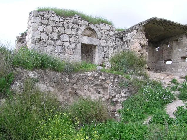
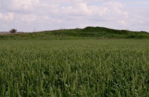
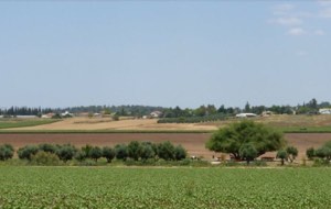
According to Walid Khalidi's field description, all of the houses of New Al-Latrun had been destroyed. Dense foxtail grass and thorny vegetation grew among the rubble.
A small number of almond and carob trees and cactus plants also remained at the village site.
The destroyed Palestinian village site should be distinguished from the monastery, Crusader fortress, police fort, and other landmarks belonging to the wider Al-Latrun area. The survival of structures elsewhere in the area does not mean that the houses of New Al-Latrun survived.
Khalidi's account is based on field research undertaken before the publication of All That Remains in 1992. It therefore provides a documented historical description rather than a comprehensive direct field verification of the village site in 2026.
Sources
- PalQuest – Interactive Encyclopedia of the Palestine Question: Al-Latrun
- PalQuest – Operation Makkabi
- PalQuest – Operation Dani
- Palestine Remembered – Al-Latrun, Ramla District
- Walid Khalidi – All That Remains: Al-Latrun
- Government of Palestine – Census of Palestine 1922, Palestinian Central Bureau of Statistics reproduction
- Institute for Palestine Studies – All That Remains, Walid Khalidi
Photo gallery




Photos from the village's people
Photos sent in by visitors and published after review.
Add a photo of this village
Log in to add photos of this village.
Other villages from Ramla


More from the archive

 Download Our Palestine App
The whole archive in the palm of your hand: depopulated villages, the Nakba, the massacres and Al-Aqsa — free, with no ads to erase the story.
Download Our Palestine App
The whole archive in the palm of your hand: depopulated villages, the Nakba, the massacres and Al-Aqsa — free, with no ads to erase the story.



Comments
No comments yet — be the first to write one.
Add your comment
Name and email are optional. Comments appear after review.