
The depopulated village of Salbit / District of Ramla
About the depopulated village of Salbit
- District
- Ramla
- Date Salbit was occupied
- 15 July 1948
- Population in 1948
- 590
- Military operation
- Operation Dani
- Who defended the village
- Jordanian Army & Local militia
- Distance from the governorate centre
- 12 (km) Southeast of al-Ramla
- Elevation above sea level
- 200 m
- Cause of displacement
- Military assault by Zionist troops
- Extent of destruction
- Salbit was completely obliterated and defaced.
- Ethnic cleansing
- Salbit inhabitants were completely ethnically cleansed.
Hover a dot to read the village name, or click to open its card.
Borders of the depopulated village of Salbit
Salbit – Depopulated Palestinian Village of Ramla
Salbit, also rendered in Arabic as Salbeit or Silbeit, was a Palestinian village in the Ramla Subdistrict and the Lydda administrative district during the British Mandate. It stood on a hill of soft white limestone along the western edge of the Jerusalem-Hebron highlands, approximately 12 kilometers southeast of Ramla and about 200 meters above sea level.
A secondary road approximately three kilometers northwest of the village linked Salbit to the Ramla-Jerusalem highway, while dirt tracks connected it with neighboring villages. Houses made of mud and stone clustered around the village center, which contained the mosque, market, and elementary school.
The population reached 510 in the official 1944/45 statistics and the village lands covered 6,111 dunums. Agriculture centered on rain-fed cereal cultivation, while the surrounding grazing land supported livestock raising. Drinking water was obtained from a village well.
Israeli forces captured Salbit on 15 July 1948 during the second phase of Operation Dani. The Second Battalion of the Kiryati Brigade was specifically assigned to occupy the village, which lay along the Arab Legion's front line. On 16 July, Arab Legion forces attempted unsuccessfully to retake Salbit and nearby villages.
Basic Information
| Field | Information |
|---|---|
| Name | Salbit |
| Arabic forms | سلبيت / سالبيت / سيلبيت |
| Subdistrict | Ramla |
| Administrative district | Lydda |
| Location | Western edge of the Jerusalem-Hebron highlands, southeast of Ramla |
| Distance from Ramla | Approximately 12 km |
| Average elevation | Approximately 200 m above sea level |
| Palestine Grid | 148/141 |
| Population in 1922 | 296, all Muslims |
| Population in 1931 | 406 – combined figure for Salbit and Bayt Shanna, not Salbit alone |
| Houses in 1931 | 71 – combined figure for Salbit and Bayt Shanna |
| Population in 1944/45 | 510 |
| 1948 population estimate | Approximately 592 – later demographic estimate, not an official census |
| Total land area | 6,111 dunums |
| Initial occupation | 15 July 1948 |
| Arab Legion counterattack | 16 July 1948; the attempt to retake Salbit failed |
| Military operation | Operation Dani – second phase |
| Military unit | Second Battalion, Kiryati Brigade |
| Cause of depopulation | Depopulation during the military assault and occupation; the precise circumstances of the villagers' departure are not independently documented |
| Destruction | The built environment subsequently disappeared almost entirely; no precise demolition date is established in Khalidi's account |
| Post-1948 settlement | Sha'alvim, established on village lands in 1951 |
Name and Earlier History
The village is recorded in Palestinian sources as Salbit, with alternative Arabic spellings Salbeit and Silbeit.
Some historical and archaeological literature associates the site with earlier place-names in the region.
The principal Palestinian sources used here, however, do not provide sufficient linguistic or archaeological evidence to establish an uninterrupted historical identity between every ancient form and the twentieth-century Palestinian village.
This article therefore uses Salbit as the documented Palestinian Mandate-period name without treating name similarity alone as proof of continuous settlement.
Location and Geography
Salbit stood on a soft limestone hill at the western edge of the Jerusalem-Hebron highlands.
A secondary road about three kilometers to the northwest connected the village with the Ramla-Jerusalem highway.
Dirt roads also linked Salbit with neighboring communities, including Bayt Shanna, Bir Ma'in, Khirbat al-Buwayra, al-Qubab, 'Imwas, Yalu, and nearby smaller localities.
Built Environment
The houses were constructed of mud and stone and clustered around the village center.
The mosque, marketplace, and elementary school stood in this central area.
The built-up land covered approximately 31 dunums in the 1944/45 statistics.
The 71 houses recorded in 1931 cannot be treated as a Salbit-only figure because the census combined Salbit with Bayt Shanna.
Population
- 1922296Official census figure for Salbit; all Muslims
- 1931406Official combined census figure for Salbit and Bayt Shanna; no separate Salbit figure is available from this entry
- 1944/45510Official Salbit population estimate
- 1948592Later demographic estimate, not an official 1948 census
- 19983,633Later Palestine Remembered estimate of refugees and descendants
Number of Houses
The 1931 census recorded seventy-one houses for the combined Salbit-Bayt Shanna census entry.
No independently documented Salbit-only house figure can therefore be extracted from that total.
No house count is inferred from population figures.
Land Ownership, 1944/45
- Palestinian6,105 dunums100%
- Transferred to Zionists0 dunums0%
- Public6 dunums<1%
The figures balance exactly: 6,105 + 6 = 6,111 dunums.
No land was recorded in the Jewish ownership category.
Land Use, 1944/45
- Palestinian
- Public
- Cereals4,066 dunums
- Plantations and irrigable land16 dunums
- Built-up area31 dunums
- Non-cultivable land1,998 dunums
The land-use categories reconcile exactly with the total village area.
The full 1,998 dunums of non-cultivable land should not be described as privately Palestinian-owned because six dunums belonged to the Public category.
Economy and Agriculture
The inhabitants relied on agriculture and livestock raising.
The quality of local grazing land supported animal husbandry, while rain-fed cereals formed the principal agricultural activity.
In 1944/45, 4,066 dunums were devoted to cereals and sixteen dunums were irrigated or used for orchards.
Water
The village obtained its drinking water from a local well.
Khalidi and PalQuest do not provide a documented list of multiple named wells or springs for Salbit, so no additional water-source names are introduced without evidence.
Education
An elementary school was established at Salbit in 1947.
Walid Khalidi, PalQuest, and Palestine Remembered record approximately 45 pupils at the school.
The Palestinian Villages Encyclopedia gives forty pupils, but the Khalidi-based sources agree on forty-five, which is therefore used here.
No independently documented teacher total or grade structure is added.
Mosque and Market
A mosque stood in the center of Salbit together with the village marketplace and school.
The principal village account does not provide a separate mosque name or construction date.
An automated Palestine Remembered field also lists a church, but Khalidi's village description and PalQuest do not document one. A church is therefore not asserted without stronger independent evidence.
Archaeological Remains
Nineteenth-century survey literature records foundations, caves, ruined walls, and a former reservoir at or near the Salbit site.
Historical literature also associates the locality with earlier place-names.
Such archaeological traces demonstrate that the site had an older history but do not by themselves prove uninterrupted settlement into the modern Palestinian village.
Operation Dani
Operation Dani began on 9 July 1948 and ended on 18 July.
The first phase, from 9 to 12 July, centered on the conquest of Lydda and Ramla. The second phase, from 13 to 18 July, pushed eastward toward the Ramallah-Latrun road and positions held by the Arab Legion.
Salbit was occupied during this second phase, after the fall and depopulation of Lydda and Ramla.
Occupation of Salbit – 15 July 1948
Following the capture of Lydda and Ramla, Israeli units were ordered to move east and seize villages along the Arab Legion front.
Salbit was one of these villages.
PalQuest's Operation Dani chronology records the Israeli capture of Salbit on 15 July 1948, alongside Barfiliya, Bir Ma'in, and al-Burj.
Khalidi's village account gives 15–16 July as the period during which Israeli forces broke through to Salbit, reflecting the continuation of fighting into the following day.
Second Battalion, Kiryati Brigade
Khalidi provides a specific village-level military attribution: the Second Battalion of the Kiryati Brigade was assigned to occupy Salbit.
The Arab Legion's front line passed through the area, making Salbit a military position on the eastern approaches beyond Lydda and Ramla toward Latrun.
Although several brigades participated in Operation Dani overall, they should not all be presented as direct participants in Salbit's occupation when the village-level source specifically identifies Kiryati's Second Battalion.
Arab Legion Counterattack – 16 July 1948
On 16 July, the Arab Legion attempted to recapture Salbit together with al-Burj and Barfiliya.
The counterattack included infantry and an armored column.
The fighting ended with the Arab force withdrawing, leaving Salbit under Israeli control.
The chronology should therefore distinguish the Israeli capture on 15 July from the unsuccessful Arab Legion counterattack on 16 July.
Cause of Depopulation
Palestine Remembered classifies the cause of depopulation as a direct military assault.
Khalidi, however, explicitly states that no details are available about what occurred within the village or what happened to its inhabitants.
It can therefore be established that Salbit was depopulated in the context of military attack and occupation, but the surviving village-level evidence does not determine whether the residents fled during the fighting, were expelled after entry, or experienced a combination of both.
The most precise formulation is: depopulation during the military assault and occupation of Salbit on 15 July 1948; the specific mechanism of the inhabitants' departure remains undocumented.
Destruction
Salbit's built environment subsequently disappeared.
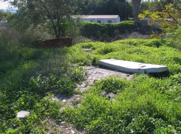
Palestine Remembered classifies the village as completely destroyed, while Khalidi's later field survey describes the end result more concretely: only cactus plants and shrubs remained on the village site.
No precise demolition date is provided in Khalidi's village account.
The July 1948 occupation and the later destruction of the built environment should therefore be treated as distinct historical stages.
Ethnic Cleansing in Source Classification
Palestine Remembered classifies Salbit using the term “complete ethnic cleansing.” The term is retained here only as an attributed source classification.
The more specifically documented sequence consists of the 15 July military assault and occupation, the failed Arab Legion attempt to recover the village on 16 July, the disappearance of the Palestinian community from the site, the absence of permanent collective return, and the later disappearance of the village's built environment.
Occupation Chronology
| Date | Event |
|---|---|
| 9 July 1948 | Operation Dani begins. |
| 9–12 July 1948 | The first phase of Operation Dani results in the capture of Lydda and Ramla and their surrounding area. |
| 13 July 1948 | The second phase begins, with Israeli forces moving east toward the Ramallah-Latrun axis. |
| 15 July 1948 | Israeli forces capture Salbit; the Second Battalion of the Kiryati Brigade is the unit assigned to occupy the village. |
| 16 July 1948 | The Arab Legion attempts to recapture Salbit, al-Burj, and Barfiliya; the counterattack fails and Salbit remains under Israeli control. |
| 18 July 1948 | Operation Dani ends with the beginning of the second truce. |
| Later period | The village buildings disappear; no independent precise demolition date is documented. |
| 1951 | Sha'alvim is established on Salbit's village lands. |
Israeli Settlements Established on Salbit's Lands
Sha'alvim was established in 1951 on the lands of Salbit.
Khalidi and PalQuest identify it as the Israeli settlement established on village lands after the Nakba.
The distinction between “on village lands” and “on the built-up village site” is important: the sources reviewed support the former, not necessarily the claim that Sha'alvim was founded directly over the former Palestinian residential core.
Salbit Today
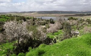
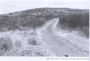
According to the field description used by Walid Khalidi before the publication of All That Remains in 1992, only shrubs and cactus plants remained on the former village site.
The site was being used for livestock grazing, while surrounding land was under cultivation.
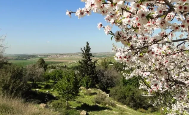
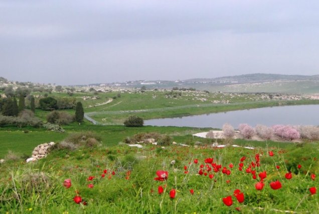
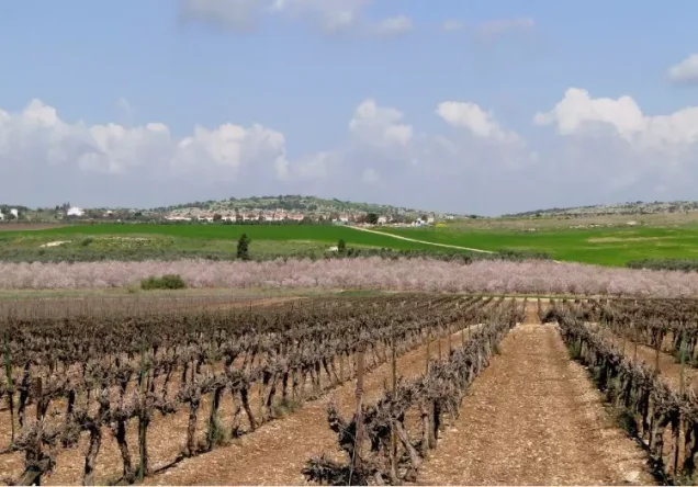
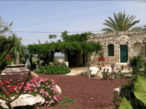
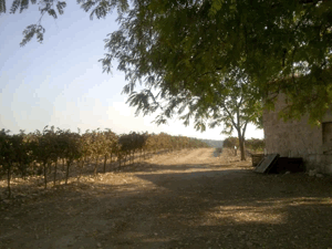
Palestine Remembered contains later Palestinian community documentation, including photographs from 2009 showing rubble, village remains, and the surrounding agricultural landscape.
These later photographs provide useful community documentation but do not constitute a comprehensive archaeological or cadastral survey.
Khalidi's description should therefore be understood as historical field documentation from before 1992, supplemented by later Palestinian community material rather than a comprehensive direct survey of the entire site in 2026.
Sources
Photo gallery


Photos from the village's people
Photos sent in by visitors and published after review.
Add a photo of this village
Log in to add photos of this village.
Other villages from Ramla
More from the archive



 Download Our Palestine App
The whole archive in the palm of your hand: depopulated villages, the Nakba, the massacres and Al-Aqsa — free, with no ads to erase the story.
Download Our Palestine App
The whole archive in the palm of your hand: depopulated villages, the Nakba, the massacres and Al-Aqsa — free, with no ads to erase the story.



Comments
No comments yet — be the first to write one.
Add your comment
Name and email are optional. Comments appear after review.