
The depopulated village of Idnibba / District of Ramla
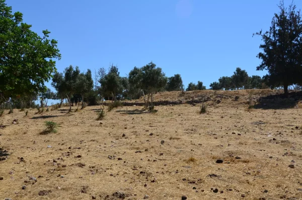
Idnibba
About the depopulated village of Idnibba
- District
- Ramla
- Date Idnibba was occupied
- 09 July 1948
- Population in 1948
- 570
- Military operation
- Operation An-Far
- Brigade that carried it out
- Givati Brigade
- Distance from the governorate centre
- 20.5 (km) South of al-Ramla
- Elevation above sea level
- 150 m
- Cause of displacement
- Influence of fall of, or exoduce from, neighboring town
- Extent of destruction
- Idnibba was completely destroyed, and only the rubble of destroyed houses left behind.
- Ethnic cleansing
- Idnibba inhabitants were completely ethnically cleansed.
Hover a dot to read the village name, or click to open its card.
Borders of the depopulated village of Idnibba
Idnibba – Depopulated Palestinian Village of the Ramla Subdistrict
Idnibba was a Palestinian village in the Ramla Subdistrict, located approximately 20.5 kilometers south of al-Ramla. It stood on hilly ground at an average elevation of about 150 meters and overlooked broad plains to the west, north, and south.
A secondary road running north linked the village with a highway connecting Gaza to the Jerusalem–Ramla road, placing Idnibba within the road network linking central and southern Palestine.
- Subdistrict
- Ramla
- Distance from al-Ramla
- Approximately 20.5 km south
- Average Elevation
- Approximately 150 meters
- Population in 1922
- 275 – official Census of Palestine
- Population in 1931
- 345 – official Census of Palestine
- Occupied Houses in 1931
- 87
- Population in 1944/1945
- 490, all Arabs
- Estimated Population in 1948
- 568 according to Salman Abu Sitta's Register – a later estimate, not an official census
- Total Land Area in 1945
- 8,103 dunums
- Occupation / Displacement Date
- 9–10 July 1948; clearing and destruction operations in the area continued into mid-July
- Military Operation
- Operation An-Far
- Military Unit
- Giv'ati Brigade; its First Battalion formed the principal force in Operation An-Far
- Cause of Displacement
- Military assault and expulsion during Operation An-Far
- Extent of Destruction
- Most of the village fabric was destroyed, while ruins, walls, and stone-house remains survived; no reliable numerical destruction percentage exists
- Post-1948 Settlements on Village Land
- No Israeli settlement is documented on Idnibba's village lands by Khalidi/PalQuest
Name and Earlier History
The village is recorded as Idnibba, with variants including Idnebbeh.
Walid Khalidi considers it possible that Idnibba occupied the site of the Roman settlement of Danuba, a name also used for the locality by the Crusaders.
The identification represents a historical interpretation of the site's continuity rather than conclusive archaeological proof for every phase of settlement.
Idnibba under Ottoman Rule
In 1596, Idnibba was recorded as a village in the nahiya of Gaza within the liwa' of Gaza.
Khalidi's reconstruction from the Ottoman tax register gives approximately 198 inhabitants.
The village paid taxes on wheat, barley, sesame, goats, and beehives, indicating an economy combining cultivation and livestock raising.
The Village in the Nineteenth Century
In the late nineteenth century, Idnibba was described as a stone-and-mud village standing on elevated ground.
Cactus hedges surrounded the settlement, while a fig orchard was located on its southern side.
The houses were built close together in the compact pattern characteristic of many Palestinian agricultural villages.
Population during the British Mandate
The official 1922 Census of Palestine recorded 275 inhabitants in Idnibba, all Muslims.
By the 1931 census, the population had risen to 345, living in 87 occupied houses.
The 1944/45 official statistics gave 490 inhabitants, all Arabs.
- 1596About 198Reconstruction from Ottoman tax records
- 1922275Official Census of Palestine
- 1931345Official Census of Palestine
- 1944/1945490Government of Palestine statistics
- 1948568Later estimate in Salman Abu Sitta's Register, not an official census
Refugees and Descendants
Salman Abu Sitta's Register estimates approximately 3,491 refugees and descendants in 1998 associated with Idnibba.
This is a later demographic estimate rather than a comprehensive official census of all people originating from the village.
Houses
The official 1931 census recorded 87 occupied houses.
Some Palestinian databases give an estimated 143 houses for 1948. That figure was not produced by a formal 1948 housing census and should therefore be treated as a later estimate rather than equated with the official 1931 count.
Land Ownership in 1945
Idnibba's total land area was 8,103 dunums.
- Palestinian6,827 dunums84%
- Transferred to Zionists1,082 dunums13%
- Communal / Public194 dunums2%
The original Government of Palestine statistics use the categories Arab, Jewish, and Public. Palestine Remembered presents the same land figures using the wording Palestinian / Transferred to Zionists / Communal.
Land Use in 1945
- Palestinian
- Transferred to Zionists
- Public
- Cereals6,162 dunums
- Plantations and Irrigable Land85 dunums
- Built-up Land25 dunums
- Non-Cultivable1,831 dunums
A total of 6,247 dunums, or approximately 77 percent of village land, was classified as cultivable.
Agriculture and Economic Life
Most villagers depended on agriculture and animal husbandry.
Idnibba's lands provided good spring pasture, making livestock raising an important part of the local economy.
Grain cultivation dominated agriculture. In 1944/45, 6,162 dunums were classified as cereal land when the Palestinian and Jewish-category holdings are combined.
Olive cultivation was also significant. Of the 85 dunums classified as plantations and irrigable land, approximately 64 dunums were planted with olives.
Archaeological Khirbas
Three substantial khirbas were located near Idnibba.
Their remains included ruined structures, cisterns, caves, foundations, door lintels, and a rock-hewn wine press.
Later Palestinian local documentation identifies sites including Khirbat al-Mansiyya, Khirbat Dayr al-Nu'man, and Khirbat al-Shaykh Dawud.
Neighboring Localities
Idnibba lay among a group of villages in southern Ramla Subdistrict and the adjoining zone, including Jilya, al-Khayma, al-Tina, Mughallis, and Tall al-Safi, with local territorial connections toward al-Burayj and Shahma.
Operation An-Far
Operation An-Far began on 8 July 1948 and continued until 15 July during the Ten Days between the First and Second Truces.
The Giv'ati Brigade conducted the operation on the southern front, with its First Battalion assigned a central attacking role.
The operation aimed to expand Giv'ati's area of control southward and eastward, establish a connection toward the Naqab, and remove civilians from territory brought under military control.
PalQuest explicitly lists Idnibba among the villages affected by Operation An-Far.
Idnibba and Operation Dani
Operation An-Far overlapped chronologically with Operation Dani, which began in the Lydda–Ramla sector on 9–10 July 1948.
Idnibba, however, is specifically associated by Khalidi and PalQuest with Operation An-Far and the Giv'ati Brigade, not with Operation Dani.
Operation Dani should therefore not be listed as Idnibba's military operation merely because the village lay in Ramla Subdistrict and was occupied during the same period.
Occupation and Displacement
Giv'ati Brigade forces advanced toward Idnibba during the Ten Days between the two truces.
Walid Khalidi places the village among those taken on 9–10 July 1948 during Operation An-Far.
Palestine Remembered gives 9 July, while Salman Abu Sitta's Register records 9–10 July. This article therefore uses the two-day range rather than presenting one day as completely undisputed.
Expulsion and Destruction in July 1948
The initial capture was followed by further clearing and destruction.
A Giv'ati Brigade headquarters report dated 16 July recorded that forces had entered Idnibba and several nearby villages, expelled their inhabitants, and demolished or burned a number of houses.
This corresponds with the broader record of Operation An-Far, during which orders to remove civilians were issued for parts of the captured area.
The evidence therefore provides stronger support for military assault and expulsion than for reducing Idnibba's depopulation simply to the influence of the fall of a neighboring locality.
Occupation and Displacement Chronology
- 8 July 1948
End of the First Truce
Operation An-Far began under the Giv'ati Brigade on the southern front.
- 9–10 July 1948
Attack and Capture of Idnibba
Giv'ati forces reached and took the village as part of their advance through the villages south of Ramla.
- July 1948
Displacement of the Population
Residents were displaced during the military offensive and clearing of the Operation An-Far area.
- 16 July 1948
Giv'ati Headquarters Report
The report recorded entry into Idnibba and nearby villages, expulsion of residents, and the demolition or burning of houses.
Military Unit
Brigade: Giv'ati Brigade.
Operational Framework: Operation An-Far.
Principal Operation-Level Unit: the First Battalion of the Giv'ati Brigade, which received the main operational assignment in An-Far.
There is no basis for assigning Operation Dani brigades to Idnibba merely because they were active in Ramla District during the same days.
Cause of Displacement
The departure of Idnibba's inhabitants was directly connected with the military assault during Operation An-Far.
Sources on the operation document instructions to remove civilians from parts of the captured zone, while the later Giv'ati report records the expulsion of the inhabitants of Idnibba and neighboring villages.
The most supportable formulation is therefore:
Military assault and expulsion from the village during Operation An-Far in July 1948.
Extent of Destruction
Idnibba was subjected to demolition and burning after its capture.
Sources document the destruction and burning of houses, while Khalidi's field description later recorded demolished walls and surviving fragments of stone houses scattered across the site.
Some later databases summarize the village as completely destroyed, but the surviving ruins and absence of a complete building-by-building inventory make a numerical figure such as 100 percent inappropriate.
The more accurate description is: most of the built-up village was destroyed, with scattered ruins, walls, and building remains surviving.
Israeli Settlements on Idnibba Land
According to Walid Khalidi and PalQuest, no Israeli settlement was established on Idnibba's village lands.
Kefar Menachem, established in 1937 before the Nakba, lies approximately two kilometers southwest of the village site.
Charuvit was established in the early 1950s about one kilometer west of the site, served for a period as a transit camp for new Jewish immigrants, and later ceased to be inhabited.
Neither is listed here as a settlement established on Idnibba land because the principal source explicitly distinguishes their locations from the village lands.
Idnibba Today
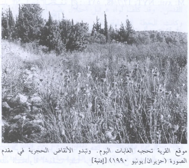
The available site description is based primarily on historical field research incorporated into Walid Khalidi's All That Remains, including documentation dating to around 1990. It is therefore not a direct 2026 field verification.
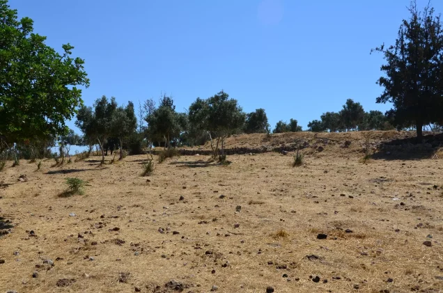
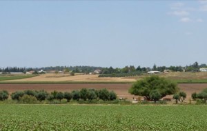
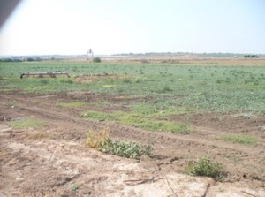
According to that description, the village site and surrounding land had been converted into pasture and woodland, while a broad area had been leveled by bulldozers.
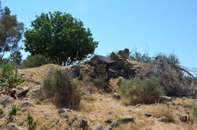
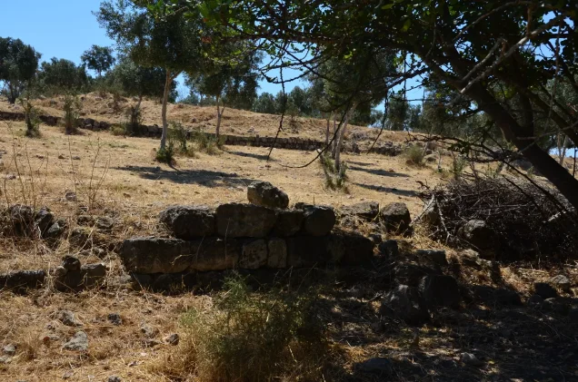
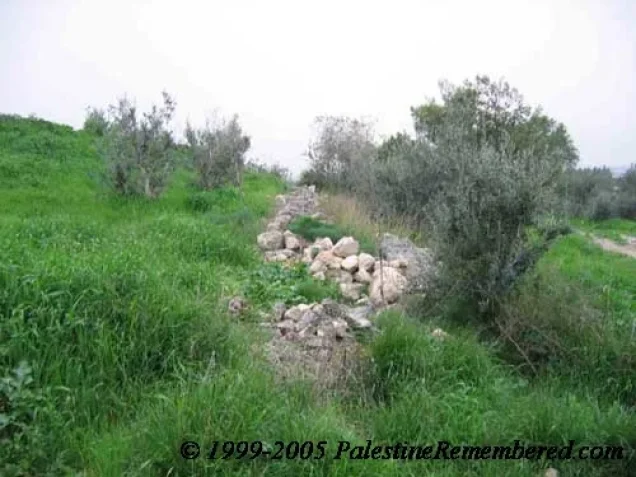
Remains of stone houses and demolished walls were scattered across the site.
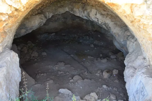
Natural caves with artificially shaped arched entrances remained visible along the upper western edge of the former village.
Sources
- PalQuest – Interactive Encyclopedia of the Palestine Question: Idnibba
- PalQuest – Operation An-Far
- Institute for Palestine Studies – Walid Khalidi, All That Remains
- Government of Palestine – Census of Palestine, 1922
- Government of Palestine – Census of Palestine, 1931
- Palestine Remembered – Idnibba, Ramla District
- Salman Abu Sitta – Register of Depopulated Palestinian Localities: Idnibba
- Palestine Land Society – Nakba Documentation: Idnibba, July 1948
Photo gallery

Photos from the village's people
Photos sent in by visitors and published after review.
Add a photo of this village
Log in to add photos of this village.
Other villages from Ramla

More from the archive

 Download Our Palestine App
The whole archive in the palm of your hand: depopulated villages, the Nakba, the massacres and Al-Aqsa — free, with no ads to erase the story.
Download Our Palestine App
The whole archive in the palm of your hand: depopulated villages, the Nakba, the massacres and Al-Aqsa — free, with no ads to erase the story.



Comments
No comments yet — be the first to write one.
Add your comment
Name and email are optional. Comments appear after review.