
The depopulated village of Kharruba / District of Ramla

Kharruba
About the depopulated village of Kharruba
- District
- Ramla
- Date Kharruba was occupied
- 10 July 1948
- Population in 1948
- 197
- Military operation
- Operation Dani
- Elevation above sea level
- 175 m
- Cause of displacement
- Military assault by Zionist troops
- Extent of destruction
- Kharruba was completely destroyed soon after occupation, and only house rubble left behind.
- Ethnic cleansing
- Kharruba inhabitants were completely ethnically cleansed.
Hover a dot to read the village name, or click to open its card.
Borders of the depopulated village of Kharruba
Kharruba – Depopulated Palestinian Village of the Ramla Subdistrict
Kharruba was a Palestinian village in the Ramla Subdistrict, situated on flat ground in the central coastal plain approximately 8 kilometers east of Ramla and at an average elevation of about 175 meters above sea level.
The village lay less than four kilometers northeast of the Jerusalem–Ramla highway. Local paths connected it with neighboring villages, particularly 'Innaba, from which secondary roads led directly to Ramla or to the main Jerusalem–Ramla road.
- Subdistrict
- Ramla
- Distance from Ramla
- Approximately 8 km east
- Average Elevation
- Approximately 175 meters
- Population in 1931
- 119
- Occupied Houses in 1931
- 21
- Population in 1944/1945
- 170
- Estimated Population in 1948
- 197 – a later demographic estimate, not an official 1948 census
- Estimated Refugees and Descendants in 1998
- 1,211 – later demographic estimate
- Total Land Area
- 3,374 dunums
- Occupation Date
- The village was documented as occupied by 10 July 1948; some later registers give 12 July as the final depopulation date
- Military Operation
- Operation Dani
- Executing Military Unit
- Yiftach Brigade
- Cause of Displacement
- Direct military assault, occupation, demolition of houses, and removal of the inhabitants
- Extent of Destruction
- The village was extensively destroyed and reduced to stone rubble; no reliable numerical destruction percentage is available
- Israeli Settlements on Village Land
- No Israeli settlements are documented on Kharruba village land
Location
Kharruba stood on flat land in the central coastal plain, east of Ramla.
It was less than four kilometers northeast of the Jerusalem–Ramla highway and was linked by local paths with 'Innaba and other nearby villages.
From 'Innaba, secondary roads led to Ramla either directly or through the main Jerusalem–Ramla road.
Neighboring Villages
Kharruba lay among a group of villages in the Ramla region, including:
- Khirbat Zakariyya to the north.
- Barfiliya to the east.
- Bayt Shanna to the southeast.
- al-Kunayyisa to the south.
- 'Innaba to the southwest.
- Ramla to the west.
- Jimzu to the northwest.
Origin of the Name
Parts of Kharruba's land were covered by woodland containing oak and carob trees.
Walid Khalidi suggests that the village name was probably derived from the Arabic word kharrub, meaning carob.
Later local accounts also associate the name with a particularly prominent carob tree, although the principal historical source only suggests the broader connection with the abundance of carob trees.
Kharruba in the Nineteenth Century
The French traveler Victor Guérin visited the region during the nineteenth century and described Kharruba as a hamlet.
The Mandate-era Palestine Index Gazetteer later classified it similarly as a small hamlet.
By the final years of the British Mandate, however, the village economy and its built-up area were expanding.
Village Houses
Kharruba's houses were principally constructed of adobe and stood relatively close together.
Narrow alleys separated the houses, although the village did not follow a clearly defined geometric plan.
The official 1931 census recorded 21 occupied houses.
No later estimated house count is presented here as an official figure because the securely documented occupied-house total belongs to the 1931 census.
Population
Kharruba's inhabitants were predominantly Palestinian Arab Muslims.
- 1931119Official Census of Palestine
- 1944/1945170Late-Mandate statistics
- 1948197Later demographic estimate, not an official census conducted in 1948
- 19981,211Later estimate of refugees from Kharruba and their descendants
Land Ownership in 1944/1945
Kharruba's total land area was 3,374 dunums.
- Palestinian3,373 dunums100%
- Transferred to Zionists0 dunums0%
- Communal/Public1 dunums<1%
The official Mandate categories were Arab, Jewish, and Public: 3,373 dunums were recorded as Arab-owned, no land was recorded in the Jewish category, and one dunum was classified as public.
Land Use in 1944/1945
- Cereals1,620 dunums32%
- Plantations and Irrigable Land25 dunums<1%
- Total Cultivable Land1,645 dunums33%
- Built-up Area3 dunums<1%
- Non-Cultivable Land1,726 dunums34%
Some reproduced versions of Khalidi's village text give 1,629 dunums for cereals. The statistical table, however, gives 1,620 dunums, which is also the arithmetically consistent figure: 1,620 dunums of cereals plus 25 dunums of plantations and irrigable land equals 1,645 dunums of cultivable land.
Economic Life
Agriculture was the principal economic activity in Kharruba.
The villagers cultivated cereals, vegetables, and fruit, with fruit orchards concentrated to the southwest and northeast of the built-up area.
Kharruba's economy expanded toward the end of the Mandate, while construction activity also increased.
The inhabitants purchased basic necessities in the markets of surrounding villages and sold their agricultural produce there.
Woodland and Trees
Part of Kharruba's territory contained woodland dominated by oak and carob trees.
This vegetation contributed to the character of the local landscape and was probably the source of the village name.
Education and Services
The principal village source reviewed does not document an independent school in Kharruba before the Nakba.
Nor does it identify a specific health institution, mosque, or named water source that can be securely attributed to the village.
No undocumented facility is therefore added to the article.
Operation Dani
Kharruba's occupation was directly associated with Operation Dani, a major Israeli offensive that began on 9 July 1948 and continued until 18 July during the Ten Days of fighting between the First and Second Truces.
The first stage focused on Lydda, Ramla, and their surrounding villages, while the second extended toward the Latrun area and the Jerusalem corridor.
Several Israeli formations participated in Operation Dani at the broader operational level, including the Yiftach, Har'el, Kiryati, Alexandroni, and Etziyoni brigades and the Eighth Armored Brigade.
For Kharruba specifically, however, the direct documentary evidence identifies the Yiftach Brigade.
Occupation of Kharruba
A report issued by the Yiftach Brigade provides unusually direct documentation of the village's occupation.
In a report dated 10 July 1948, the brigade stated that its units had occupied Kharruba during their advance, demolished houses, and cleared the village.
On the following day, Yiftach units received orders to consolidate the positions they had captured and to destroy houses that were not required for military use.
The earliest secure formulation is therefore that Kharruba was under Yiftach control by 10 July 1948.
Why Do Some Sources Give 12 July?
Some later Palestinian statistical registers, including Palestine Remembered and WAFA, give 12 July 1948 as Kharruba's depopulation date.
The Yiftach Brigade report dated 10 July, however, states that the village had already been occupied.
The most precise chronology is therefore:
- Documented military occupation: by 10 July 1948.
- Final depopulation date given in some later registers: 12 July 1948.
The two dates should not be collapsed into one without explaining the difference.
Executing Military Unit
Executing military unit: Yiftach Brigade.
This attribution is stronger than simply identifying one of the many units that participated in Operation Dani because a Yiftach Brigade report itself records the occupation and demolition of Kharruba.
Other brigades participating elsewhere in Operation Dani are therefore not assigned to Kharruba without village-specific evidence.
Occupation and Displacement Chronology
- Until early July 1948
Village before the Offensive
A small agricultural village east of Ramla, with a population of 170 in 1944/45.
- 9 July 1948
Beginning of Operation Dani
The large Israeli offensive against Lydda, Ramla, and surrounding localities began.
- By 10 July 1948
Documented Occupation of Kharruba
A Yiftach Brigade report records the village's occupation and the demolition of houses during the advance.
- 11 July 1948
Demolition Orders
Yiftach units were ordered to consolidate captured positions and destroy houses not needed for military accommodation.
- 12 July 1948
Depopulation Date in Some Later Registers
Several Palestinian databases use this as the final displacement date, although military control had already been documented earlier.
- Until 18 July 1948
Continuation of Operation Dani
Israeli operations continued across the Lydda–Ramla–Latrun region and Jerusalem corridor.
Cause of Displacement
The immediate cause of Kharruba's depopulation was a direct military assault and occupation by Yiftach Brigade units.
The documentary record indicates that houses were demolished during the advance rather than the population leaving solely because of events in neighboring Lydda or Ramla.
Kharruba can therefore be linked directly to a village-specific military action during Operation Dani.
Destruction
Kharruba's houses were blown up during the occupation, and additional demolition orders followed the next day for structures not required by the occupying forces.
Later field descriptions show that the village ceased to exist as a functioning built-up locality and that stone rubble covered the site.
The village can therefore be described as extensively and almost completely destroyed, although no reliable numerical percentage such as 100 percent is available.
Israeli Settlements on Kharruba Land
According to Walid Khalidi and PalQuest, no Israeli settlements were established on Kharruba's village lands.
No nearby settlement should therefore be assigned to the village merely on the basis of geographic proximity.
Kharruba Today
The available site description is based primarily on historical field research incorporated into Walid Khalidi's All That Remains. It is not a direct field verification conducted in 2026.
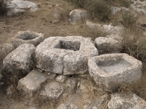
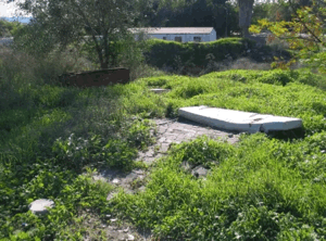
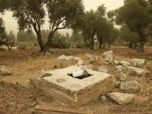
According to that description, the village site is covered by stone rubble from destroyed houses and overgrown with wild vegetation.
Plants and trees traditionally grown by Palestinians near their homes remained visible, including cactuses, castor-oil plants, cypress, Christ's-thorn, and olive trees.
The surrounding lands were being used as grazing grounds at the time of the historical survey.
Sources
- PalQuest – Interactive Encyclopedia of the Palestine Question: Kharruba
- PalQuest – Operation Dani
- Institute for Palestine Studies – Walid Khalidi, All That Remains
- Palestine Remembered – Kharruba, Ramla
- Palestine Remembered – Kharruba entry from All That Remains
- WAFA – Palestinian Localities Depopulated in 1948
Photos from the village's people
Photos sent in by visitors and published after review.
Add a photo of this village
Log in to add photos of this village.
Other villages from Ramla
More from the archive



 Download Our Palestine App
The whole archive in the palm of your hand: depopulated villages, the Nakba, the massacres and Al-Aqsa — free, with no ads to erase the story.
Download Our Palestine App
The whole archive in the palm of your hand: depopulated villages, the Nakba, the massacres and Al-Aqsa — free, with no ads to erase the story.



Comments
No comments yet — be the first to write one.
Add your comment
Name and email are optional. Comments appear after review.