
The depopulated village of Shilta / District of Ramla

About the depopulated village of Shilta
- District
- Ramla
- Date Shilta was occupied
- 18 July 1948
- Population in 1948
- 120
- Military operation
- Operation Dani
- Brigade that carried it out
- Givati Brigade
- Who defended the village
- Jordanian Army & Local militia
- Distance from the governorate centre
- 15 (km) East of al-Ramla
- Elevation above sea level
- 300 m
- Cause of displacement
- Military assault by Zionist troops
- Extent of destruction
- Shilta was completely obliterated and defaced.
- Ethnic cleansing
- Shilta inhabitants were completely ethnically cleansed.
Hover a dot to read the village name, or click to open its card.
Borders of the depopulated village of Shilta
Shilta – Depopulated Palestinian Village of the Ramla Subdistrict
Shilta was a Palestinian village in the Ramla Subdistrict, located approximately 15 kilometers east of Ramla on a hard limestone hill at the easternmost edge of the central coastal plain. Its average elevation was approximately 300 meters above sea level.
The village was relatively small. Its stone-and-mud houses stood close together along narrow alleys, and its inhabitants depended principally on rain-fed agriculture and animal husbandry. They cultivated cereals, vegetables, grapes, figs, almonds, and olives.
- Subdistrict
- Ramla
- Distance from Ramla
- Approximately 15 km east
- Average Elevation
- Approximately 300 meters
- Population in 1931
- 22
- Occupied Houses in 1931
- 7
- Population in 1944/1945
- 100
- Estimated Population in 1948
- Approximately 116 – a later estimate, not an official 1948 census
- Total Land Area in 1945
- 5,380 dunums
- Attack and Depopulation
- Night of 17–18 July 1948; the village was probably depopulated as a result of the attack
- Final Israeli Control
- Date uncertain; the Yiftach unit that entered Shilta on 18 July withdrew that morning
- Military Operation
- Operation Dani
- Village-Specific Attacking Unit
- A company of the First Battalion, Yiftach Brigade
- Cause of Displacement
- Military assault during the final stage of Operation Dani
- Documented Settlements on Village Land
- Shilat and Kefar Rut, established in 1977
Location
Shilta stood on a hard limestone hill at the eastern edge of the central coastal plain, where the lowlands begin to rise toward the central Palestinian highlands.
Several trails connected the village with neighboring communities, including Ni'lin, al-Midya, Saffa, Bayt Sira, al-Burj, and Barfiliya.
The village's elevated position gave it a commanding relationship to the surrounding landscape and later became important during the fighting of July 1948.
Historical Background
Walid Khalidi identifies the village site with the Crusader locality known as Capharscylta.
When the French traveler Victor Guérin visited in 1874, he described Shilta as consisting of only a few houses. Some incorporated remains of older buildings that had been enclosed by newer walls to make them habitable.
Guérin also recorded the remains of a Crusader-period structure.
The modern Palestinian village therefore occupied a site with archaeological and settlement remains predating its later built environment.
Built Environment
Shilta's houses were constructed largely of stone and mud and stood close together, separated by narrow alleys.
The Palestine Index Gazetteer classified Shilta as a small hamlet or farm locality.
The official 1931 Census of Palestine recorded seven occupied houses and a population of 22.
Population
- 193122Official Census of Palestine – 13 males and 9 females in 7 occupied houses
- 1944/1945100Government of Palestine Village Statistics
- 1948116Later demographic estimate, not an official census
- 1998712Later estimate of refugees and descendants rather than a comprehensive official census
The 1948 and 1998 figures should not be described as British Mandate census statistics. They are later demographic estimates reproduced in Palestinian documentation.
Land Ownership in 1945
The 1945 Village Statistics recorded a total of 5,380 dunums for Shilta.
Using the original terminology of the official Mandate table:
- Arab5,379 dunums100%
- Jewish0 dunums0%
- Public1 dunums<1%
Almost the entire village land area was therefore classified as Arab in the official statistics, with no land recorded in the Jewish category.
Land Use in 1945
- Cereals2,159 dunums29%
- Plantations and Irrigable Land27 dunums<1%
- Total Cultivated / Cultivable Land2,186 dunums29%
- Built-up Area6 dunums<1%
- Non-Cultivable Land3,188 dunums42%
Cultivated and cultivable land represented approximately 41 percent of the village total, while built-up and non-cultivable land accounted for about 59 percent.
Economic Life
The inhabitants relied principally on rain-fed agriculture and animal husbandry.
Cereals occupied the largest cultivated area, while residents also grew vegetables and fruit trees including grapes, figs, almonds, and olives.
The rocky character of the surrounding landscape limited agricultural expansion, but more than two thousand dunums were still devoted to cereal cultivation before the Nakba.
Mosque and the Shrine of Shaykh Ahmad al-Shiltawi
A mosque stood at the northern end of Shilta.
Near it was a shrine associated with Shaykh Ahmad al-Shiltawi, one of the locally remembered religious landmarks of the village.
Education and Services
Walid Khalidi's principal village entry does not document an independent school in Shilta, and the principal sources used here do not provide sufficient evidence to establish one.
No school name or pupil count is therefore added without direct documentation.
Operation Dani
Shilta's military history in 1948 is tied to the final stage of Operation Dani, which ran from 9 to 18 July.
It was the largest Israeli offensive launched during the Ten Days between the First and Second Truces and was carried out in two stages.
The first stage, from 9 to 12 July, focused on Lydda, Ramla, and surrounding localities.
The second stage, from 13 to 18 July, shifted operations toward al-Latrun and the al-Latrun–Ramallah road.
The Attack on Shilta, 17–18 July 1948
During the closing hours of Operation Dani, immediately before the Second Truce, Israeli forces turned from the Lydda–Ramla plain toward al-Latrun.
On the night of 17–18 July, they attempted to cut the al-Latrun–Ramallah road.
After midnight on 18 July, a company of the First Battalion of the Yiftach Brigade occupied Shilta.
This is the specifically documented unit that entered the village and should not be confused with all the other brigades participating elsewhere in Operation Dani.
Yiftach's Withdrawal from Shilta
By morning, the company concluded that Shilta could not be held because an elevated position controlled by the Arab Legion dominated its position.
The unit therefore withdrew from the village but came under heavy fire during the withdrawal. Khalidi's source records forty-four Israeli soldiers killed.
This episode is important because the Israeli entry into Shilta after midnight on 18 July was not itself an uninterrupted final occupation; the attacking unit withdrew that morning.
Depopulation of Shilta
Walid Khalidi concludes that Shilta was probably depopulated as a result of this attack.
18 July 1948 is therefore the clearest date associated with the military assault and probable depopulation, but it should not automatically be treated as the date of permanent Israeli control.
The most clearly supported cause of displacement is direct military assault during Operation Dani.
When Did Final Israeli Control Begin?
After the Yiftach company withdrew, Khalidi states that it is not clear when Shilta was occupied again.
He raises the possibility that the village ultimately came under Israeli control through the later armistice arrangements.
The historical sequence therefore requires three separate stages: the temporary Israeli occupation on 18 July, the probable depopulation associated with the attack, and a later final transfer to Israeli control whose exact date is not established.
Occupation and Depopulation Chronology
- 9 July 1948
Beginning of Operation Dani
A large Israeli offensive began across the Lydda–Ramla region and the Jerusalem corridor.
- 13 July 1948
Second Stage Begins
Operations increasingly shifted toward al-Latrun and the Ramallah road.
- Night of 17–18 July 1948
Attack on Shilta
Yiftach forces moved as part of the attempt to cut the al-Latrun–Ramallah road.
- After midnight, 18 July 1948
Temporary Occupation
A company of the First Battalion of the Yiftach Brigade entered and occupied Shilta.
- Morning of 18 July 1948
Israeli Withdrawal
The company withdrew under heavy fire after determining that its position was dominated by an elevated Arab Legion position.
- Probably during the same episode
Depopulation
Khalidi considers the village likely to have been depopulated as a result of the military assault.
- Exact date unknown
Final Israeli Control
The principal source does not establish when the village was reoccupied and suggests that it may ultimately have passed to Israel under armistice arrangements.
Military Operation and Unit
Military Operation: Operation Dani.
Village-Specific Attacking Unit: A company of the First Battalion, Yiftach Brigade.
Other brigades participated in Operation Dani elsewhere on the front, but the principal source specifically identifies the First Battalion of Yiftach in the assault on Shilta.
Cause of Displacement
The most clearly documented cause of Shilta's depopulation was the military assault conducted during Operation Dani.
The principal sources do not describe an earlier voluntary or economic departure; they connect the village's depopulation directly with the July 1948 attack.
Extent of Destruction
The original Palestinian built-up center largely disappeared after the Nakba and Shilta no longer survives as the village it was before 1948.
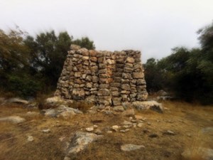
Nevertheless, Khalidi's field description records surviving cactus hedges, wells, trees, and elements of the older agricultural landscape.
No reliable numerical destruction percentage is supplied by the principal source, so an unsupported figure such as 100 percent is not used.
Settlements on Shilta Land
Walid Khalidi and PalQuest document two agricultural settlements established on Shilta land in 1977:
| Settlement | Year Established | Documentation |
|---|---|---|
| Shilat | 1977 | Documented by Khalidi and PalQuest on Shilta village land |
| Kefar Rut | 1977 | Documented by Khalidi and PalQuest on Shilta village land |
Later Palestinian land documentation also associates parts of the former Shilta land area with subsequent settlement expansion, including Lapid, established in 1996. The core Khalidi/PalQuest village entry, however, specifically names Shilat and Kefar Rut, so they are retained here as the principal directly documented settlements.
Shilta Today
The available description of the site comes primarily from historical field research incorporated into Walid Khalidi's All That Remains and should not be interpreted as direct field verification in 2026.
At the time of that documentation, the site was covered by mountain vegetation and long grasses, together with pomegranate, almond, and carob trees.
Some cactus hedges survived and several wells remained visible.
Greenhouses for flower cultivation and newer structures had been built at the site, while Israeli settlement housing had also been constructed on village land.
The original Palestinian village no longer survived as an inhabited community, although elements of its agricultural and water landscape remained visible.
Sources
- PalQuest – Interactive Encyclopedia of the Palestine Question: Shilta
- PalQuest – Operation Dani
- Institute for Palestine Studies – Walid Khalidi, All That Remains
- Palestine Remembered – Shilta, Ramla District
- Palestine Remembered – Shilta entry from All That Remains
- Village Statistics 1945 – Ramle Subdistrict: Shilta Population and Land Ownership
- Village Statistics 1945 – Ramle Subdistrict: Shilta Agricultural Land Use
- Village Statistics 1945 – Ramle Subdistrict: Shilta Built-up and Non-Cultivable Land
Photos from the village's people
Photos sent in by visitors and published after review.
Add a photo of this village
Log in to add photos of this village.
Other villages from Ramla

More from the archive


 Download Our Palestine App
The whole archive in the palm of your hand: depopulated villages, the Nakba, the massacres and Al-Aqsa — free, with no ads to erase the story.
Download Our Palestine App
The whole archive in the palm of your hand: depopulated villages, the Nakba, the massacres and Al-Aqsa — free, with no ads to erase the story.



Comments
No comments yet — be the first to write one.
Add your comment
Name and email are optional. Comments appear after review.