
The depopulated village of Khulda / District of Ramla
About the depopulated village of Khulda
- District
- Ramla
- Date Khulda was occupied
- 06 April 1948
- Population in 1948
- 325
- Military operation
- Operation Nachshon
- Brigade that carried it out
- Haganah
- Distance from the governorate centre
- 12 km south of Ramla
- Elevation above sea level
- 150 m
- Cause of displacement
- Direct military assault by Zionist forces (the Haganah) in the course of Operation Nachshon; Benny Morris, as cited by PalQuest, states that the inhabitants of the area seized in the operation fled either before or during the conquest of their villages
- Extent of destruction
- On April 20th, 1948, Khulda was mostly bulldozed with the exception of two houses remain standing.
- Ethnic cleansing
- Early April 1948, Khulda inhabitants were completely ethnically cleansed.
- Settlements built on the built-up area of Khulda after 1948
- Mishmar David (a kibbutz established in 1948 on village lands, about 0.5 km west of the site)
Hover a dot to read the village name, or click to open its card.
Borders of the depopulated village of Khulda
Khulda: A Depopulated Palestinian Village in the Ramla District
Khulda was a Palestinian village in the Ramla District, located approximately 12 km south of Ramla on a flat-topped hill overlooking broad areas of the surrounding countryside, at an average elevation of about 150 metres above sea level. Its inhabitants were displaced during the Nakba and the occupation of Palestine in 1948. Khulda was among the first Palestinian villages seized by the Haganah in the course of Operation Nachshon in April 1948 and was systematically demolished on 20 April.
- Subdistrict
- Ramla
- Distance from district center
- 12 km south of Ramla
- Average Elevation
- 150 m above sea level
- Population in 1931
- 178
- Number of Houses in 1931
- 29
- Population in 1944/1945
- 280
- Estimated Population in 1948
- About 325 – a later demographic estimate, not an official census
- Total Land Area in 1945
- 9,461 dunams
- Attack and Depopulation
- A Haganah battalion occupied the village along with neighbouring Dayr Muhaysin at the start of Operation Nachshon in early April 1948, “without fighting” according to the History of the Haganah as cited by Khalidi; the village was then systematically levelled with bulldozers on 20 April 1948.
- Final Israeli Control
- 3–6 April 1948; sources differ: 3 April in the English text of the village entry on PalQuest and on the Operation Nachshon page, 5 April in PalQuest's overall chronology, and 6 April in the Arabic text of the village entry
- Military Operation
- Operation Nachshon
- Military Unit
- A Haganah battalion
- Cause of Depopulation
- Direct military assault by Zionist forces (the Haganah) in the course of Operation Nachshon; Benny Morris, as cited by PalQuest, states that the inhabitants of the area seized in the operation fled either before or during the conquest of their villages
- Settlements Documented on Village Lands
- Mishmar David, a kibbutz established in 1948 on village lands about 0.5 km west of the site; Tal Shachar, 2 km south of the site, is not on village lands
Location of Khulda
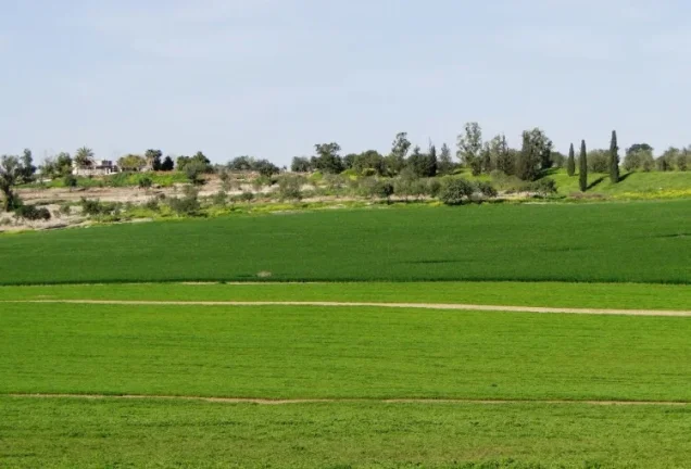
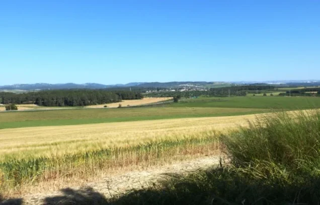
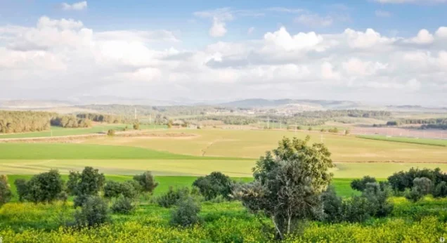
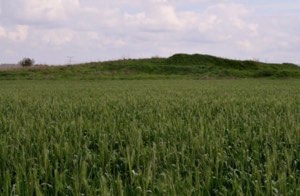
Khulda stood on a flat-topped hill commanding broad views in all directions.
The village was approximately 12 km south of Ramla and had an average elevation of about 150 metres above sea level.
It lay near a highway linking Gaza with the Ramla–Jerusalem road, while a network of secondary roads connected the village with Ramla, other major roads, and neighbouring Palestinian villages.
Villages bordering or lying near Khulda's lands included Dayr Muhaysin, Saydun, Umm Kalkha, Sajad, Qazaza, Khirbat Bayt Far, and al-Mansura.
Name and History of Khulda
Khulda is identified with a locality known to the Crusaders as Huldre.
In 1596, Khulda was a village in the nahiya of Ramla within the liwa of Gaza, with an estimated population of approximately 66. It paid taxes on crops including wheat and barley, as well as on goats and beehives.
The American biblical scholar and traveller Edward Robinson passed by Khulda in 1838 and described it as a large village.
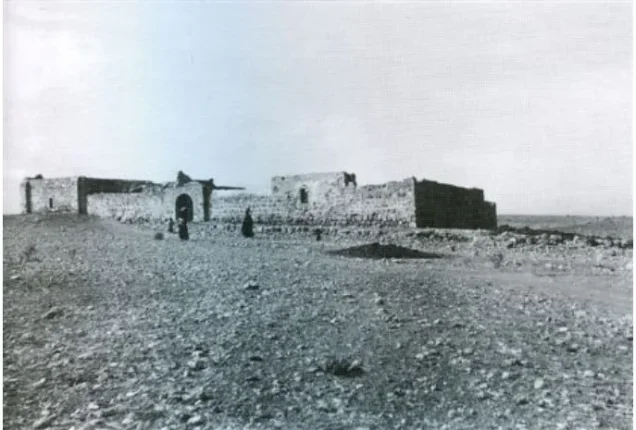
In the late nineteenth century, Khulda was described as a village constructed of stone and mud on the slope of a hill. A masonry well stood on its western side.
Architecture and Local Services in Khulda
In the late nineteenth century, the houses of Khulda were built primarily of stone and mud and occupied the hill and its slopes.
All of the village's inhabitants were Muslim, and Khulda had its own mosque.
Villagers obtained domestic water from two wells northeast of the village, in addition to the masonry well documented west of the village in nineteenth-century descriptions.
Education in Khulda
The principal approved sources used for this article do not provide sufficiently documented information concerning a village school or a date for the establishment of one before the Nakba. No unverified educational details are therefore added.
Economic Life in Khulda
The inhabitants of Khulda depended mainly on livestock raising and rainfed agriculture.
Cereals were the principal crop, while smaller quantities of vegetables were also cultivated.
According to the 1944/45 statistics, 8,994 dunums were devoted to cereals and 9 dunums were irrigated or used for plantations.
The overwhelming majority of the village's cultivable land was therefore used for cereal production.
Land Ownership in Khulda
The total registered land area of Khulda was 9,461 dunums in the 1944/45 statistics.
Land ownership in Khulda, 1944/45, using the terminology of Palestine Remembered
- Palestinian9,349 dunums99%
- Transferred to Zionists0 dunums0%
- Communal112 dunums1%
The figures record no land in Khulda under the category “Transferred to Zionists” in 1944/45.
Land Use in Khulda, 1944/45
Land use in Khulda, with ownership categories separated according to PalQuest's detailed data
- Palestinian
- Communal/Public
- Plantations and irrigable land9 dunums
- Cereals8,994 dunums
- Built-up area8 dunums
- Non-cultivable land450 dunums
A total of 9,003 dunums, approximately 95 percent of Khulda's lands, was cultivated or cultivable, all of it recorded as Palestinian land.
Built-up and non-cultivable land together amounted to 458 dunums, or approximately 5 percent of the total.
Palestine Remembered presents all 450 dunums of non-arable land in a single Palestinian column. PalQuest's more detailed table separates this into 338 Arab dunums and 112 public dunums. The communal/public category is therefore shown separately above.
Population of Khulda
Population of Khulda in selected years
- 159666Estimate derived from Ottoman records
- 192253Official British Mandate census
- 1931178Official British Mandate census
- 1944/45280Official statistics; all recorded inhabitants were Arab
- 1948325Later estimate published by Palestine Remembered
- Estimated refugees in 19981,995Later estimate published by Palestine Remembered
Number of Houses in Khulda
Number of houses in Khulda
- 193129Official British Mandate census figure
- 194852Later estimate published by Palestine Remembered
Archaeological Remains around Khulda
In addition to the identification of Khulda with the Crusader locality of Huldre, Palestine Remembered records an archaeological site nearby known as Khirbat al-Shaykh Khalid.
According to that source, Khirbat al-Shaykh Khalid contains cisterns, caves, and remains of walls. These details are attributed specifically to Palestine Remembered because they are not described at the same level of detail in Khalidi's PalQuest entry.
Operation Nachshon and the Occupation of Khulda
Khulda was among the earliest Palestinian villages targeted during Operation Nachshon, a Haganah and Palmach offensive conducted in April 1948 within the broader framework of Plan Dalet. The operation sought to seize villages along the approaches to Jerusalem and establish a corridor for military forces and supplies.
PalQuest dates Operation Nachshon from 3 to 15 April 1948. Approximately 1,500 Haganah and Palmach troops organized into three battalions were mobilized for the offensive. PalQuest lists the Har'el and Giv'ati Brigades among the Zionist units participating in the operation as a whole.
For Khulda itself, however, the dedicated Arabic PalQuest entry states that a Haganah battalion occupied Khulda and neighbouring Dayr Muhaysin on 6 April 1948. Palestine Remembered's statistical summary also gives 6 April as the occupation date.
The approved sources nevertheless contain a discrepancy. PalQuest's dedicated Operation Nachshon page states that the operation began with the capture of Khulda and Dayr Muhaysin on 3 April, while PalQuest's overall chronology places the attack on the two villages on 5 April.
This article therefore uses 6 April as the village-specific occupation date given in the dedicated Khulda entry and Palestine Remembered while explicitly preserving the alternative dates of 3 and 5 April found elsewhere in PalQuest.
The History of the Haganah, as quoted by Khalidi, states only that Khulda was taken “without fighting.” This Israeli source is not used independently here; the statement is included only because it is reproduced in the approved Palestinian reference.
- Occupation date used in the dedicated village entry: 6 April 1948.
- Date given on PalQuest's Operation Nachshon page: 3 April 1948.
- Date given in PalQuest's overall chronology: 5 April 1948.
- Military operation: Operation Nachshon.
- Village-specific occupying force according to Khalidi's entry: a Haganah battalion.
- Forces involved in Operation Nachshon overall: Haganah and Palmach units; PalQuest lists the Har'el and Giv'ati Brigades.
- Fate of the inhabitants: Khulda was depopulated of its Palestinian residents during the military offensive and the Nakba.
Occupation and Depopulation Chronology
- 3 April 1948
Beginning of the military operation
Operation Nachshon began; Ben-Gurion and the Haganah General Staff had decided to launch it within the general framework of Plan Dalet, 1,500 Palmach and Haganah troops in three battalions were mobilized for it, and its operational orders stated that all the Arab villages along the Khulda–Jerusalem axis were to be treated as enemy assembly or jump-off bases. According to PalQuest's page on the operation, it began with the occupation of Dayr Muhaysin and neighbouring Khulda on 3 April.
- 3, 5 or 6 April 1948 (sources differ)
Final occupation
A Haganah battalion occupied Khulda along with neighbouring Dayr Muhaysin at the start of Operation Nachshon, and the History of the Haganah, as cited by Khalidi, says only that the village was taken “without fighting.” The English text of the village entry and the Operation Nachshon page on PalQuest date this to 3 April, PalQuest's overall chronology to 5 April, and the Arabic text of the village entry to 6 April.
- The day after the occupation (6 April 1948, according to PalQuest's overall chronology)
Failed Palestinian counterattack
According to PalQuest's overall chronology, Khulda and Dayr Muhaysin were attacked and captured on 5 April, and a Palestinian counterattack the following day failed.
- 20 April 1948
Destruction of the village
The village was systematically levelled with bulldozers, two weeks after its capture.
- Last week of May 1948
Fighting in the village area
Battles continued to rage around the village in the following weeks, especially when an engagement around al-Latrun spread to the Khulda area, becoming what the press called “the biggest single clash of the war to date.”
- 1948
Settlement on village lands
Kibbutz Mishmar David was established on village lands, about 0.5 km west of the village site.
Destruction of Khulda on 20 April 1948
The occupation and depopulation of Khulda were followed by the systematic destruction of the village. Approximately two weeks after it was captured, most of Khulda was levelled on 20 April 1948.
The military significance of the area did not end with the destruction of the village. Fighting continued around Khulda during the following weeks.
During the final week of May 1948, battles around al-Latrun spread into the Khulda area, once again turning the surrounding countryside into a major battlefield.
Settlements Established on the Lands of Khulda
Kibbutz Mishmar David was established in 1948 on Khulda's lands, approximately half a kilometre west of the former village site.
Tal Shachar lies approximately 2 km south of the site. Walid Khalidi and PalQuest explicitly state, however, that it was not established on Khulda's village lands.
- Mishmar David: established in 1948 on Khulda's lands.
- Tal Shachar: located nearby but not on Khulda's lands.
Khulda Today
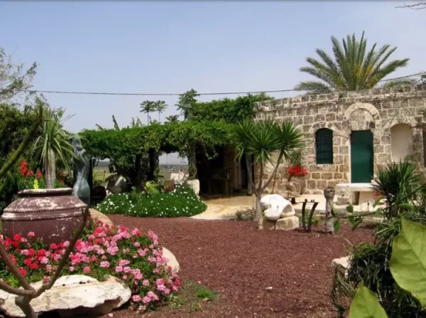
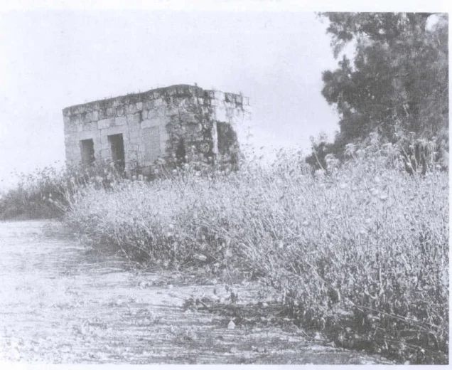
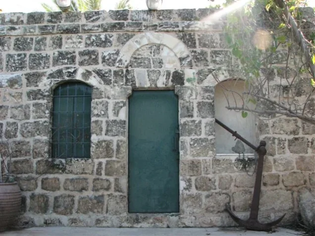
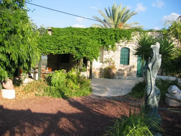
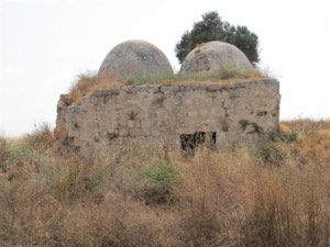
According to the field description published by Walid Khalidi in All That Remains, two houses remained standing at the former village site. Between them stood the walls of two ruined houses, with iron roof supports still attached to the stonework.
Wild vegetation covered much of the site, while eucalyptus, cypress, and carob trees grew around it.
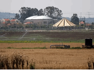
Palestine Remembered contains later user-contributed photographs, including images dated 2002 showing one of the surviving village houses. Some captions indicate that a surviving structure had been adapted to a new use by that time. These photographs are individual contributions and do not constitute a comprehensive independent field survey.
The principal description above therefore relies on the historical field documentation published by Khalidi in 1992. The approved sources used here do not provide a sufficiently comprehensive and independent recent survey to verify the precise condition of every part of the Khulda site in 2026.
Sources
- PalQuestPalQuest – Interactive Encyclopedia of the Palestine Question: Khulda
- PalQuestPalQuest – Operation Nachshon
- Palestine RememberedPalestine Remembered – Khulda, Ramla District
- Palestine RememberedPalestine Remembered – Khulda entry from All That Remains
- Institute for Palestine StudiesInstitute for Palestine Studies – All That Remains, Walid Khalidi
Photo gallery










Photos from the village's people
Photos sent in by visitors and published after review.
Add a photo of this village
Log in to add photos of this village.
Other villages from Ramla

More from the archive



 Download Our Palestine App
The whole archive in the palm of your hand: depopulated villages, the Nakba, the massacres and Al-Aqsa — free, with no ads to erase the story.
Download Our Palestine App
The whole archive in the palm of your hand: depopulated villages, the Nakba, the massacres and Al-Aqsa — free, with no ads to erase the story.



Comments
No comments yet — be the first to write one.
Add your comment
Name and email are optional. Comments appear after review.