
The depopulated village of Bir Ma'in (Bir Imma'in) / District of Ramla
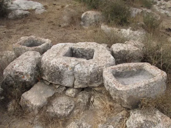
Bir Ma'in (Bir Imma'in)
About the depopulated village of Bir Ma'in (Bir Imma'in)
- District
- Ramla
- Date Bir Ma'in (Bir Imma'in) was occupied
- 16 July 1948
- Population in 1948
- 590
- Military operation
- Operation Dani
- Who defended the village
- Jordanian Army
- Distance from the governorate centre
- 14 (km) East of al-Ramla
- Elevation above sea level
- 275 m
- Cause of displacement
- Military assault by Zionist troops
- Extent of destruction
- Bir Ma'in was mostly destroyed with the exception of two deserted houses remain standing.
- Ethnic cleansing
- Bir Ma'in inhabitants were completely ethnically cleansed.
Hover a dot to read the village name, or click to open its card.
Borders of the depopulated village of Bir Ma'in (Bir Imma'in)
Bir Ma'in (Bir Imma'in) – Depopulated Palestinian Village of the Ramla Subdistrict
Bir Ma'in, also recorded as Bir Imma'in, was a depopulated Palestinian village in the Ramla Subdistrict. It stood approximately 14 kilometers east of Ramla on rolling terrain at the western edge of the Ramallah Mountains, at an average elevation of about 275 meters above sea level.
A secondary road connected the village to the Ramla–Ramallah highway, which passed to its northeast, while additional roads linked it with neighboring villages including al-Burj, Barfiliya, Safa, Bayt Sira, Salbit, Bayt Shanna, al-Buwayra, and al-Kunayyisa. Agriculture formed the principal basis of the village economy, aided by plentiful groundwater.
- District
- Ramla
- Distance from Ramla
- Approximately 14 km east of Ramla
- Elevation
- Approximately 275 m above sea level
- Natural Setting
- Rolling terrain on the western foothills of the Ramallah Mountains
- Population in 1944/1945
- 510 inhabitants
- Estimated Population in 1948
- 592 inhabitants – a later Palestine Remembered estimate, not an official census
- Occupation and Depopulation Date
- 15 July 1948; fighting in the sector continued on 16 July
- Military Operation
- Operation Dani – second phase
- Military Unit
- Two platoons from the First and Second Battalions of the Yiftach Brigade
- Total Land Area
- 9,319 dunums
- Settlement Established on Village Lands
- Makkabim, established in 1986
The Name Bir Ma'in and Its Earlier History
PalQuest records the village as Bir Ma'in and lists Bir Imma'in as an alternative name. The form Bi'r Ma'in is also widely used in modern Palestinian sources.
The village developed around an old well bearing the same name. During the Crusader period it was recorded as Bermenayn and in the twelfth century was a fief belonging to the Church of the Holy Sepulchre.
In 1596, Bir Ma'in belonged to the nahiya of Ramla in the liwa' of Gaza and had an estimated population of 165. The villagers paid taxes on wheat, barley, olives, sesame, goats, beehives, and a press used for processing olives or grapes.
By the late nineteenth century, the locality was described as a small hamlet on elevated ground.
Location and Built Environment
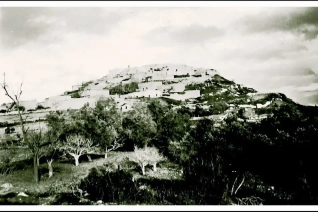
Bir Ma'in stood at the western edge of the Ramallah foothills in a transitional landscape between the central highlands and the coastal plain.
In the modern period, the built-up area was divided into two sections separated by a paved street. The northern section was rectangular, while the southern section had a roughly semicircular plan.
Village houses were built of stone and mud. Construction expanded during the final years of the British Mandate, particularly toward the northwest.
Population of Bir Ma'in
The inhabitants of Bir Ma'in were Muslims during the Mandate period. Palestine Remembered's summary table displays 47 for 1922, but this conflicts with the official Census of Palestine, which recorded 289 inhabitants. The official figure is therefore used here.
- 1596165Historical figure derived from Ottoman records
- 1922289Official Census of Palestine; all Muslims
- 1931355Official Census of Palestine; all Muslims
- 1944/1945510Official Mandate-period statistics
- 1948592Later Palestine Remembered estimate; not an official census
- 19983,633 refugeesLater estimate of refugees and descendants; not an official village census
Number of Houses
- 193185 occupied housesOfficial census
- 1948141 housesLater Palestine Remembered estimate; not an official 1948 census figure
Land Ownership in Bir Ma'in
Bir Ma'in had a total land area of 9,319 dunums in the 1944/45 statistics. The official table recorded no land under Jewish ownership.
Palestine Remembered presents the simplified categories as follows:
- Palestinian9,317 dunums100%
- Transferred to Zionists0 dunums0%
- Communal/Public2 dunums<1%
The official Village Statistics use the categories Arab and Public, listing 9,317 Arab dunums and 2 public dunums.
Land Use in 1944/1945
- Arab
- Public
- Cereals2,880 dunums
- Plantations and Irrigable Land176 dunums
- Built-up Area9 dunums
- Non-Cultivable Land6,254 dunums
Cultivated or cultivable land totaled 3,056 dunums, approximately 33 percent of the village land area. Built-up and non-cultivable land accounted for 6,263 dunums, or approximately 67 percent.
Sources also state that approximately 146 dunums were planted with olive trees. This figure is understood within the agricultural/orchard categories and is not added again to the official land-use total.
Economic Life in Bir Ma'in
The villagers depended primarily on agriculture. The abundance of groundwater made possible a relatively diverse range of crops, including cereals, vegetables, grapes, figs, plums, almonds, and olives.
In 1944/45, 2,880 dunums were devoted to cereals and 176 dunums were irrigated or used for orchards. Approximately 146 dunums were planted with olives.
Water Resources
The village itself developed around an old well bearing its name. Its lands were also considered well supplied with groundwater, supporting both field crops and orchards.
The principal sources do not provide a separate quantified inventory of wells or water output, so no unsupported figures are added.
Education
An elementary boys' school was established in Bir Ma'in in 1934 and stood beside the village mosque.
Later local and secondary accounts differ over enrollment, giving figures such as 40 and 65 pupils. Since the principal historical source does not provide a single independently verified enrollment figure, no precise student number is adopted here.
The Mosque and Religious Life
Bir Ma'in had a mosque beside the elementary school, and its population was recorded as Muslim in the official Mandate censuses.
Palestine Remembered contains an isolated database field referring to a church, but the principal historical narrative and official population data do not independently verify such a structure. It is therefore not included as established fact.
Archaeological Remains
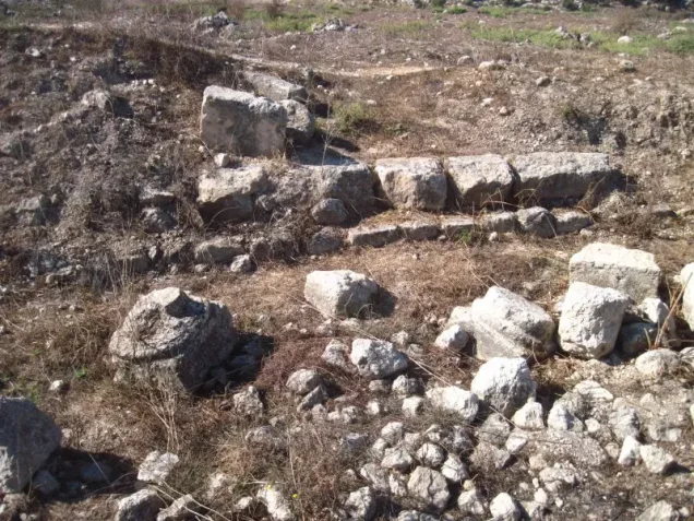
Three khirbas in the vicinity of Bir Ma'in contained archaeological remains including house foundations, column fragments, cisterns, rock-cut caves, burial places, and a large square corral.
The principal sources do not provide precise dates for all of these remains, so they are presented as archaeological features without assigning unsupported periods to each one.
Occupation and Depopulation of Bir Ma'in
Bir Ma'in was occupied during the second phase of Operation Dani in July 1948, following the capture of Lydda and Ramla during the operation's first phase.
Operation Dani began on 9 July and continued until 18 July. Its second stage, from 13 to 18 July, pushed eastward toward the Ramallah–Latrun axis and attempted to extend Israeli control toward Latrun and Ramallah.
On 15 July 1948, Israeli forces occupied Barfiliya, Bir Ma'in, al-Burj, and Salbit. The commonly cited range “15–16 July” reflects the continued fighting and counterattacks in the area on the following day.
Khalidi's account identifies the force involved in capturing Bir Ma'in as two platoons from the First and Second Battalions of the Yiftach Brigade.
On 16 July, the Transjordanian Arab Legion launched a counterattack in an attempt to recover neighboring positions, including Salbit, Barfiliya, and al-Burj, but failed. On the following day, the Associated Press reported that Israeli forces stationed at Bir Ma'in and al-Burj were able to bring the Latrun–Ramallah road under small-arms fire.
Occupation Chronology
- 9 July 1948
Beginning of Operation Dani
The operation began with the objective of expanding control eastward from the Tel Aviv area toward Lydda, Ramla, Latrun, and the approaches to Jerusalem.
- 12 July 1948
End of the First Phase
Lydda and Ramla had been occupied and operations shifted farther east.
- 13 July 1948
Beginning of the Second Phase
The military effort shifted toward the Ramallah–Latrun road and villages along the eastern axis.
- 15 July 1948
Occupation of Bir Ma'in
Israeli forces occupied Bir Ma'in together with Barfiliya, al-Burj, and Salbit. Two platoons from the First and Second Battalions of the Yiftach Brigade participated in the capture of Bir Ma'in.
- 16 July 1948
Arab Legion Counterattack
The Arab Legion attempted to recover several neighboring positions but was unable to reverse the Israeli advance.
- 17 July 1948
Fire Control over the Latrun–Ramallah Road
A contemporary press report stated that forces based in Bir Ma'in and al-Burj were able to bring the main road under small-arms fire.
Operation Dani
Operation Dani lasted from 9 to 18 July 1948 and was one of the largest military offensives undertaken during the period between the two truces.
Its first phase, from 9 to 12 July, resulted in the occupation of Lydda, Ramla, and a number of surrounding villages. During the second phase, from 13 to 18 July, forces advanced eastward toward Latrun and Ramallah, and Bir Ma'in was occupied along this axis.
Although the operation secured numerous villages and sections of the road network, its wider objective of capturing Latrun and Ramallah was not achieved.
Military Unit
Military Unit: Yiftach Brigade, specifically two platoons from its First and Second Battalions.
Bir Ma'in is one of the cases in which the historical account provides a village-specific identification of the attacking force. Other brigades that participated elsewhere in Operation Dani should therefore not be substituted for this documented unit.
Cause of Depopulation
Palestine Remembered classifies the cause of Bir Ma'in's depopulation as a direct military assault. Khalidi's account likewise places the village's depopulation in the context of its military capture during the second phase of Operation Dani.
The villagers' displacement was therefore directly associated with the assault and occupation of the village on 15 July 1948.
Destruction of Bir Ma'in
Most of Bir Ma'in's built environment was destroyed after the population was displaced. Palestine Remembered describes extensive destruction while noting that portions of some walls survived.
Khalidi's later field description records two abandoned buildings with crumbling walls still standing at the site, so statements that the village was “completely destroyed” require this qualification.
Settlement on Bir Ma'in Village Lands
Makkabim was established in 1986 on Bir Ma'in village lands and was originally described as a military settlement.
This is the settlement directly identified by Khalidi and PalQuest as having been established on the village lands. No additional locality is added here without equivalent village-level documentation.
Bir Ma'in Today
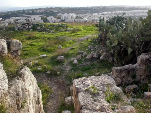
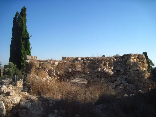
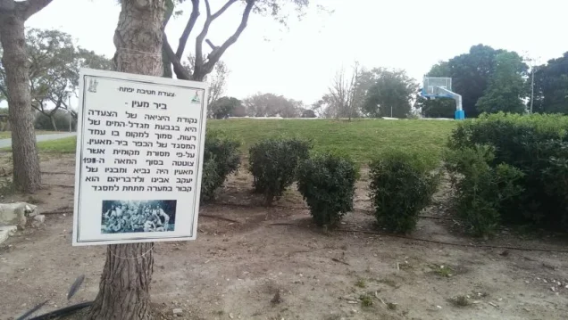
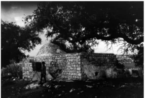
According to Walid Khalidi's field description documented before the publication of All That Remains in 1992, two abandoned buildings with crumbling walls remained at the village site.
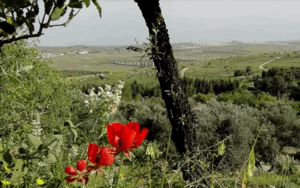
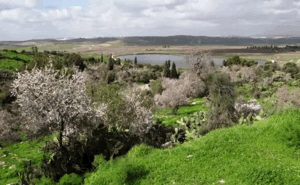
The site was otherwise overgrown with cactus, thorny vegetation, foxtail, a plant locally called rijl al-hamam, and pine and almond trees.
Part of the surrounding land was used for target practice and other military purposes, while other sections were cultivated.
This description reflects historical field documentation from the period preceding the publication of Khalidi's book in 1992 and should not be treated as direct field verification of conditions in 2026.
Sources
- PalQuest – Interactive Encyclopedia of the Palestine Question: Bir Ma'in
- PalQuest – Operation Dani
- Palestine Remembered – Bir Ma'in, Ramla District
- Government of Palestine – Census of Palestine, 1922, edited by J. B. Barron
- Government of Palestine – Census of Palestine, 1931, edited by E. Mills
- Sami Hadawi – Village Statistics 1945, reproducing Government of Palestine statistics
- Institute for Palestine Studies – Walid Khalidi, All That Remains
Photo gallery



Photos from the village's people
Photos sent in by visitors and published after review.
Add a photo of this village
Log in to add photos of this village.
Other villages from Ramla
More from the archive



 Download Our Palestine App
The whole archive in the palm of your hand: depopulated villages, the Nakba, the massacres and Al-Aqsa — free, with no ads to erase the story.
Download Our Palestine App
The whole archive in the palm of your hand: depopulated villages, the Nakba, the massacres and Al-Aqsa — free, with no ads to erase the story.



Comments
No comments yet — be the first to write one.
Add your comment
Name and email are optional. Comments appear after review.