
The depopulated village of Kuwaykat / District of Akka (Acre)
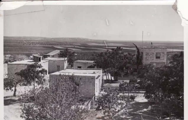
About the depopulated village of Kuwaykat
- District
- Akka (Acre)
- Date Kuwaykat was occupied
- 10 July 1948
- Population in 1948
- 1,218
- Military operation
- Operation Dekel
- Brigade that carried it out
- The Seventh Brigade، The Carmeli Brigade
- Distance from the governorate centre
- 9 km northeast of Acre
- Elevation above sea level
- 55 m
- Cause of displacement
- Heavy artillery bombardment and direct military assault by Israeli occupation forces, followed by the expulsion of the remaining inhabitants
- Extent of destruction
- Kuwaykat was mostly destroyed with the exception of its shrine.
- Ethnic cleansing
- Kuwaykat inhabitants were completely ethnically cleansed.
- Settlements built on the built-up area of Kuwaykat after 1948
- Kibbutz ha-Bonim, established in January 1949 on village lands near the village site and later renamed Beyt ha-Emeq
Hover a dot to read the village name, or click to open its card.
Borders of the depopulated village of Kuwaykat
Kuwaykat: A Depopulated Palestinian Village in the Acre District
Kuwaykat was a Palestinian village in the Acre District, situated on a slightly elevated hill in the eastern part of the Acre Plain approximately 9 kilometres northeast of Acre, at an average elevation of about 55 metres above sea level. Its population reached 1,050 in the 1944/1945 statistics, all Muslims. The village came under heavy bombardment on the night of 9–10 July 1948 and was occupied by units of the Seventh (Sheva') and Carmeli Brigades during Operation Dekel. Its inhabitants were displaced and most of the village was destroyed during the Nakba and the occupation of Palestine in 1948.
- Subdistrict
- Acre
- Distance from district center
- 9 km northeast of Acre
- Average Elevation
- 55 m above sea level
- Population in 1931
- 789
- Number of Houses in 1931
- 163
- Population in 1944/1945
- 1,050
- Estimated Population in 1948
- About 1,218 – a later demographic estimate, not an official census
- Total Land Area in 1945
- 4,733 dunams
- Attack and Depopulation
- The village's defenders repulsed attacks on 18–19 January, 6–7 February and 11 June 1948. When Operation Dekel began on the night of 9 July 1948, the village came under heavy bombardment that killed two people, wounded two and caused most of the inhabitants to flee; units of the Sheva' (Seventh) and Carmeli Brigades then captured it, and those who remained, mostly elderly, were soon expelled to Kafr Yasif.
- Final Israeli Control
- Probably 9–10 July 1948, in the first stage of Operation Dekel (8–14 July 1948); PalQuest does not give the day the forces entered the village
- Military Operation
- Operation Dekel (first stage)
- Military Unit
- Units of the Seventh (Sheva') Brigade and the Carmeli Brigade, according to Benny Morris as cited by Khalidi; a company commander of the Twenty-First Battalion took part in the attack
- Cause of Depopulation
- Heavy artillery bombardment and direct military assault by Israeli occupation forces, followed by the expulsion of the remaining inhabitants
- Settlements Documented on Village Lands
- Kibbutz ha-Bonim, established in January 1949 on village lands near the village site and later renamed Beyt ha-Emeq
Location
Kuwaykat stood on a slightly elevated hill in the eastern part of the Acre Plain, approximately 9 kilometres northeast of Acre and at an average elevation of about 55 metres above sea level.
Secondary roads connected the village with the Acre–Safad highway and with neighbouring Palestinian villages.
Abu Sinan, Kafr Yasif, 'Amqa, al-Ghabisiyya, and other nearby communities were connected with Kuwaykat through local roads.
Following the depopulation of Kuwaykat, many villagers took refuge in Abu Sinan and Kafr Yasif, and a substantial number of Kuwaykat families and their descendants later lived in these communities.
Kuwaykat Through History
The Crusaders knew the village as Coket.
Ottoman records document the village in the sixteenth century, and later historical compilations give an estimated population of approximately 300 in 1596.
Late nineteenth-century travellers and surveyors described Kuwaykat as a stone-built village situated at the foot of hills, with approximately 300 inhabitants who cultivated olives.
Local oral history maintains that the name Kuwaykat was inherited from earlier generations and appeared in Ottoman documents in a similar form. This is best presented as local historical documentation unless a more detailed linguistic study of the successive recorded forms of the name is available.
Architecture
Most houses in Kuwaykat were built of adobe brick and stood close together, separated by narrow alleys that generally intersected at right angles.
The village contained a mosque, an elementary school, and a shrine dedicated to Shaykh Abu Muhammad al-Qurayshi.
Wells provided water for domestic use and irrigation.
The built-up area covered approximately 26 dunams in the 1944/1945 statistics.
Population
The 1922 census recorded 604 inhabitants in Kuwaykat.
By the 1931 census, the population had increased to 789 people living in 163 houses.
According to the 1944/1945 statistics, Kuwaykat had 1,050 inhabitants, all Arab Muslims.
The estimate of approximately 1,218 inhabitants in 1948 is a later demographic estimate rather than an official British Mandate census figure.
Palestine Remembered estimates the number of refugees and their descendants at approximately 7,480 in 1998.
Population of Kuwaykat
- 1596About 300Historical estimate
- 1922604Official census
- 1931789Official census; 163 houses
- 1944/19451,050Government of Palestine statistics
- 1948About 1,218Later estimate
- 19987,480Estimate of refugees and their descendants
Number of Houses
The 1931 census recorded 163 houses in Kuwaykat.
The figure of approximately 251 houses in 1948 is a later estimate rather than an official census count.
Education
Kuwaykat had an elementary school established by the Ottoman authorities in 1887.
Because of the village's relative proximity to Acre, some inhabitants were also able to benefit from educational facilities in the city and surrounding communities.
Local Palestinian accounts state that pupils seeking education beyond the village's elementary level sometimes continued their studies in Kafr Yasif and later in Acre.
The year 1935 appears in some local accounts but is not used here as the founding date, since Walid Khalidi and PalQuest explicitly date the elementary school to 1887.
Land of Kuwaykat
According to the 1944/1945 statistics, Kuwaykat had a total land area of 4,733 dunams.
Arab ownership amounted to 4,668 dunams, while 65 dunams were classified as public land. No Jewish-owned land was recorded.
The 65 dunams of public land should not automatically be described entirely as roads and wadis, since the official statistical category is simply public land.
Land Ownership in Kuwaykat in 1944/1945
- Arab ownership4,668 dunums99%
- Jewish ownership0 dunums0%
- Public land65 dunums1%
Agriculture and Economic Life
Kuwaykat's lands were considered among the most fertile in the Acre subdistrict, and agriculture and livestock raising formed the basis of the village economy.
Grain, olives, and watermelons were among the principal crops.
According to the 1944/1945 statistics, 3,316 dunams were devoted to cereals and 1,246 dunams were irrigated or used for plantations.
Approximately 500 dunams were planted with olive trees. This figure forms part of the cultivated and plantation land and should not be added separately to the overall land-use total.
Villagers also raised livestock and poultry and produced dairy products and olive oil.
Land Use in Kuwaykat in 1944/1945, in Dunams
- Arab
- Public
- Irrigated and plantation land1,246 dunums
- Cereals3,316 dunums
- Built-up area26 dunums
- Uncultivable land145 dunums
Archaeological and Religious Sites
Kuwaykat and its surroundings contained a number of archaeological sites, particularly Tall Mimas.
Recorded remains included ancient water reservoirs, wine presses, and rock-cut tombs.
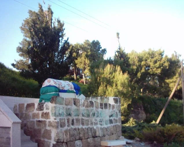
Shrine of Shaykh Abu Muhammad al-Qurayshi
The village contained a shrine dedicated to Shaykh Abu Muhammad al-Qurayshi, which held religious significance for local inhabitants and was also regarded as sacred by members of the Druze community.
Local village traditions state that the tomb was visited before the Nakba and that visitors placed cloth coverings at the shrine.
Khan Koko
Local oral documentation records a khan in the centre of Kuwaykat known as Khan Koko, with a broad courtyard and a large gate.
Village tradition holds that it served merchants and travellers during the Ottoman period. The principal reference sources reviewed do not independently date the structure, and it is therefore presented here as part of Kuwaykat's local historical memory.
Attacks Before the Final Occupation
Kuwaykat was subjected to several attacks before its final occupation.
According to the Palestinian newspaper Filastin, as transmitted through Walid Khalidi and PalQuest, an attack involving approximately eighty Zionist militiamen took place on 18–19 January 1948 and was repelled.
The newspaper also recorded another unsuccessful attack on the night of 6–7 February.
The first major assault immediately before the first truce occurred on 11 June 1948.
According to later interviews with villagers, approximately sixty local fighters defended the village with between thirty-five and fifty rifles and one Bren gun and succeeded in repelling the attack.
Operation Dekel
Operation Dekel lasted from 8 to 18 July 1948 and sought to expand Israeli control over western and Lower Galilee.
Forces from the Seventh (Sheva') Brigade, Carmeli Brigade, and Golani Brigade participated in the operation.
During its first phase, forces from the Seventh and Carmeli Brigades attacked a chain of villages in western Galilee, and Kuwaykat was among the villages affected during this opening stage.
The statement that Kuwaykat was entered between 15 and 18 July during the second phase is a confusion with the Palestinian village of Mi'ar, which was occupied by Seventh Brigade units during that period.
The Occupation and Depopulation of Kuwaykat
On 9 July 1948, after the end of the first truce, the mukhtar of Kuwaykat was asked to surrender according to village testimonies transmitted by Walid Khalidi, but he refused.
On the night of 9–10 July, Kuwaykat came under heavy artillery bombardment before the ground assault.
According to villagers' testimonies, two people were killed and two were wounded during the shelling, which also caused widespread panic and the flight of most civilians.
Palestine Remembered gives 10 July 1948 as the occupation date.
PalQuest and Walid Khalidi, transmitting Benny Morris's account, state that the forces that captured Kuwaykat included units of the Seventh (Sheva') and Carmeli Brigades.
The source also quotes a company commander from the Twenty-First Battalion who participated in the assault and confirmed that heavy artillery bombardment preceded the advance into the village.
The Twenty-First Battalion should not, however, be treated as the sole force responsible for the capture. The most precise formation-level attribution is to units from the Seventh and Carmeli Brigades.
The local militia withdrew to hilly ground east of the village and remained there for several days while awaiting reinforcements from the Arab Liberation Army that never arrived.
Many villagers fled to Abu Sinan and Kafr Yasif and other nearby communities. Those who remained in Kuwaykat, most of them elderly, were soon expelled to Kafr Yasif.
During the first days after the occupation, some village women reportedly returned clandestinely to retrieve food and clothing from their homes.
Information originating in Israeli accounts is cited here only as transmitted through Walid Khalidi and PalQuest and not through direct reliance on the original Israeli sources.
Occupation and Depopulation Chronology
- 18–19 January 1948
First attack on the village
Some eighty Zionist militiamen attacked the village and were repulsed by its defenders, according to the newspaper Filastin as cited by Khalidi.
- Night of 6–7 February 1948
Second attack
Another attack on the village was driven back; Filastin gave no casualty figures.
- 11 June 1948
Third attack (the first large attack)
The first large attack on the village came just before the first truce took effect and was repulsed by the local militia of around sixty men armed with thirty-five to fifty assorted rifles and one Bren gun, according to eyewitnesses interviewed in later years.
- 8 July 1948 or 9 July 1948
Beginning of the military operation
PalQuest's page on Operation Dekel dates its start to the night of 8 July, while the village entry says it began on the night of 9 July, the day the first truce ended. In its first stage (8–14 July), Israeli forces captured a number of western Galilee villages, including Kuwaykat.
- 9 July 1948
Demand for the village's surrender
On the day the truce ended, some Arabs collaborating with the Zionists came to the village and asked the mukhtar to surrender, but he refused. During the truce, representatives of the Arab Liberation Army had advised the villagers not to evacuate the women and children, according to villagers interviewed in 1973.
- Night of 9 July 1948
Shelling of the village
The village came under heavy shelling and artillery fire as Operation Dekel began; two people were killed and two wounded, and the village was seized by panic, according to a villager's account.
- Night of 9 July 1948
Beginning of the exodus
Most of the villagers began to flee in their nightclothes, and many fled to Abu Sinan, Kafr Yasif and other villages that later surrendered.
- Probably 9–10 July 1948
Final occupation
Units of the Sheva' (Seventh) and Carmeli Brigades captured the village, according to Morris as cited by Khalidi, and a company commander of the Twenty-First Battalion who took part in the attack confirmed the heavy bombardment that preceded the occupation, saying that 'the psychological effect was achieved' and the non-combatant inhabitants fled before the assault began. PalQuest does not give the day the forces entered; the militia retreated to a hilly position east of the village and waited four days in vain for Arab Liberation Army reinforcements to recapture it.
- July 1948, soon after the occupation
Expulsion of the remaining inhabitants
Those who remained in the village, mostly elderly, were soon expelled to Kafr Yasif, and in the early days after the occupation the women of the village often slipped back in to get food and clothing.
- January 1949
Settlement on village lands
Kibbutz ha-Bonim was established on village lands near the village site and later renamed Beyt ha-Emeq; its settlers were Jewish immigrants from England, Hungary and the Netherlands.
Israeli Settlements on Kuwaykat's Lands
ha-Bonim / Beyt ha-Emeq
In January 1949, Kibbutz ha-Bonim was established near the Kuwaykat village site on village lands.
The settlement was later renamed Beyt ha-Emeq.
Its original settlers were Jewish immigrants from England, Hungary, and the Netherlands.
- 1949ha-Bonim, later Beyt ha-Emeq
Established near the village site on Kuwaykat's lands
Segev, Ya'ad, and Manof
Segev, Ya'ad, and Manof are not identified by Walid Khalidi or PalQuest as settlements established on Kuwaykat's lands.
They are associated instead with the lands of the depopulated Palestinian village of Mi'ar: Segev was established in 1953, Ya'ad in 1975, and Manof in 1980.
Kuwaykat After the Nakba
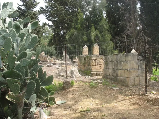
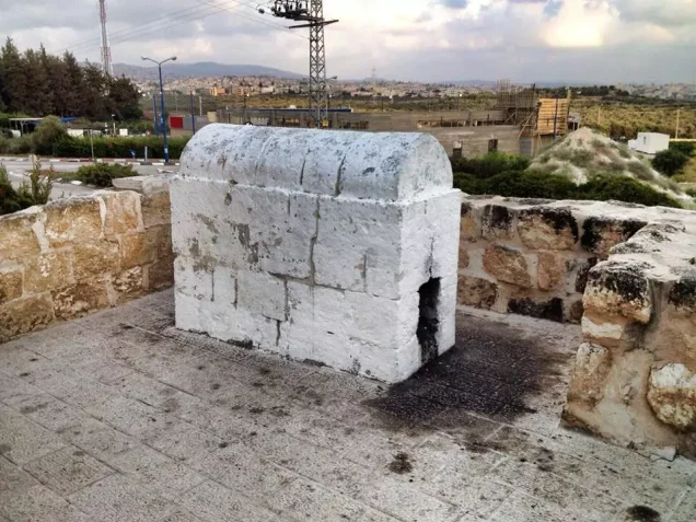
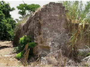
According to the field documentation relied upon by Walid Khalidi, little remained of Kuwaykat except the abandoned cemetery, house rubble, and the shrine of Shaykh Abu Muhammad al-Qurayshi.
The cemetery was overgrown, although inscriptions remained visible on several graves.
The shrine of Shaykh Abu Muhammad al-Qurayshi survived, but its stone base was badly cracked and deteriorating at the time of Khalidi's documentation.
A forest of pine and eucalyptus trees was planted at the site.
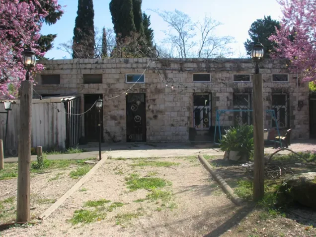
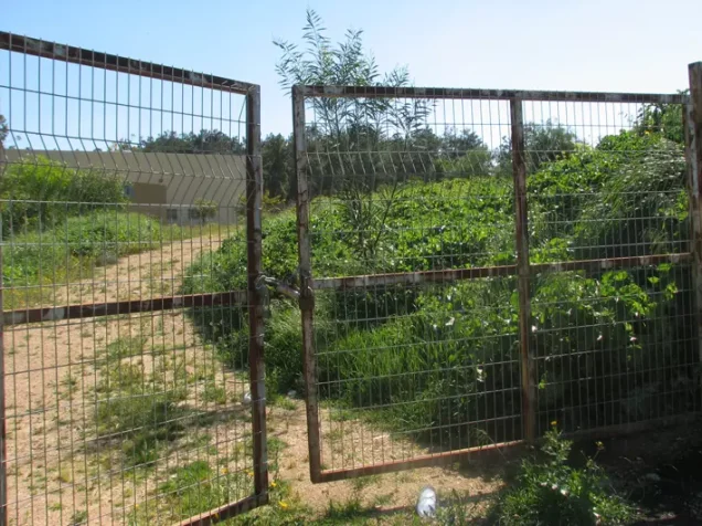
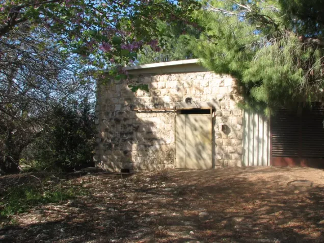
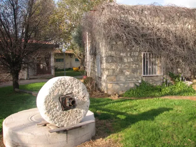
Later local Palestinian documentation, particularly photographs from 2003, records the survival of several older Kuwaykat buildings that were being used within Beyt ha-Emeq for residential, commercial, or community purposes.
Khalidi's earlier field description should therefore be distinguished from later local documentation, and neither should necessarily be treated as a comprehensive survey updated to 2026.
Sources
- PalQuest – Interactive Encyclopedia of the Palestine Question: Kuwaykat.
- PalQuest: كويكات.
- PalQuest: Operation Dekel.
- PalQuest: Mi'ar – for correcting the Segev, Ya'ad, and Manof attribution.
- Palestine Remembered: Kuwaykat, Acre District.
- Walid Khalidi, All That Remains: Kuwaykat, as reproduced by Palestine Remembered.
- Walid Khalidi, All That Remains, entry on Kuwaykat.
- Local Palestinian oral-history documentation of Kuwaykat published through Palestine Remembered.
- Government of Palestine, censuses of 1922 and 1931.
- Government of Palestine, Department of Statistics, Village Statistics, 1945.
Photo gallery









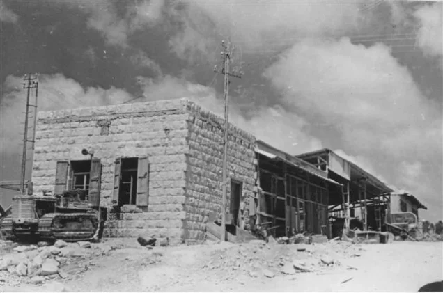
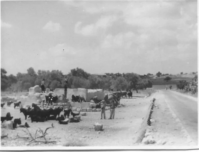


Photos from the village's people
Photos sent in by visitors and published after review.
Add a photo of this village
Log in to add photos of this village.
Other villages from Akka (Acre)
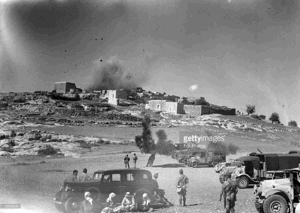

More from the archive



 Download Our Palestine App
The whole archive in the palm of your hand: depopulated villages, the Nakba, the massacres and Al-Aqsa — free, with no ads to erase the story.
Download Our Palestine App
The whole archive in the palm of your hand: depopulated villages, the Nakba, the massacres and Al-Aqsa — free, with no ads to erase the story.



Comments
No comments yet — be the first to write one.
Add your comment
Name and email are optional. Comments appear after review.