
The depopulated village of Dayr Nakhkhas / District of Hebron
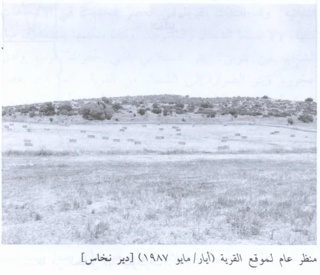
Dayr Nakhkhas
About the depopulated village of Dayr Nakhkhas
- District
- Hebron
- Date Dayr Nakhkhas was occupied
- 29 October 1948
- Population in 1948
- 700
- Military operation
- Operation Yoav
- Who defended the village
- Egyptian Army
- Distance from the governorate centre
- 20 (km) Northwest of Hebron
- Elevation above sea level
- 325 m
- Cause of displacement
- Military assault by Zionist troops
- Extent of destruction
- Dayr Nakhkhas was completely destroyed with the exception of few deserted and partially destroyed houses.
- Ethnic cleansing
- Soon after the massacre committed at al-Dawayima, a nearby village, Dayr Nakhkhas inhabitants were terrorized in leaving their village.
Hover a dot to read the village name, or click to open its card.
Borders of the depopulated village of Dayr Nakhkhas
Dayr Nakhkhas – Hebron Subdistrict
Dayr Nakhkhas was a depopulated Palestinian village in the Hebron subdistrict, located approximately 20 km northwest of Hebron at an average elevation of about 325 meters above sea level.
The village stood on a hilltop underlain by hard limestone and overlooked Wadi Bayt Jibrin to the north. It lay south of the Hebron–Bayt Jibrin–al-Majdal highway and was connected with neighboring villages and khirbas by secondary roads.
The official 1931 Census of Palestine recorded 451 inhabitants, while the 1944/45 statistics recorded 600. The village lands totaled 14,476 dunums.
Israeli occupation forces captured Dayr Nakhkhas on 29 October 1948 during the third stage of Operation Yoav. On the same day, a massacre was carried out in neighboring al-Dawayima, contributing to a wider flight from the surrounding area.
The Name Dayr Nakhkhas
The principal source does not establish the etymology of the village name with certainty.
Walid Khalidi suggests that the second element, Nakhkhas, may derive from a common Semitic word associated with copper.
Local traditions that connect the name more specifically with copper production or with an ancient Christian monastery are therefore best treated as interpretations rather than firmly established linguistic facts.
Location
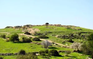
Dayr Nakhkhas occupied a limestone hill in the western foothills of the Hebron highlands and overlooked Wadi Bayt Jibrin to the north.
It stood south of the main Hebron–Bayt Jibrin–al-Majdal road and only a short distance east of Bayt Jibrin.
PalQuest gives a distance of approximately 20 km northwest of Hebron and an average elevation of 325 meters. Some Palestinian local sources give about 23 km, but this article follows the Khalidi/PalQuest figure.
Boundaries and Neighboring Localities
Palestinian local documentation describes the immediate village lands approximately as follows:
| Direction | Neighboring locality / land |
|---|---|
| North | Kuma |
| East | Khirbat Umm Burj |
| South | Khirbat Jammura |
| West | Bayt Jibrin and its associated khirbas |
Palestinian maps also place 'Ajjur, Kidna, Idna, Bayt Ula, al-Dawayima, al-Qubayba, and Tall al-Safi within the wider geographical surroundings.
Nearby villages should not automatically be treated as direct cadastral boundaries; original Mandate land-demarcation maps remain the strongest evidence for exact boundary lines.
Dayr Nakhkhas in the Ottoman Period
In 1596, Dayr Nakhkhas belonged to the nahiya of al-Khalil in the liwa' of Jerusalem and had an estimated population of 72.
The villagers paid taxes on wheat, barley, olives, goats, beehives, and other agricultural production, indicating a mixed farming and pastoral economy.
Dayr Nakhkhas in the Late Nineteenth Century
Late nineteenth-century descriptions portrayed Dayr Nakhkhas as a small village perched on a high, steep hill overlooking a valley to the north.
The village had a rectangular plan and expanded along and toward the road leading to Hebron.
The inhabitants built their houses primarily of stone.
Population
- 159672Estimate derived from an Ottoman tax register
- 1922336Official Census of Palestine; all inhabitants were Muslims
- 1931451Official Census of Palestine; all inhabitants were Muslims
- 1944/45600Official Government of Palestine statistics; all were Arabs and Muslims
- 1948696Later Palestine Remembered estimate; not an official Mandate census
- 19984,274 refugees and descendantsLater demographic estimate published by Palestine Remembered
Number of Houses
- 193186 occupied housesOfficial Census of Palestine
- 1948132Later Palestine Remembered estimate; not an official census figure
Land Ownership in 1944/45
Dayr Nakhkhas had a total registered land area of 14,476 dunums.
Using Palestine Remembered's simplified terminology:
- Palestinian8,923 dunums62%
- Transferred to Zionists0 dunums0%
- Communal/Public5,553 dunums38%
The official categories record 8,923 Arab dunums and 5,553 Public dunums, with no land in the Jewish ownership category.
Land Use in 1944/45
- Arab
- Public
- Cereals4,887 dunums
- Plantations and irrigable land362 dunums
- Built-up land22 dunums
- Non-cultivable land9,205 dunums
The land-use categories balance exactly with the official ownership figures.
The 9,205 dunums of non-cultivable land shown in simplified tables should not be described entirely as privately Palestinian-held land: the official breakdown consists of 3,652 Arab dunums and 5,553 Public dunums.
Palestine Remembered also gives approximately 424 dunums of olive groves. This is a crop-specific supplementary figure and should not be added again to the land-use total, which already balances.
Economic Life in Dayr Nakhkhas
Agriculture and animal husbandry formed the principal basis of the village economy.
The inhabitants cultivated grain, particularly wheat, together with grapes and olives.
In 1944/45, 4,887 dunums were planted with cereals and 362 dunums were irrigated or used for orchards.
The uncultivated hills were covered with woods, shrubs, and wild grasses and were used as pasture for sheep and goats.
Water Sources
Khalidi's village entry and the PalQuest statistical material do not provide a securely documented list of named springs or wells that supplied Dayr Nakhkhas in the late Mandate period.
The many archaeological remains in the village lands include cisterns and other water-related features, but these should not automatically be treated as evidence for the village's modern domestic water system.
No specific modern spring or well has therefore been added without supporting Palestinian or official documentation.
Education
No independent village school is documented in Khalidi's account.
Children from Dayr Nakhkhas attended schools in neighboring villages.
Palestinian local sources indicate that Bayt Jibrin served as an important nearby center for education, trade, and other services.
Religious Life
The inhabitants were Muslims according to the Mandate-era censuses.
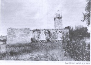
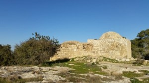
Palestine Remembered contains community documentation and photographs of a shrine known as Maqam al-Shaykh 'Ushaysh.
Khalidi's core village entry does not provide a detailed history of the shrine, so additional traditions concerning its origin have not been added without documentation.
Archaeological Sites
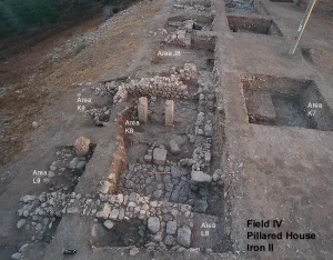
Dayr Nakhkhas stood in an area exceptionally rich in archaeological remains.
Khalidi records approximately fifteen archaeological sites within the village's nearly 15,000 dunums, including the village site itself, which had been built over an older settlement.
Palestinian local sources name Khirbat Haqqin, 'Awda, 'Ushaysh, al-Safiyya, Umm Raziq, Umm Qutn, Umm Malik, al-Hammam, and other sites among the archaeological localities associated with the village.
Caves, cisterns, tombs, and building remains are reported in parts of this landscape, although the date of each feature requires specialized archaeological study.
Dayr Nakhkhas before the Nakba
The village's location near Bayt Jibrin and the roads leading toward Hebron became militarily important during the autumn of 1948.
Egyptian forces were the principal Arab military formation operating on the southern front and in the western Hebron region during Operation Yoav.
Operation Yoav
Operation Yoav ran from 15 October to 4 November 1948.
Its principal objective was to break through the Egyptian lines, link Israeli forces in the Negev with those farther north, and seize additional territory in southern Palestine.
The Giv'ati, Yiftach, Negev, and Har'el brigades participated in the broader operation.
On 23 October, Israeli forces broke through parts of the Egyptian line, after which the operational area expanded eastward toward the Hebron hills.
Occupation of Bayt Jibrin and Dayr Nakhkhas
Israeli occupation forces captured Dayr Nakhkhas on 29 October 1948.
Khalidi states that the village was occupied at approximately the same time as Bayt Jibrin, during the third stage of Operation Yoav.
After the bulk of the operation had been completed, Israeli units continued their eastward advance into the Hebron area and took Dayr Nakhkhas.
The al-Dawayima Massacre and Its Regional Impact
On the same day, 29 October 1948, Israeli occupation forces perpetrated a massacre in neighboring al-Dawayima.
Khalidi, citing one of the Israeli sources used in his research, records the assessment that the massacre accelerated a massive flight from the surrounding region.
This should not be understood to mean that fear of the massacre was the sole cause of the Dayr Nakhkhas exodus; the direct military occupation and the broader fighting in the area were also central factors.
Military Unit
Khalidi's village-specific entry does not identify one Israeli brigade as the force that physically entered Dayr Nakhkhas.
The Giv'ati, Yiftach, Negev, and Har'el brigades all participated in Operation Yoav at the wider operational level.
Assigning the capture of Dayr Nakhkhas to any one of them without village-specific evidence would therefore go beyond the available sources.
The most accurate formulation is: Israeli occupation forces during the third stage of Operation Yoav.
The principal Arab defenders on this front were Egyptian forces.
Occupation Chronology
- 15 October 1948
Beginning of Operation Yoav
Israeli occupation forces launched a major offensive designed to break the Egyptian lines and link their forces in the Negev with territory farther north.
- 23 October 1948
Breakthrough of Egyptian lines
Israeli forces penetrated parts of the Egyptian front, allowing the operational area to expand eastward toward the Hebron hills.
- Late October 1948
Advance toward Bayt Jibrin
After the main objectives of Operation Yoav had largely been achieved, Israeli units continued advancing eastward toward Bayt Jibrin and surrounding Palestinian villages.
- 29 October 1948
Occupation of Dayr Nakhkhas
Israeli occupation forces captured Dayr Nakhkhas during the third stage of Operation Yoav, at approximately the same time as Bayt Jibrin.
- 29 October 1948
al-Dawayima massacre
A massacre was perpetrated in nearby al-Dawayima. Khalidi records that it accelerated mass flight from the surrounding region.
- Late October 1948
Final depopulation
Direct military occupation and fear generated by events in the surrounding area brought the permanent Palestinian presence in the village to an end.
- 4 November 1948
Formal end of Operation Yoav
The operation ended after military control had shifted across wide areas of southern Palestine and the western Hebron region.
- Later; exact date not documented
Destruction of most of the village
Most village houses were destroyed, although a small number of buildings and ruins remained.
Refugees from Dayr Nakhkhas
Palestine Remembered estimates the village population in 1948 at approximately 696. This is a later demographic estimate rather than an official Government of Palestine census figure.
The same source estimates that refugees from Dayr Nakhkhas and their descendants numbered approximately 4,274 in 1998.
Palestinian documentation of refugee camps records families from Dayr Nakhkhas in the West Bank and Jordan, but the core sources do not provide a complete official distribution of every displaced family.
Israeli Settlements on Dayr Nakhkhas Village Lands
Walid Khalidi and PalQuest state that no Israeli settlement was established on Dayr Nakhkhas village lands.
| Settlement | Established | Relationship to Dayr Nakhkhas |
|---|---|---|
| Nechusha | 1982 | Located approximately 3 km west of Dayr Nakhkhas but established on the lands of Khirbat Umm Burj, not on Dayr Nakhkhas land |
Some later secondary Palestinian sources attribute Nechusha to Dayr Nakhkhas or give a different founding date. The more specific Khalidi/PalQuest account places it on Khirbat Umm Burj land and is therefore followed here.
Dayr Nakhkhas Today
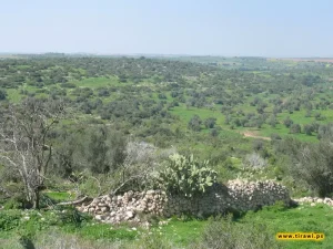
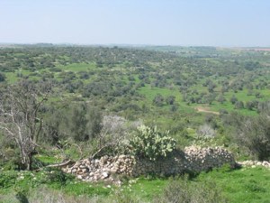
In Walid Khalidi's field description, only a few deserted houses and the rubble of other homes remained.
One surviving concrete house had rectangular windows and a flat roof and bore Arabic writing while standing amid tall wild grasses and weeds.
A fenced cave was also visible, while surrounding land was under cultivation.
PalQuest dates one field photograph of the village site to May 1987. This documentation formed part of the field research for All That Remains, carried out between 1987 and 1990 before the book's publication in 1992.
The description therefore does not constitute direct comprehensive field verification of all former Dayr Nakhkhas lands in 2026, although later Palestinian photographs and community documentation help preserve evidence of the site and village memory.
Sources
- PalQuestPalQuest – Dayr Nakhkhas
- PalQuestPalQuest – Operation Yoav
- Palestine RememberedPalestine Remembered – Dayr Nakhkhas, Hebron District
- Palestine RememberedPalestine Remembered – Dayr Nakhkhas entry from Walid Khalidi's All That Remains
- Institute for Palestine StudiesInstitute for Palestine Studies – Walid Khalidi, All That Remains
- palqura.comPalestinian Villages Encyclopedia – Dayr Nakhkhas; supplementary Palestinian documentation on boundaries and archaeological sites
- pal48.psOur Palestine – Dayr Nakhkhas; supplementary Palestinian documentation
- PalQuestPalQuest – All That Remains: Methodology and Field Research
Photo gallery
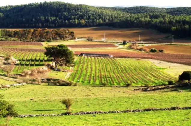
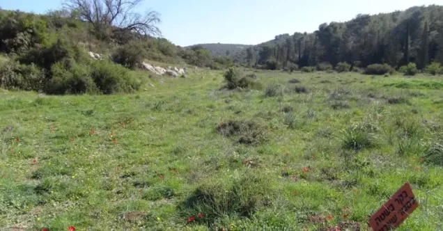
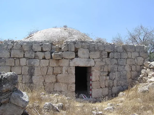
Photos from the village's people
Photos sent in by visitors and published after review.
Add a photo of this village
Log in to add photos of this village.

More from the archive
 Download Our Palestine App
The whole archive in the palm of your hand: depopulated villages, the Nakba, the massacres and Al-Aqsa — free, with no ads to erase the story.
Download Our Palestine App
The whole archive in the palm of your hand: depopulated villages, the Nakba, the massacres and Al-Aqsa — free, with no ads to erase the story.



Comments
No comments yet — be the first to write one.
Add your comment
Name and email are optional. Comments appear after review.