
The depopulated village of Al-Samakiyya / District of Tiberias

Al-Samakiyya
About the depopulated village of Al-Samakiyya
- District
- Tiberias
- Date Al-Samakiyya was occupied
- 04 May 1948
- Population in 1948
- 440
- Military operation
- Operation Yiftach
- Distance from the governorate centre
- 11 (km) Northeast of Tiberias
- Elevation above sea level
- 200 m
- Cause of displacement
- Expulsion by Zionist troops
- Extent of destruction
- al-Samakiyyan was completely obliterated and defaced.
- Ethnic cleansing
- al-Samakiyya inhabitants were completely ethnically cleansed.
Hover a dot to read the village name, or click to open its card.
Borders of the depopulated village of Al-Samakiyya
al-Samakiyya ('Arab al-Samakiyya / Tall Hum): A Depopulated Palestinian Village in the Tiberias District
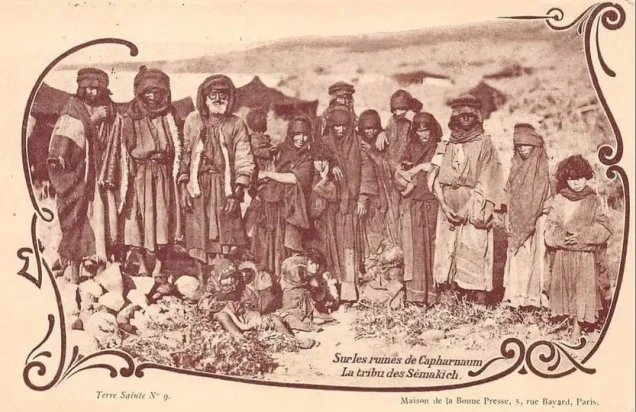
al-Samakiyya, also known as 'Arab al-Samakiyya, was a Palestinian village in the Tiberias District. It stood in a volcanic area on the northern shore of Lake Tiberias, approximately 11 km northeast of Tiberias and about 200 metres below sea level. The village was also closely associated in local memory with Tall Hum, the nearby archaeological site of Roman-Byzantine Capernaum. Its Palestinian inhabitants were displaced during the Nakba and the occupation of Palestine in 1948, on 4 May, during Operation Matate (“Broom”), a sub-operation of Operation Yiftach.
Location of al-Samakiyya
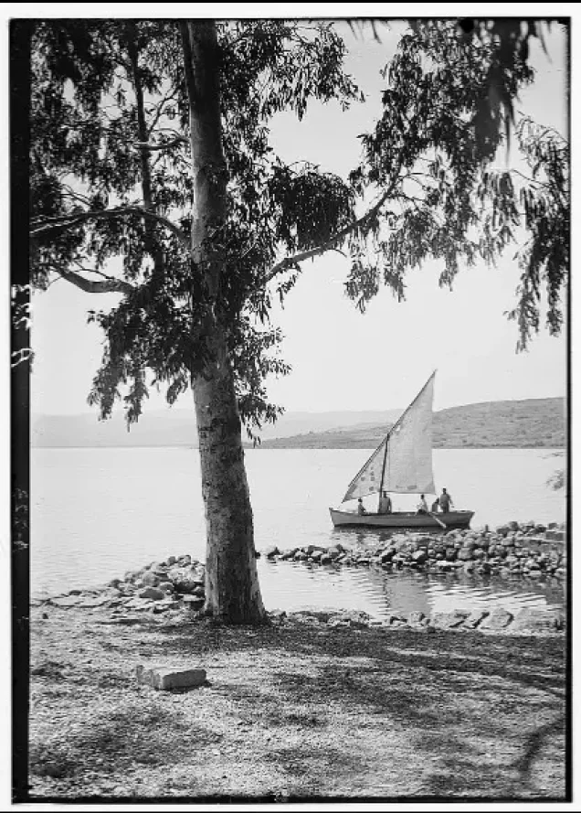
al-Samakiyya stood in a volcanic area on the northern shore of Lake Tiberias.
It was approximately 11 km northeast of Tiberias and had an average elevation of about 200 metres below sea level.
A secondary road connected the village with the highway running along the lakeshore toward Tiberias.
The dwellings of 'Arab al-Samakiyya were scattered irregularly southwest of Wadi al-Wadabani rather than forming a compact village core.
Nearby Palestinian communities included al-Tabigha, 'Arab al-Shamalina, al-Zanghariyya, al-Qudayriyya, and Jubb Yusuf, while Lake Tiberias bordered the area to the south.
al-Samakiyya, 'Arab al-Samakiyya, and Tall Hum
Walid Khalidi and PalQuest use al-Samakiyya as the principal village name and identify it also as 'Arab al-Samakiyya, after the Bedouin tribe that inhabited the area.
Tall Hum, by contrast, is historically the name given to the nearby archaeological remains of Roman-Byzantine Kefar Nachum, or Capernaum.
Although Tall Hum and the modern Palestinian Bedouin settlement are not historically identical entities, the name Tall Hum became widely used by villagers and in local memory to refer to the village and surrounding area.
The administrative overlap is also reflected in the 1931 census figures, which explicitly state that the population and house counts for al-Samakiyya include Tall Hum.
Capernaum and the Historical Site
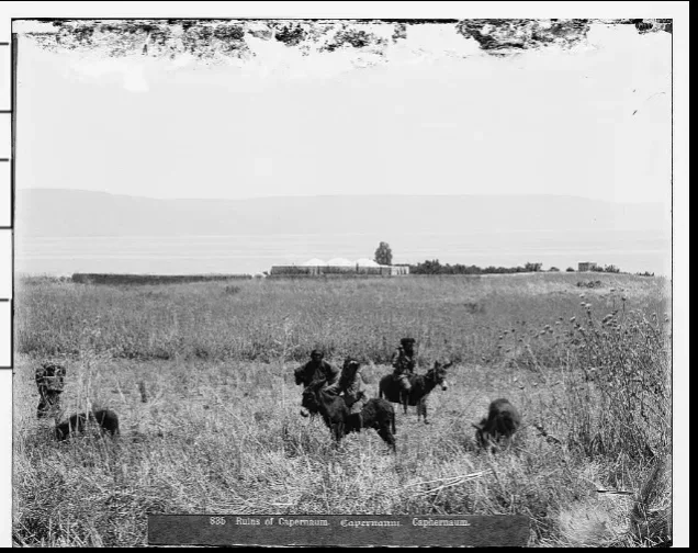
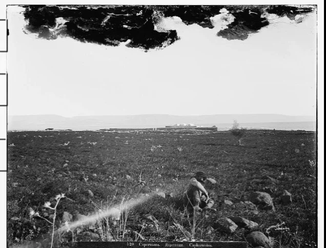
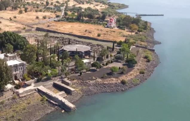
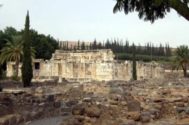
al-Samakiyya was built near the ruins of the Roman-Byzantine town of Kefar Nachum, known in Latin as Capernaum and later as Tall Hum.
The historian Josephus described the area along the northern shore of Lake Tiberias as fertile agricultural land associated with Capharnaum.
Capernaum also holds major significance in Christian tradition as one of the principal places associated with the life of Jesus after his departure from Nazareth.
The ancient town should nevertheless be distinguished from the modern Palestinian community of 'Arab al-Samakiyya, despite their geographic proximity and the overlap in local naming and Mandate-era statistics.
Architecture of al-Samakiyya
The village had no regular settlement pattern. Its dwellings were dispersed southwest of Wadi al-Wadabani.
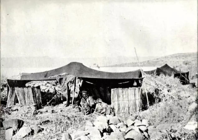
Some households lived in Bedouin tents made of goat hair, while others occupied permanent houses built of stone and mud, stone and cement, or concrete.
In the nineteenth century, American biblical scholar Edward Robinson noted that the small al-Samakiyya tribe used some houses in Abu Shusha to the southwest as storage places.
Religion and Religious Sites
In 1944/45, al-Samakiyya had 380 inhabitants: 330 Muslims and 50 Christians.
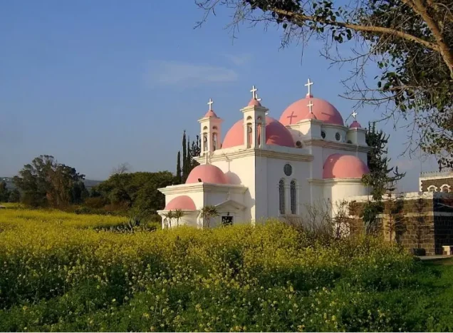
Several Christian religious institutions stood on the hills between al-Samakiyya and neighboring al-Tabigha, including an Italian monastery, a Franciscan church, and a Greek Orthodox church.
The nearby Khirbat al-Mubaraka was also associated with the Christian tradition of the Sermon on the Mount.
Khalidi describes these churches and monasteries as lying on the hills between al-Samakiyya and al-Tabigha; they should not all be treated as institutions located inside the residential core of 'Arab al-Samakiyya itself.
Education in al-Samakiyya
The principal approved sources used here do not provide sufficiently documented information concerning an independent school in al-Samakiyya before the Nakba.
No unverified educational details are therefore added.
Economic Life in al-Samakiyya
The villagers depended primarily on livestock raising and agriculture, especially cereal cultivation.
In 1944/45, 4,034 dunums were devoted to cereals, 66 dunums were irrigated or used for plantations, and only 2 dunums were devoted to citrus and bananas.
Palestine Remembered separately records 50 dunums of olive groves. This figure is treated as a detail within the agricultural and plantation categories rather than added again to the cultivable-land total.
The pastoral character of 'Arab al-Samakiyya made livestock raising an important part of the village economy.
Land Ownership in al-Samakiyya
The total registered land area of al-Samakiyya was 10,526 dunums in the 1944/45 statistics.
Land ownership in al-Samakiyya, 1944/45, using the terminology of Palestine Remembered
- Palestinian10,474 dunums100%
- Transferred to Zionists0 dunums0%
- Communal52 dunums<1%
No land was recorded under the category “Transferred to Zionists” in the 1944/45 ownership statistics.
Land Use in al-Samakiyya, 1944/45
Land use in al-Samakiyya according to PalQuest's detailed statistics
- Palestinian
- Communal/Public
- Citrus and bananas2 dunums
- Plantations and irrigable land66 dunums
- Cereals4,034 dunums
- Non-cultivable / remaining classified land6,424 dunums
A total of 4,102 dunums, approximately 39 percent of the village lands, was cultivated or cultivable.
The remaining 6,424 dunums, approximately 61 percent, were classified as non-cultivable or within the residual non-cultivated category: 6,372 Palestinian dunums and 52 communal/public dunums.
Palestine Remembered places all 6,424 dunums in its Palestinian column, while PalQuest's detailed table separates 52 dunums as public land. The communal/public category is therefore shown separately above.
The detailed PalQuest table does not provide a distinct built-up-area figure, so no separate built-up acreage is invented.
Population of al-Samakiyya
Population of al-Samakiyya in selected years
- 1922193Official Mandate census figure as reproduced by Palestine Remembered
- 1931290Official Mandate census; includes Tall Hum
- 1944/45380Official statistics: 330 Muslims and 50 Christians
- 1948441Later estimate published by Palestine Remembered
- Estimated refugees in 19982,707Later estimate published by Palestine Remembered
Number of Houses in al-Samakiyya
Number of houses in al-Samakiyya
- 193160Includes Tall Hum
The principal approved sources used here do not provide a verified official house count for 1948.
Archaeological Remains at al-Samakiyya and Tall Hum
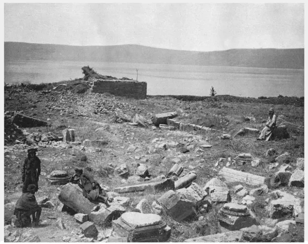
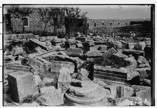
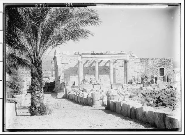
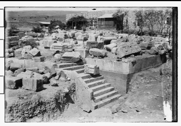
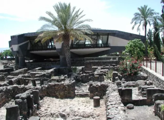
al-Samakiyya lay beside one of the most significant archaeological and historical areas on the northern shore of Lake Tiberias: Capernaum, or Tall Hum.
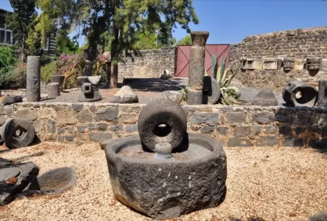
The wider area contains ancient walls, tombs, presses, and religious buildings from different historical periods.
Khirbat al-Mubaraka is also located on the nearby hills and is associated with Christian religious traditions and historic ecclesiastical buildings.
It is important to distinguish these ancient remains and religious sites from the Palestinian houses and Bedouin dwellings of 'Arab al-Samakiyya that existed in the area until the Nakba.
Operation Matate (“Broom”)
al-Samakiyya lay within the area targeted by Operation Matate, or “Broom,” on 4 May 1948.
Matate was a sub-operation of Operation Yiftach, launched by the Palmach between 15 April and 25 May 1948 to seize control of eastern Galilee before the end of the British Mandate.
PalQuest states that the broader Operation Yiftach aimed to depopulate eastern Galilee of its Palestinian inhabitants and that the Palmach's First Battalion spearheaded the larger operation.
Operation Matate specifically targeted the area between Lake Hula and Lake Tiberias and along the Jordan Valley, with the objective of expelling Palestinian inhabitants, demolishing dwellings, and creating a wide territorial corridor under Zionist control.
Occupation and Depopulation of al-Samakiyya during the Nakba
On 4 May 1948, 'Arab al-Samakiyya was attacked and displaced in the course of Operation Matate (“Broom”).
Walid Khalidi reproduces an account stating that Israeli forces expelled the Bedouin 'Arab al-Samakiyya tribe from the area and that the operation aimed at removing local inhabitants and destroying their homes.
Testimony from neighboring al-Tabigha provides additional context. Villagers from al-Tabigha later recalled that they first fled to al-Samakiyya, whose inhabitants possessed five rifles and believed they could defend themselves.
On 4 May they saw smoke rising from al-Tabigha, and later armored vehicles approached al-Samakiyya. As the destruction of al-Tabigha became clear, panic spread and villagers fled toward Syria while attacking forces fired over their heads, according to testimony reproduced by Khalidi.
The displacement of al-Samakiyya should therefore not be described as a spontaneous population movement. It occurred during a military operation whose stated purpose included expelling Palestinian inhabitants from the area.
The dedicated al-Samakiyya entry does not identify a specific Palmach battalion as the village-level occupying unit, however, so no such unit is asserted without direct evidence.
- Occupation and depopulation date: 4 May 1948.
- Military operation: Operation Matate (“Broom”).
- Wider operational framework: Operation Yiftach.
- Principal force in Operation Yiftach overall: Palmach; its First Battalion spearheaded the broader operation.
- Village-specific occupying battalion: not identified in the dedicated village entry.
- Cause of depopulation: expulsion during the military operation.
- Destination of at least part of the displaced population: toward Syria, according to regional testimony.
Israeli Settlements on al-Samakiyya's Lands
Several Israeli settlements and facilities were established on al-Samakiyya's lands decades after the Nakba:
- Amnon: established in 1983 on village land, approximately 2 km north of the site.
- Korazim: established in 1983 on al-Samakiyya's lands.
- Wered ha-Galil: a private farm established in 1983 on village land.
The principal sources used here do not identify a civilian Israeli settlement established directly on al-Samakiyya's lands in the immediate years after 1948.
al-Samakiyya Today
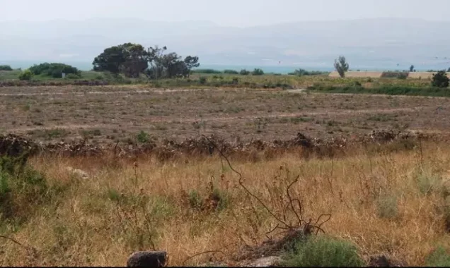
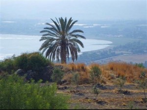
According to the field description published by Walid Khalidi in All That Remains, wild vegetation covered much of the former village site.
Piles of basalt stones were scattered across the site, marking the remains of the destroyed Palestinian dwellings, while several date palm trees also survived.
Part of the surrounding land was used as pasture, while other areas were planted with walnut trees and other fruit trees.
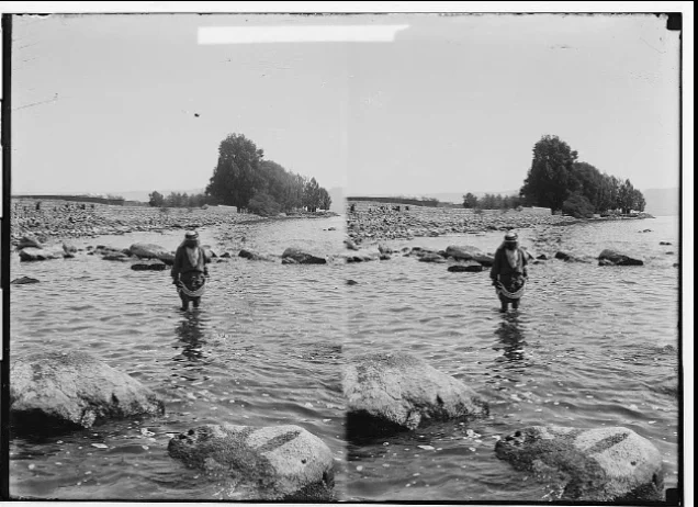
Palestine Remembered preserves later user-contributed photographs and community material showing the lands of al-Samakiyya, Tall Hum, Lake Tiberias, and various historical remains.
These contributions are useful historical and community documentation but do not constitute a systematic independent contemporary field survey.
The principal site description therefore remains Khalidi's field account published in 1992. The approved sources used here do not provide a sufficiently comprehensive independent 2026 survey to verify the precise condition of every surviving feature of al-Samakiyya today.
Sources
- PalQuestPalQuest – Interactive Encyclopedia of the Palestine Question: al-Samakiyya / 'Arab al-Samakiyya
- PalQuestPalQuest – Operation Yiftach
- Palestine RememberedPalestine Remembered – al-Samakiyya, Tiberias District
- Palestine RememberedPalestine Remembered – al-Samakiyya entry from All That Remains
- Institute for Palestine StudiesInstitute for Palestine Studies – All That Remains, Walid Khalidi
Photo gallery







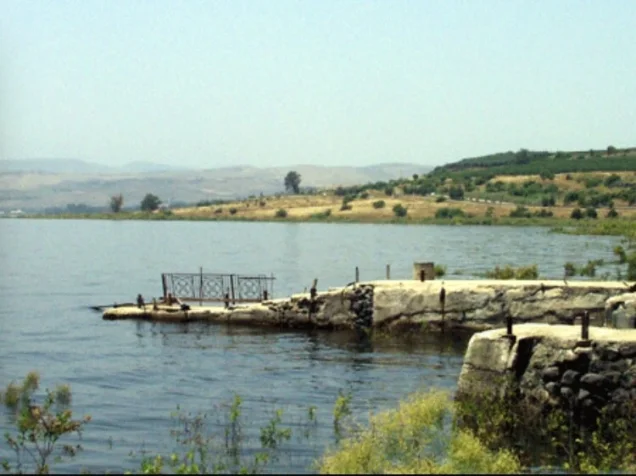
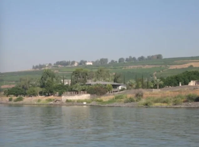
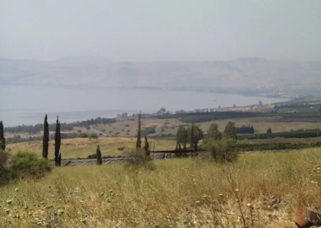
Photos from the village's people
Photos sent in by visitors and published after review.
Add a photo of this village
Log in to add photos of this village.
Other villages from Tiberias

More from the archive


 Download Our Palestine App
The whole archive in the palm of your hand: depopulated villages, the Nakba, the massacres and Al-Aqsa — free, with no ads to erase the story.
Download Our Palestine App
The whole archive in the palm of your hand: depopulated villages, the Nakba, the massacres and Al-Aqsa — free, with no ads to erase the story.



Comments
No comments yet — be the first to write one.
Add your comment
Name and email are optional. Comments appear after review.