
The depopulated village of Al-Manara / District of Tiberias

Al-Manara
About the depopulated village of Al-Manara
- District
- Tiberias
- Date Al-Manara was occupied
- 02 March 1948
- Population in 1948
- 570
- Brigade that carried it out
- Haganah
- Distance from the governorate centre
- 5 (km) South of Tiberias
- Elevation above sea level
- 225 m
- Cause of displacement
- Expulsion by Zionist troops
- Extent of destruction
- al-Manara was completely obliterated and defaced.
- Ethnic cleansing
- al-Manara inhabitants were completely ethnically cleansed.
- Settlements built on the built-up area of Al-Manara after 1948
- Poria Hospital
Hover a dot to read the village name, or click to open its card.
Borders of the depopulated village of Al-Manara
al-Manara ('Arab al-Manara) – Tiberias Subdistrict
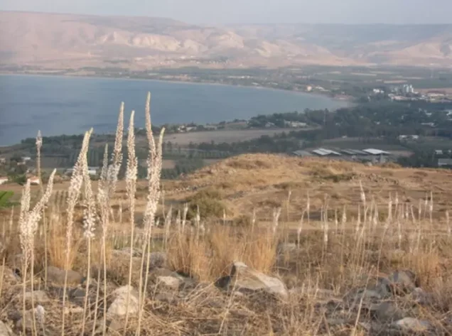
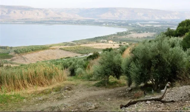
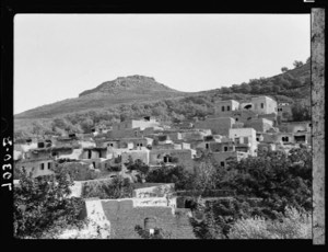
Al-Manara, also known as 'Arab al-Manara, was a depopulated Palestinian village in the Tiberias subdistrict. It stood on a hilltop overlooking Lake Tiberias in lower eastern Galilee, approximately 5 km south of the city of Tiberias and at an average elevation of about 225 meters above sea level.
The official 1931 Census of Palestine recorded 214 inhabitants, while the 1944/45 statistics recorded 490. The village's land statistics were combined with those of neighboring Nasir al-Din into a single unit totaling 6,797 dunums.
Haganah forces attacked al-Manara in early March 1948. Eyewitness testimony collected by Palestinian historian Nafez Nazzal specifically dates the assault to 2 March. The villagers were expelled, some houses were destroyed, and the attack became an early step in isolating Tiberias from its Palestinian hinterland to the south.
Location of al-Manara
Al-Manara stood on a hilltop overlooking Lake Tiberias in lower eastern Galilee. Northeast of the village, a steep escarpment descended toward the lakeshore, while a gently sloping plain extended to the south.
A secondary road linked the village with a main road running northwest toward Tiberias.
Nasir al-Din, which Khalidi describes as al-Manara's twin village, lay approximately 3 km to the northwest.
Neighboring Villages and Areas
Palestinian local documentation and village maps place al-Manara within the following geographical surroundings:
| Direction | Village / Area |
|---|---|
| North | Tiberias and its surroundings |
| Northwest | Nasir al-Din, approximately 3 km away |
| West | Lubya |
| South | al-'Ubaydiyya |
| Southeast | Samakh and its surrounding area |
| East | Lake Tiberias |
These locations describe the village's geographical surroundings and should not automatically be treated as exact cadastral boundaries without reference to original land-demarcation maps.
Name and Earlier History
Walid Khalidi suggests that the name al-Manara may have derived from Kefar Menori, a settlement that occupied the same locality during the Roman period.
The site was known as Menan during the Crusader period.
This identification is a historical and archaeological possibility rather than proof of uninterrupted settlement by the same population from the Roman period to the modern Palestinian village.
Archaeological Remains
The village itself occupied an archaeological site containing the ruins of older houses.
Additional archaeological remains were recorded at nearby Khirbat al-Manara and Khirbat Sarjuna.
The principal sources reviewed do not securely date every surviving feature, and the remains should not all be assigned to a single historical period without specialized archaeological study.
Built Environment
Al-Manara was a small and relatively compact village. Its built-up area was roughly square and its houses stood close together.
The official 1931 census recorded 33 occupied houses.
The 1944/45 built-up land category was combined statistically with Nasir al-Din, so the full land-use figure should not be attributed exclusively to al-Manara's physical built-up area.
Population of al-Manara
- 1922122Official Census of Palestine: 121 Muslims and 1 Jew
- 1931214Official Census of Palestine; all Muslims, living in 33 occupied houses
- 1944/45490Official statistics for al-Manara itself; Nasir al-Din was separately recorded with 90 inhabitants
- 1948568Later estimate published by Palestine Remembered; not an official census
- 19983,491 refugees and descendantsLater demographic estimate published by Palestine Remembered
Palestine Remembered gives a 1945 figure of 580. This does not represent al-Manara alone: the official statistics record 490 for al-Manara and 90 for Nasir al-Din, producing 580 only if the two village populations are added together.
The village-specific official figure used here is therefore 490.
Number of Houses
- 193133Official Census of Palestine
- 194887Later Palestine Remembered estimate; not an official census figure
Land Ownership: al-Manara and Nasir al-Din Combined
The land statistics require particular caution because the 1944/45 records combined al-Manara and Nasir al-Din into a single land unit.
The combined area totaled 6,797 dunums.
Using Palestine Remembered's simplified terminology:
- Palestinian4,185 dunums62%
- Transferred to Zionists1,410 dunums21%
- Communal/Public1,202 dunums18%
The official categories are Arab, Jewish, and Public, with the same respective figures of 4,185, 1,410, and 1,202 dunums.
These land figures apply to al-Manara and Nasir al-Din together and must not be presented as the land area of al-Manara alone.
Land Use in 1944/45: al-Manara and Nasir al-Din Combined
- Arab
- Jewish
- Public
- Cereals5,555 dunums
- Built-up land187 dunums
- Non-cultivable land1,055 dunums
The categories balance exactly with the official ownership totals.
This also corrects a presentation problem in Palestine Remembered, where 4,320 dunums of cereals appear under the Palestinian category. The official breakdown shows that this figure combines 4,172 Arab dunums with 148 Public dunums.
Likewise, 1,054 dunums of non-cultivable land were Public land, while only one dunum in that category was Jewish-owned.
Economic Life in al-Manara
The inhabitants depended on agriculture and livestock breeding.
The principal crops documented by Khalidi were cereals, watermelons, and tobacco. In 1944/45, 4,172 Arab dunums within the combined al-Manara–Nasir al-Din land unit were devoted to cereals.
Later Palestinian local documentation also mentions fishing in Lake Tiberias. Since Khalidi's core village entry emphasizes agriculture and livestock, fishing is best treated as supplementary local evidence rather than the principal documented livelihood.
Water Sources
Several springs were located near al-Manara, including a group of hot springs approximately 1.5 km northeast of the village on the shore of Lake Tiberias.
Palestinian local documentation also records 'Ayn al-Qasab north of the village and several wadis associated with the local drainage system, including Wadi al-Basas, Wadi al-Qasab, Wadi al-Dalba, Wadi al-Wasi', and Wadi al-Jardun.
These details help reconstruct the village environment while distinguishing between the core Khalidi account and later Palestinian geographical documentation.
Education and Services
Khalidi's village entry does not document a formal school in al-Manara.
The Palestinian Encyclopedia states that the village lacked formal public services, which is consistent with the absence of a documented government school or other public institution.
No school, founding date, or enrollment figure has therefore been inferred without supporting evidence.
Religious Life
The 1931 census recorded all of al-Manara's inhabitants as Muslims, and the 1945 statistics listed its population in the Arab category.
The principal village sources reviewed do not provide securely documented information about a mosque or a named shrine within the village, so none has been added without evidence.
al-Manara before the Nakba
Al-Manara's position south of Tiberias gave it military importance because it overlooked approaches to the city from the south.
As fighting intensified in early 1948, the Haganah increasingly targeted villages in the hinterlands of Palestinian cities in order to isolate those cities and weaken the morale of their inhabitants.
Al-Manara became one of the earliest villages in the Tiberias area to be attacked in this context, more than a month before the city itself fell.
Occupation and Depopulation of al-Manara
Khalidi dates the fall of al-Manara generally to early March 1948 during an attack that served as a prelude to the eventual capture of Tiberias.
Palestine Remembered lists 1 March 1948 in its summary data. Eyewitnesses interviewed by Palestinian historian Nafez Nazzal, however, specifically dated the Haganah assault to 2 March 1948.
According to those testimonies, Haganah soldiers expelled the villagers, destroyed some houses, and left leaflets warning the inhabitants not to return because the village had been mined.
The most accurate formulation is therefore that al-Manara was attacked and depopulated in early March 1948, with eyewitness testimony specifically dating the assault to 2 March, rather than treating 1 March as an unquestionably exact date.
The Attack and the Isolation of Tiberias
The assault on al-Manara was directly connected to the struggle over Tiberias.
Its capture cut an important southern approach to the city and contributed to a growing sense of encirclement and demoralization among Tiberias's Palestinian population.
It was thus an early step in isolating the city from its Palestinian hinterland. Tiberias itself did not fall until 18 April 1948.
Military Unit
The military organization securely identified in the attack on al-Manara is the Haganah.
Khalidi's village-specific account does not name a particular brigade or battalion.
The attack should therefore not automatically be attributed to the Golani Brigade merely because Golani later attacked nearby Nasir al-Din in April 1948. The two village assaults occurred more than a month apart and the sources do not justify transferring the unit identification from one village to the other.
Occupation Chronology
- Early 1948
Growing military pressure around Tiberias
The Haganah increasingly targeted villages around Tiberias as part of efforts to isolate the city from its Palestinian hinterland.
- 1 March 1948
Palestine Remembered summary date
This date appears in the site's summary box but is less precise than the eyewitness account preserved by Nafez Nazzal.
- 2 March 1948
Haganah assault
Eyewitness testimony collected by Nafez Nazzal identifies this as the date of the attack.
- 2 March 1948
Expulsion of the villagers
Witnesses stated that Haganah soldiers drove the inhabitants from the village and destroyed some houses.
- Immediately after the attack
Warning against return
Leaflets were reportedly left warning residents not to return and claiming that the village had been mined.
- March–April 1948
Further isolation of Tiberias
The loss of al-Manara helped cut Tiberias off from the south and increased pressure on its Palestinian inhabitants.
- 18 April 1948
Fall of Tiberias
The Palestinian population of the city was displaced more than a month after the attack on al-Manara.
- Later; exact date not established
Destruction of al-Manara
Most of the village site was eventually levelled, although no single documented demolition date is provided by the core source.
Refugees from al-Manara
Palestine Remembered estimates al-Manara's population in 1948 at approximately 568. This is a later demographic estimate rather than an official British Mandate census figure.
The same source estimates that refugees from the village and their descendants numbered approximately 3,491 in 1998.
Israeli Settlements on al-Manara Village Lands
Walid Khalidi and PalQuest state that no Israeli settlement was established on al-Manara's village lands.
Khalidi identifies Poriyya, established in 1949 to the south, as the closest settlement but does not classify it as being built on al-Manara land.
Some later Palestinian reference works differ in identifying nearby settlements. This article retains the more cautious village-specific conclusion of Khalidi and PalQuest unless original cadastral evidence establishes otherwise.
al-Manara Today
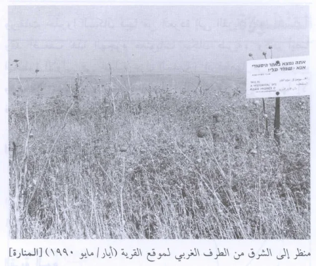
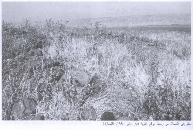
In Walid Khalidi's field description, the village site had been levelled and was strewn with pieces of black stone.
Dark stone walls remained at the northern edge of the site, with doum palms growing among them.
A multilingual sign identified the location as an archaeological site and asked visitors to protect it.
This description does not constitute direct field verification of conditions in 2026. It derives from the fieldwork conducted for All That Remains before the book's publication in 1992.
Palestine Remembered also hosts later community photographs and documentation of the site, which are useful for tracing subsequent changes but do not by themselves constitute a comprehensive contemporary field survey of all former village lands.
Sources
- PalQuestPalQuest – al-Manara
- Palestine RememberedPalestine Remembered – al-Manara, Tiberias District
- Palestine RememberedPalestine Remembered – al-Manara entry from Walid Khalidi's All That Remains
- Institute for Palestine StudiesInstitute for Palestine Studies – Walid Khalidi, All That Remains
- Institute for Palestine StudiesInstitute for Palestine Studies – document including 1948 population figures for the Tiberias-area villages
- users.cecs.anu.edu.auGovernment of Palestine – Census of Palestine 1922
- all4palestine.orgGovernment of Palestine – Census of Palestine 1931
- palqura.comGovernment of Palestine – Village Statistics, April 1945
- palestinapedia.psPalestinian Encyclopedia – al-Manara
- palqura.comPalestinian Villages Encyclopedia – al-Manara / 'Arab al-Manara; local documentation on boundaries and water sources
- PalQuestPalQuest – All That Remains: Methodology and Field Research
Photo gallery

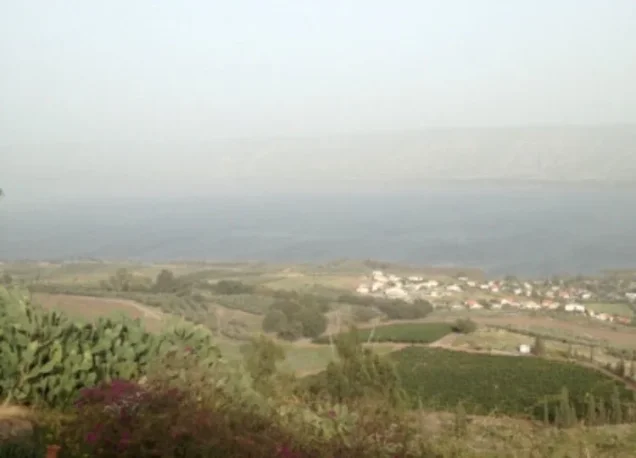
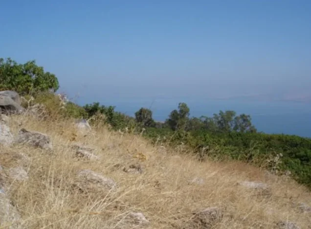
Photos from the village's people
Photos sent in by visitors and published after review.
Add a photo of this village
Log in to add photos of this village.
Other villages from Tiberias
More from the archive


 Download Our Palestine App
The whole archive in the palm of your hand: depopulated villages, the Nakba, the massacres and Al-Aqsa — free, with no ads to erase the story.
Download Our Palestine App
The whole archive in the palm of your hand: depopulated villages, the Nakba, the massacres and Al-Aqsa — free, with no ads to erase the story.



Comments
No comments yet — be the first to write one.
Add your comment
Name and email are optional. Comments appear after review.