
The depopulated village of 'Awlam / District of Tiberias

About the depopulated village of 'Awlam
- District
- Tiberias
- Date 'Awlam was occupied
- 12 May 1948
- Population in 1948
- 840
- Brigade that carried it out
- Golani Brigade
- Elevation above sea level
- 250 m
- Cause of displacement
- Abandonment based on Arab orders
- Extent of destruction
- 'Awlam was completely obliterated defaced.
- Ethnic cleansing
- 'Awlam inhabitants were completely ethnically cleansed.
Hover a dot to read the village name, or click to open its card.
Borders of the depopulated village of 'Awlam
‘Awlam (‘Ulam) – Depopulated Palestinian Village of the Tiberias District
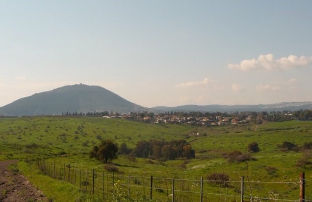
‘Awlam, also known as ‘Ulam, was a depopulated Palestinian village in the Tiberias District. It stood on the slopes of Wadi ‘Awlam in Lower Galilee, approximately 15 kilometers southwest of Tiberias, at an average elevation of about 250 meters above sea level.
Units of the Haganah's Golani Brigade entered and occupied the village on 12 May 1948 during the broader offensive that coincided with the occupation of Baysan and the villages of Sirin, Hadatha, and Ma'dhar, in the wider context of Operation Gideon. The inhabitants of ‘Awlam were displaced during the Nakba and the 1948 occupation of Palestine.
Location and Geography
‘Awlam was situated on the slopes of Wadi ‘Awlam, a tributary of Wadi al-Bira, and faced northwest. A secondary road connected it with the main road leading toward Tiberias and neighboring villages.
The village lay approximately 15 kilometers southwest of Tiberias in direct distance. Some sources give a distance of about 26 kilometers by the Hadatha–Kafr Kama road; this represents a road distance rather than the direct distance from the district capital.
Its lands adjoined those of several villages. Hadatha lay to the north, Ma'dhar to the west, Sirin to the south, and al-Dalhamiyya to the east. The area formed part of the uplands linking Lower Galilee with the Baysan Valley.
Name and Historical Site
The principal Arabic form of the village name is ‘Awlam, while ‘Ulam is also recorded as an alternative name. Researchers have identified the site with the important Roman settlement of Oulamma, later referred to as Heulem in Crusader sources.
In 1596, ‘Awlam was a village in the nahiya of Tiberias in the liwa' of Safad, with an estimated population of 83. Its inhabitants paid taxes on crops including wheat and barley, as well as on other forms of production and property such as goats and beehives.
In the late nineteenth century, ‘Awlam was described as a village built of adobe on elevated ground and inhabited by approximately 120 people. The extensive reuse of older building stones and the presence of earlier structural remains indicate that the modern village occupied at least part of an older settlement site.
Population and Houses
The inhabitants of ‘Awlam were Muslims, and the population included members of the Bedouin group known as Arab al-Muwaylhat. Official Mandate figures record substantial population growth during the first half of the twentieth century.
- 159683Historical Ottoman figure, not a British Mandate census
- Late nineteenth centuryAbout 120Historical estimate from a contemporary village description
- 1922496Official Mandate census
- 1931555Official census; includes Arab al-Muwaylhat
- 1945720Official statistics
- 1948About 835Later estimate, not an official British census
- 1998About 5,129 refugees and descendantsLater estimate published by Palestine Remembered
The 1931 census recorded 139 houses. Like the population figure for that census, however, the house count includes Arab al-Muwaylhat and therefore should not automatically be treated as the number of houses within the compact village core alone.
Built Environment
During the Mandate period, the village had an irregular plan, with its longest axis extending from east to west. Most houses stood close together and were constructed of stone and adobe brick, with roofs made of timber and reeds covered with mud. A small number of buildings were constructed of stone and cement or reinforced concrete.
The official 1944/45 land-use table records 50 dunams as built-up land: 28 dunams in the Arab category and 22 in the Jewish category. Mustafa Murad al-Dabbagh, as reproduced by the Palestinian Encyclopedia, separately gives the “village area” as 58 dunams in 1945. These figures appear to represent different statistical concepts and should not be merged.
Mosque and Education
‘Awlam had a mosque serving its Muslim population. It also had a boys' elementary school founded during the Ottoman period, but the school was closed during the British Mandate.
The principal historical sources reviewed do not provide reliable evidence for a church in the village. Walid Khalidi specifically describes the villagers as Muslims, and the unsupported church entry found in one online database has therefore not been adopted.
Water Resources
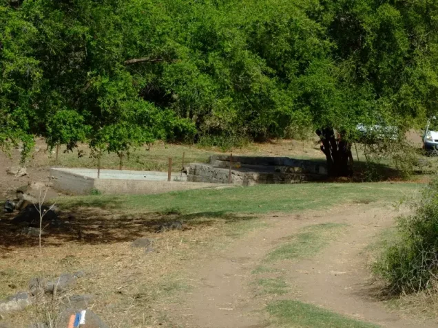
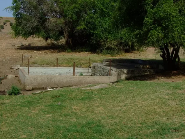
The villagers obtained drinking and domestic water from springs. Walid Khalidi records more than six springs used by the inhabitants, while the Palestinian Encyclopedia specifically identifies ‘Ayn ‘Awlam as an important source of domestic water.
The presence of these springs contributed to both settlement and agricultural activity. The principal sources, however, do not provide a single consistent list of the names of all the springs, so additional names found only in secondary local compilations are not presented here as established facts.
Economic Life and Agriculture
Agriculture and livestock raising were the principal foundations of the village economy. Grain was the dominant crop, while villagers also cultivated summer vegetables and fruit trees, including figs, grapes, and pomegranates.
Fruit orchards were concentrated north, northwest, and west of the village. In 1944/45, 6,623 dunams of Arab-owned land were allocated to cereals and 202 dunams to plantations or irrigable land.
The Palestinian Encyclopedia records approximately 410 dunams planted with olive trees in the 1942/43 season, of which about 200 dunams were productive. This is a crop-specific figure from a different agricultural season and must not be added again to the balanced 1944/45 land-use totals.
Land Ownership, 1944/45
The total land area of ‘Awlam was 18,546 dunams. Using the categories of the official Government of Palestine statistics, ownership was distributed as follows:
- Arab10,816 dunums58%
- Jewish7,725 dunums42%
- Public5 dunums<1%
Palestine Remembered presents the same ownership figures using its simplified terminology: 10,816 dunams “Palestinian,” 7,725 dunams “Transferred to Zionists,” and 5 dunams “Communal/Public.” The phrase “Transferred to Zionists” has been retained because it is the terminology used by that source and should not be silently replaced with “Jewish ownership.”
Land Use, 1944/45
- Arab
- Jewish
- Public
- Cereals11,139 dunums
- Plantations and irrigable land360 dunums
- Total cultivable/cultivated land11,499 dunums
- Non-cultivable land6,997 dunums
- Built-up land50 dunums
- Total non-cultivable and built-up7,047 dunums
The official table balances exactly: 11,499 dunams of cultivable or cultivated land plus 7,047 dunams of non-cultivable and built-up land equal the village's total land area of 18,546 dunams.
Archaeology
‘Awlam was an archaeologically significant site. Researchers have identified it with the Roman settlement of Oulamma, later known as Heulem in Crusader sources. Older architectural remains were found in and around the village, and ancient building stones were frequently reused in more recent structures.
This identification does not mean that all archaeological remains belong to a single historical period. The site experienced successive periods of occupation, and individual remains should therefore be dated cautiously.
Occupation and Depopulation
Walid Khalidi records conflicting accounts concerning the beginning of the villagers' displacement. Israeli military intelligence claimed that the Arab Higher Committee had ordered the inhabitants to leave on 6 April 1948, allegedly because it feared that they might assist the Zionists.
Khalidi points out, however, that this allegation is contradicted by the account he cites from the History of the Haganah. According to that account, units of the Golani Brigade entered ‘Awlam on 12 May 1948 and the villagers left in fear of the Jewish forces. The claim that the village was simply evacuated on Arab orders therefore cannot be treated as an established explanation for its depopulation.
During the same assault, Haganah forces seized Sirin in the Baysan District and Hadatha and Ma'dhar in the Tiberias District. Khalidi's account states that the operation left this part of Lower Galilee emptied of its Arab population.
‘Awlam and Operation Gideon
Operation Gideon was carried out by the Golani Brigade from 10 to 15 May 1948. Its principal objective was the conquest of the Baysan Valley, including Baysan itself, and the displacement of the Palestinian population of the area.
The dedicated PalQuest page for ‘Awlam does not explicitly name Operation Gideon, and ‘Awlam is not included in the short affected-villages list on PalQuest's dedicated Operation Gideon page. However, PalQuest's overall chronology places the capture of ‘Awlam, Hadatha, and Ma'dhar on 12 May within the military sequence initiated by Operation Gideon on 10 May and the capture of Baysan on 12 May.
The most careful formulation is therefore that ‘Awlam was occupied on 12 May 1948 by units of the Golani Brigade during the broader offensive associated with Operation Gideon and the conquest of the Baysan–Lower Galilee area, while noting that the operation-specific village list does not explicitly name ‘Awlam.
The village-specific sources do not identify a particular Golani battalion as the unit that entered ‘Awlam. The brigade can therefore be established, but assigning the village's capture to a specific battalion would go beyond the available evidence.
Occupation Chronology
- 6 April 1948
Disputed early evacuation claim
Khalidi records an Israeli military intelligence claim that the Arab Higher Committee ordered the villagers to leave, but notes contradictory evidence; the claim is therefore not treated as an established cause of depopulation.
- 10 May 1948
Beginning of Operation Gideon
The Golani Brigade launched Operation Gideon to conquer the Baysan Valley and depopulate its Palestinian communities.
- 12 May 1948
Capture of Baysan
Golani forces took Baysan during Operation Gideon.
- 12 May 1948
Occupation of ‘Awlam
Units of the Golani Brigade entered the village. Sirin, Hadatha, and Ma'dhar were seized in the same broader assault.
- By 12 May 1948
Depopulation
The account cited by Khalidi from the History of the Haganah states that the inhabitants left in fear of the Jewish forces. The principal source does not establish the destination of all villagers.
- 15 May 1948
End of Operation Gideon
The operation concluded after the conquest of Baysan and much of its surrounding area.
- Exact date not documented
Destruction of village buildings
The sources confirm the village's destruction but do not provide a securely documented day for the demolition of its buildings.
Israeli Settlements on Village Lands
According to Walid Khalidi, no Israeli settlement was established on the lands of ‘Awlam itself.
Kefar Qish, founded in 1946, lies approximately 4.5 kilometers west of the village site. It was established on lands belonging to the neighboring Palestinian village of Ma'dhar rather than on ‘Awlam's lands, and should therefore not be listed as a settlement built on ‘Awlam village land.
‘Awlam Today
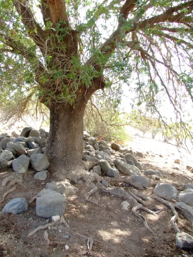
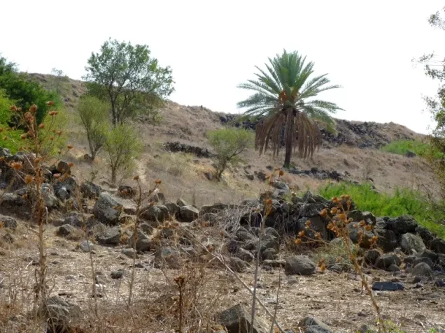
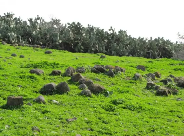
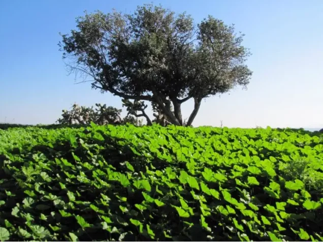
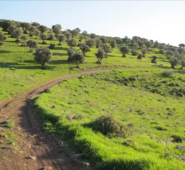
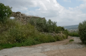
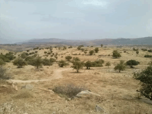
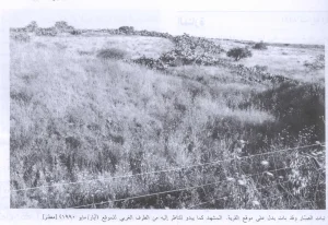
According to the field description published in Walid Khalidi's All That Remains, only stone rubble remained of ‘Awlam's buildings when the site was surveyed. One spring formerly used by the villagers remained intact. The site had been converted into a cow pasture, cactuses grew across it, and nearby lands were cultivated by residents of Kefar Qish.
This is a historical field description and should not be treated as a verification of conditions at the site in 2026. Field research for the All That Remains project was carried out between 1987 and 1990. The principal sources reviewed here do not provide a comprehensive recent field survey that would justify a definitive description of every surviving feature today.
Sources
- PalQuest – Interactive Encyclopedia of the Palestine Question: ‘Awlam
- PalQuest – Operation Gideon
- PalQuest – Overall Chronology: Zionist Conquest of Eastern Galilee
- Palestine Remembered – ‘Awlam, Tiberias District
- Palestinian Encyclopedia – ‘Awlam
- Institute for Palestine Studies – Walid Khalidi, All That Remains
- PalQuest – All That Remains: Methodology
Photo gallery
Photos from the village's people
Photos sent in by visitors and published after review.
Add a photo of this village
Log in to add photos of this village.
Other villages from Tiberias
More from the archive


 Download Our Palestine App
The whole archive in the palm of your hand: depopulated villages, the Nakba, the massacres and Al-Aqsa — free, with no ads to erase the story.
Download Our Palestine App
The whole archive in the palm of your hand: depopulated villages, the Nakba, the massacres and Al-Aqsa — free, with no ads to erase the story.



Comments
No comments yet — be the first to write one.
Add your comment
Name and email are optional. Comments appear after review.