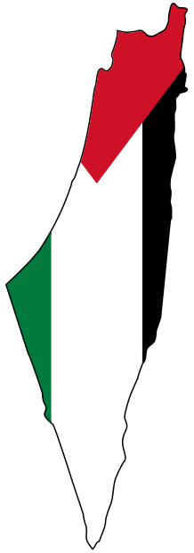
Jenin before the Nakba: the Sibat market and Marj Ibn Amer
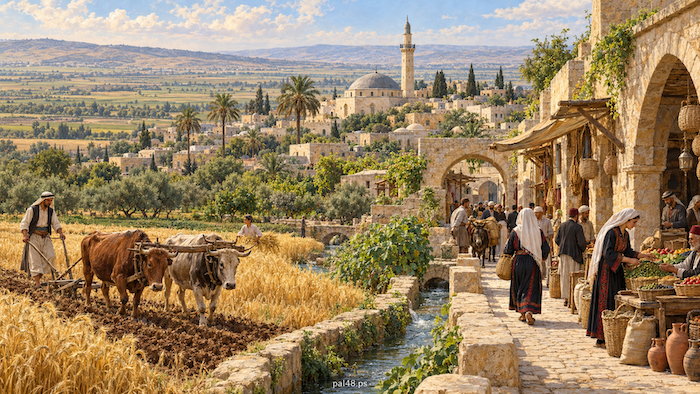
Jenin before the Nakba was no town on the margins of Palestine. It opened northward onto the Marj Ibn Amer plain, linked the Nablus hills with Haifa, Nazareth and Beisan, and gathered in its markets the crops of farmers, the crafts of townspeople and the news of travellers. Ploughs worked the fields around it, shops clustered in the Sibat market, and its schools produced students with strong ties to the countryside they came from. [1][5][12]
Then came the Nakba of 1948. Zionist forces attacked the city in June 1948 and were driven back by the Iraqi army and Palestinian fighters, so Jenin stayed on its land. But those forces expelled the people of villages in its district, such as Zir’in, al-Lajjun and Nuris, and cut the city off from Haifa and the coast. Refugees from Haifa and the Carmel arrived, and Jenin camp was later built for them. [2][3][8][9][10][19]
Contents
- Jenin before the Nakba at a glance
- The name: a spring and its gardens
- Location: the gateway of the Nablus hills onto Marj Ibn Amer
- Farming: wheat, orchards and olives
- Livestock: herding, dairy and the market
- Crafts: workshops serving a farming society
- The Sibat market: the heart of the old town
- Roads and the railway: when Haifa was close
- Houses and landmarks: a town around mosque, market and Saraya
- Customs and social life
- Women: work and education
- Education: from Ottoman schools to a full secondary school
- Health: al-Shifa hospital
- National life: from the rural revolt to Mandate repression
- The Battle of Jenin, 1948: the town that held
- Depopulated villages: what Jenin lost around it
- The refugees and Jenin camp
- How the Nakba changed Jenin
- From the Nakba to occupation: Jenin and its camp after 1967
- Frequently asked questions about Jenin before the Nakba
Jenin before the Nakba at a glance
| Item | Details |
|---|---|
| Location | The northern edge of the Nablus hills, at the entrance to Marj Ibn Amer |
| City population, 1922 | About 2,637 |
| City population, 1945 | About 3,990 |
| Jenin district, late Mandate | One town and about 70 villages |
| Main economic activities | Grain, orchards, olives and livestock; crafts and trade |
| Landmarks | The Sibat market, the Great Mosque (Fatima Khatun Mosque), the Ottoman Saraya (1882) |
| In the Nakba | The Battle of Jenin (2–4 June 1948); villages of the district depopulated |
| Jenin camp | Set up in 1953 for refugees from Haifa and the Carmel |
| Occupation of the city | June 1967 |
The population figures are for the town alone, not the villages of the district or the camp set up after the Nakba. [1][3][4][6][7][19]
The name: a spring and its gardens
Historical sources link the name Jenin to “Ein Ganim” or “Ein Jenim”, interpreted as “the spring of the gardens”, and give related ancient names such as “Gina” and “Ginae”. The interpretation fits a place known for its springs and orchards. [4]
Read also: Jenin, its villages and old photographs.
Location: the gateway of the Nablus hills onto Marj Ibn Amer
Jenin lies at the northern edge of the Nablus highlands, at the entrance to the Marj Ibn Amer plain. Its position between plain, hills and the roads to the Jordan Valley made it a station for people and goods moving between northern and central Palestine, linked to Haifa, Nazareth and Beisan as well as Nablus and Jerusalem. [1][5]
Farming: wheat, orchards and olives
The varied land around Jenin supported several kinds of farming: grain on the plains, fruit trees on the hills, vegetables and orchards near water. In Zir’in grain dominated; in al-Lajjun farming met a roadside location, water and mills; and Nuris, on the slopes of Mount Gilboa (Jabal Faqqu‘a), was linked by roads to neighbouring villages. [1][8][9][10]
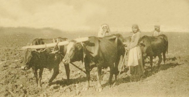
Rain-fed farming followed the rains: preparing the land, sowing, harvesting and carting the crop, and archival photographs show ploughing with draught animals around Jenin. [11]
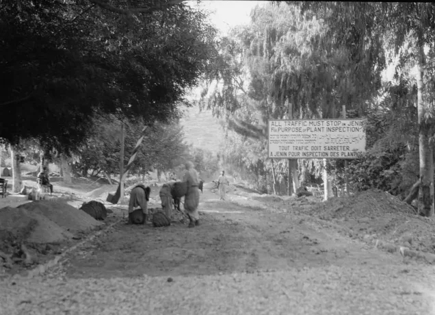
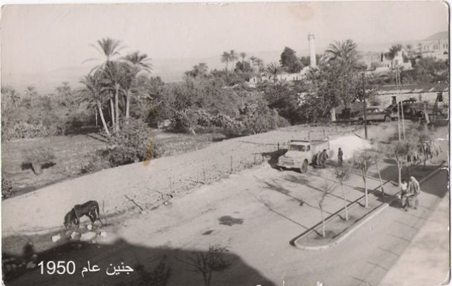
The Nini spring and the orchards hold a clear place in the city’s photographs and memory, and its gallery includes the government plant inspection station of 1930–1933. [11]
More: Agriculture in Palestine before the Nakba; Life in the Palestinian village.
Livestock: herding, dairy and the market
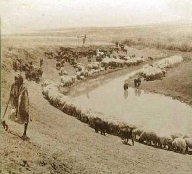
The land around Jenin was used for both farming and herding, and livestock provided food and goods for work and exchange. Memories of the Sibat market recall village women bringing dairy products, eggs and poultry to sell in town. [11][12][13]
Crafts: workshops serving a farming society
Jenin’s industry rested on a network of crafts serving the home, the field and the traveller. The history of the Sibat market, for the late nineteenth and early twentieth centuries, lists the blacksmith, plough maker, saddler, shoemaker, tailor, upholsterer, coppersmith, baker, spice seller and farrier, alongside carters and innkeepers. [12]
Read: Palestinian industries before 1948.
The Sibat market: the heart of the old town
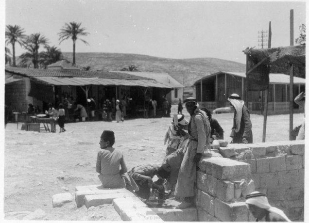
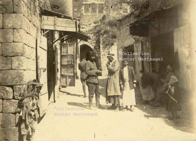
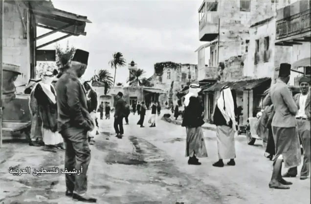
The Sibat is an Ottoman market in the old town, known for its arcades, arches and shops. It brought together trade, work and meeting, linking townspeople with villagers who came with farm produce, food and spices. [12][14]
More: Markets and trade in Palestine before the Nakba.
Roads and the railway: when Haifa was close
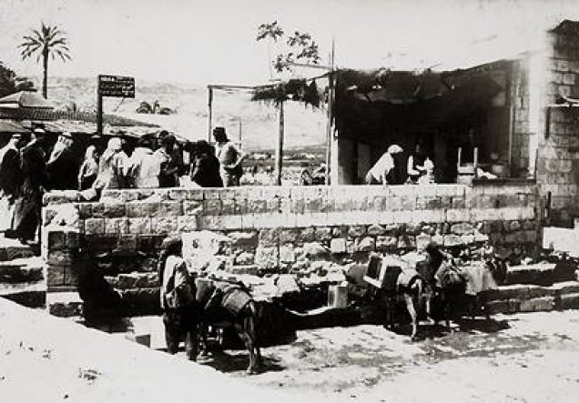
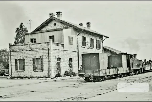
A 1930 photograph of the Haifa bus stop and a 1941 photograph of the railway station attest to Jenin’s connections before the Nakba. A study of land use in Jenin shows that its trade reached Haifa, Nazareth and Beisan, and that the 1948 war cut these links and weakened its commercial standing, turning its trade toward the West Bank and Jordan. [5][11]
Houses and landmarks: a town around mosque, market and Saraya
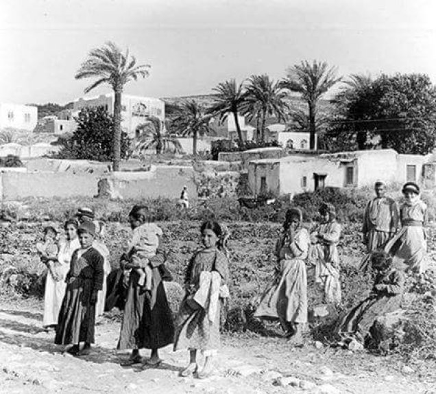
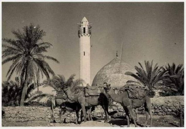
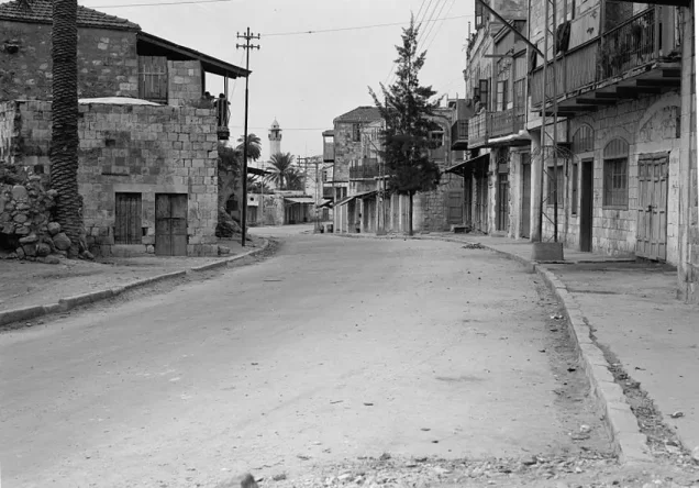
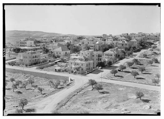
Photographs show low buildings, closely packed houses, minarets and palm trees. Among Jenin’s Ottoman landmarks are the Great Mosque, known as the Fatima Khatun Mosque, the Saraya, built in 1882 and used as a seat of government and later for administrative and educational purposes, and the market. [4][11]
Customs and social life
Jenin was part of the Palestinian cultural world in which occasions centred on family, neighbours, hospitality and folk song: coffee to welcome guests, songs and zajal at weddings, and mutual support in celebrations and hard times. [15]
Read also: Palestinian weddings before the Nakba.
Women: work and education
In 1944–45 Jenin’s government girls’ school had 256 pupils and eight teachers, while memories of the Sibat recall village women carrying produce to sell in the market. [6][13]
After the expulsions the burden on women grew, as families lost their fields, homes and nearby networks of support.
Education: from Ottoman schools to a full secondary school
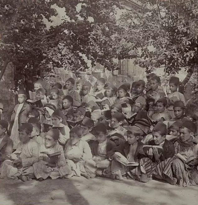
A boys’ elementary school was founded in Jenin in 1881 and a Rushdiyya school in 1887. By the late Mandate, government education in the town rested on one boys’ school and one girls’ school. [6]
| School | Year | Pupils | Teachers |
|---|---|---|---|
| Government boys’ school | 1944–1945 | 555 boys | 13 |
| Government girls’ school | 1944–1945 | 256 girls | 8 |
The boys’ school became a full secondary school in 1947–48, with a hostel for village students and a garden for agricultural practice, while the girls’ school was a full seven-grade elementary school. The community helped fund education: the people of Qabatiya, for example, paid for additional teachers. [6]
More: Palestinian education before 1948.
Health: al-Shifa hospital
One sign of health care in Jenin before the Nakba is al-Shifa hospital: according to Al-Hayat al-Jadida, based on the testimony of the family of its founder, Judge Muhammad Muti‘ Uthman al-Asir, the project began in 1946 and opened the following year. Alongside modern medicine, the Sibat had its spice sellers and barbers who practised some traditional remedies. [12][16]
Read: Health in Palestine before the Nakba.
National life: from the rural revolt to Mandate repression
The Jenin countryside was bound up with the 1936–1939 revolt. Its best-known figure was Sheikh Farhan al-Sa‘di of al-Mazar village, educated at the village kuttab and the Jenin school, who led rebels and was executed by the British authorities in 1937. [17]
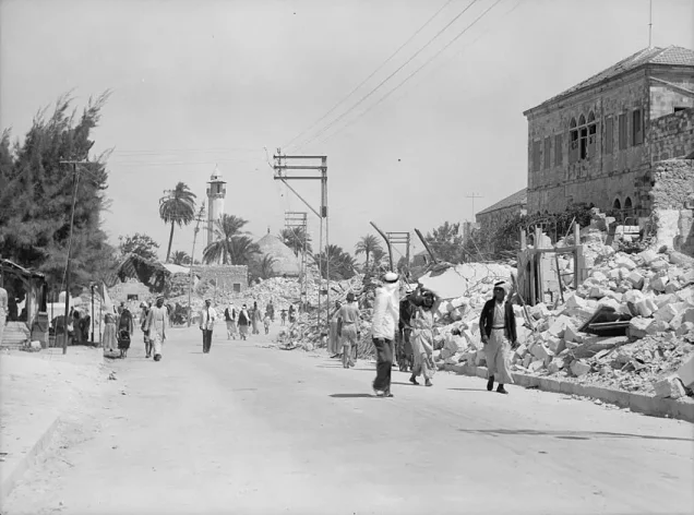
In 1938 the Mandate authorities imposed curfews on the town and destroyed buildings in September of that year, as archival photographs show. Jenin thus entered the 1948 war after years of British repression. [11][18]
The Battle of Jenin, 1948: the town that held
On 28 May 1948 the Iraqi mechanised regiment under Lt. Col. Nuh al-Jalabi reached Jenin. Zionist forces then attacked the town between 2 and 4 June, shelling it and pushing inside. But Iraqi reinforcements under Omar Ali, backed by Palestinian fighters, forced them to withdraw, and the town remained Arab. [2][20]
During the attack residents and refugees fled to villages further south, and those who could returned once the fighting ebbed. In May 1949 the Iraqi army withdrew and Jordanian forces replaced it; the town remained under Jordanian administration until Israel occupied it with the West Bank in 1967. [1][2][20]
Depopulated villages: what Jenin lost around it
In 1948 Zionist forces expelled the people of villages around Jenin, including Zir’in, Nuris and al-Lajjun, severing ties built over years of trade and kinship. The town lost the producers of its countryside and the customers of its market. [8][9][10]
More: Depopulated Palestinian villages; the Nakba; massacres.
The refugees and Jenin camp
Refugees reached Jenin and its surroundings during the 1948 war, most of them from Haifa, the Carmel and their villages. In 1953 Jenin camp was set up on land UNRWA leased from the Jordanian government, after a snowstorm hit the earlier camp in the area. [3][19]
The camp’s people remain tied to relatives inside the 1948 territories, holding on to their right to return to the villages they were driven from. [19] More: Palestinian refugee camps.
How the Nakba changed Jenin
| Area | Before the Nakba | What the Nakba did |
|---|---|---|
| Location and trade | Links with Haifa, Nazareth and Beisan | Roads and markets cut; trade turned toward the West Bank and Jordan |
| Farming | Villages and fields tied to the town market | Villagers expelled and their land lost |
| Population and housing | A small town serving its countryside | Refugees received, then the camp set up in 1953 |
| Society and memory | Kinship and neighbourliness tied to place | Families scattered; village memory carried into town and camp |
The table summarises what the sections above show about the Nakba’s impact on the town. [1][3][5][8][9][10]
From the Nakba to occupation: Jenin and its camp after 1967
After the 1967 occupation, Jenin camp became a constant target of the occupation. In 2002, during the Second Intifada, the occupation army almost completely destroyed the camp, killing at least 52 Palestinians, including women and children, according to a Human Rights Watch investigation. [19]
On 21 January 2025 the occupation launched Operation “Iron Wall”, expelling the people of the Jenin, Tulkarm and Nur Shams camps and barring their return; by October 2025, 52% of the buildings in Jenin camp had been destroyed or damaged. Occupation officers told the displaced: “There will be no more refugee camps.” Human Rights Watch described the expulsion as a war crime and a crime against humanity. [21][22]
Jenin thus carries two stories: that of a town that repelled the attack in 1948 and stayed on its land, and that of refugees who brought to it the names of the villages of Haifa and the Carmel, only to be driven out again more than seven decades later.
Frequently asked questions about Jenin before the Nakba
Where does the name Jenin come from?
From “Ein Ganim” or “Ein Jenim”, interpreted as “the spring of the gardens”. [4]
What was Jenin’s population before the Nakba?
About 3,990 in 1945 and about 2,637 in the 1922 census, not counting the villages of the district. [7]
What is Jenin’s best-known old market?
The Sibat market in the old town, an Ottoman market that linked the town to its countryside. [12][14]
Was Jenin occupied in the 1948 war?
No. Zionist forces entered parts of it on 2–4 June 1948 and were driven out by the Iraqi army and Palestinian fighters. The town was occupied in 1967. [1][2]
Who defended Jenin in 1948?
The Iraqi army under Nuh al-Jalabi and Omar Ali, backed by Palestinian fighters. [2][20]
Did girls go to school in Jenin before the Nakba?
Yes. The government girls’ school had 256 pupils and eight teachers in 1944–45. [6]
When was Jenin camp set up, and where are its people from?
In 1953; its people come from Haifa, the Carmel and their villages. [3][19]
Read also on Palestinuna
- Jenin archive and photographs
- Depopulated villages
- Zionist massacres
- Palestinian refugee camps
- Palestine before the Nakba
Sources and references
- Palestinian Encyclopedia, “Jenin (city)” (in Arabic).
- Mustafa Kabha, “The Battle of Jenin (2–4 June 1948) and Its Strategic and Historical Dimensions,” Palestine Remembered, from Arab48 (in Arabic).
- UNRWA, “Jenin Camp”.
- Palestinian National Information Center – WAFA, “Jenin” (in Arabic).
- An-Najah National University, “The Development of Land Use Patterns in Jenin City” (in Arabic).
- Palestinian National Information Center – WAFA, “Education under the British Mandate,” Jenin district section, citing Mustafa Murad al-Dabbagh (in Arabic).
- University of Palestine, “Palestinian Cities,” Jenin section (in Arabic).
- Palestinuna, “The depopulated village of Zir’in”.
- Palestinuna, “The depopulated village of al-Lajjun”.
- Palestinuna, “The depopulated village of Nuris”.
- Palestinuna, “Jenin photo gallery”.
- Yamen Nubani, “The Sibat Market: The Scent of Jenin,” 7 April 2015 (in Arabic).
- Ultra Palestine, “Al-Sibat: When a Story Thousands of Years Old Is Deleted” (in Arabic).
- Palestinian National Information Center – WAFA, “Palestinian Markets” (in Arabic).
- Palestinian National Information Center – WAFA, “National List of Palestinian Intangible Cultural Heritage” (in Arabic).
- Abdul Basset Khalaf, “Al-Shifa: A Hospital Older than the Occupation State,” Al-Hayat al-Jadida, 23 September 2024 (in Arabic).
- Palestinian National Information Center – WAFA, “Farhan al-Sa‘di” (in Arabic).
- Ultra Palestine, “Photos of Old Jenin: What Did It Look Like?” 6 August 2019 (in Arabic).
- “Why Is It a Constant Target of the Israeli Occupation? The History of Jenin Camp,” Arabi Post, 4 July 2023 (in Arabic).
- “The Iraqi Officer Who Liberated Jenin during the Nakba: Omar Ali,” Arabi Post, 21 July 2022 (in Arabic).
- “UN Report Documents the Occupation’s Displacement of over 33,000 Palestinians from Northern West Bank Camps,” Qatar News Agency, 4 September 2026 (in Arabic).
- Human Rights Watch, “West Bank: Israel’s Emptying of Refugee Camps a Crime against Humanity,” 20 November 2025.
More from the archive
 Download Our Palestine App
The whole archive in the palm of your hand: depopulated villages, the Nakba, the massacres and Al-Aqsa — free, with no ads to erase the story.
Comments
No comments yet — be the first to write one.
Add your comment
Name and email are optional. Comments appear after review.