
The depopulated village of Zakariyya / District of Hebron

Estimated population in 1948: Approximately 1,370.
Date of occupation: 23 October 1948.
Military operations: Operations Ha-Har and Yoav.
Occupying unit: Probably the Fourth Battalion of the Giv’ati Brigade.
Israeli settlements established on the village’s lands after its occupation: Zekharya, established in 1950 near the village site.
Final displacement of the Palestinian inhabitants: 9 June 1950.
Zakariyya was located approximately 25 km northwest of al-Khalil.
Zakariyya was a Palestinian village in the Hebron Subdistrict. Its population was estimated at approximately 1,370 before its occupation in October 1948. Unlike most inhabitants of villages occupied during Operations Ha-Har and Yoav, the people of Zakariyya were not all displaced immediately. Many remained or returned after the fighting, but the Israeli authorities ultimately expelled the remaining Palestinian population in 1950.
- The village stood on undulating terrain underlain by soft Eocene limestone in the western foothills of the al-Khalil Mountains.
- Zakariyya was surrounded by extensive olive groves. Its houses were constructed primarily of stone and mud. Its Palestinian inhabitants were Muslims, and the village contained a mosque.
- The villagers obtained drinking water from two communal wells and several domestic rainwater cisterns. Rainfed agriculture formed the basis of the economy, followed by animal husbandry, including the raising of poultry, sheep, and goats.
- Several archaeological sites were located in the vicinity of the village.
Boundaries of Zakariyya
Zakariyya was situated among the following Palestinian villages and localities:
- Northeast: al-Burayj.
- East: Tall al-Safi.
- Southeast: ‘Ajjur.
- South: Khirbat Umm Burj.
- West: Bayt Nattif.
- Northwest: Bayt Jimal, also known locally as al-Hikma.

Inhabitants of Zakariyya
In 1945, Zakariyya had approximately 1,180 inhabitants, all classified as Palestinian Arabs in the British Mandate statistics. The population was predominantly Muslim.
Population of Zakariyya
| Year | Population* |
|---|---|
| 1596 | Approximately 259 |
| 1922 | 682 |
| 1931 | 742 |
| 1945 | 1,180 |
| 1948 | Approximately 1,370 before the occupation |
| Palestinians remaining in or near the village after the 1948 occupation | Numbers declined over time; an Israeli official referred to approximately 145 remaining villagers in March 1949 |
| Estimated refugee population in 1998 | Not reliably established; one secondary compilation gives 2,351, but this figure is based on an inconsistent 1948 population estimate |
* The 1948 population is a later demographic estimate rather than a contemporaneous census count. The figure of 383 found in some secondary tables does not represent the village’s total population in 1948 and conflicts with the documented population of 1,180 in 1945. It may reflect a later estimate of inhabitants who remained after the occupation, but its precise basis has not been established.
Landmarks in Zakariyya
Before its occupation, the village contained:
- One mosque.
- The shrine of Shaykh Hasan.
- An active marketplace with commercial shops.
- One elementary school.
Education in Zakariyya
Zakariyya was among the Palestinian villages in the area where formal education developed relatively early. Traditional instruction in the kuttab was gradually supplemented by elementary schooling during the 1920s. By the late 1920s, the village had an elementary school.
Economic Life in Zakariyya
Rainfed agriculture formed the backbone of the village economy. Cereals, beans, fruit, and olives were among its principal crops. In 1944/45, 6,523 dunams were allocated to cereal cultivation, while 961 dunams consisted of irrigated land or orchards. Of the latter category, 440 dunams were planted with olive trees.
Animal husbandry constituted another important economic activity. The villagers raised poultry and grazed sheep and goats on the wild grasses and shrubs growing along the surrounding hillsides and wadis.
The inhabitants obtained drinking water from two communal wells: Bir al-Saflani, drilled near Wadi ‘Ajjur, and Bir al-Sarara, north of the village. Additional water was collected in domestic cisterns that stored rainfall.
Land Ownership in Zakariyya
| Ownership category | Land area (dunams)* |
|---|---|
| Palestinian ownership | 15,311 |
| Jewish ownership | 0 |
| Public land | 9 |
| Total | 15,320 |
* One dunam equals approximately 1,000 square metres.
Land Use in Zakariyya in 1944/45
| Land-use category | Palestinian ownership (dunams)* | Public land (dunams)* | Total (dunams)* |
|---|---|---|---|
| Irrigated land and orchards | 961 | 0 | 961 |
| Olive cultivation* | 440 | 0 | 440 |
| Cereal cultivation | 6,523 | 0 | 6,523 |
| Built-up area | 70 | 0 | 70 |
| Total cultivable land | 7,484 | 0 | 7,484 |
| Uncultivated land | 7,757 | 9 | 7,766 |
* One dunam equals approximately 1,000 square metres. The olive-growing area formed part of the irrigated-land and orchard category and should not be added separately to the total cultivable area.
Architectural Structure of Zakariyya
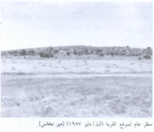
Zakariyya stood on a slope overlooking a broad, level valley and was surrounded by extensive olive groves. Its Palestinian inhabitants, who were Muslims, built their houses primarily of stone and mud.
The older sections of the village were located at its centre and in its northern and southern quarters. The centre contained a mosque, a shrine dedicated to Shaykh Hasan, an active marketplace, and an elementary school. During the modern period, the built-up area expanded in every direction, particularly toward the north and south.
Archaeological Sites Near Zakariyya
Several ancient sites were located near the village. Approximately one kilometre to the southwest stood Tall Zakariyya, rising about 117 metres above the surrounding plain.
The plain east of the village has traditionally been identified with Wadi al-Butm, corresponding to the Valley of Elah in the biblical account in which David fought Goliath (1 Samuel 17). This is a textual and archaeological identification rather than independently verifiable evidence that the described event occurred at the site.
Tall Zakariyya was excavated in 1898 and identified with the ancient city of Azekah. Azekah may also be mentioned in an inscription found on a pottery fragment at Tall al-Duwayr. Biblical tradition associates Azekah with Joshua’s campaign against the Canaanites. These identifications belong to biblical and archaeological scholarship and should be distinguished from the documented modern history of the Palestinian village.
Occupation and Depopulation of Zakariyya
Zakariyya first came under Zionist attack during the early months of 1948 in connection with fighting around the Kfar Etzion bloc south of Bethlehem. Together with Dayr Aban and Bayt Nattif, the village was besieged by a Haganah force estimated by contemporary Arab sources at approximately 100 men.
The operation was described as a punitive expedition following an ambush of a Palmach force in the area. Israeli forces fired on the villages on 17 and 18 January 1948, but the available contemporary reporting did not specify the number of Palestinian casualties.
Zakariyya was occupied more than nine months later, on 23 October 1948, toward the end of Operations Ha-Har and Yoav. The occupying force was probably the Fourth Battalion of the Giv’ati Brigade. Its advance linked Israeli-held positions in the western foothills of al-Khalil with the Jerusalem corridor.
The occupation did not result in the immediate removal of the entire Palestinian population. Many inhabitants remained in the village or returned after the fighting ended. In December 1948, however, the Israeli army expelled approximately forty elderly men and women to the West Bank.
In March 1949, an Israeli Interior Ministry official reported that approximately 145 Palestinians remained and noted that the village contained houses that could be used to accommodate Jewish immigrants. A broader military proposal to expel the villagers was delayed after objections from the Israeli Foreign Ministry.
Efforts to remove the remaining Palestinian population continued into 1950. In January of that year, David Ben-Gurion, Moshe Sharett, and Jewish National Fund official Yosef Weitz agreed that the villagers should be removed. The remaining inhabitants were ultimately expelled on 9 June 1950. Most were transferred toward al-Ramla or the West Bank, and many of the village’s displaced families later lived in al-‘Arrub and al-Dheisheh refugee camps.
Israeli Settlements Established on the Lands of Zakariyya
The Israeli settlement of Zekharya was established in 1950 on land belonging to Zakariyya, close to the Palestinian village site. It was founded during the same period in which the remaining Palestinian inhabitants were expelled.
The earlier statement that no Israeli settlement was established on the village’s lands after 1948 is therefore incorrect.
Zakariyya Today
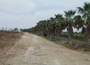
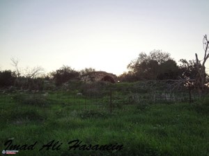
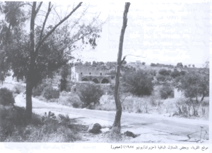
The village mosque and a number of Palestinian houses remain standing. Some houses were occupied by Jewish residents, while others were left deserted. Large parts of the site became covered with wild vegetation.
When the mosque was documented, sections of its walls and roof, as well as the surrounding ground, were overgrown and neglected. An Israeli flag had been placed on its minaret.
One of the occupied Palestinian houses was a two-storey stone building with a flat roof. Its upper-storey windows had rounded arches and metal grillwork. Parts of the surrounding village lands were cultivated by Israeli farmers.
Sources
- Interactive Encyclopedia of the Palestine Question: “Zakariyya”, Institute for Palestine Studies.
- Palestine Remembered: “Zakariyya, Hebron”.
- Walid Khalidi, ed., All That Remains: The Palestinian Villages Occupied and Depopulated by Israel in 1948, Institute for Palestine Studies, 1992.
- Dan Tsahor, “Postwar Nakba: A Microhistory of the Depopulation of Zakariyya, 1950”, Journal of Palestine Studies.
- Bibliographic record for Walid Khalidi’s All That Remains, Google Books.
- Government of Palestine, Village Statistics, April 1945.
- Our Palestine: “The Depopulated Village of Zakariyya”.
Photo gallery


Photos from the village's people
Photos sent in by visitors and published after review.
Add a photo of this village
Log in to add photos of this village.
Other villages from Hebron
 Download Our Palestine App
The whole archive in the palm of your hand: depopulated villages, the Nakba, the massacres and Al-Aqsa — free, with no ads to erase the story.
Download Our Palestine App
The whole archive in the palm of your hand: depopulated villages, the Nakba, the massacres and Al-Aqsa — free, with no ads to erase the story.



Comments
No comments yet — be the first to write one.
Add your comment
Name and email are optional. Comments appear after review.