
The depopulated village of Tall al-Safi / District of Hebron

Tall al-Safi
About the depopulated village of Tall al-Safi
- District
- Hebron
- Date Tall al-Safi was occupied
- 09 July 1948
- Population in 1948
- 1,496
- Military operation
- Operation An-Far
- Brigade that carried it out
- Givati Brigade
- Who defended the village
- Egyptian Muslim Brotherhoods, local Palestinian militias and some Arab Liberation Army volunteers.
- Distance from the governorate centre
- 31 km northwest of Hebron
- Elevation above sea level
- 175 m
- Cause of displacement
- Direct military assault by Israeli occupation forces (Givati Brigade) in Operation An-Far, whose orders called for the expulsion of the refugees encamped in the village area
- Extent of destruction
- The village was completely obliterated and defaced.
- Ethnic cleansing
- Tall al-Safi inhabitants were completely ethnically cleansed.
- Settlements built on the built-up area of Tall al-Safi after 1948
- None – according to Khalidi, there are no Israeli settlements on village lands
- Refugees' migration routes
- Refugess headed to the Hebron hills.
Hover a dot to read the village name, or click to open its card.
Borders of the depopulated village of Tall al-Safi
Tall al-Safi: A Depopulated Palestinian Village in the Hebron District
Tall al-Safi was a Palestinian village in the Hebron District, located approximately 31 kilometres northwest of the city of Hebron in the western foothills of the Hebron Mountains, at an average elevation of about 175 metres above sea level. The village was a major objective of Operation An-Far, carried out by the First Battalion of the Givati Brigade in July 1948. It was occupied during 9–10 July, and its inhabitants were displaced during the Nakba and the occupation of Palestine in 1948.
- Subdistrict
- Hebron
- Distance from district center
- 31 km northwest of Hebron
- Average Elevation
- 175 m above sea level
- Population in 1931
- 925 – includes Khirbat Damdam, Khirbat Rasim and Khirbat Ghattas
- Number of Houses in 1931
- 208 – includes Khirbat Damdam, Khirbat Rasim and Khirbat Ghattas
- Population in 1944/1945
- 1,290
- Estimated Population in 1948
- About 1,496 – a later demographic estimate, not an official census
- Total Land Area in 1945
- 28,925 dunams
- Attack and Depopulation
- The village was a central target of Operation An-Far, launched by the Givati Brigade's First Battalion in July 1948, after brigade commander Shimon Avidan ordered it on 7 July to take the Tall al-Safi area and “expel the refugees encamped” there. The site was taken during the operation, and an Israeli army report, quoted by Israeli historian Benny Morris as cited by Khalidi, concluded that the capture of Tall al-Safi completely undermined the morale of the surrounding villages.
- Final Israeli Control
- 9–10 July 1948 according to the English text of Khalidi's entry on PalQuest; the Arabic PalQuest text gives “9–19 July”, while PalQuest dates Operation An-Far to 8–15 July 1948.
- Military Operation
- Operation An-Far
- Military Unit
- The Givati Brigade's First Battalion
- Cause of Depopulation
- Direct military assault by Israeli occupation forces (Givati Brigade) in Operation An-Far, whose orders called for the expulsion of the refugees encamped in the village area
- Settlements Documented on Village Lands
- None – according to Khalidi, there are no Israeli settlements on village lands
Location
Tall al-Safi stood on the summit of a hill rising approximately 100 metres above the surrounding plain, on the southern edge of Wadi al-Ajjur in the western foothills of the Hebron Mountains.
A secondary road connected the village with the highway running from al-Majdal toward the main Jerusalem–Jaffa road, which passed northwest of Tall al-Safi.
The village lands bordered or lay near those of several Palestinian villages, including Ajjur, Mughallis, Dayr al-Dubban, Thikrin, and Barqusya.
Tall al-Safi Through History
Tall al-Safi was one of the ancient inhabited sites of Palestine. Archaeological evidence indicates that the site was occupied from the third millennium BCE until the Nakba in 1948.
This does not mean that the modern Palestinian village itself was necessarily founded in the third millennium BCE; rather, the archaeological mound experienced successive periods of settlement over thousands of years.
Ancient Philistine Gath
Archaeological evidence strongly suggests that Tall al-Safi was the site of ancient Gath, one of the principal cities of the ancient Philistines.
In 1899, limited excavations were conducted at the site on behalf of the Palestine Exploration Fund. The excavations uncovered ancient Philistine pottery, adding support to this identification.
Saphitha and the Madaba Map
The site appears on the Byzantine Madaba Map of the sixth century CE under the name “Saphitha.”
Some reproduced versions of Walid Khalidi's account incorrectly describe the Madaba Map as dating to the sixth century BCE. The map is in fact a Byzantine mosaic from the sixth century CE.
The Crusader Period
During the Crusader period, a fortress known as Blanche Garde, meaning “White Guard,” was built at the site, probably referring to the prominent white rock formation on the eastern side of the mound.
The fortress was subsequently destroyed during the period of Salah al-Din al-Ayyubi.
Yaqut al-Hamawi later described Tall al-Safi as a fortress near Bayt Jibrin, while the Jerusalem historian Mujir al-Din al-Hanbali noted that it fell within the administrative jurisdiction of Gaza.
Tall al-Safi During the Ottoman Period
In 1596, Tall al-Safi was a village in the Gaza subdistrict of the Gaza district, with an estimated population of approximately 484.
The inhabitants paid taxes on wheat, barley, fruit, sesame, goats, beehives, and other agricultural products.
Architecture and Public Facilities
In the late nineteenth century, Tall al-Safi was described as a village built of adobe, with a well in the valley to its north.
The walls of village houses were made of stone held together with mud mortar. Houses were built along the roads that wound through and out of the village, creating an approximately star-shaped settlement pattern.
The village had a marketplace, a mosque, and a shrine dedicated to a local holy man known as Shaykh Muhammad.
The built-up area amounted to approximately 68 dunams according to the 1944/1945 statistics, all of it Arab-owned.
Population
The official 1922 Census of Palestine recorded 644 inhabitants in Tall al-Safi.
In the 1931 census, the population reached 925, living in 208 houses. These figures included the nearby hamlets of Khirbat Damdam, Khirbat Rasim, and Khirbat Ghattas.
According to the 1944/1945 Village Statistics, the population stood at 1,290, all of whom were Palestinian Arab Muslims.
The estimate of approximately 1,496 inhabitants for 1948 and the estimate of 9,190 refugees and descendants in 1998, published by Palestine Remembered, are later estimates rather than official censuses of the Government of Palestine.
Population of Tall al-Safi
- 1596About 484Historical estimate based on Ottoman records
- 1922644Official census
- 1931925Official census; includes three nearby khirbas
- 1944/19451,290Government of Palestine statistics
- 1948About 1,496Later estimate
- 19989,190Estimate of refugees and their descendants
Number of Houses
The 1931 census recorded 208 houses in the population unit that included Tall al-Safi, Khirbat Damdam, Khirbat Rasim, and Khirbat Ghattas.
Land of Tall al-Safi
According to the 1944/1945 statistics, the lands of Tall al-Safi covered a total of 28,925 dunams.
Arab ownership amounted to 27,794 dunams, Jewish ownership to 1,120 dunams, while 11 dunams were classified as public land.
Land Ownership in Tall al-Safi in 1944/1945
- Arab ownership27,794 dunums96%
- Jewish ownership1,120 dunums4%
- Public land11 dunums<1%
Agriculture and Economic Life
The economy of Tall al-Safi depended primarily on rain-fed agriculture, followed by livestock raising, particularly sheep and goats.
The agricultural lands were rugged in some areas and level in others. The villagers cultivated cereals, vegetables, and fruit, including grapes, figs, and almonds.
Approximately 521 dunams were planted with olive trees. This figure represents a crop category within the cultivated land and should not be added separately to the overall land-use totals.
According to the 1944/1945 statistics, cereal cultivation covered 20,831 dunams, including 19,716 Arab-owned dunams and 1,115 Jewish-owned dunams.
A further 696 dunams were irrigated or used for plantations, all of them Arab-owned.
Land Use in Tall al-Safi in 1944/1945, in Dunams
- Arab
- Jewish
- Public
- Cereals20,831 dunums
- Irrigated and plantation land696 dunums
- Built-up area68 dunums
- Uncultivable land7,330 dunums
Archaeology and Historical Landmarks
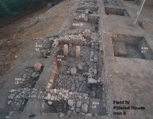
Tall al-Safi contained archaeological remains from numerous historical periods.
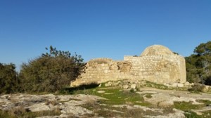
Among the principal remains documented by Palestinian sources were the ruins of the Crusader fortress, ancient walls, burial sites, a cave, and carved stones.
The shrine of Shaykh Muhammad stood along the eastern road of the village.
The site's particular archaeological importance derives from its probable identification with ancient Philistine Gath and from its successive archaeological layers documenting thousands of years of habitation.
The Nakba and Operation An-Far
Operation An-Far
Tall al-Safi was a central objective of Operation An-Far, an offensive launched by the First Battalion of the Givati Brigade on the southern front beginning on 8 July 1948.
The operation sought to expand Givati's area of control eastward and southward during the period between the two truces. It resulted in the occupation and depopulation of numerous Palestinian villages near the meeting point of the Hebron, Gaza, and Ramla districts.
Orders of 7 July
On 7 July, Givati Brigade commander Shimon Avidan ordered the First Battalion to take control of the Tall al-Safi area and remove refugees who were camped there in order to prevent Arab forces from approaching the strategic position from the east.
These details are reproduced through PalQuest and Walid Khalidi from Israeli military material cited by the Palestinian source; this article does not rely directly on the original Israeli material.
Occupation of the Village
Tall al-Safi was occupied during 9–10 July 1948.
The Palestine Remembered statistical table lists 9 July as the occupation date, while the detailed text reproduced from All That Remains states that the position was taken on 9–10 July.
The current PalQuest village page displays “9–19 July,” but this does not correspond with the reproduced Khalidi text or with PalQuest's own chronology of Operation An-Far, which ended on 15 July. This article therefore adopts 9–10 July 1948.
Tall al-Safi and Barqusya
The nearby village of Barqusya was also occupied during Operation An-Far, probably on 9–10 July.
It is therefore accurate to say that both villages fell during the same phase of the operation, but there is insufficient evidence to state that the occupation and destruction of both were completed on precisely the same day.
Occupation and Depopulation Chronology
- 8 July 1948
Beginning of the military operation
The Givati Brigade's First Battalion launched Operation An-Far on the southern front in the period between the two truces, with Tall al-Safi as a central target. Brigade commander Shimon Avidan had ordered the battalion on 7 July to take the Tall al-Safi area and “expel the refugees encamped” there.
- 9–10 July 1948 or 9–19 July 1948
Final occupation
The site was taken on 9–10 July according to the English text of Khalidi's entry on PalQuest, and on “9–19 July” according to the Arabic text, while PalQuest dates the end of Operation An-Far to 15 July. An Israeli army report, quoted by Benny Morris as cited by Khalidi, concluded that the capture of the village completely undermined the morale of the surrounding villages.
- July 1948
Depopulation of the village
PalQuest lists Tall al-Safi among the villages affected by Operation An-Far, which drove out the population of some sixteen villages near the intersection of the Gaza, Hebron and Ramla districts. The available sources give no details specific to the departure of Tall al-Safi's inhabitants.
Displacement and Fate of the Village
The occupation of Tall al-Safi resulted in the displacement of its Palestinian inhabitants. Refugees from other villages were also present in the area during the fighting.
Palestinian sources indicate that the fall of Tall al-Safi had a major impact on surrounding villages by isolating them from Arab forces positioned farther east and south and accelerating the movement of inhabitants toward the Hebron hills.
The village's built-up area was subsequently demolished, and its Palestinian inhabitants were not permitted to return and re-establish their community.
Israeli Settlements on the Lands of Tall al-Safi
According to Walid Khalidi and PalQuest, no Israeli settlement was established directly on the lands of Tall al-Safi.
| Status | Details |
|---|---|
| Settlements established directly on village lands | None according to Walid Khalidi and PalQuest |
The Site of Tall al-Safi After the Nakba
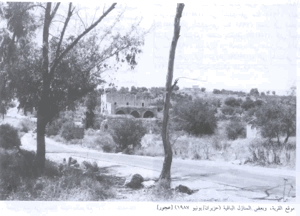
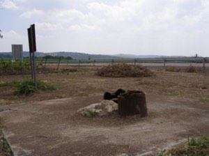
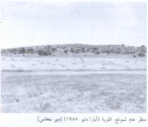
According to the field documentation relied upon by Walid Khalidi, the village site was largely covered with wild vegetation, particularly foxtail and thorny plants.
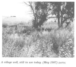
Cactus plants and several date-palm and olive trees were scattered across the site, while the remains of a well and the crumbling stone walls of an old pool were still visible.
At the time of that documentation, surrounding lands were cultivated with citrus, sunflowers, and cereals.
Groups of Bedouin also occasionally pitched tents near the site.
This description reflects the condition of the site during the period of field documentation used by Walid Khalidi and should not necessarily be interpreted as a comprehensive survey updated to 2026.
Sources
- PalQuest – Interactive Encyclopedia of the Palestine Question: Tall al-Safi.
- PalQuest: Operation An-Far.
- PalQuest: Tall al-Safi.
- Palestine Remembered: Tall al-Safi, Hebron District.
- Palestine Remembered: Tall al-Safi.
- PalQuest: Barqusya.
- Walid Khalidi, All That Remains, entry on Tall al-Safi.
- Government of Palestine, censuses of 1922 and 1931.
- Government of Palestine, Department of Statistics, Village Statistics, 1945.
Photo gallery


Photos from the village's people
Photos sent in by visitors and published after review.
Add a photo of this village
Log in to add photos of this village.
Other villages from Hebron

More from the archive
 Download Our Palestine App
The whole archive in the palm of your hand: depopulated villages, the Nakba, the massacres and Al-Aqsa — free, with no ads to erase the story.
Download Our Palestine App
The whole archive in the palm of your hand: depopulated villages, the Nakba, the massacres and Al-Aqsa — free, with no ads to erase the story.



Comments
No comments yet — be the first to write one.
Add your comment
Name and email are optional. Comments appear after review.