
The depopulated village of Al-Shawka al-Tahta / District of Safed
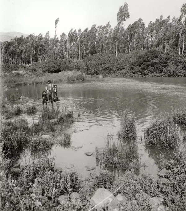
Al-Shawka al-Tahta
About the depopulated village of Al-Shawka al-Tahta
- District
- Safed
- Date Al-Shawka al-Tahta was occupied
- 14 May 1948
- Population in 1948
- 232
- Military operation
- Operation Yiftach
- Brigade that carried it out
- Palmach
- Elevation above sea level
- 175 m
- Cause of displacement
- Fear of Jewish attack, or of being caught in the fighting
- Extent of destruction
- The village has been completely destroyed, and only house rubble left behind
- Ethnic cleansing
- al-Shawka al-Tahta inhabitants were completely ethnically cleansed.
Hover a dot to read the village name, or click to open its card.
al-Shawka al-Tahta: A Depopulated Palestinian Village in the Safad District
al-Shawka al-Tahta was a Palestinian village in the Safad District, situated on gently sloping hills in the northeastern Hula Plain approximately 31.5 km northeast of Safad, at an average elevation of about 175 metres above sea level. It stood southwest of Tall al-Qadi and benefited from abundant flowing water and nearby springs, which supported both rainfed and irrigated agriculture. Its inhabitants were all Muslim. During the Nakba and the occupation of Palestine in 1948, the villagers left on 14 May, a few days after the fall of Safad, out of fear of an impending Zionist attack in the context of Operation Yiftach.
Location of al-Shawka al-Tahta
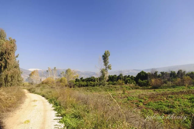
al-Shawka al-Tahta stood on gently sloping hills in the northeastern part of the Hula Plain, southwest of Tall al-Qadi.
The village was approximately 31.5 km northeast of Safad and had an average elevation of about 175 metres above sea level.
A paved road connected the village with the neighboring settlements of Dan and Dafna and continued westward toward al-Khalisa, which lay on the main road to Safad.
Nearby localities and lands included al-Khalisa, al-Khisas, al-Sanbariyya, al-Zuq al-Fawqani, Dafna, and the Tall al-Qadi area.
Architecture of al-Shawka al-Tahta
The village had a semicircular layout, and its houses were closely clustered.
The built-up area amounted to approximately 17 dunums in the 1944/45 statistics.
The principal approved sources do not provide sufficiently detailed information about building materials or formally defined internal quarters, so no unsupported architectural details are added.
Water and Natural Environment
al-Shawka al-Tahta benefited from an abundant and dependable water supply.
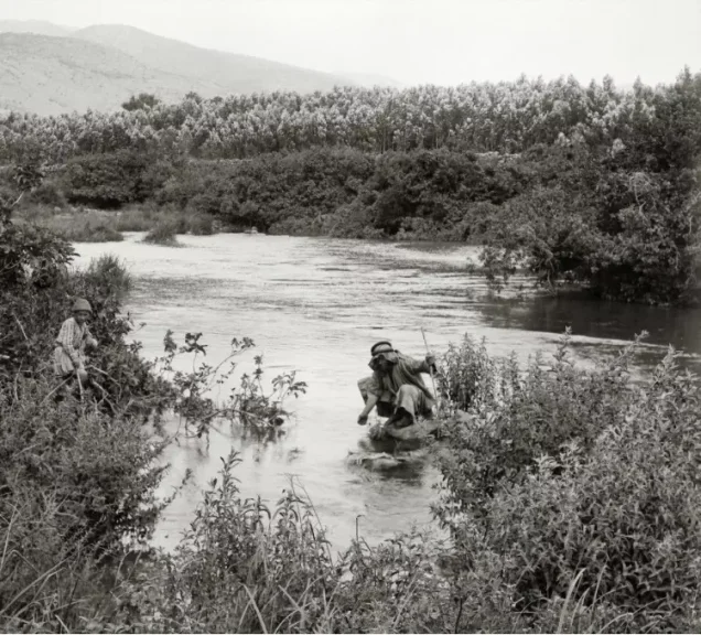
Dense natural vegetation grew north of the village because of the perennial stream flowing from the Tall al-Qadi area.
Several springs also supplied water for irrigation.
The combination of fertile Hula Plain soils and plentiful water meant that most of the registered village lands were cultivated or cultivable.
Population of al-Shawka al-Tahta
The inhabitants of al-Shawka al-Tahta were all Muslim.
The official 1931 Census of Palestine recorded 136 inhabitants living in 31 houses.
In 1944/45, the official population figure was 200, but this statistic included Mughr al-Shab'an together with al-Shawka al-Tahta.
Population of al-Shawka al-Tahta in selected years
- 1931136Official British Mandate census; all Muslim
- 1944/45200Official statistics; includes Mughr al-Shab'an
- 1948232Later estimate published by Palestine Remembered
- Estimated refugees in 19981,425Later estimate published by Palestine Remembered
The principal sources used here do not provide a reliable separate 1944/45 population figure for Mughr al-Shab'an, so the official total of 200 cannot safely be divided between the two localities.
Number of Houses
Number of houses in al-Shawka al-Tahta
- 193131Official British Mandate census
- 194852Later estimate published by Palestine Remembered
Education and Public Services
Khalidi's principal PalQuest entry does not provide sufficiently documented information concerning an independent school, clinic, mosque, or other specific public institution in al-Shawka al-Tahta before the Nakba.
No unsupported institutional details are therefore added.
Economic Life in al-Shawka al-Tahta
Agriculture was the principal source of livelihood.
Some cultivation was rainfed, while other fields and orchards were irrigated from nearby springs.
Cereals and fruit were the principal crops documented in the main source.
In 1944/45, 140 dunums were devoted to cereals, while 1,845 dunums were irrigated or used for plantations.
Cultivated or cultivable land therefore totaled 1,985 dunums, approximately 93 percent of the registered land area.
Land Ownership in al-Shawka al-Tahta
The total registered land area was 2,132 dunums in the 1944/45 statistics. These figures include Mughr al-Shab'an together with al-Shawka al-Tahta.
Land ownership in al-Shawka al-Tahta, 1944/45, using Palestine Remembered's ownership terminology
- Palestinian2,009 dunums94%
- Transferred to Zionists0 dunums0%
- Communal/Public123 dunums6%
No land was recorded in the category “Transferred to Zionists” in the 1944/45 ownership figures.
Palestinian land represented approximately 94 percent of the total, while public/communal land accounted for approximately 6 percent.
Land Use in al-Shawka al-Tahta, 1944/45
PalQuest's detailed land-use statistics use the categories Arab and Public. The table below preserves that distinction.
Land use in the combined al-Shawka al-Tahta–Mughr al-Shab'an statistics, 1944/45
- Arab
- Public
- Plantations and irrigable land1,845 dunums
- Cereals140 dunums
- Built-up area17 dunums
- Non-cultivable land130 dunums
Cultivated or cultivable land totaled 1,985 dunums, approximately 93 percent of the registered area.
Built-up and non-cultivable land together amounted to 147 dunums, approximately 7 percent.
The entire 130 dunums of non-cultivable land should not be treated as Palestinian land: the detailed figures consist of 7 Arab dunums and 123 public dunums.
These 1944/45 land-use figures include Mughr al-Shab'an together with al-Shawka al-Tahta.
Archaeological Sites
The principal archaeological sites identified near al-Shawka al-Tahta were Tall al-Qadi to the northeast and Khirbat al-Day'a to the south.
Khalidi's principal entry does not provide a detailed archaeological chronology for these sites, so the article does not add unsupported descriptions of their remains or historical periods.
Operation Yiftach and al-Shawka al-Tahta
The depopulation of al-Shawka al-Tahta occurred in the wider context of Operation Yiftach, conducted by Palmach forces in eastern Galilee from 15 April to 25 May 1948.
The Palmach's First Battalion spearheaded the broader operation.
Operation Yiftach sought to seize eastern Galilee before the end of the British Mandate, and a combination of direct attacks, intimidation, and psychological warfare caused the depopulation of numerous Palestinian communities.
Safad fell on 10–11 May 1948, spreading fear among nearby villages in the district, including al-Shawka al-Tahta.
Depopulation on 14 May 1948
Khalidi, citing Israeli sources within his discussion, states that the inhabitants of al-Shawka al-Tahta left on 14 May 1948 because they feared an impending Zionist attack.
The recent fall of Safad was an important factor in intensifying fear among the villagers.
Khalidi's dedicated village entry does not describe a direct battle inside al-Shawka al-Tahta on 14 May and does not state that the village was stormed after fighting that day.
Palestine Remembered associates the village with Operation Yiftach, lists the Palmach's First Battalion as the attacking unit, and gives fear of a Zionist attack or of being caught in the fighting as the cause of departure.
Because PalQuest establishes the First Battalion's role as the spearhead of Operation Yiftach generally, while Khalidi's village entry does not independently identify a village-specific assault by that battalion, the broader operational role and the documented cause of flight are distinguished here.
- Broader military operation: Operation Yiftach.
- Operation Yiftach dates: 15 April–25 May 1948.
- Fall of Safad: 10–11 May 1948.
- Date the inhabitants left al-Shawka al-Tahta: 14 May 1948.
- Cause given by Khalidi: fear of an impending Zionist attack following the fall of Safad.
- Documented direct battle in the village on 14 May: not established in the principal entry.
- Palmach First Battalion: spearheaded Operation Yiftach overall and is listed by Palestine Remembered, but Khalidi's village entry does not independently establish it as the village-specific assault force.
Nearby Zionist Settlements
Dan and Dafna were established in 1939 close to al-Shawka al-Tahta before the Nakba.
- Dan: established in 1939, approximately 2 km east of the village site.
- Dafna: established in 1939, approximately 1 km southeast of the site.
Khalidi/PalQuest explicitly states that neither settlement stood on al-Shawka al-Tahta's lands.
They should therefore not be listed as settlements founded on the village lands, even though some summary fields on Palestine Remembered may give that impression.
Khalidi's entry does not identify a new Israeli settlement established after 1948 directly on al-Shawka al-Tahta's registered village lands.
al-Shawka al-Tahta Today
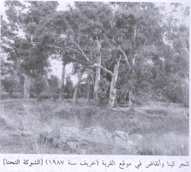
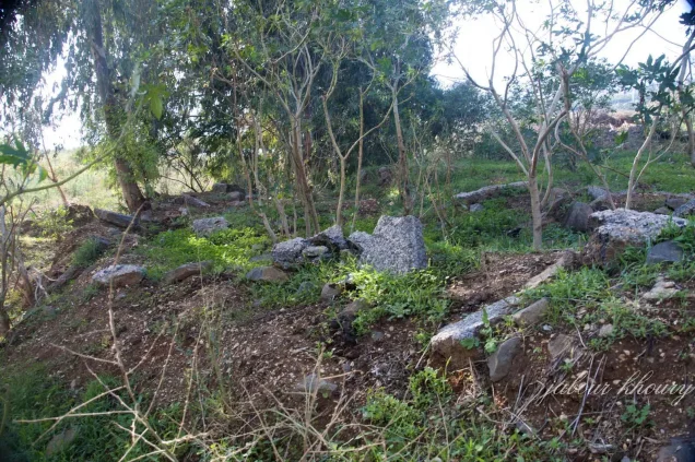
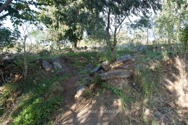
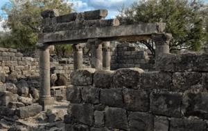
According to the field description published by Walid Khalidi in All That Remains, no building remained standing at the former village site.
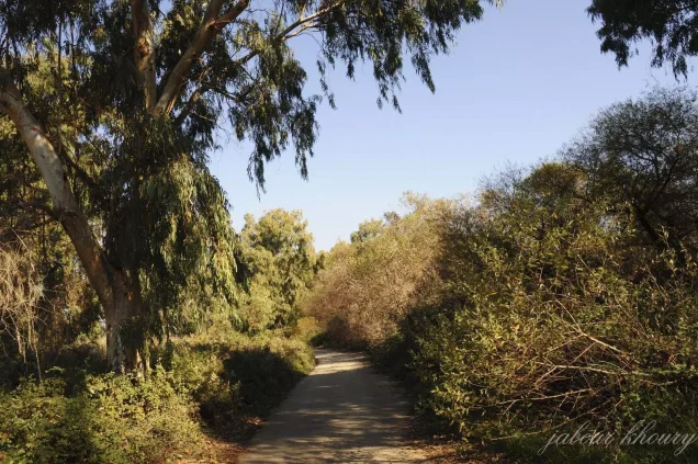
Stone rubble from demolished houses was largely hidden beneath wild grasses and eucalyptus trees.
A small number of cactus plants also grew at the site.
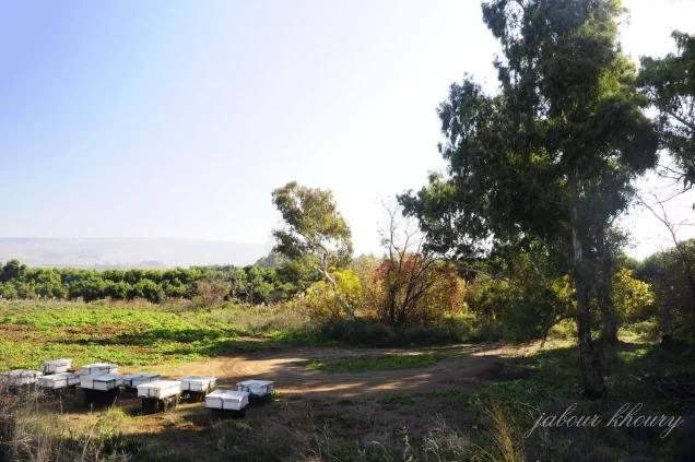
At the time of Khalidi's documentation, the surrounding lands were being used both for cultivation and for livestock grazing.
Palestine Remembered preserves later community documentation, including an image of the depopulated village uploaded on 16 June 2025.
In August 2026, Palestine Remembered also published a community-contributed video associated with al-Shawka al-Tahta, Dafna, and the Lebanese border; the item itself identifies the footage with the year 2017. The site notes that user-contributed material represents the contributor's own account and is not guaranteed as independently verified.
These later photographs and videos are therefore useful community documentation but do not constitute a systematic independent field survey of the entire site in 2026.
Khalidi's historical field description remains the principal systematic account used here and should not be presented as direct contemporary verification of the precise condition of every part of al-Shawka al-Tahta today.
Sources
- PalQuestPalQuest – Interactive Encyclopedia of the Palestine Question: al-Shawka al-Tahta
- PalQuestPalQuest – Operation Yiftach
- Palestine RememberedPalestine Remembered – al-Shawka al-Tahta, Safad District
- Palestine RememberedPalestine Remembered – al-Shawka al-Tahta entry from All That Remains
- Palestine RememberedGovernment of Palestine – Census of Palestine, 1931
- Palestine RememberedPalestine Remembered – community photograph of al-Shawka al-Tahta, uploaded in 2025
- Palestine RememberedPalestine Remembered – community video associated with al-Shawka al-Tahta, published in 2026 and identified with 2017
- Institute for Palestine StudiesInstitute for Palestine Studies – All That Remains, Walid Khalidi
Photo gallery
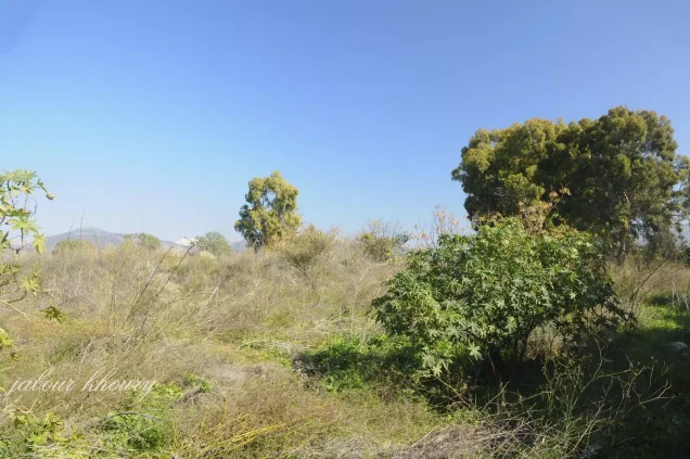
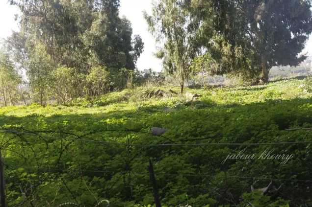
Photos from the village's people
Photos sent in by visitors and published after review.
Add a photo of this village
Log in to add photos of this village.
Other villages from Safed
More from the archive



 Download Our Palestine App
The whole archive in the palm of your hand: depopulated villages, the Nakba, the massacres and Al-Aqsa — free, with no ads to erase the story.
Download Our Palestine App
The whole archive in the palm of your hand: depopulated villages, the Nakba, the massacres and Al-Aqsa — free, with no ads to erase the story.



Comments
No comments yet — be the first to write one.
Add your comment
Name and email are optional. Comments appear after review.