
The depopulated village of Al-Zahiriyya al-Tahta / District of Safed
Al-Zahiriyya al-Tahta
About the depopulated village of Al-Zahiriyya al-Tahta
- District
- Safed
- Date Al-Zahiriyya al-Tahta was occupied
- 10 May 1948
- Population in 1948
- 410
- Military operation
- Operation Yiftach
- Brigade that carried it out
- Palmach
- Who defended the village
- Second Yarmuk Battalion of the Arab Liberation Army and local Palestinian militia (numbered less than 20)
- Distance from the governorate centre
- 1 (km) South of Safad
- Elevation above sea level
- 700 m
- Extent of destruction
- The village has been completely destroyed, and only house rubble left behind
- Ethnic cleansing
- Many of the villagers fled to al-Farradiyya and al-Sammu'i soon after occupation.
Hover a dot to read the village name, or click to open its card.
Borders of the depopulated village of Al-Zahiriyya al-Tahta
al-Zahiriyya al-Tahta: A Depopulated Palestinian Village in the Safad District
al-Zahiriyya al-Tahta was a Palestinian village in the Safad District, situated on a slope near the southwestern edge of Safad. PalQuest places it approximately 1 km from the city at an average elevation of about 600 metres above sea level. The village lay within the basin feeding the upper reaches of Wadi al-Laymun, overlooked several valleys, and faced Mount Jarmaq. Its Palestinian inhabitants were displaced during the Nakba and the occupation of Palestine in 1948. Most civilians had already been evacuated in early May, and the village militia withdrew after learning of Safad's fall on 10 May. Al-Zahiriyya al-Tahta fell shortly thereafter in the wider context of Operation Yiftach.
Location of al-Zahiriyya al-Tahta
al-Zahiriyya al-Tahta stood on a slope close to the southwestern edge of Safad and was connected with the city by several roads.
PalQuest gives its distance from Safad as approximately 1 km and its average elevation as about 600 metres above sea level.
Palestine Remembered's statistical header instead gives 3 km south of Safad and an elevation of 700 metres. Because of this discrepancy, the PalQuest/Khalidi figures are used here as the principal reference.
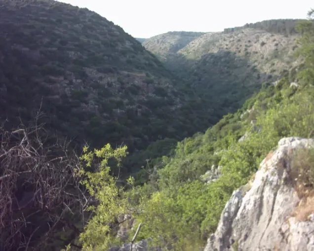
The village lay in the basin feeding the upper reaches of Wadi al-Laymun, overlooked several valleys, and faced Mount Jarmaq.
Nearby localities included al-Zahiriyya al-Fawqa, 'Ayn al-Zaytun, 'Akbara, al-Shuna, al-Sammu'i, al-Farradiyya, and the city of Safad itself.
The Name al-Zahiriyya al-Tahta
Walid Khalidi suggests that the name al-Zahiriyya may have commemorated the Mamluk sultan al-Zahir Baybars.
The second element, al-Tahta, means “lower” and distinguished the village from neighboring al-Zahiriyya al-Fawqa, the “upper” village.
Palestine Remembered also records a local possibility linking the name to Zahir al-'Umar al-Zaydani. Because Khalidi does not present this as the primary explanation, it is treated here as an alternative interpretation rather than an established etymology.
al-Zahiriyya al-Tahta in the Ottoman Period
In 1596, al-Zahiriyya al-Tahta was a village in the nahiya of Jira within the liwa of Safad and had an estimated population of approximately 308.
The inhabitants paid taxes on pastureland, goats, and beehives, and the records mention a press used for processing olives or grapes.
In the late nineteenth century, the village was described as stone-built at the foot of a hill, surrounded by olive trees and arable land, with an estimated population of approximately 100.
Architecture of al-Zahiriyya al-Tahta
The modern village had an elongated layout, and its houses were tightly clustered.
Expansion westward was restricted by the cliffs along Wadi al-Laymun, so newer houses were built northwest of the older residential core.
The houses were principally constructed of stone, and the village's proximity to Safad gave it direct access to the city's road network.
The built-up area amounted to approximately 28 dunums in 1944/45.
Water Resources
al-Zahiriyya al-Tahta was richly supplied with springs and wells, which supported irrigated cultivation and orchards.
Palestine Remembered preserves later community-contributed photographs of a village spring immediately west of the road to Safad. These later images document the landscape but are not part of the official Mandate statistical record.
Education
Khalidi's village entry does not document an independent formal school within al-Zahiriyya al-Tahta. Children attended schools in nearby Safad.
Palestine Remembered likewise states that pupils received their formal schooling in Safad.
Local oral-history material refers to elementary religious instruction in a village kuttab, but this should not replace the principal documented point that formal school education was obtained in Safad.
Population of al-Zahiriyya al-Tahta
The inhabitants were predominantly Muslim.
Members of the al-Kharabina Bedouin community also established seasonal camps west of the village, but they should not automatically be incorporated into the official figures for the settled village population.
Population of al-Zahiriyya al-Tahta in selected years
- 1596308Estimate derived from Ottoman records
- Late nineteenth centuryApproximately 100Historical estimate
- 1922212Official British Mandate census
- 1931256Official British Mandate census
- 1944/45350Official statistics
- Estimated refugees in 19982,493Later estimate published by Palestine Remembered
Number of Houses
Number of houses in al-Zahiriyya al-Tahta
- 193153Official British Mandate census
The principal approved sources used here do not provide a reliable official house count for 1948.
Economic Life
Agriculture was the principal source of livelihood, supported by the village's proximity to Safad and its abundant springs and wells.
Olive cultivation was particularly important. Olive trees covered approximately 145 dunums, especially on the eastern village lands and between the village and the southern outskirts of Safad.
The village also contained several olive presses.
In 1944, 3,042 dunums were devoted to cereals and 810 dunums were irrigated or used for plantations.
Local oral-history accounts describe additional employment outside agriculture, including work in Safad and Haifa. Khalidi's principal entry does not quantify these activities, so they are not presented as major statistically established economic sectors.
Land Ownership
The total registered land area of al-Zahiriyya al-Tahta was 6,773 dunums in the 1944/45 statistics.
Land ownership in al-Zahiriyya al-Tahta, 1944/45
- Palestinian6,771 dunums100%
- Transferred to Zionists0 dunums0%
- Communal/Public2 dunums<1%
No land was recorded in the category “Transferred to Zionists.” Almost the entire registered area was Palestinian, apart from two public/communal dunums.
Land Use in al-Zahiriyya al-Tahta, 1944/45
Land use in al-Zahiriyya al-Tahta according to PalQuest's detailed statistics
- Palestinian
- Communal/Public
- Plantations and irrigable land810 dunums
- Cereals3,042 dunums
- Built-up area28 dunums
- Non-cultivable land2,893 dunums
Cultivated or cultivable land totaled 3,852 dunums, approximately 57 percent of the village lands.
Built-up and non-cultivable land together amounted to 2,921 dunums, approximately 43 percent of the total.
Palestine Remembered presents 2,893 dunums of non-arable land in a single Palestinian column, while PalQuest's detailed statistics show 2,891 Arab dunums and two public dunums. The public category is therefore separated above.
The 145 dunums of olive trees represent a crop detail within the agricultural land and should not be added again to the total cultivable area.
The Failed 4 May 1948 Attack
al-Zahiriyya al-Tahta was attacked several days before Safad fell.
On 5 May 1948, Arab Liberation Army commander Fawzi al-Qawuqji reported that Zionist forces had attempted the previous day, 4 May, to capture al-Zahiriyya al-Tahta and Safad.
The attack was repelled, and the Arab unit involved in the defense was the Second Battalion of the Yarmuk Regiment of the Arab Liberation Army.
Four May should therefore not be treated as the village's occupation date; it marks a failed attempt preceding the fall of Safad.
The Evacuation of Civilians
According to villagers later interviewed by Palestinian historian Nafez Nazzal, the displacement process had already begun before Safad's fall.
On 1 May, following the assault on 'Ayn al-Zaytun, elderly people, women, and children from al-Zahiriyya al-Tahta were evacuated to 'Ayn al-Wuhush immediately south of the village.
Approximately twenty to thirty men remained behind as a local militia to guard the village.
The depopulation of al-Zahiriyya al-Tahta was therefore a process that unfolded over several days rather than a single moment.
Operation Yiftach and the Fall of al-Zahiriyya al-Tahta
The events at al-Zahiriyya al-Tahta occurred within the broader framework of Operation Yiftach, conducted by Palmach forces in eastern Galilee between 15 April and 25 May 1948.
The Palmach's First Battalion spearheaded the broader operation.
Palestine Remembered classifies al-Zahiriyya al-Tahta under Operation Yiftach and lists the Palmach First Battalion as the responsible unit.
Khalidi's dedicated village entry, however, does not explicitly identify the First Battalion as the village-specific force that entered al-Zahiriyya al-Tahta after Safad fell. The general operational attribution should therefore not be converted into an unquestioned village-level unit identification.
Occupation and Depopulation during the Nakba
Safad fell on 10 May 1948.
When the local militia in al-Zahiriyya al-Tahta learned of Safad's fall, its members withdrew to rejoin their families, who had already been evacuated.
Some later moved to al-Farradiyya to the south and al-Sammu'i to the east.
Khalidi states that al-Zahiriyya al-Tahta fell “shortly after” Safad, while Palestine Remembered lists 10 May itself as the occupation date.
The most precise formulation is therefore that the village was emptied and fell in the immediate aftermath of Safad's capture on 10 May, without claiming a separately documented final battle inside the village on that exact day.
An Israeli military intelligence report prepared the following month stated that the inhabitants left because they feared an imminent Zionist attack.
According to survivor testimony, some villagers later attempted to return to retrieve possessions, and a small number were killed by mines planted by the Haganah.
- Broader military operation: Operation Yiftach.
- Operation Yiftach dates: 15 April–25 May 1948.
- Evacuation of elderly people, women, and children: 1 May 1948 after the assault on 'Ayn al-Zaytun.
- Failed Zionist attempt to capture the village: 4 May 1948.
- Arab unit that repelled the attack: Second Battalion of the Yarmuk Regiment, Arab Liberation Army.
- Fall of Safad: 10 May 1948.
- Withdrawal of the village militia: after learning of Safad's fall.
- Fall of al-Zahiriyya al-Tahta: shortly after Safad; Palestine Remembered lists 10 May.
- Palmach First Battalion: spearheaded Operation Yiftach generally and is listed by Palestine Remembered, but Khalidi does not independently establish it as the village-specific occupying unit.
- Cause of departure recorded in the intelligence report: fear of an imminent Zionist attack amid the collapse of the surrounding area.
Israeli Development on the Village Lands
Khalidi does not identify a separate Israeli settlement newly founded under another name directly on the village site.
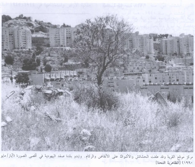
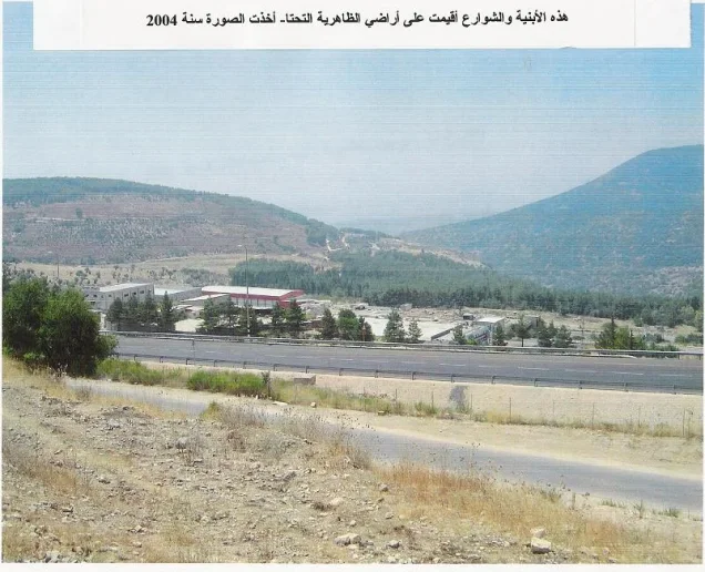
Instead, the southern neighborhoods built as Safad expanded after 1948 absorbed the former village site and substantial portions of al-Zahiriyya al-Tahta's lands.
al-Zahiriyya al-Tahta Today
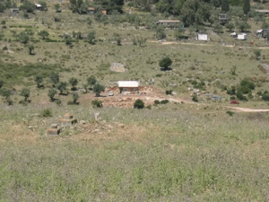
According to the field description published by Walid Khalidi in All That Remains, the site's topography had been drastically altered as the expansion of Safad absorbed the former village lands.
A road crossing the site formed part of the expanded urban neighborhood and led to a cluster of houses that were recently built at the time of Khalidi's documentation.
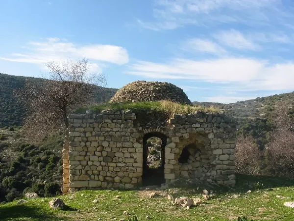
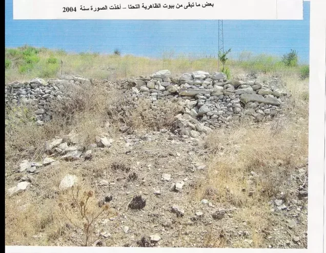
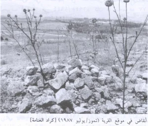
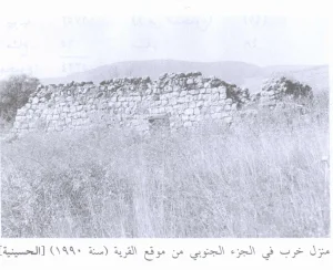
Despite this transformation, scattered stone rubble from demolished Palestinian houses could still be identified, together with iron supports projecting from ruined cement walls.
The village cemetery remained visible, although badly deteriorated, and olive and almond trees survived along the edge of the site.
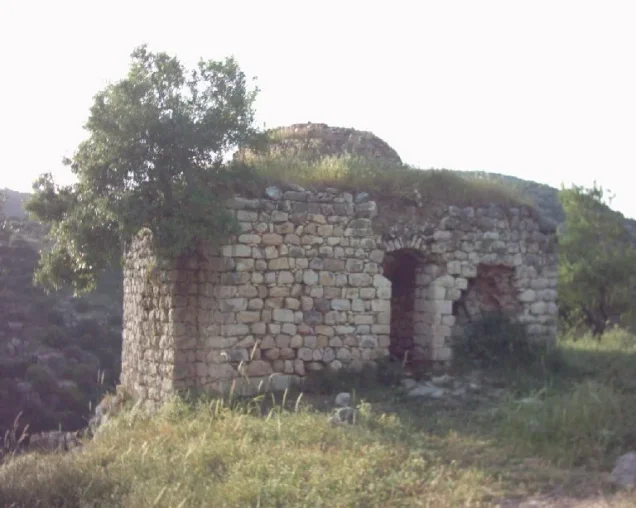
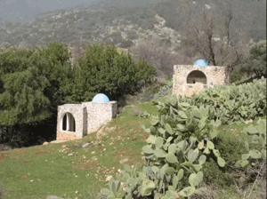
Palestine Remembered preserves later community-contributed photographs, including images taken in 2003 of the village spring, fig groves, surviving olive trees, and a shrine locally identified as Maqam al-Shaykh Quways.
These materials are valuable community documentation but do not constitute a systematic independent field survey of the entire former village.
Khalidi's principal field description predates the publication of his 1992 book and should therefore not be treated as a direct field verification of the site's condition in 2026.
The approved sources used here do not provide a sufficiently comprehensive independent contemporary survey to establish the precise condition of every surviving feature of al-Zahiriyya al-Tahta today.
Sources
- PalQuestPalQuest – Interactive Encyclopedia of the Palestine Question: al-Zahiriyya al-Tahta
- PalQuestPalQuest – Operation Yiftach
- Palestine RememberedPalestine Remembered – al-Zahiriyya al-Tahta, Safad District
- Palestine RememberedPalestine Remembered – al-Zahiriyya al-Tahta entry from All That Remains
- archive.orgGovernment of Palestine – Census of Palestine, 1922
- Institute for Palestine StudiesInstitute for Palestine Studies – All That Remains, Walid Khalidi
Photo gallery





Photos from the village's people
Photos sent in by visitors and published after review.
Add a photo of this village
Log in to add photos of this village.
Other villages from Safed
More from the archive



 Download Our Palestine App
The whole archive in the palm of your hand: depopulated villages, the Nakba, the massacres and Al-Aqsa — free, with no ads to erase the story.
Download Our Palestine App
The whole archive in the palm of your hand: depopulated villages, the Nakba, the massacres and Al-Aqsa — free, with no ads to erase the story.



Comments
No comments yet — be the first to write one.
Add your comment
Name and email are optional. Comments appear after review.