Jericho before the Nakba: oasis of water, bananas and refuge
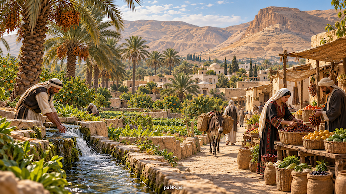
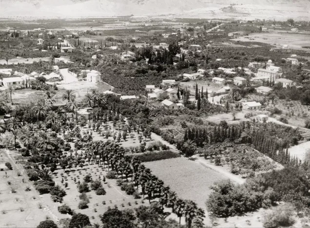
In Jericho before the Nakba, water drove the whole story: to the orchard, the home and the road that carried crops to market. Beneath dry mountains lay a green oasis with a small town visited by farmers, merchants, pilgrims and winter guests, where daily life sat beside the remains of the oldest human settlement in Palestine. [1][2][3]
Then came the Nakba. Israeli forces did not occupy Jericho in 1948, but the oasis became one of the largest centres receiving Palestinians driven by Zionist forces from their towns and villages; the Aqabat Jabr and Ein al-Sultan camps were set up beside it, and the first alone held some 30,000 refugees before the 1967 war. [4][5]
Contents
- Jericho before the Nakba at a glance
- The name: city of the moon and of palms
- Tell es-Sultan: the oldest settlement
- Location and climate: valley warmth near the mountains
- Jericho’s population before the Nakba
- Ein al-Sultan and the irrigation channels
- Farming: bananas, citrus and date palms
- Crafts: milling, mats and baskets
- Market and road: Jericho between Jerusalem and the valley
- Homes and families
- Customs and the Nabi Musa festival
- Winter and visitors
- Deir Qarantal and Hisham’s Palace
- Women and children
- Education
- Jericho in 1948: refuge for the uprooted
- Aqabat Jabr and Ein al-Sultan
- Musa al-Alami’s project
- From the Nakba to occupation: Jericho after 1967
- Frequently asked questions about Jericho before the Nakba
Jericho before the Nakba at a glance
| Item | Details |
|---|---|
| Location | The western edge of the Jordan Valley, below sea level |
| Town population | About 300 (1912), 1,039 (1922), 1,693 (1931), about 3,010 (1945) |
| Main water source | Ein al-Sultan spring |
| Main crops | Bananas, citrus, date palms and vegetables |
| Landmarks | Tell es-Sultan, Hisham’s Palace, Deir Qarantal, the Nabi Musa shrine nearby |
| Education | Two elementary schools, for boys and girls (1942–1943) |
| In the Nakba | Refugees received; Aqabat Jabr and Ein al-Sultan camps set up in 1948 |
| Occupation of the town | June 1967 |
Population figures are for the town alone, not the camps set up after the Nakba. [2][6][3][7][4][5]
The name: city of the moon and of palms
Palestinian sources link the name Jericho to ancient Semitic forms such as “Yeriho” and to the moon, and give the Arabic forms Ariha and Arihaa. Its epithet “city of palms” evokes the oasis and its farming through history. [1]
Read also: Jericho and its old photographs.
Tell es-Sultan: the oldest settlement
Tell es-Sultan lies north-west of modern Jericho, beside the perennial Ein al-Sultan spring. UNESCO notes that the site preserves successive layers of human activity, with a large, permanent settlement there in the ninth and eighth millennia BCE. [3]
Read also: Tell es-Sultan, ancient Jericho.
Location and climate: valley warmth near the mountains
Jericho lies at the western edge of the Jordan Valley, between the highlands to the west and the valley floor to the east, giving it a role in movement between Jerusalem, the Jordan River and the east, and in visitors’ journeys. It is below sea level, with winters warmer than in the highland towns. [1][2]
Jericho’s population before the Nakba
Jericho’s population grew steadily in the first half of the twentieth century, according to the municipality and the Palestinian Central Bureau of Statistics. It was a small town, but water, farming, visitors and the road gave it a role beyond its size. [2][6]
- 1912About 300
- 19221,039
- 19311,693
- 1945About 3,010
Ein al-Sultan and the irrigation channels
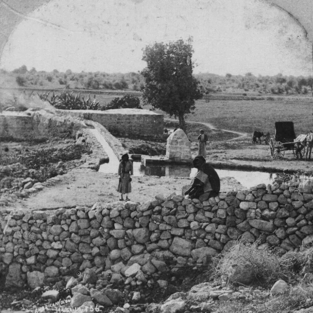
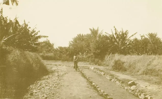
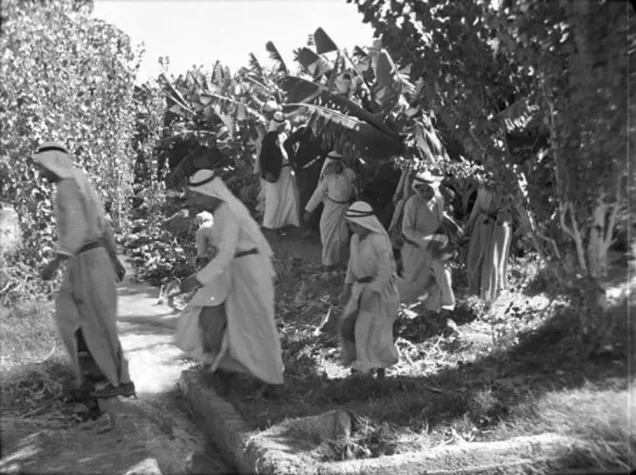
Ein al-Sultan has been a perennial water source since ancient Jericho, and archival photographs show the spring and the channels carrying water between plots, among them an irrigation channel lined with greenery around 1926. [3][8]
Farming: bananas, citrus and date palms
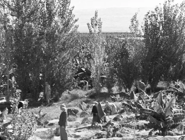
Jericho grew grain and fruit trees, above all bananas, citrus and date palms, along with other crops. [2]
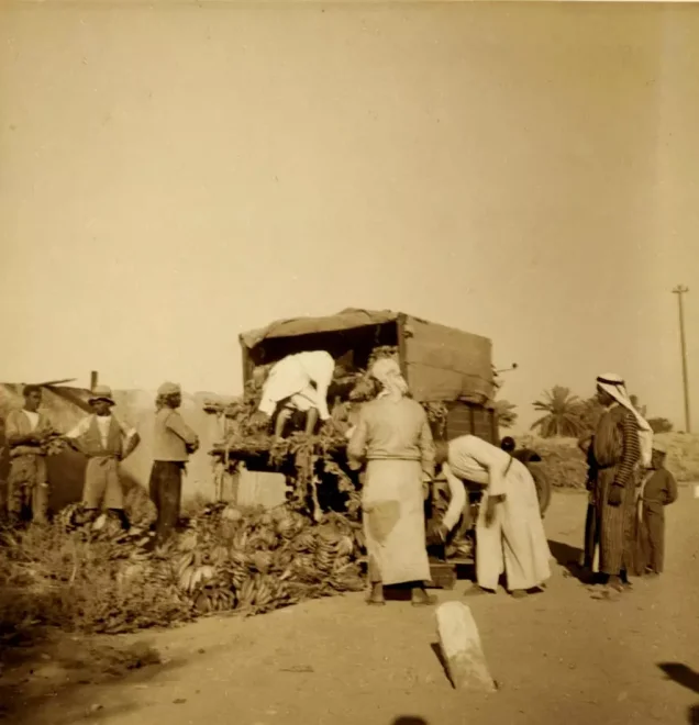
Archival photographs show the banana groves and those who worked them, and bananas being loaded in 1937, in a chain of work from tending and harvesting to transport and sale. [8]
Read also: Agriculture in Palestine before the Nakba; Life in the Palestinian village.
Crafts: milling, mats and baskets
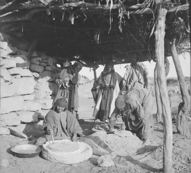
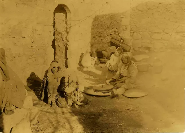
The Jericho gallery holds a photograph of grain being ground and bread made around 1900, and sources record a long history of making mats, baskets and bricks from local materials. [8][2][7]
Read also: Palestinian industries before the Nakba.
Market and road: Jericho between Jerusalem and the valley
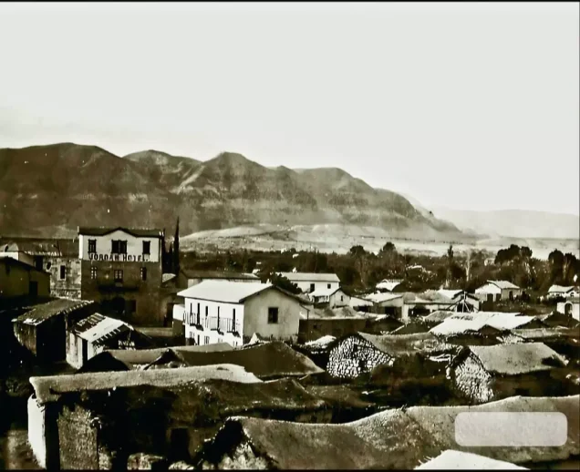
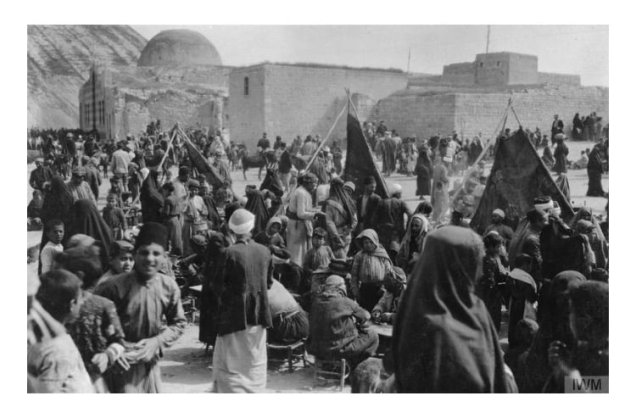
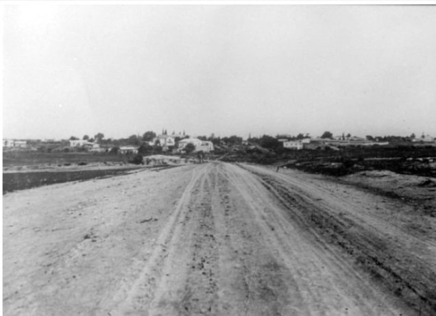
Its position made Jericho a crossing point between Palestine and the east, where residents, visitors and farm workers met: surplus was sold, households bought what they did not produce, and travellers found food and lodging. A 1917 photograph shows the western entrance and the road into town. [1][8][9]
Read also: Markets and trade in Palestine before 1948.
Homes and families
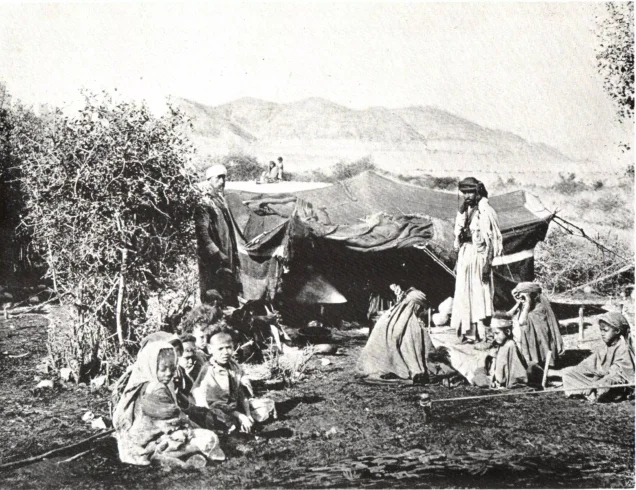
A photograph of a Jericho family around 1917 shows people by a modest building with everyday tools, while an 1893 photograph of Bedouin tents preserves another way of living around Jericho. [8]
Customs and the Nabi Musa festival
Jericho shared in the Palestinian cultural world built around family, neighbours and hospitality: coffee, folk song, embroidery and shared joys and sorrows. [10]
Nearby, the spring Nabi Musa festival drew delegations from Jerusalem and elsewhere, in processions with banners and songs, blending religion, social life and trade. [11][12]
Read also: Popular seasonal festivals before the Nakba; Palestinian wedding customs.
Winter and visitors
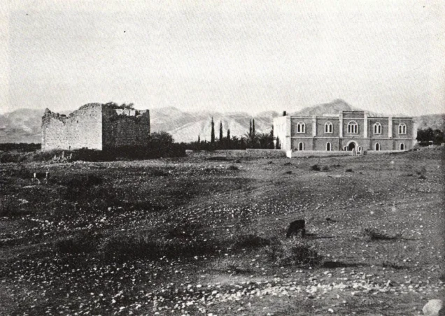
Mild winters and nearby religious and archaeological sites drew visitors to Jericho, and an 1891 photograph shows a hostel for Russian pilgrims. The Ministry of Tourism and Antiquities links Jericho with the Mount of Temptation, the Jordan River and Christian pilgrimage sites. [8][13]
Read also: Tourism and hotels in Palestine before the Nakba.
Deir Qarantal and Hisham’s Palace
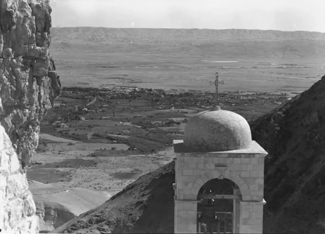
Deir Qarantal is linked in Christian tradition with Christ’s fast and temptation in the wilderness, and looks down on the oasis from the cliff. [14]
Under the Mandate, excavations at Hisham’s Palace (Khirbat al-Mafjar) took place between 1935 and 1948 under the Palestinian archaeologist Dimitri Baramki, and John Garstang excavated at Jericho between 1930 and 1936. [15][16]
Women and children
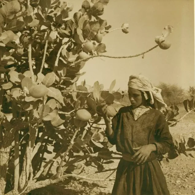
Women and children appear in photographs of families, schooling and life outdoors, and housework, cooking, childcare and storing provisions were part of the household economy. [8]
Read also: Palestinian women before the Nakba.
Education
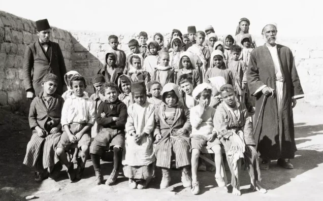
In 1942–43 Jericho had two elementary schools, one for boys and one for girls; in the period covered by WAFA’s source, fourth grade was the highest class in both, so pupils wishing to continue had to move to other towns. [7][17]
Read also: Palestinian education before 1948.
Jericho in 1948: refuge for the uprooted
Jericho remained outside the control of Israeli forces in the 1948 war, then came under Jordanian administration until Israel occupied it with the West Bank in 1967. Families driven by Zionist forces from their homes and land arrived there; UNRWA defines a refugee as one who lost both home and livelihood as a result of the 1948 war. [7][18]
On 1 December 1948 the Jericho Conference met there and called for Palestinian-Jordanian unity; its resolutions included demands to save Palestine and for the refugees’ return. [19]
Read also: The union of the two banks, 1950.
Aqabat Jabr and Ein al-Sultan
The Aqabat Jabr and Ein al-Sultan camps were set up in 1948. [4][5]
| Camp | Founded | Location and origins |
|---|---|---|
| Aqabat Jabr | 1948 | South-west of Jericho; from villages including Ajjur, al-Abbasiyya, Bayt Jibrin, Tell al-Safi, Bayt Dajan, Yazur and Kafr Ana |
| Ein al-Sultan | 1948 | Beside Jericho, near the spring and the tell |
UNRWA lists among the origins of Aqabat Jabr families villages across Palestine, such as Yazur. [4]
Read also: Palestinian refugee camps; Depopulated villages; Massacres.
Musa al-Alami’s project
Musa al-Alami founded the Arab Development Society before the Nakba; in 1949 he requested land near Jericho, and in 1950 brought refugee families there for work, farming and vocational training, trying to turn lost livelihoods into production and education. [20][21]
From the Nakba to occupation: Jericho after 1967
In the 1967 war Israel occupied Jericho; most of Ein al-Sultan camp’s people were displaced to Jordan, and many fled Aqabat Jabr, which had held some 30,000 refugees: a second Nakba for the same refugees. [5][4]
The occupation still targets the camps: in early February 2023 it besieged Jericho for about a week, closing its exits with checkpoints, and raided Aqabat Jabr camp twice in 24 hours, wounding about 13 Palestinians and partly demolishing a house. [22]
Jericho thus carries two memories: that of the oasis that lived from its water and land, and that of the refugees who brought to it the names of villages they have never given up the right to return to.
Frequently asked questions about Jericho before the Nakba
Where does the name Jericho come from?
Sources link it to ancient Semitic forms such as “Yeriho” and to the moon. [1]
Is modern Jericho the same as Tell es-Sultan?
No. Tell es-Sultan is the site of ancient Jericho, north-west of the modern town. [3]
What was Jericho’s population in 1945?
Were bananas grown in Jericho before 1948?
Yes; one record is a 1937 photograph of bananas being loaded in Jericho’s gardens. [8]
What is Jericho’s link to the Nabi Musa festival?
The shrine is nearby, and the spring festival drew delegations from Jerusalem and elsewhere. [11][12]
Did Israel occupy Jericho in 1948?
No. It remained under Jordanian administration until its occupation in 1967. [7]
When were the Aqabat Jabr and Ein al-Sultan camps set up?
In 1948, to shelter refugees expelled by Zionist forces from their towns and villages. [4][5]
Read also on Palestinuna
- Jericho and its photographs
- Aqabat Jabr camp
- Ein al-Sultan camp
- Palestinian refugee camps
- Depopulated villages
- Palestine before the Nakba
Sources and references
- Palestinian National Information Center – WAFA, “Jericho” (in Arabic).
- Jericho Municipality, “Population and Economic Activity” (in Arabic).
- UNESCO, “Ancient Jericho/Tell es-Sultan”.
- UNRWA, “Aqabat Jabr Camp”.
- UNRWA, “Ein el-Sultan Camp”.
- Palestinian Central Bureau of Statistics, “Jericho City Report” (in Arabic).
- Palestinian Encyclopedia, “Jericho (city)” (in Arabic).
- Palestinuna, “Jericho photo gallery”.
- Palestinuna, “Markets and Trade in Palestine before 1948”.
- Palestinian National Information Center – WAFA, “National List of Palestinian Intangible Cultural Heritage” (in Arabic).
- Palestinuna, “Popular Seasonal Festivals before the Nakba”.
- Palestinuna, “The Shrine of Nabi Musa”.
- Palestinian Ministry of Tourism and Antiquities, “Jericho” (in Arabic).
- Palestinian Ministry of Tourism and Antiquities, “Deir Qarantal” (in Arabic).
- Palestinian Ministry of Tourism and Antiquities, “Hisham’s Palace (Khirbat al-Mafjar)”.
- Garstang Museum of Archaeology, “John Garstang’s Excavations at Jericho”.
- Palestinian National Information Center – WAFA, “Education under the British Mandate,” Jerusalem district section (in Arabic).
- UNRWA, “Palestine Refugees”.
- Institute for Palestine Studies – PalQuest, “Resolutions of the Jericho Conference on Palestinian-Jordanian Unity, 1 December 1948” (in Arabic).
- Institute for Palestine Studies – PalQuest, “Musa al-Alami” (in Arabic).
- Arab Development Society, “History of the Association”.
- “After Raiding Aqabat Jabr Camp, the Occupation Fails to Arrest the Almog Attackers,” Al Jazeera Net, 4 February 2023 (in Arabic).
More from the archive
 Download Our Palestine App
The whole archive in the palm of your hand: depopulated villages, the Nakba, the massacres and Al-Aqsa — free, with no ads to erase the story.
Comments
No comments yet — be the first to write one.
Add your comment
Name and email are optional. Comments appear after review.