
The depopulated village of Qaytiyya / District of Safed

Qaytiyya
About the depopulated village of Qaytiyya
- District
- Safed
- Date Qaytiyya was occupied
- 19 May 1948
- Population in 1948
- 1,100
- Military operation
- Operation Yiftach
- Brigade that carried it out
- Palmach
- Distance from the governorate centre
- 28 (km) North East of Safad
- Elevation above sea level
- 75 m
- Cause of displacement
- Haganah 'Wispering' campaign (psychological warfare)
- Extent of destruction
- Mostly destroyed with the exception of few stone houses
- Ethnic cleansing
- Mostly ethnically cleansed as a result of a campaign of psychological warfare on the 19th of May 1948. Completely ethnical cleansed in June 1949
- Settlements built on the land of Qaytiyya before 1948
- Kfar Blum
Hover a dot to read the village name, or click to open its card.
Borders of the depopulated village of Qaytiyya
Qaytiyya – A Depopulated Palestinian Village in the Safad Subdistrict
Qaytiyya was a Palestinian village in the Safad Subdistrict, situated in the northern sector of the al-Hula Plain, northeast of the city of Safad and between the Dan and al-Hasibani rivers, both tributaries of the Jordan River. PalQuest and Walid Khalidi place the village approximately 28 km northeast of Safad at an average elevation of about 75 meters above sea level.
The Palestinian Encyclopedia gives a road distance of approximately 42.5 km from Safad, of which 40.5 km was paved, and places the village at an elevation of about 85 meters. The figures can be understood as reflecting different methods of measurement: an approximate geographical distance in the first case and road distance in the second.
Qaytiyya experienced its principal wave of displacement during the Nakba and the occupation of Palestine in 1948, in connection with the psychological-warfare campaign associated with Operation Yiftach. The displacement, however, was not completed in 1948. Some inhabitants remained until 5 June 1949, when Israeli occupation forces expelled them toward 'Akbara together with inhabitants of al-Ja'una and al-Khisas.
Location and Geography of Qaytiyya
Qaytiyya stood on flat ground in the northern al-Hula Plain, between the Dan and al-Hasibani rivers. A secondary road connected the village with nearby al-Khalisa, approximately 3 km to the west, which in turn lay on a main road leading toward Safad.
The Palestinian Encyclopedia states that al-Hasibani crossed the western part of the village and that the al-Qaruni River passed immediately to its east, while the Banias River was approximately 1.5 km away. Walid Khalidi and PalQuest, however, describe Qaytiyya primarily as lying between the Dan and al-Hasibani rivers.
- Subdistrict
- Safad
- Distance from Safad
- Approximately 28 km northeast according to PalQuest and Khalidi; approximately 42.5 km by road according to the Palestinian Encyclopedia
- Elevation
- 75 m according to PalQuest; approximately 85 m according to the Palestinian Encyclopedia
- Physical setting
- Northern al-Hula Plain, between the Dan and al-Hasibani rivers
- Total land area
- 5,390 dunums
- Built-up area, 1944/45
- 93 dunums
Built Form of Qaytiyya
Qaytiyya consisted of two principal sections. Walid Khalidi describes the eastern quarter as standing on the western bank of the Dan River, with its houses relatively closely clustered, while the western quarter stood on the eastern bank of al-Hasibani and had more widely dispersed houses.
The Palestinian Encyclopedia gives a more detailed description, identifying the larger eastern section as lying west of the al-Qaruni River and east of al-Hasibani. It consisted of a densely built portion extending north to south and a more dispersed area to its west. The smaller western section was situated near al-Hasibani and also extended broadly from north to south.
Neighboring Villages and Lands
Palestine Remembered lists the lands of Lazzaza, al-Mansura, al-'Abisiyya, al-Zuq al-Tahtani, al-Na'ima, al-Salihiyya, and al-Dawwara among the lands surrounding Qaytiyya. Al-Khalisa was also one of the village's closest neighboring communities to the west.
Secondary Palestinian geographical sources place Lazzaza to the north, al-'Abisiyya to the east, al-Dawwara to the south, al-Na'ima to the southwest, al-Khalisa to the west, and al-Zuq al-Tahtani to the northwest. These directions are best treated as approximate geographical descriptions rather than substitutes for detailed village-boundary maps.
Population of Qaytiyya
The official 1931 Census of Palestine recorded 824 inhabitants in Qaytiyya, all of them Muslims, living in 163 occupied houses.
In the 1944/45 Village Statistics, Qaytiyya had a population of 940 Arabs. Palestine Remembered later estimated the village population at 1,090 in 1948 and the number of refugees and their descendants at 6,696 in 1998. These latter two figures are retrospective estimates and are not official British Mandate census counts.
- 1931824Official census; all recorded as Muslims
- 1944/45940Official Village Statistics; classified as Arabs
- 19481,090Later estimate reported by Palestine Remembered, not an official census
- 19986,696 refugeesLater estimate of refugees and their descendants
Number of Houses
- 1931163Occupied houses recorded in the official 1931 census
- 1948215Later estimate reported by Palestine Remembered
The Palestinian Encyclopedia gives 193 houses for 1931, but the official census table clearly records 163 occupied houses. The official figure is therefore used here.
Land Ownership in Qaytiyya
Qaytiyya's total land area in the 1944/45 Village Statistics was 5,390 dunums. Palestine Remembered presents its simplified ownership categories as follows:
- Palestinian4,682 dunums87%
- Transferred to Zionists183 dunums3%
- Communal/Public525 dunums10%
The official categories reproduced by PalQuest classify 4,682 dunums as Arab land, 183 dunums as Jewish land, and 525 dunums as public land. The land classified as Jewish amounted to approximately 3.4 percent of the village's total land area.
Land Use in 1944/45
- Arab
- Jewish
- Public
- Citrus and bananas19 dunums
- Plantations and irrigable land4,648 dunums
- Cereals44 dunums
- Built-up land93 dunums
- Non-cultivable land586 dunums
A total of 4,711 dunums were classified as cultivable, including 4,528 Arab dunums and 183 Jewish dunums. The Arab cultivable total consisted of 19 dunums devoted to citrus and bananas, 4,465 dunums of plantations and irrigable land, and 44 dunums used for cereals.
The 586 dunums classified as non-cultivable should not be attributed entirely to Palestinian ownership. The detailed official table divides them into 61 Arab dunums and 525 public dunums. A further 93 Arab dunums constituted the built-up area.
Economic Life in Qaytiyya
Agriculture and animal husbandry formed the principal basis of Qaytiyya's economy. Its location amid the waterways of the northern al-Hula Plain supported extensive irrigation and orchard cultivation.
In 1944/45, 19 dunums were devoted to citrus and bananas and 44 dunums to cereals. Plantations and irrigable land covered 4,648 dunums in total, comprising 4,465 Arab dunums and 183 Jewish dunums.
The village also contained a grain mill. Walid Khalidi places it on the bank of the Dan River, while the Palestinian Encyclopedia describes the mill as standing on the eastern bank of the al-Qaruni River.
Water
The geography and economy of Qaytiyya were closely tied to the waterways of the northern al-Hula Plain. Khalidi describes the village as lying between al-Hasibani and the Dan River, and its extensive irrigated lands benefited from the area's abundant water resources.
The Palestinian Encyclopedia additionally places the Banias River approximately 1.5 km from Qaytiyya and describes the network of nearby streams as part of the upper tributary system of the Jordan River.
Education and Services
The principal sources used here do not provide sufficiently documented evidence of a formal school in Qaytiyya. The Palestinian Encyclopedia states more generally that the village lacked public services. No reliable founding date, pupil count, or other formal school data can therefore be established from the available sources.
Displacement of Qaytiyya in 1948
The displacement of Qaytiyya cannot accurately be reduced to a single date. Walid Khalidi, citing Israeli historian Benny Morris in this context, attributes the villagers' initial departure to the psychological-warfare campaign conducted by the Haganah within the broader framework of Operation Yiftach in eastern Galilee.
Operation Yiftach lasted from 15 April to 25 May 1948. Palmach forces played the principal military role, and the Palmach's First Battalion served as the spearhead of the operation generally.
Khalidi reports, on the basis of Morris's account, that the residents of Qaytiyya left on 19 May 1948. Palestine Remembered presents this date as the village's occupation date, but the detailed narrative specifically identifies it as the date of the principal exodus associated with psychological warfare. It is therefore more precise to describe 19 May as the principal documented date of population departure rather than automatically equating it with a separately verified military entry into the village.
Palestine Remembered identifies the Palmach's First Battalion as the attacking unit. Although that battalion is independently documented as the spearhead of Operation Yiftach as a whole, Khalidi's village-specific entry does not independently identify the unit that physically entered Qaytiyya.
Final Expulsion of the Remaining Inhabitants in 1949
Not all of Qaytiyya's inhabitants left in 1948. According to the account transmitted by Khalidi, at least some residents remained in the village until June 1949.
At midnight on 5 June 1949, trucks carrying Israeli occupation forces surrounded Qaytiyya. Soldiers entered the village, rounded up its remaining inhabitants, and expelled them, together with residents of al-Ja'una and al-Khisas, to a bare hillside near 'Akbara, south of Safad.
Khalidi, citing the Israeli account he discusses, reports that the treatment of the villagers generated criticism in some Israeli political circles. A Mapam member of the Knesset described the villagers as having been subjected to kicks, curses, and maltreatment. Israeli military authorities justified the removal on security grounds connected with the proximity of the border and alleged Syrian intelligence efforts to recruit local villagers.
This 1949 expulsion must be distinguished from Operation Yiftach. The operation ended on 25 May 1948, whereas the final removal of Qaytiyya's remaining residents took place on 5 June 1949, more than a year later.
- 15 April – 25 May 1948
Operation Yiftach
Operation to seize eastern Galilee; the Palmach's First Battalion spearheaded the operation generally
- 19 May 1948
Main population exodus
According to Benny Morris as cited by Khalidi; associated with psychological warfare
- 1948 – June 1949
Some inhabitants remain
Khalidi's account indicates that part of the population remained in Qaytiyya
- 5 June 1949
Final expulsion of remaining residents
Israeli occupation forces expelled them toward 'Akbara with residents of al-Ja'una and al-Khisas
Israeli Settlements on Qaytiyya's Lands
Kefar Blum: Founded in 1943 south of Qaytiyya on land belonging to the village. Khalidi and PalQuest clearly identify it as a settlement established on Qaytiyya's lands before the Nakba.
Beyt Hillel: Founded in 1940 and situated closer to the Qaytiyya site than Kefar Blum, but it was not originally established on village land. Khalidi states that it may have absorbed some of Qaytiyya's land when it expanded in 1948. The Palestinian Encyclopedia also notes that later expansion reached the northwestern edge of the village site.
Qaytiyya Today
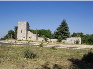
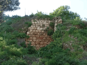
According to the field description published by Walid Khalidi in All That Remains, only a few stones from the former village remained visible. The surrounding land was under cultivation, except for a small area containing scattered stone rubble and overgrown with thorny vegetation and eucalyptus trees.
This description derives from fieldwork conducted before the publication of All That Remains in 1992 and should not be treated as direct field verification of the site's condition in 2026. Palestine Remembered contains later community documentation of the village and its lands, but upload dates do not necessarily establish when individual photographs or other materials were recorded, and they should not be treated as a comprehensive current survey.
Sources
- PalQuestPalQuest – Interactive Encyclopedia of the Palestine Question: Qaytiyya
- PalQuestPalQuest – Operation Yiftach
- Palestine RememberedPalestine Remembered – Qaytiyya, Safad
- palestinapedia.psPalestinian Encyclopedia – Qaytiyya
- pcbs.gov.psGovernment of Palestine – Census of Palestine 1931
- maktabatsabil.comGovernment of Palestine – Village Statistics 1945, Safad Subdistrict table
- Walid Khalidi, ed., All That Remains: The Palestinian Villages Occupied and Depopulated by Israel in 1948, Institute for Palestine Studies, 1992.
Photo gallery


Photos from the village's people
Photos sent in by visitors and published after review.
Add a photo of this village
Log in to add photos of this village.
Other villages from Safed


More from the archive


 Download Our Palestine App
The whole archive in the palm of your hand: depopulated villages, the Nakba, the massacres and Al-Aqsa — free, with no ads to erase the story.
Download Our Palestine App
The whole archive in the palm of your hand: depopulated villages, the Nakba, the massacres and Al-Aqsa — free, with no ads to erase the story.



Comments
No comments yet — be the first to write one.
Add your comment
Name and email are optional. Comments appear after review.