
The depopulated village of Marus / District of Safed
About the depopulated village of Marus
- District
- Safed
- Date Marus was occupied
- 26 May 1948
- Population in 1948
- 90
- Military operation
- Operation Yiftach
- Brigade that carried it out
- The Seventh Brigade
- Distance from the governorate centre
- 7 (km) North East of Safad
- Elevation above sea level
- 450 m
- Cause of displacement
- Military assault by Zionist troops
- Extent of destruction
- The village has been completely obliterated
- Ethnic cleansing
- Marus was mostly ethnically cleansed on 28th of May 1948 as a result of psychological warfare. By 30th of October 1948, the village was completely ethnically cleansed.
Hover a dot to read the village name, or click to open its card.
Borders of the depopulated village of Marus
Marus – Depopulated Palestinian Village of the Safad District
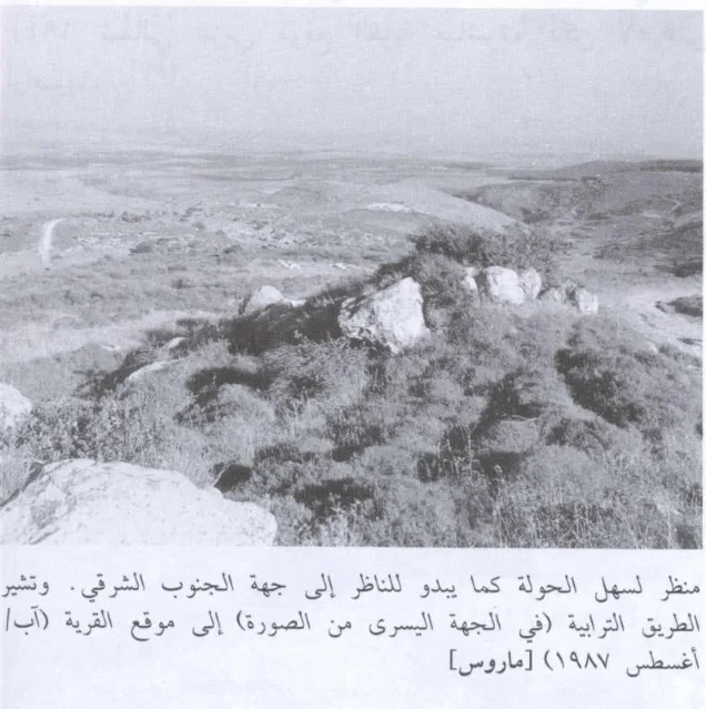
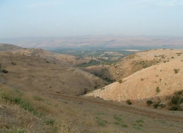
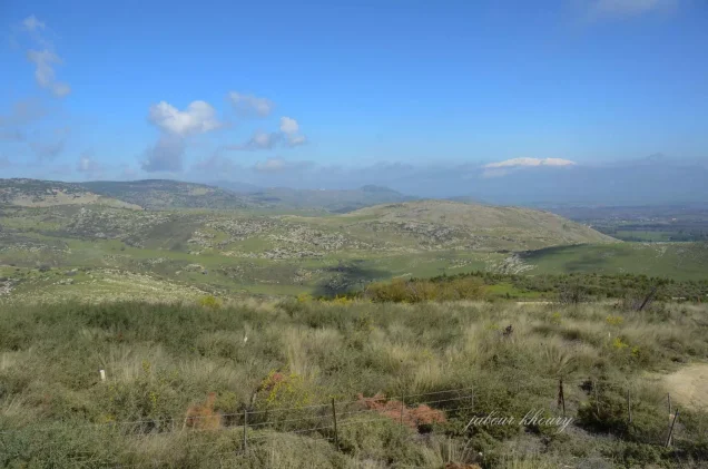
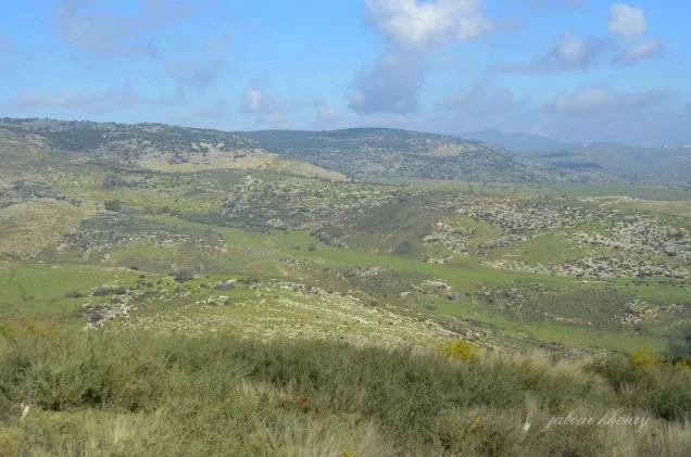
Marus was a depopulated Palestinian village in the Safad District. It stood on a slope descending from the eastern Upper Galilee mountains and overlooked the al-Hula Plain to the east. The village lay approximately 7 kilometers from Safad at an average elevation of about 450 meters above sea level.
Most of Marus's inhabitants left during an early phase of the Nakba. Military intelligence reports cited by Walid Khalidi record their departure on 28 May 1948 amid scattered ground attacks, mortar fire, and psychological warfare in the Galilee panhandle. The village, however, was not permanently occupied at that time. Final Israeli control came during Operation Hiram in late October, and Khalidi considers it likely that any inhabitants still present were expelled by the Sheva' or Seventh Brigade on 30 October 1948.
Location and Geography
Marus stood on a slope descending from the eastern Upper Galilee mountains toward the al-Hula Plain, which it overlooked to the east.
It lay approximately 7 kilometers from Safad at an average elevation of about 450 meters above sea level.
Some Palestinian local sources use a distance of approximately 9 kilometers, but Walid Khalidi and PalQuest give about 7 kilometers, which is the figure adopted here.
Two wadis passed near the village: one approximately 0.25 kilometers to the north and another roughly 0.5 kilometers to the southwest.
'Ayn Abu Zamla flowed approximately 0.75 kilometers south of the village.
Supporting Palestinian documentation places 'Alma to the north, Dayshum to the northeast, al-Husayniyya to the east, and Dalata to the west, with al-Wayziyya, Qabba'a, and 'Ayn al-Zaytun in the broader southern and southwestern surroundings.
Name
Walid Khalidi does not provide a conclusive etymology for the name Marus.
Palestinian local documentation derives the name from a Syriac term, “Marusa,” said to mean a person who presses grapes and olives.
Because this derivation does not appear in the principal village account, it is presented as a local tradition rather than a conclusively established linguistic origin.
Ottoman Period
In 1596, Marus was a village in the nahiya of Jira in the liwa' of Safad.
Its population was approximately 176.
The villagers paid taxes on wheat, barley, fruits, goats, and other forms of agricultural and livestock production.
Built Environment
During the Mandate period, the Palestine Index Gazetteer classified Marus as a small hamlet or farm.
The official 1944/45 statistics recorded only about 8 dunams of built-up land, consistent with the village's very small population and number of houses.
Marus was among the smaller rural communities of the Safad District.
Population and Houses
The inhabitants of Marus during the British Mandate were Muslims.
- 1596About 176Historical estimate based on Ottoman records
- 192245Official Census of Palestine; all inhabitants were Muslims
- 193159Official census; all inhabitants were Muslims
- 194580Official statistics; all inhabitants were Palestinian Arab Muslims
- 1948About 93Later demographic estimate, not an official Mandate census
- 1998About 570 refugees and descendantsLater estimate published by Palestine Remembered
The official 1931 census recorded 12 houses in Marus.
The estimate of approximately 18 houses for 1948 is a later calculation rather than an official Government of Palestine census figure.
Education and Religious Institutions
Walid Khalidi and PalQuest do not provide clear documentation of an independent school in Marus before the Nakba.
The principal village source also does not identify a particular mosque or shrine.
No specific educational or religious institution is therefore added without stronger village-level Palestinian documentation.
Water Resources
'Ayn Abu Zamla was one of the principal documented water sources associated with Marus and lay approximately 750 meters south of the village.
The local water resources and the mountainous environment supported both agriculture and livestock raising.
Economic Life and Agriculture
Grain cultivation and animal husbandry were the principal sources of livelihood.
The villagers cultivated wheat and barley as well as figs and other fruit trees, particularly to the east, northeast, and north of the village site.
In 1944/45, 903 dunams were devoted to cereals and 108 dunams were classified as plantations and irrigable land.
Palestine Remembered separately records 53 dunams planted with olives. This is a crop-specific figure and should not be added again to the official land-use totals.
Land Ownership, 1944/45
The total land area of Marus was 3,183 dunams.
- Arab3,181 dunums100%
- Jewish0 dunums0%
- Public2 dunums<1%
The official figures balance exactly: 3,181 + 2 = 3,183 dunams.
Under Palestine Remembered's terminology, the corresponding categories are 3,181 dunams “Palestinian,” 0 dunams “Transferred to Zionists,” and 2 dunams “Communal/Public.”
The wording “Transferred to Zionists” should be preserved when reproducing that source's classification.
Land Use, 1944/45
- Arab
- Public
- Cereals903 dunums
- Plantations and irrigable land108 dunums
- Total cultivable/cultivated land1,011 dunums
- Non-cultivable land2,164 dunums
- Built-up land8 dunums
- Total non-cultivable and built-up2,172 dunums
The official figures balance exactly: 1,011 dunams of cultivated or cultivable land plus 2,172 dunams of built-up and non-cultivable land equal the village's total area of 3,183 dunams.
Archaeology
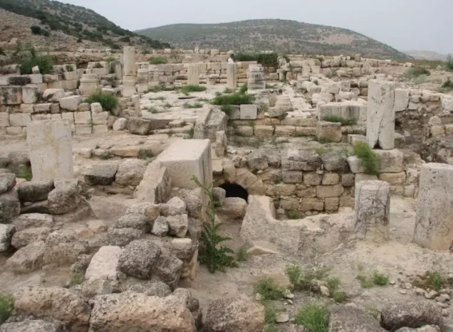
Marus was an important archaeological site in Upper Galilee.
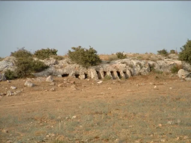
Archaeological remains included columns, rock-cut tombs, presses, and a cave with a carved stone entrance.
Excavations also focused on a building interpreted as a synagogue that functioned from approximately the seventh through the twelfth centuries CE. After it was abandoned, the structure was redesigned for residential use in the fourteenth century.
These findings document archaeological phases predating the modern Palestinian village and should not be used to erase or substitute for the history of Marus and its later inhabitants.
Supporting Palestinian documentation also records Khirbat Qasyun or Qasiun north of Marus, with remains including an ancient structure, a pool, cisterns, an olive press, rock-cut tombs, columns, column bases, and decorated architectural fragments.
First Exodus in May 1948
Israeli military intelligence reports cited by Walid Khalidi record the departure of Marus's villagers on 28 May 1948.
This occurred during a broader exodus from the Galilee panhandle.
Khalidi, citing Benny Morris, states that scattered ground attacks and mortar bombardment by Zionist forces helped prompt the population to leave.
Palmach commander Yigal Allon had also initiated psychological warfare in the region aimed at inducing Palestinian villagers to depart.
28 May should therefore be understood as a documented date of population flight, not the date of Marus's final military occupation.
Was Marus Occupied in May 1948?
No.
Palestine Remembered's statistical header displays 26 May 1948 as the “occupation date,” but Khalidi's detailed account does not support this as the village's final occupation.
Marus remained outside permanent Israeli control until the last days of October 1948.
Neither 26 nor 28 May should therefore be presented as the village's final occupation date; they belong to the earlier phase of military pressure and civilian flight.
Operation Hiram
Operation Hiram began on 28 October and ended on 31 October 1948.
It was a large-scale Israeli offensive intended to eliminate the remaining Arab-held pocket in Upper Galilee and extend Israeli military control toward the Lebanese frontier.
Several brigades participated at the operation-wide level, including the Sheva' or Seventh Brigade, Carmeli, Golani, Oded, and Giv'ati.
PalQuest explicitly lists Marus among the villages affected by Operation Hiram.
Final Occupation of Marus
Marus was not permanently occupied until the final days of Operation Hiram.
Walid Khalidi states that any villagers still remaining after the May exodus were probably expelled by the Sheva' or Seventh Brigade on 30 October 1948.
This is the best-supported date for the final occupation of the village.
The Palestinian Villages Encyclopedia and Falastinuna also use 30 October 1948 as Marus's occupation date.
Military Unit
The formation most directly associated with the final seizure of Marus was the Sheva' Brigade, or Seventh Brigade.
Other brigades participated elsewhere in Operation Hiram but should not automatically be transferred to the village-level attribution for Marus.
Note on the Claim of a Massacre
Palestine Remembered's statistical page marks Marus as a village where a massacre occurred.
Khalidi's village-specific account, however, does not provide a documented narrative or details of a massacre at Marus.
This article therefore does not present a massacre at Marus as established fact without a more specific independent Palestinian or academic source.
Occupation Chronology
- May 1948
Military and psychological pressure in the Galilee panhandle
The region experienced scattered ground attacks, mortar bombardment, and psychological warfare intended to induce Palestinian villagers to leave.
- 28 May 1948
Flight of Marus's villagers
Israeli military intelligence recorded the villagers' departure as part of a wider regional exodus.
- Summer–October 1948
Village remained outside final Israeli control
Despite the earlier exodus, Marus was not finally occupied in May.
- 28 October 1948
Beginning of Operation Hiram
Israeli forces launched the major offensive to conquer Upper Galilee.
- 30 October 1948
Final occupation and probable expulsion of those remaining
Khalidi considers it likely that the Sheva'/Seventh Brigade occupied the village and expelled any inhabitants still present.
- 31 October 1948
End of Operation Hiram
Israeli military control over most of Upper Galilee was completed by the end of the operation.
- After occupation; exact date not documented
Destruction of village buildings
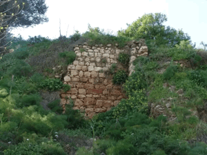
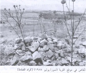
The houses were demolished, leaving scattered stones and some trees on the site.
Israeli Settlements on Village Lands
According to Walid Khalidi and PalQuest, no Israeli settlement was established on Marus village land.
Settlements on the lands of neighboring Safad District villages should therefore not be attributed to Marus.
Marus Today
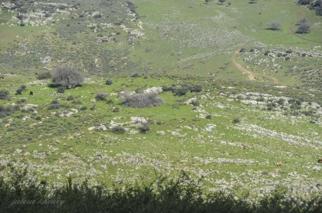
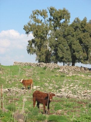
According to the field description published in Walid Khalidi's All That Remains, some olive and fig trees survived on the former village site together with stones from the demolished houses.
The surrounding land was being used for grazing at the time of the survey.
This description should not be treated as a comprehensive field verification of conditions in 2026. It derives from the historical fieldwork associated with All That Remains, conducted between 1987 and 1990, and therefore documents the site's condition during that survey period.
Sources
- PalQuest – Interactive Encyclopedia of the Palestine Question: Marus
- PalQuest – Operation Hiram
- Palestine Remembered – Marus, Safad District
- Palestine Remembered – Walid Khalidi's account of Marus
- Palestinian Villages Encyclopedia – Marus; supporting Palestinian local documentation
- Falastinuna – Marus, Safad District
- PLO Department of Refugee Affairs – Depopulated Villages of the Safad District
- Institute for Palestine Studies – Walid Khalidi, All That Remains
- PalQuest – All That Remains: Methodology and Fieldwork
Photo gallery
Photos from the village's people
Photos sent in by visitors and published after review.
Add a photo of this village
Log in to add photos of this village.
Other villages from Safed

More from the archive



 Download Our Palestine App
The whole archive in the palm of your hand: depopulated villages, the Nakba, the massacres and Al-Aqsa — free, with no ads to erase the story.
Download Our Palestine App
The whole archive in the palm of your hand: depopulated villages, the Nakba, the massacres and Al-Aqsa — free, with no ads to erase the story.



Comments
No comments yet — be the first to write one.
Add your comment
Name and email are optional. Comments appear after review.