
The depopulated village of Dallata / District of Safed
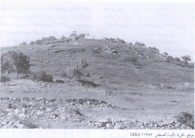
Dallata
About the depopulated village of Dallata
- District
- Safed
- Date Dallata was occupied
- 10 May 1948
- Population in 1948
- 420
- Military operation
- Operation Yiftach
- Brigade that carried it out
- Palmach
- Distance from the governorate centre
- 6 (km) North of Safad
- Elevation above sea level
- 825 m
- Cause of displacement
- Military assault by Zionist troops
- Extent of destruction
- The village has been completely obliterated, and only house rubble left behind.
- Ethnic cleansing
- Dallata inhabitants were completely ethnically cleansed.
- Settlements built on the built-up area of Dallata after 1948
- Dalton
Hover a dot to read the village name, or click to open its card.
Borders of the depopulated village of Dallata
Dallata: A Depopulated Palestinian Village in the Safad District
Dallata was a Palestinian village in the Safad District, situated approximately 6 km north of Safad on the upper slope of a relatively high hill, at an average elevation of about 825 metres above sea level. The village was built over the ruins of an ancient site containing old structures, formerly inhabited caves, cisterns, and large pools, and was surrounded by olive groves and agricultural land. Its Palestinian population was displaced during the Nakba and the occupation of Palestine in 1948. The exact date of Dallata's occupation is uncertain, but Walid Khalidi considers it probable that the village was taken after the fall of Safad during the later stages of Operation Yiftach.
Location of Dallata
Dallata stood on the upper slope of a relatively high hill in Upper Galilee, approximately 6 km north of Safad.
Its average elevation was about 825 metres above sea level.
The village was surrounded by rocky formations that provided readily available building stone.
Nearby Palestinian villages included 'Alma, Marus, Taytaba, 'Ammuqa, and al-Rayhaniyya, while al-Ras al-Ahmar and Jish were also situated nearby.
Local springs supplied water for household use.
The Name and Historical Background of Dallata
During the Crusader period, the site was known as Deleha.
In 1596, Dallata was a village in the nahiya of Jira within the liwa of Safad and had an estimated population of approximately 127.
The inhabitants paid taxes on wheat, barley, olives, and vineyards, as well as goats and beehives. The Ottoman records also mention a press used to process either grapes or olives.
In the late nineteenth century, Dallata was described as a stone-and-mud village at the foot of a large hill, surrounded by olive groves and cultivated land. Its population at the time was estimated at approximately 100.
Architecture of Dallata
In the late nineteenth century, the houses of Dallata were built of stone and mud.
The dwellings were relatively comfortably spaced rather than being tightly packed into a single dense residential core, and the surrounding rock formations supplied building material.
The built-up area amounted to approximately 37 dunums in the 1944/45 statistics.
Local accounts describe upper and lower quarters within Dallata, but Khalidi's principal PalQuest entry does not document this subdivision in sufficient detail for it to be presented as an official village layout.
Religious Landmarks
The inhabitants of Dallata were all Muslim.
Palestine Remembered records a local shrine known as Maqam al-Shaykh al-Battah and identifies it among the surviving landmarks associated with the village.
Other names found in some local accounts—including Shaykh Muhammad al-Nattah, Shaykh Yusuf al-Siddiq, Isma'il al-Siddiq, and Shaykh al-'Ajami—are not sufficiently corroborated in the principal approved sources used here and are therefore not presented as a verified inventory of village shrines.
Archaeology of Dallata
Dallata was built over an ancient archaeological site.
The documented remains included old structures, caves that had once been inhabited, cisterns, and large pools.
Palestine Remembered additionally describes tombs, building foundations, caves, cisterns, and a circular pool at the site.
These remains demonstrate a history of settlement predating the modern Palestinian village, although the principal sources used here do not provide a precise archaeological chronology for every surviving feature.
Water Resources
Springs around Dallata supplied water for domestic use.
The village environment supported orchards and other cultivation, although the agricultural economy remained primarily dependent on rainfed farming.
Education in Dallata
Dallata had a small boys' school.
In 1945, the school had an enrollment of 37 pupils.
Palestine Remembered also preserves Mandate-era documents concerning villagers involved in education, including records relating to Qasim Hamid of Dallata and his appointment to the school at Sirin between 1945 and 1947.
Economic Life in Dallata
The villagers depended principally on rainfed agriculture.
Some inhabitants also raised livestock, while others cut and sold firewood.
Fruit trees and olives were among the principal crops, with olive trees planted in scattered plots around the village.
Cereals were cultivated in nearby wadis and on small plots at the foot of the surrounding slopes.
In 1944/45, 3,651 dunums were devoted to cereals and 302 dunums were irrigated or used for plantations.
Palestine Remembered separately records 52 dunums of olive groves. This is treated as a crop detail within the agricultural land and is not added again to the total cultivable area.
Land Ownership in Dallata
The total registered land area of Dallata was 9,074 dunums in the 1944/45 statistics.
Land ownership in Dallata, 1944/45
- Palestinian9,072 dunums100%
- Transferred to Zionists0 dunums0%
- Communal/Public2 dunums<1%
No land was recorded in the category “Transferred to Zionists.” Almost the entire registered area was Palestinian, apart from two public/communal dunums.
Land Use in Dallata, 1944/45
Land use in Dallata according to PalQuest's detailed statistics
- Palestinian
- Communal/Public
- Plantations and irrigable land302 dunums
- Cereals3,651 dunums
- Built-up area37 dunums
- Non-cultivable land5,084 dunums
Cultivated or cultivable land totaled 3,953 dunums, approximately 44 percent of the village lands.
Built-up and non-cultivable land together amounted to 5,121 dunums, approximately 56 percent of the total.
Palestine Remembered's simplified table places all 5,084 dunums of non-arable land in a Palestinian column. PalQuest's detailed statistics show that 5,082 dunums were Arab land and two dunums were public land. The public category is therefore separated above.
Population of Dallata
The inhabitants of Dallata were all Muslim.
Population of Dallata in selected years
- 1596127Estimate derived from Ottoman records
- Late nineteenth centuryApproximately 100Historical estimate
- 1922204Official British Mandate census; all Muslim
- 1931256Official census; all Muslim
- 1944/45360Official statistics; all classified as Arab
- 1948418Later estimate published by Palestine Remembered
- Estimated refugees in 19982,565Later estimate published by Palestine Remembered
Number of Houses in Dallata
Number of houses in Dallata
- 193143Official British Mandate census
- 194870Later estimate published by Palestine Remembered
Operation Yiftach and Dallata
Operation Yiftach began on 15 April 1948 and continued until 25 May. It was conducted by Palmach forces with the objective of taking control of eastern Galilee before the end of the British Mandate.
The Palmach's First Battalion spearheaded the broader operation.
This does not establish, however, that the First Battalion was necessarily the village-specific unit that entered Dallata, because Khalidi's dedicated village entry does not identify the force that captured the village.
Occupation and Depopulation of Dallata
Walid Khalidi does not give a precise date for the occupation of Dallata.
He considers it probable that the village was taken sometime after the fall of Safad on 10–11 May 1948.
Indirect evidence suggests that Dallata was occupied during Operation Yiftach. If this reconstruction is correct, the village was probably among those attacked during the later stages of the operation.
Khalidi specifically compares Dallata with neighboring 'Ammuqa, which was occupied on 24 May.
The later part of May 1948 is therefore the most plausible period for Dallata's occupation, but it should not be presented as a precisely documented village-specific date.
Palestine Remembered's summary table lists 10 May 1948, identifies the Palmach First Battalion, and classifies the depopulation as resulting from direct military assault.
The detailed historical narrative on the same page, however, follows Khalidi and states that Dallata was probably occupied sometime after Safad fell and likely during the later stages of Operation Yiftach.
This article therefore does not treat 10 May as a confirmed occupation date. The date remains uncertain, with the second half or final days of May 1948 the more cautious historical estimate.
- Probable military operation: Operation Yiftach.
- Operation Yiftach: 15 April–25 May 1948.
- Fall of Safad: 10–11 May 1948.
- Dallata's occupation: sometime after Safad; exact date unknown.
- Most likely period: the later stages of Operation Yiftach, probably in the second half of May.
- Khalidi's comparison: neighboring 'Ammuqa was occupied on 24 May.
- Date in Palestine Remembered's summary table: 10 May, which is not supported by the detailed Khalidi narrative on the same page.
- Palmach First Battalion: spearheaded Operation Yiftach generally and is listed by Palestine Remembered, but Khalidi does not establish it as Dallata's specific occupying unit.
Israeli Settlement on Dallata's Lands
The Israeli settlement of Dalton was established in 1950 on Dallata's lands.
Khalidi places it slightly southwest of the former village site; his site description also locates it about 1 km south of the ruins.
- Dalton: established in 1950 on Dallata's lands, south to southwest of the former village site.
Dallata Today
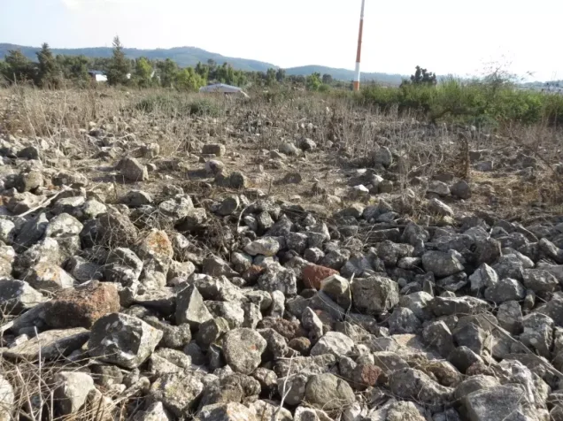
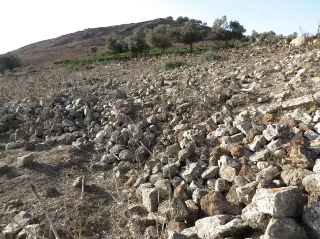
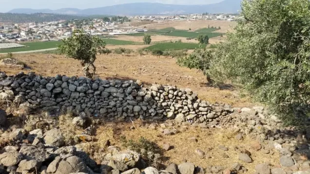
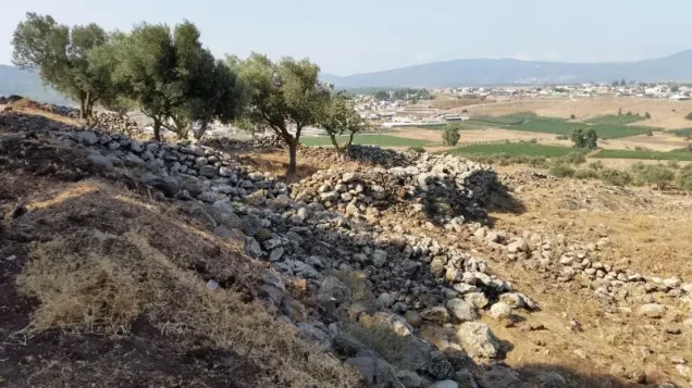
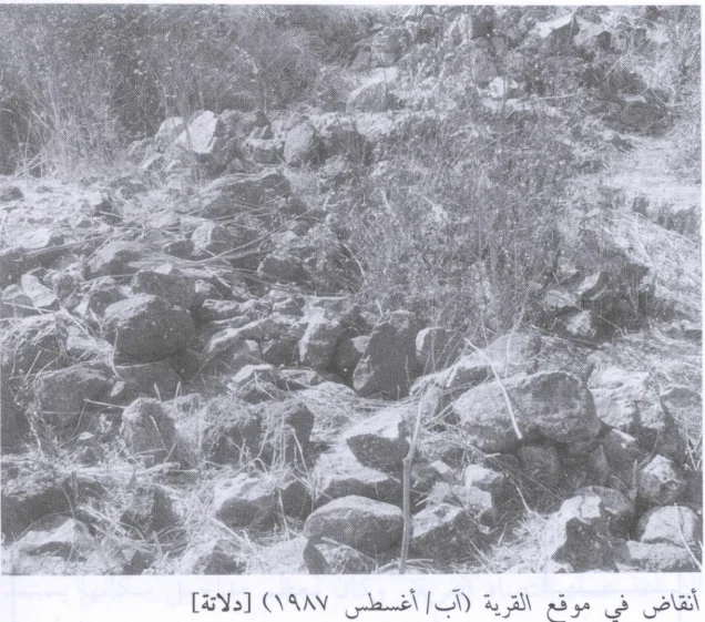
According to the field description published by Walid Khalidi in All That Remains, the principal remains of Dallata were the rubble of demolished houses scattered across the village site.
Grass, shrubs, and trees partly covered the ruins.
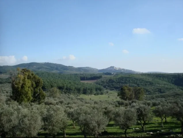
A number of old stone terraces remained intact, and some olive trees continued to grow on village land.
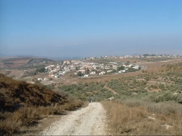
The Israeli settlement of Dalton lies south of the site on Dallata's lands.
Part of the surrounding land had been converted into forest, while other areas were being used as pasture.
Palestine Remembered preserves field photographs taken in 1987 and later reproduced from Khalidi's research, showing the village site and house rubble. Community contributors also uploaded later photographs of Dallata's lands and Dalton, including material posted in 2015.
Items added to Palestine Remembered in 2025 and 2026 include historical maps and Mandate-era documents. Their recent upload dates do not constitute contemporary field verification of the site.
Khalidi's account therefore remains the principal systematic field description used here. It is an older description and should not be presented as a direct 2026 field survey. The approved sources used for this article do not provide a sufficiently comprehensive independent contemporary survey to verify the precise condition of every surviving feature of Dallata today.
Sources
- PalQuestPalQuest – Interactive Encyclopedia of the Palestine Question: Dallata
- PalQuestPalQuest – Operation Yiftach
- Palestine RememberedPalestine Remembered – Dallata, Safad District
- Palestine RememberedPalestine Remembered – Dallata entry from All That Remains
- pcbs.gov.psGovernment of Palestine – Census of Palestine, 1931: Safad Sub-District
- archive.orgGovernment of Palestine – Census of Palestine, 1922
- Institute for Palestine StudiesInstitute for Palestine Studies – All That Remains, Walid Khalidi
Photo gallery
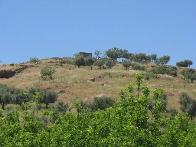

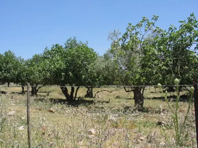
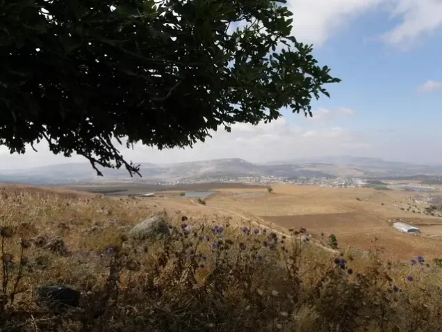





Photos from the village's people
Photos sent in by visitors and published after review.
Add a photo of this village
Log in to add photos of this village.
Other villages from Safed
More from the archive



 Download Our Palestine App
The whole archive in the palm of your hand: depopulated villages, the Nakba, the massacres and Al-Aqsa — free, with no ads to erase the story.
Download Our Palestine App
The whole archive in the palm of your hand: depopulated villages, the Nakba, the massacres and Al-Aqsa — free, with no ads to erase the story.



Comments
No comments yet — be the first to write one.
Add your comment
Name and email are optional. Comments appear after review.