
The depopulated village of Al-Zawiya / District of Safed

Al-Zawiya
About the depopulated village of Al-Zawiya
- District
- Safed
- Date Al-Zawiya was occupied
- 24 May 1948
- Population in 1948
- 880
- Military operation
- Operation Yiftach
- Brigade that carried it out
- Palmach
- Distance from the governorate centre
- 23 (km) North East of Safad
- Elevation above sea level
- 75m
- Cause of displacement
- Military assault by Zionist troops
- Extent of destruction
- The village has been completely destroyed soon after occupation.
- Ethnic cleansing
- al-Zawiya has been ethnically cleansed as a result of psychological warfare conducted on the 24th of May 1948
- Settlements built on the land of Al-Zawiya before 1948
- Ne'Ot Mordechai
Hover a dot to read the village name, or click to open its card.
Borders of the depopulated village of Al-Zawiya
Al-Zawiya – A Depopulated Palestinian Village in the Safad Subdistrict
Al-Zawiya, also rendered as al-Zawiyya or al-Zawiya in different Palestinian sources, was a Palestinian village in the Safad Subdistrict. It stood on the western half of the al-Hula Plain, approximately 23 km northeast of the city of Safad, at an average elevation of about 75 meters above sea level.
The village was occupied and its inhabitants displaced during the Nakba and the occupation of Palestine in 1948. According to Walid Khalidi, citing a report prepared by Israeli military intelligence, al-Zawiya was emptied of its inhabitants on 24 May 1948 as a result of a direct military assault carried out during Operation Yiftach.
Location and Geography of Al-Zawiya
Al-Zawiya was situated on flat terrain in the western half of the al-Hula Plain. A secondary road linked it with the main highway passing to its west and leading toward Safad.
The village originally consisted of two clusters of houses situated on opposite sides of an irrigation canal drawing water from the Jordan River. A bridge crossed the canal and connected the two sections, making the waterway a central feature of the village's physical layout.
According to the mapping and locality information presented by Palestine Remembered, al-Na'ima lay to the north, al-Salihiyya to the northeast, al-Muftakhira to the east, and al-Buwayziyya and al-Mays to the west, while the lands of the al-Hula Plain extended southward.
Built Form of Al-Zawiya
The village developed as two residential clusters on the two sides of the irrigation canal, linked by a bridge. Khalidi records that shops stood along both sides of the canal, indicating that this waterway also formed an important commercial and social axis within the village.
Later local documentation adds that the mukhtar's guesthouse and a central open space stood near the center of the village, with houses and lanes extending outward. These details derive from local and oral-history documentation and are not described at the same level of detail in Khalidi's village entry.
Population of Al-Zawiya
The official 1931 Census of Palestine recorded 590 inhabitants in al-Zawiya, all Muslims, living in 141 occupied houses.
In the 1944/45 Village Statistics, the village population stood at 760 Arabs. Palestine Remembered later estimated the population at 882 in 1948 and the number of refugees and their descendants at 5,414 in 1998. These latter figures are retrospective estimates and not official British Mandate census counts.
- 1931590Official census; all recorded as Muslims
- 1944/45760Official British Mandate statistics
- 1948882Later estimate reported by Palestine Remembered, not an official census
- 19985,414 refugeesLater estimate of refugees and their descendants
Number of Houses
- 1931141Official Census of Palestine
- 1948210Later estimate reported by Palestine Remembered
Land Ownership in Al-Zawiya
The total land area of al-Zawiya in the 1944/45 statistics was 3,958 dunums. Palestine Remembered presents the simplified ownership categories as follows:
- Palestinian3,797 dunums96%
- Transferred to Zionists0 dunums0%
- Communal/Public161 dunums4%
The official table reproduced by PalQuest uses the categories Arab and Public: 3,797 dunums were classified as Arab land and 161 dunums as public land. No land in the village was classified as Jewish in the official ownership table.
Land Use in 1944/45
- Arab
- Public
- Cereals3,593 dunums
- Built-up land195 dunums
- Non-cultivable land170 dunums
A total of 3,593 dunums, approximately 91 percent of the village lands, were classified as cultivable, all of them devoted to cereals in the official table. The built-up area covered 195 dunums.
Non-cultivable land totaled 170 dunums: 9 Arab dunums and 161 public dunums. The simplified Palestine Remembered table therefore understates the full non-cultivable total when it displays only the 161 public dunums.
Economic Life in Al-Zawiya
Agriculture formed the basis of the village economy, with cereal cultivation occupying 3,593 dunums in 1944/45.
Khalidi also records that villagers cultivated vegetables and fruit to the east and south of the village site, with fruit orchards concentrated particularly to the east. The official land-use table does not provide a separate acreage for these crops, so no unsupported numerical figure has been assigned to them.
Shops located along both sides of the irrigation canal provided a local commercial function within the village.
Water and Irrigation
Water was a defining feature of al-Zawiya. An irrigation canal drawing water from the Jordan River ran through the village, with the two principal residential clusters situated on its opposite banks and connected by a bridge.
The irrigation system supported the cultivation of vegetables and fruit in addition to cereal agriculture and directly linked village life to the water system of the al-Hula Plain.
Education and Services
Khalidi's village entry does not identify a formal school in al-Zawiya. Later local documentation states that the village had no school and lacked educational facilities within the settlement. Because this information derives from local documentation, no unsupported founding dates or pupil numbers have been added.
Mosque and Shrine
Khalidi's entry does not describe a mosque or shrine in the village. Local oral-history documentation collected by the Palestinian Villages Encyclopedia states that al-Zawiya had no mosque and that one local shrine was known as Maqam al-Sidri, named after a large sidr tree at its location.
This information should be treated as local historical memory rather than independently established archaeological evidence.
Occupation and Depopulation of Al-Zawiya in 1948
Al-Zawiya lay within the operational area of Operation Yiftach, which ran from 15 April to 25 May 1948 and aimed to seize eastern Galilee. Palmach forces formed the principal military force in the operation, with the Palmach First Battalion serving as its spearhead generally.
According to Walid Khalidi, citing a report prepared by Israeli military intelligence, al-Zawiya was among the villages occupied in late May 1948 as Zionist forces advanced through eastern Galilee. The village was emptied of its inhabitants on 24 May 1948 as a result of a direct military assault.
Unlike cases in which the date of civilian departure and the date of military occupation must be clearly separated, the account of al-Zawiya directly connects the evacuation of the population on 24 May with a military assault during Operation Yiftach. This makes 24 May the strongest documented date for the occupation and depopulation of the village.
Palestine Remembered identifies the Palmach First Battalion as the unit responsible for the attack. It is independently documented that this battalion spearheaded Operation Yiftach generally, although Khalidi's village-specific entry does not separately name the assault unit. The First Battalion attribution should therefore be presented with that distinction.
- 15 April 1948
Beginning of Operation Yiftach
Beginning of the operation to seize eastern Galilee
- 24 May 1948
Occupation and depopulation of al-Zawiya
A direct military assault emptied the village, according to an Israeli intelligence report cited by Khalidi
- 25 May 1948
End of Operation Yiftach
The operation ended one day after al-Zawiya was occupied
Israeli Settlements on the Lands of Al-Zawiya
Walid Khalidi identifies no Israeli settlement as having been established on the lands of al-Zawiya itself.
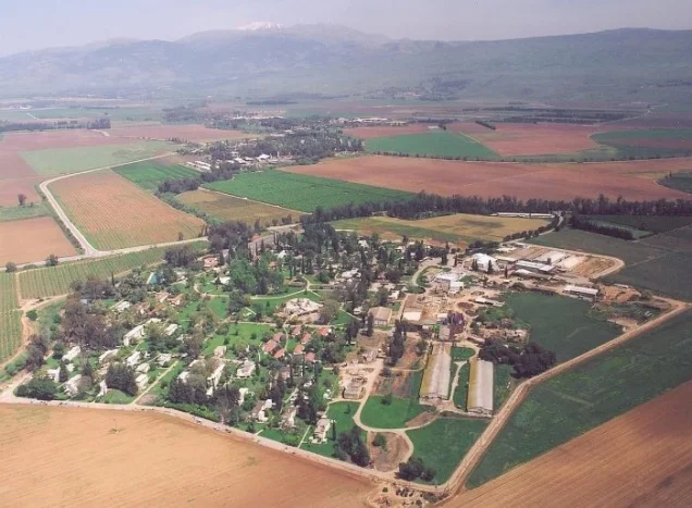
Ne'ot Mordekhay: Founded in 1946 less than approximately one kilometer north of the village site. Despite its proximity, Khalidi explicitly distinguishes it from a settlement founded on al-Zawiya's land.
After the village was depopulated, its site became part of the agricultural land used by Ne'ot Mordekhay. This later agricultural use should not be confused with the original location on which the settlement itself was founded.
Al-Zawiya Today
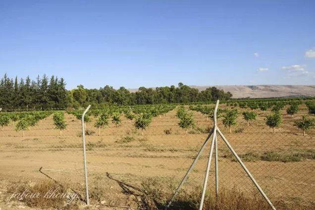
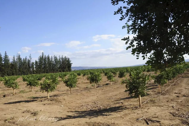
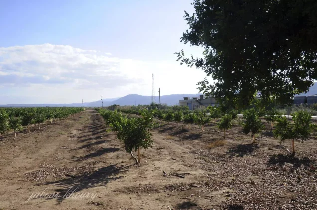
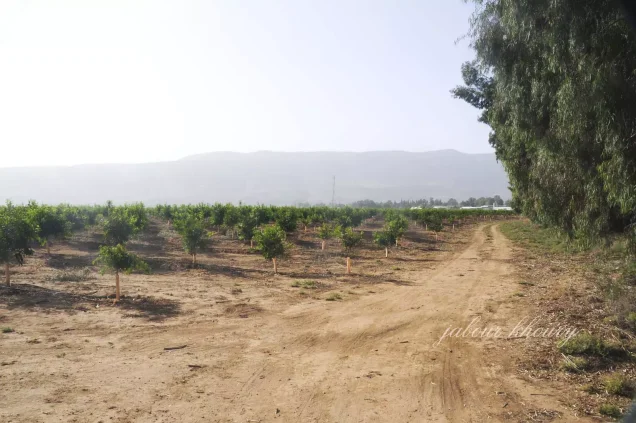
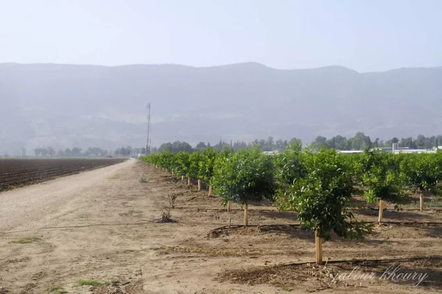
According to the field description published by Walid Khalidi in All That Remains, no visible traces, landmarks, or ruins of al-Zawiya remained. The village site had become part of the agricultural lands used by Ne'ot Mordekhay and was concealed beneath cotton fields.
This description derives from fieldwork conducted before the publication of All That Remains in 1992 and should not be treated as direct field verification of conditions at the site in 2026. Later community documentation exists, but it does not constitute a comprehensive current survey capable of confirming that the present crop pattern or appearance of the site remains identical to Khalidi's earlier description.
Sources
- PalQuestPalQuest – Interactive Encyclopedia of the Palestine Question: al-Zawiya
- PalQuestPalQuest – Operation Yiftach
- Palestine RememberedPalestine Remembered – al-Zawiya, Safad
- Palestine RememberedPalestine Remembered – al-Zawiya entry from All That Remains
- Institute for Palestine StudiesInstitute for Palestine Studies – Walid Khalidi, All That Remains
- palqura.comPalestinian Villages Encyclopedia – al-Zawiya / al-Zawiyya, local and oral-history documentation
- fada.birzeit.eduBirzeit University Repository – Census of Palestine 1931
- commons.wikimedia.orgGovernment of Palestine – Village Statistics 1945
Photo gallery

Photos from the village's people
Photos sent in by visitors and published after review.
Add a photo of this village
Log in to add photos of this village.
Other villages from Safed

More from the archive

 Download Our Palestine App
The whole archive in the palm of your hand: depopulated villages, the Nakba, the massacres and Al-Aqsa — free, with no ads to erase the story.
Download Our Palestine App
The whole archive in the palm of your hand: depopulated villages, the Nakba, the massacres and Al-Aqsa — free, with no ads to erase the story.



Comments
No comments yet — be the first to write one.
Add your comment
Name and email are optional. Comments appear after review.