
The depopulated village of Khirbat al-Taqa / District of Baysan

Khirbat al-Taqa
About the depopulated village of Khirbat al-Taqa
- District
- Baysan
- Date Khirbat al-Taqa was occupied
- 01 May 1948
- Military operation
- Operation Gideon
- Brigade that carried it out
- Golani Brigade
- Who defended the village
- Iraqi Army
- Distance from the governorate centre
- 14 (km) North of Baysan
- Elevation above sea level
- -200 (m)
- Extent of destruction
- Khirbat al-Taqa was completely obliterated.
- Ethnic cleansing
- al-Taqa, Khirbat inhabitants were completely ethnically cleansed.
Hover a dot to read the village name, or click to open its card.
Khirbat al-Taqa – Depopulated Palestinian Hamlet of Baysan
Khirbat al-Taqa, also known simply as al-Taqa, was a small Palestinian community in the Baysan Subdistrict. The Palestine Index Gazetteer classified it as a hamlet.
The village stood on the northern bank of Wadi al-Bira approximately 14 kilometers north of Baysan and about 200 meters below sea level. It was situated where the wadi emerged from the hills and descended toward the Jordan Valley, which lay roughly three kilometers to the southeast.
Khirbat al-Taqa was small enough that the principal village-level sources reviewed here do not provide an independent 1945 population series or a separate documented land-ownership table. No figures from neighboring villages or statistical units are therefore transferred to al-Taqa.
Walid Khalidi considers it probable that the village fell during Operation Gideon, conducted by the Golani Brigade in the Baysan Valley between 10 and 15 May 1948. After 15 May Iraqi forces crossed the Jordan River near al-Taqa and recovered several positions on its western bank, possibly including the village itself, before the Iraqi attempt ultimately failed under heavy Israeli artillery fire.
Basic Information
| Field | Information |
|---|---|
| Name | Khirbat al-Taqa |
| Arabic name | خِرْبة الطَّاقة |
| Alternative name | al-Taqa |
| Subdistrict | Baysan |
| Pre-1948 classification | Hamlet in the Palestine Index Gazetteer |
| Location | Northern bank of Wadi al-Bira, north of Baysan |
| Distance from Baysan | Approximately 14 km north |
| Average elevation | Approximately 200 m below sea level |
| Palestine Grid | 200/224 |
| Pre-Nakba population | No independently documented village figure located |
| Number of houses | No independently documented official figure located |
| Land area | No independently documented village land total located |
| Probable initial occupation | During Operation Gideon and by 15 May 1948; the exact village-specific day is not independently established |
| Military operation | Operation Gideon |
| Military unit | Golani Brigade at the operational level; no village-specific battalion is securely documented |
| Cause of depopulation | Military operations and the conquest of the Baysan Valley during Operation Gideon; the immediate circumstances of the inhabitants' departure are not independently documented |
| Destruction | No house remains were visible in Khalidi's later field survey; the demolition date is unknown |
| Israeli settlements on village lands | None according to Walid Khalidi and PalQuest |
Name
The locality appears in Palestinian sources as Khirbat al-Taqa and, in shortened form, al-Taqa.
Khalidi and PalQuest do not provide a securely documented linguistic derivation of the name, so no unsupported etymology is introduced here.
Location and Geography
Khirbat al-Taqa stood on the northern bank of Wadi al-Bira, near the point where the wadi left the hills and descended toward the Jordan Valley.
The valley floor lay about three kilometers to the southeast, while hills screened the village from both the north and south.
This location placed the hamlet along a natural route between the uplands and the Jordan Valley and close to the roads connecting Baysan with the principal Jordan River crossing at Jisr al-Majami'.
Wadi al-Bira and the Water Mill
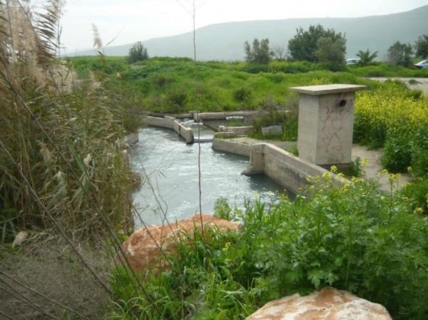
Wadi al-Bira was the principal natural feature associated with the village.
On the southern bank of the wadi, opposite Khirbat al-Taqa, stood the ruins of an abandoned water-powered mill.
The mill reflects the former importance of flowing water to the rural economy of the area, although it was already abandoned in the description reproduced by Khalidi.
The Road to Jisr al-Majami'
Khirbat al-Taqa stood only about 500 meters from the highway leading north toward Jisr al-Majami'.
Jisr al-Majami' was a major Jordan River crossing, combining an important bridge with a ford.
The same highway led south to Baysan, giving the small community direct access to the regional transportation network.
Cemetery
The cemetery of Khirbat al-Taqa lay on higher ground overlooking the village from the north.
The principal sources do not provide sufficient evidence to add a construction history, exact cemetery area, or documented grave count.
Population
No independent population series for Khirbat al-Taqa was located in the principal Palestinian village sources reviewed.
| Year | Population | Note |
|---|---|---|
| 1922 | No independently documented figure located | No population is inferred from neighboring communities |
| 1931 | No independently documented figure located | No secure village-level figure is provided by the principal sources reviewed |
| 1944/45 | No independently documented figure located | Figures from neighboring statistical units are not transferred to the hamlet |
| 1948 | No reliable independent estimate | No mathematical estimate is generated from incomplete evidence |
Number of Houses
No independent official house count for Khirbat al-Taqa was located in the principal sources used here.
Because it was classified as a small hamlet, no house figure is inferred from population estimates or neighboring communities.
Land and Land Ownership
No independent official land area or 1944/45 land-ownership table for Khirbat al-Taqa was located in the principal sources reviewed.
The Palestinian Villages Encyclopedia likewise states that the precise area of the village lands is unavailable.
No Palestinian / Transferred to Zionists / Public table is therefore created without a documentary basis, and no land totals from Wadi al-Bira, Kawkab al-Hawa, or Jisr al-Majami' are assigned to the village.
Economy
No independent land-use table survives in the sources reviewed from which cereal, orchard, or grazing acreage can be calculated for Khirbat al-Taqa.
The presence of Wadi al-Bira and the former water-powered mill nevertheless demonstrates the economic importance of water in the surrounding rural landscape.
Later Palestinian community testimony also preserves memories of agricultural use and landholding around al-Taqa and Wadi al-Bira, but such testimony is not substituted for missing official land statistics.
Education and Services
No independently documented school, clinic, or administrative institution was located for Khirbat al-Taqa in the principal sources reviewed.
No pupil or teacher totals are therefore supplied.
Religious Buildings
No independently documented mosque, shrine, or church specific to Khirbat al-Taqa before 1948 was located in the principal village sources reviewed.
No religious building is therefore asserted without direct evidence.
Operation Gideon
The Golani Brigade carried out Operation Gideon in the Baysan Valley from 10 to 15 May 1948.
The operation resulted in the occupation of Baysan and the depopulation of most Palestinian communities in the subdistrict by 15 May.
PalQuest lists Khirbat al-Taqa among the localities affected by Operation Gideon, while Khalidi states that the hamlet probably fell within the scope of the operation.
The operational attribution is therefore strong, although there is no separate village report identifying the exact hour or day on which Golani forces first entered Khirbat al-Taqa.
Date of Initial Occupation
Palestine Remembered gives 15 May 1948 as the occupation date.
Khalidi's wording is more cautious: he states that Operation Gideon had occupied Baysan and most of the subdistrict's villages by 15 May rather than providing a separate al-Taqa capture report for that day.
A Palestinian secondary page displays 1 May in its heading, but its own narrative reproduces the Operation Gideon chronology, which did not begin until 10 May.
The most defensible formulation is therefore: Khirbat al-Taqa probably fell during Operation Gideon and was under Israeli control by 15 May 1948, while the exact village-specific date of the first occupation is not independently established.
Military Unit
The Golani Brigade was the formation responsible for Operation Gideon.
PalQuest notes a possibility that Irgun forces participated in the wider campaign, based on an Irgun announcement that it had captured five northern villages on 14 May.
No village-level source, however, independently connects the Irgun to Khirbat al-Taqa.
The military-unit field is therefore recorded as Golani Brigade, without assigning an unverified battalion or Irgun unit.
Iraqi Forces after 15 May
After 15 May Iraqi forces crossed the Jordan River near Khirbat al-Taqa in an attempt to restore positions on its western bank.
They besieged the nearby settlement of Gesher and recaptured a number of positions west of the river.
This chronology is important because some secondary tables list the Iraqi Army as the village's defender. The Iraqi movement described by Khalidi occurred after al-Taqa's probable initial fall and therefore should not be presented as evidence that Iraqi troops defended the hamlet during the opening phase of Operation Gideon.
Was Khirbat al-Taqa Temporarily Recaptured?
Khalidi raises an important possibility: the positions recovered by Iraqi forces west of the Jordan River may have included Khirbat al-Taqa.
The source does not establish this as a confirmed event, so an Iraqi recapture of the village should not be stated categorically.
The Iraqi attempt in the area ultimately failed under heavy Israeli artillery bombardment from batteries positioned at Kawkab al-Hawa.
The cautious chronology is therefore an initial probable fall during Operation Gideon, followed by a possible temporary Iraqi recovery of al-Taqa or nearby positions, and subsequent consolidation of Israeli control.
Cause of Depopulation
Khalidi does not provide an independent narrative explaining exactly how the residents of Khirbat al-Taqa left.
The hamlet clearly fell within the military campaign that conquered the Baysan Valley and depopulated most of its Palestinian communities.
The most accurate formulation is therefore: depopulation in the context of Operation Gideon and the military conquest of the Baysan Valley; whether the inhabitants fled before entry, during the fighting, or were removed afterward is not independently documented.
Destruction
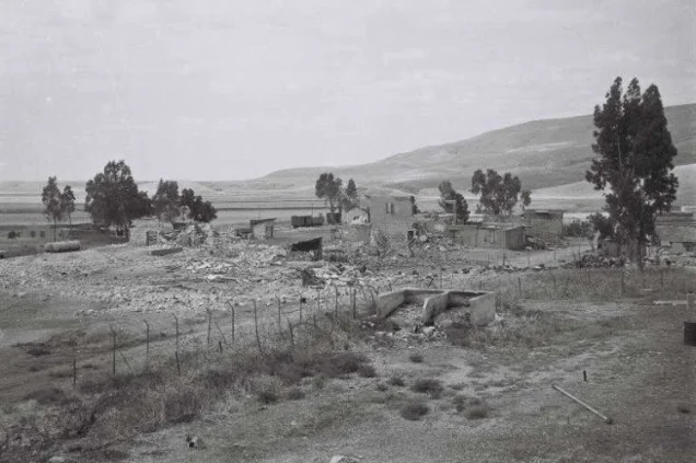
The houses of Khirbat al-Taqa later disappeared entirely.
Khalidi's field description states that no trace of the village houses remained.
The sources do not establish when demolition took place, so the May 1948 depopulation and the later destruction of the built environment should be treated as separate historical stages.
Ethnic Cleansing in Source Classification
Palestine Remembered classifies Khirbat al-Taqa using the term “complete ethnic cleansing.” The expression is retained here only as an attributed source classification.
The more specifically documented facts are the hamlet's probable occupation during Operation Gideon, disappearance of its Palestinian residents, the possibility of temporary military reversals after Iraqi forces crossed the Jordan, subsequent Israeli control, and the absence of a permanent collective return.
Occupation and Depopulation Chronology
| Date | Event |
|---|---|
| 10 May 1948 | Operation Gideon begins under the Golani Brigade in the Baysan Valley. |
| 12 May 1948 | Baysan falls during the operation. |
| 10–15 May 1948 | Most Palestinian villages and hamlets in the Baysan Subdistrict are occupied or depopulated; Khalidi considers Khirbat al-Taqa likely to have fallen during this phase. |
| By 15 May 1948 | Khirbat al-Taqa was probably under Israeli control. Palestine Remembered uses 15 May as the occupation date, although no independent village-specific capture report is available. |
| After 15 May 1948 | Iraqi forces cross the Jordan near Khirbat al-Taqa, besiege Gesher, and recover several positions west of the river. |
| After 15 May 1948 | Khalidi states that the recovered positions may have included Khirbat al-Taqa, but this remains unconfirmed. |
| Later in May 1948 | The Iraqi attempt fails under heavy Israeli artillery fire from the Kawkab al-Hawa area and Israeli control of the region is consolidated. |
| Later period | All village houses disappear; the precise demolition date is undocumented. |
Israeli Settlements on Khirbat al-Taqa's Lands
According to Walid Khalidi and PalQuest, no Israeli settlement was established on the lands of Khirbat al-Taqa itself.
Gesher, founded in 1939 before the Nakba, lay northeast of the village site.
Although a Palestine Remembered summary field associates Gesher with the village, the detailed Khalidi text reproduced on the same page explicitly states that Gesher was nearby rather than established on Khirbat al-Taqa land.
Gesher is therefore treated as a nearby pre-1948 settlement, not as a settlement founded on the village lands.
Khirbat al-Taqa Today
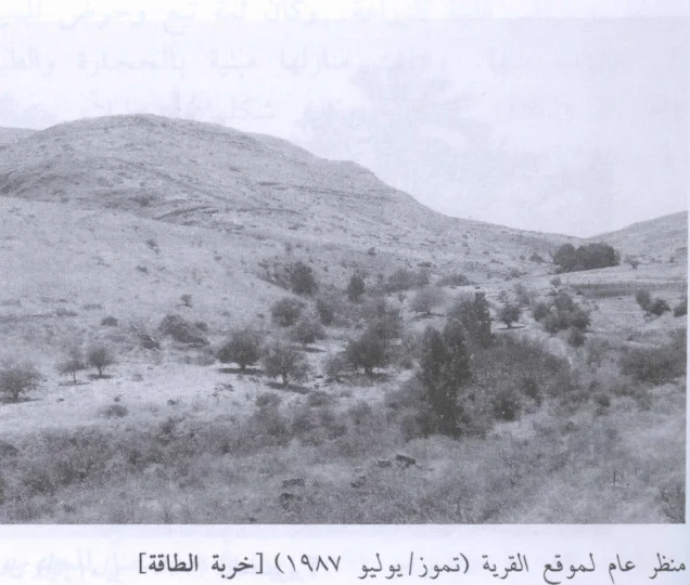
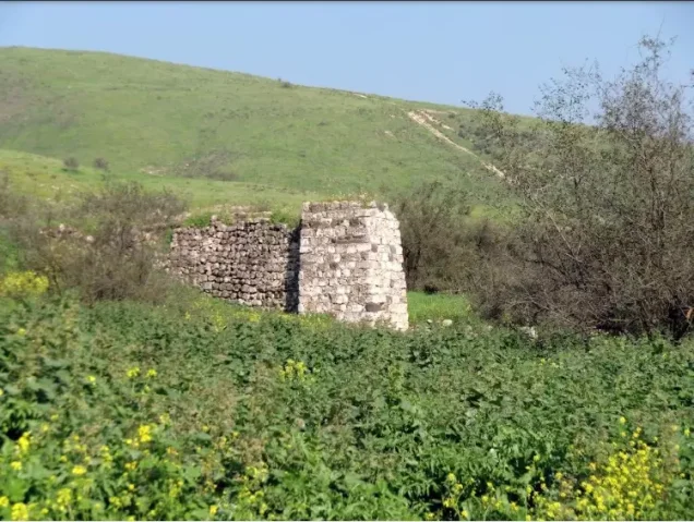
According to the field description used by Walid Khalidi before the publication of All That Remains in 1992, no trace of the village houses remained.
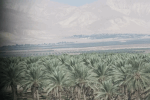
The site was covered by thorns, cactus, palm trees, and eucalyptus trees, while part of the adjacent land had been fenced and used as cattle pasture.
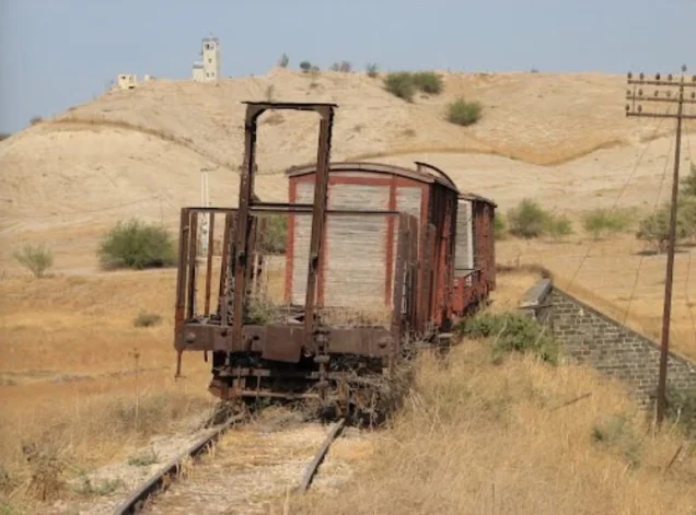
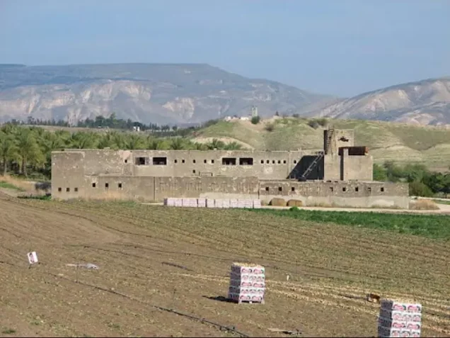
A field photograph associated with Khalidi's documentation dates to 1987. Palestine Remembered also contains later community photographs from 2015 documenting the site, Wadi al-Bira, bridges, and surrounding land.
These materials constitute historical and Palestinian community documentation rather than a comprehensive archaeological or cadastral field survey of the site in 2026.
Sources
- PalQuest – Interactive Encyclopedia of the Palestine Question: Khirbat al-Taqa
- PalQuest – Operation Gideon
- Palestine Remembered – Khirbat al-Taqa, Baysan Subdistrict
- Palestine Remembered – Khirbat al-Taqa entry from Walid Khalidi's All That Remains
- Palestinian Villages Encyclopedia – Khirbat al-Taqa / al-Taqa
- Falastinuna – Khirbat al-Taqa, Baysan Subdistrict
- Palestine Remembered – Community account of landholding and agricultural use around al-Taqa and Wadi al-Bira
Photo gallery






Photos from the village's people
Photos sent in by visitors and published after review.
Add a photo of this village
Log in to add photos of this village.
Other villages from Baysan

More from the archive


 Download Our Palestine App
The whole archive in the palm of your hand: depopulated villages, the Nakba, the massacres and Al-Aqsa — free, with no ads to erase the story.
Download Our Palestine App
The whole archive in the palm of your hand: depopulated villages, the Nakba, the massacres and Al-Aqsa — free, with no ads to erase the story.



Comments
No comments yet — be the first to write one.
Add your comment
Name and email are optional. Comments appear after review.