
The depopulated village of Masil al-Jizl / District of Baysan

Masil al-Jizl
About the depopulated village of Masil al-Jizl
- District
- Baysan
- Date Masil al-Jizl was occupied
- 30 May 1948
- Population in 1948
- 120
- Military operation
- Operation Gideon
- Brigade that carried it out
- Golani Brigade
- Distance from the governorate centre
- 6 (km) South East of Baysan
- Elevation above sea level
- -250 (m)
- Cause of displacement
- Expulsion by Zionist troops
- Extent of destruction
- The village was completely obliterated and defaced.
- Ethnic cleansing
- Masil al-Jizl inhabitants were completely ethnically cleansed.
- Settlements built on the land of Masil al-Jizl before 1948
- Kfar Rupin
Hover a dot to read the village name, or click to open its card.
Borders of the depopulated village of Masil al-Jizl
Masil al-Jizl / Arab al-Zinati – Depopulated Palestinian Village of Baysan
Masil al-Jizl, also known as 'Arab al-Zinati and 'Arab Masil al-Jizl, was a Palestinian village in the Baysan Subdistrict. It originated with the settlement of members of the 'Arab al-Zinati Bedouin tribe along the western edge of the Jordan Valley.
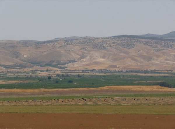
The village stood on level ground approximately 6 kilometers southeast of Baysan and about 250 meters below sea level. It overlooked the Jordan Valley and Jordan River to the east and was surrounded by springs, particularly toward the western edge of the valley.
The official 1922 census recorded 64 inhabitants, while the 1931 census recorded 197 residents living in 47 houses. In the 1944/45 statistics, Masil al-Jizl itself had 100 Palestinian inhabitants. The combined statistical unit also included the 180 Jewish residents of Kefar Ruppin, and these two populations should not be merged when describing the Palestinian village.
Basic Information
| Field | Information |
|---|---|
| Name | Masil al-Jizl |
| Arabic name | مَسِيل الجِزْل |
| Alternative names | 'Arab al-Zinati; 'Arab Masil al-Jizl |
| Subdistrict | Baysan |
| Location | Southeast of Baysan on the western edge of the Jordan Valley |
| Distance from Baysan | Approximately 6 km |
| Average elevation | Approximately 250 m below sea level |
| Palestine Grid | 202/207 |
| Population in 1922 | 64, all Muslims |
| Population in 1931 | 197, all Muslims |
| Houses in 1931 | 47 |
| Palestinian population in 1944/45 | 100; the combined statistical unit also included 180 Jewish residents of Kefar Ruppin |
| 1948 population estimate | 116 – later estimate, not an official census |
| Probable depopulation date | 30–31 May 1948; Palestinian sources differ by one day |
| Military context | Continued Golani control of the Baysan Valley after the formal end of Operation Gideon |
| Military unit | Golani Brigade – probable and strongly supported; no village-specific battalion is documented |
| Cause of depopulation | Probable expulsion toward Transjordan during the military consolidation of the Jordan Valley; exact village-level circumstances remain undocumented |
| Pre-1948 settlement | Kefar Ruppin, founded in 1938 on land traditionally regarded as belonging to the village |
| Post-1948 settlement | No new settlement is identified by Khalidi as having been founded directly on the former village site after 1948 |
'Arab al-Zinati and the Formation of the Village
Masil al-Jizl was founded by members of the 'Arab al-Zinati Bedouin tribe, which explains the alternative names 'Arab al-Zinati and 'Arab Masil al-Jizl.
Some houses were scattered around the springs from which the inhabitants drew water, while others stood along the roads connecting the village with Baysan and neighboring communities.
Most houses were constructed of adobe and cane, reflecting both the Jordan Valley environment and the semi-sedentary origins of the community.
Location and Geography
The village occupied level terrain overlooking a wide open area to the east, beyond which lay the Jordan Valley and the Jordan River.
Two Jordan River fords, Makhadat al-Turaykhim and Makhadat al-Saghir, provided important crossings toward the eastern side of the valley and Transjordan.
A secondary road connected Masil al-Jizl with Baysan, while other tracks led to the main road between Baysan and Transjordan.
Population
- 192264Official census; 31 males and 33 females, all Muslims
- 1931197Official census; all Muslims
- 1944/45100 PalestiniansPalestinian population within the combined statistical unit; Kefar Ruppin added 180 Jewish residents
- 1948116Later estimate, not an official census
- 1998712Later estimate of refugees and descendants
The figure of 280 for 1945 should not be presented as the population of Palestinian Masil al-Jizl. It represents 100 Palestinian inhabitants together with 180 Jewish residents of Kefar Ruppin in the combined statistical unit.
Number of Houses
The official 1931 census recorded 47 occupied houses.
A later Palestine Remembered table repeats 47 for 1948, but this is not a new official house census and is therefore not treated as an official 1948 figure.
Land Ownership, 1944/45
The 1945 land table requires particular caution because PalQuest explicitly states that the statistical unit includes Kefar Ruppin.
- Palestinian976 dunums17%
- Transferred to Zionists / Jewish category in the original table2,222 dunums38%
- Public2,675 dunums46%
The original Government of Palestine categories were Arab, Jewish, and Public.
The total of 5,873 dunums should not be described simply as privately owned Palestinian Masil al-Jizl land. The table combines the Palestinian village, Kefar Ruppin, and public land within one statistical unit.
Land Use – Palestinian Component
The Palestinian ownership component can be separated clearly and totals 976 dunums:
- Palestinian Dunums
- Cereals702 dunums
- Plantations and irrigable land252 dunums
- Non-cultivable land22 dunums
The figures balance exactly: 702 + 252 + 22 = 976 dunums.
No separate built-up acreage is recorded in the Arab column. The 40 built-up dunums in the combined unit are recorded in the Jewish column associated with Kefar Ruppin.
A Statistical Error in Secondary Tables
A Palestine Remembered summary table assigns 1,149 dunums of cereals to the Arab category. This appears to combine 702 Arab dunums with 447 public dunums.
The same summary assigns 2,250 non-arable dunums to the Arab category, apparently combining 22 Arab dunums with 2,228 public dunums.
This article therefore follows the more detailed PalQuest breakdown and keeps Palestinian, Jewish, and Public categories separate.
Economy and Agriculture
The villagers relied primarily on agriculture, particularly cereals, vegetables, and irrigated cultivation.
The abundance of springs supported vegetable plots and orchards. In 1944/45, 702 Palestinian dunums were devoted to cereals and 252 to plantations or irrigable land.
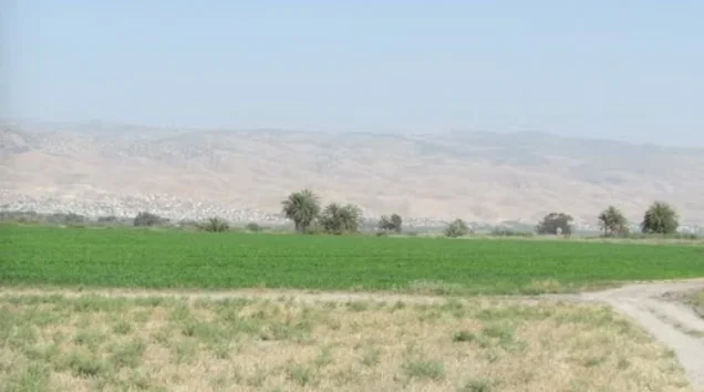
South of the village was a narrow strip of uncultivated land running parallel to the Jordan River and marked by rows of palm trees.
Water
Water was central to the settlement pattern of Masil al-Jizl. Several houses were built close to springs used for domestic consumption and agriculture.
The local landscape also included Wadi al-Shaykh Muhammad, Masil al-Jizl itself, and the nearby Jordan River.
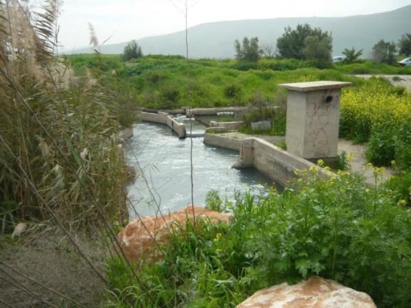
Later Palestinian community documentation from 2023 records 'Ayn al-Masil, also known locally as 'Ayn al-Shaykh Samad, as a continuing water feature in the area.
Education and Services
No independently documented school, pupil enrollment, or teacher totals were located for Masil al-Jizl in the principal sources consulted.
No school, clinic, or administrative institution is therefore assumed without direct documentary evidence.
Archaeology and Religious Remains
Khalidi records at least three archaeological sites surrounding Masil al-Jizl: Tall al-Qitaf, Khirbat al-Hajj Mahmud, and Tall al-Shaykh Dawud.
Pottery fragments, flint artifacts, and building foundations were found in these locations.
In 1929, remains of a small mosque were discovered near the village at Tall al-Shaykh Muhammad al-Qabu.
This archaeological mosque remain should not automatically be interpreted as evidence for a functioning village mosque immediately before 1948 without additional documentation.
Operation Gideon
Operation Gideon was conducted by the Golani Brigade in the Baysan Valley from 10 to 15 May 1948.
It resulted in the capture of Baysan and several surrounding Palestinian communities and contributed to the large-scale depopulation of the valley.
However, if Masil al-Jizl was depopulated on 30–31 May, its final occupation cannot chronologically have taken place during Operation Gideon itself.
Occupation and Depopulation in Late May 1948
Walid Khalidi states explicitly that specific information concerning the occupation of Masil al-Jizl is unavailable.
He considers it reasonable to assume that the village was occupied at the same time as other communities along the Jordan River in the Baysan area, most of which were overrun by the Golani Brigade in late May.
The Palestine Land Society register gives 30 May 1948, while Palestine Remembered and Palestinian official reference material give 31 May.
This article therefore uses 30–31 May 1948 as the most defensible documented period rather than treating either date as conclusively established.
Was Masil al-Jizl Occupied during Operation Gideon?
Some secondary sources assign Operation Gideon to Masil al-Jizl while also dating the village's depopulation to 31 May.
This creates a chronological contradiction because Operation Gideon formally ended on 15 May.
The more accurate formulation is that Masil al-Jizl was depopulated in the aftermath of Operation Gideon, during the Golani Brigade's continued consolidation of control over the Baysan and Jordan Valley region in late May.
Military Unit
The Golani Brigade is the strongest documented military attribution for Masil al-Jizl.
Khalidi connects the village's likely occupation with Golani's late-May advance through communities along the Jordan River.
No specific battalion is independently identified as having entered Masil al-Jizl.
Possible Irgun participation concerns Operation Gideon at the broader operational level and should not be transferred to Masil al-Jizl without village-specific evidence.
Cause of Depopulation
Palestine Remembered classifies the cause as expulsion by Zionist forces.
Khalidi is more cautious, writing that the villagers may have been expelled toward Transjordan as occurred with other inhabitants of the area.
Expulsion toward Transjordan is therefore the strongest available interpretation, but the precise village-level circumstances of how the inhabitants were removed are not independently documented.
Destruction
The Palestinian built environment of Masil al-Jizl subsequently disappeared.
Khalidi does not provide an exact date for demolition, so destruction should not automatically be assigned to 30 or 31 May.
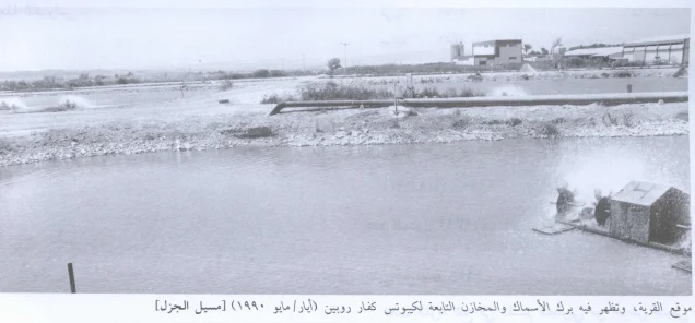
By the time of later fieldwork, fish ponds and warehouses belonging to Kefar Ruppin covered part of the former village site.
Ethnic Cleansing in Source Classification
Palestine Remembered uses the classification “complete ethnic cleansing” for Masil al-Jizl. The term is retained here only as an attributed source classification.
The more specifically documented sequence consists of the Golani Brigade's consolidation of the Baysan Valley, the villagers' probable expulsion toward Transjordan in late May 1948, the absence of a permanent collective return, and the later use of the village site by Kefar Ruppin.
Occupation and Depopulation Chronology
| Date | Event |
|---|---|
| 10 May 1948 | Operation Gideon begins under the Golani Brigade in the Baysan Valley. |
| 12 May 1948 | Baysan falls during the operation. |
| 15 May 1948 | Operation Gideon formally ends. |
| Second half of May 1948 | Golani forces continue consolidating control over Palestinian communities in the Baysan and Jordan River area. |
| 30 May 1948 | Date listed by the Palestine Land Society register for Masil al-Jizl's depopulation. |
| 31 May 1948 | Date used by Palestine Remembered and Palestinian official reference material. |
| Late May 1948 | Khalidi considers Golani the likely occupying force and suggests that the inhabitants may have been expelled toward Transjordan. |
| After depopulation | The village structures disappear and part of the site becomes occupied by Kefar Ruppin fish ponds and warehouses. |
Israeli Settlements on Masil al-Jizl's Lands
Kefar Ruppin was established in 1938 north of Masil al-Jizl, before the Nakba.
Khalidi states that it was established on land traditionally considered part of the village lands.
Kefar Ruppin should therefore be classified as a pre-1948 Zionist settlement on traditionally recognized Masil al-Jizl land, rather than as a post-1948 settlement founded after the village was depopulated.
Khalidi does not identify a new Israeli settlement founded specifically on the village site after 1948.
Masil al-Jizl Today
According to the field description used by Walid Khalidi before the publication of All That Remains in 1992, fish ponds and warehouses belonging to Kibbutz Kefar Ruppin partly covered the former village site.
The waters of Masil al-Jizl continued to flow through the kibbutz, preserving an element of the village's historical water landscape despite the disappearance of its Palestinian built environment.
Palestine Remembered contains later Palestinian community documentation, including 2023 visits to 'Ayn al-Masil / 'Ayn al-Shaykh Samad and other water and landscape features around the former village.
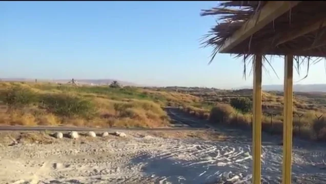
Such recent material is useful community documentation but is not a comprehensive archaeological or cadastral survey. Khalidi's field description likewise represents historical documentation from before 1992 rather than a complete direct survey of the site in 2026.
Sources
- PalQuest – Interactive Encyclopedia of the Palestine Question: Masil al-Jizl
- PalQuest – Operation Gideon and its chronology
- Palestine Remembered – Masil al-Jizl / 'Arab al-Zinati
- Palestine Remembered – Masil al-Jizl entry from Walid Khalidi's All That Remains
- Government of Palestine – Census of Palestine 1922: Mesil al-Jezel
- Palestine Land Society – Register of Depopulated Localities in Palestine
- Palestine Encyclopedia – Masil al-Jizl
- Palestinian Villages Encyclopedia – Masil al-Jizl / 'Arab al-Zinati
- WAFA – Palestinian localities depopulated in 1948
Photo gallery



Photos from the village's people
Photos sent in by visitors and published after review.
Add a photo of this village
Log in to add photos of this village.
Other villages from Baysan
More from the archive



 Download Our Palestine App
The whole archive in the palm of your hand: depopulated villages, the Nakba, the massacres and Al-Aqsa — free, with no ads to erase the story.
Download Our Palestine App
The whole archive in the palm of your hand: depopulated villages, the Nakba, the massacres and Al-Aqsa — free, with no ads to erase the story.



Comments
No comments yet — be the first to write one.
Add your comment
Name and email are optional. Comments appear after review.