
The depopulated village of Shatta / District of Baysan

About the depopulated village of Shatta
- District
- Baysan
- Population in 1948
- 255
Hover a dot to read the village name, or click to open its card.
Shatta – Depopulated Palestinian Village in Baysan Subdistrict
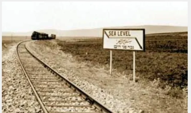
Shatta, also rendered Shutta, was a Palestinian Arab village in the Baysan subdistrict of Galilee. It stood approximately 10 kilometers northwest of Baysan, near the Baysan–'Afula–Haifa road and a branch of the railway system, at an elevation of roughly 65 meters below sea level.
Shatta differs fundamentally from most of the villages documented in the history of the 1948 Nakba because its Palestinian Arab community had already been removed before 1948. The official 1931 census still recorded 255 inhabitants living in 85 houses, but Palestinian sources state that the Arab residents were expelled by the end of 1935 following the sale of village lands by absentee landowners.
Beit HaShitta was established on land acquired from Shatta in 1935. By the official 1944/45 Village Statistics, the locality appeared as “Beit hash Shitta (Shatta)” with 590 Jewish residents and no registered Arab population.
Shatta therefore has no 1948 military operation, attacking brigade, or Nakba-era occupation date comparable to other villages of the Baysan Valley. Its Palestinian community had ceased to exist at the village site more than a decade earlier.
Key Facts about Shatta
| Field | Information |
|---|---|
| Name | Shatta |
| Alternative transliteration | Shutta |
| Subdistrict | Baysan |
| Distance from Baysan | Approximately 10 km northwest |
| Average elevation | Approximately 65 m below sea level |
| Population, 1922 | 280 – 277 Muslims and 3 Orthodox Christians |
| Population, 1931 | 255 in 85 houses |
| Arab population, 1944/45 | No Arabs registered; the statistical locality had become Beit hash Shitta (Shatta) |
| Depopulation | By the end of 1935 according to the Palestinian Encyclopedia |
| Cause of depopulation | Removal of the Arab residents following the sale and transfer of village lands by absentee owners |
| 1948 military operation | Not applicable; the Arab village had already been depopulated |
| Attacking military unit | Not applicable |
| Settlement on village land | Beit HaShitta – established in 1935 |
Location of Shatta
Shatta stood at the northwestern edge of the Baysan Valley, near the transition toward the eastern part of Marj Ibn 'Amir.
It lay approximately 10 kilometers northwest of Baysan near the Baysan–'Afula–Haifa highway and the railway, giving the village considerable geographic and economic importance.
Together with Qumya, Shatta was described as one of the western gateways to the Baysan plain, connecting the Jordan Valley with Marj Ibn 'Amir and areas farther west.
Secondary roads linked Shatta with al-Murassas, Yubla, al-Tayyiba, Qumya, and other villages in the district.
Topography and Village Layout
Shatta was situated on the eastern side of a wadi feeding the Jalud River, at the foot of the northwestern edge of the Baysan plain.
Agricultural land surrounded the village particularly to the north and east, while the built-up area extended southward toward the Baysan–'Afula road and the railway station.
The late nineteenth-century Survey of Western Palestine described Shatta as a small adobe village on slightly elevated ground surrounded by cactus hedges and ploughed fields.
Archaeological Remains
Shatta occupied a site containing older archaeological remains, including foundations, columns, rock-cut features, and an ancient cemetery.
Nineteenth-century descriptions also mentioned subterranean pits or silos used by village families for storing grain.
The precise dating of each archaeological feature requires specialist evidence and has not been inferred here.
Population of Shatta
- 1922280Official census: 277 Muslims and 3 Orthodox Christians
- 1931255Official census: 250 Muslims, 3 Christians, and 2 Jews, living in 85 houses
- 1944/450 registered ArabsThe official statistical locality was Beit hash Shitta (Shatta), with 590 Jewish residents
Correction to the 1922 Population Figure
The Palestinian Encyclopedia gives a figure of 180 inhabitants for 1922, but the official Census of Palestine records 280: 277 Muslims and 3 Orthodox Christians.
The official figure of 280 is therefore used here; the 180 figure appears to be a transcription or typographical error.
No Official “1948 Population” for Arab Shatta
There was no official Arab population figure for Shatta in 1948 because the Palestinian community had already been removed from the village site years earlier.
The 1931 total of 255 or estimates of roughly 300 inhabitants around 1935 should therefore not be relabeled as a “1948 population.”
Number of Houses
| Year | Houses | Notes |
|---|---|---|
| 1931 | 85 | Official Census of Palestine figure |
| 1945 | Not applicable to the former Arab village | By this date the statistical unit was recorded as Beit hash Shitta (Shatta) |
Economic Life before Depopulation
Most of Shatta's Palestinian inhabitants depended on agriculture.
Farming lands surrounded the village, especially to the north and east. Proximity to the main highway and railway station facilitated the movement of produce and connected residents with Baysan and Marj Ibn 'Amir.
Its position on a major east–west passage also made Shatta a stopping point for trade and movement between the Baysan Valley and the interior plains.
Water Resources
Shatta was connected to the water system of the Jalud River and 'Ayn Jalud area.
Nineteenth-century descriptions record village women obtaining water from the 'Ayn Jalud canal.
The principal Palestinian sources reviewed here do not provide a complete independent list of the village's wells and springs immediately before its depopulation.
Education and Institutions
No reliable documentation of an independent village school, founding date, or enrollment total was found in the principal sources reviewed.
Later institutions associated with the name Shatta, including the prison, should not be retroactively treated as institutions of the original Palestinian village.
Land Transfer and Depopulation
Shatta underwent a fundamental transformation during the early 1930s as large portions of its land changed hands.
The Palestinian Encyclopedia, drawing on Mustafa Murad al-Dabbagh, states that absentee landowners sold village lands and that Shatta's Arab inhabitants were expelled by the end of 1935.
Other academic documentation indicates that major land-transfer proceedings had begun by 1931 and that the status, compensation, and resettlement of resident tenants and cultivators became the subject of dispute.
The principal Palestinian account used here therefore supports the following formulation: Shatta's Arab residents were removed from the village by the end of 1935 following the transfer of village lands sold by absentee owners.
Was Shatta Occupied in 1948?
No 1948 military operation can accurately be described as the occupation of the Palestinian Arab village of Shatta because its community had already been removed approximately thirteen years earlier.
Shatta should therefore not be associated with Operation Gideon, which the Golani Brigade carried out in the Baysan Valley between 10 and 15 May 1948.
Operation Gideon affected Palestinian communities that still existed in the valley on the eve of the Nakba; Shatta's former village site had already become associated with Beit HaShitta.
Depopulation and Transformation Chronology
- 1922
First Mandate census
Shatta had 280 inhabitants: 277 Muslims and 3 Orthodox Christians
- 1931
Second Mandate census
255 inhabitants lived in 85 houses; the Palestinian community remained present
- Early 1930s
Major land transfer
Substantial village lands changed hands and disputes arose over the position of resident cultivators and tenants
- By the end of 1935
Removal of Arab residents
The Palestinian Encyclopedia states that villagers were expelled following the sale of Shatta's lands
- 1935
Establishment of Beit HaShitta
The settlement was established on land acquired from Shatta
- 1945
1944/45 Village Statistics
Beit hash Shitta (Shatta) had 590 Jewish residents and no registered Arab population
- 1948
Nakba
No separate military occupation of the former Arab village occurred because it no longer existed as an inhabited Palestinian village
Land Ownership in the 1944/45 Statistics
These figures require careful interpretation. They describe Beit hash Shitta (Shatta) after the Palestinian residents had been removed and most of the village land had changed hands. They do not represent the ownership pattern of the Arab village before the transfer process.
- Arab4 dunums<1%
- Jewish6,644 dunums99%
- Public69 dunums1%
The figures balance exactly: 4 + 6,644 + 69 = 6,717 dunums.
These numbers should not be used to claim that the historic Palestinian village had possessed only four Arab-owned dunums; they reflect the administrative situation after the land transfer and establishment of Beit HaShitta.
Land Use in 1944/45
- Arab
- Jewish
- Public
- Plantations and irrigable land88 dunums
- Cereals5,961 dunums
- Built-up land117 dunums
- Non-cultivable land551 dunums
The land-use figures balance exactly: 88 + 5,961 + 117 + 551 = 6,717 dunums.
Again, these statistics relate to the post-depopulation Beit hash Shitta (Shatta) statistical unit, not to the earlier Palestinian village economy.
Settlement Established on Shatta's Lands
| Settlement | Established | Relationship to Shatta |
|---|---|---|
| Beit HaShitta | 1935 | Established before the Nakba on land acquired from the Palestinian village of Shatta |
PalQuest's entry for nearby al-Murassas explicitly confirms that Beit HaShitta was established in 1935 on land purchased from Shatta.
Shatta Prison and Railway Station
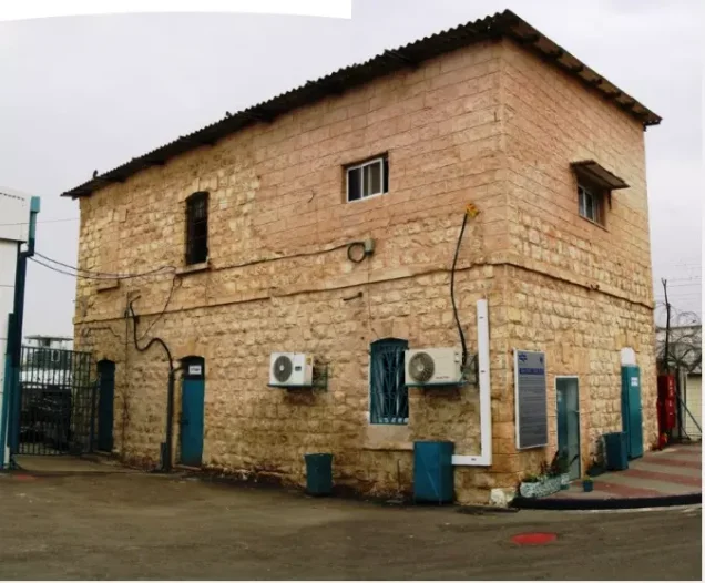
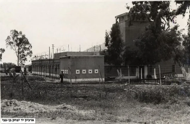
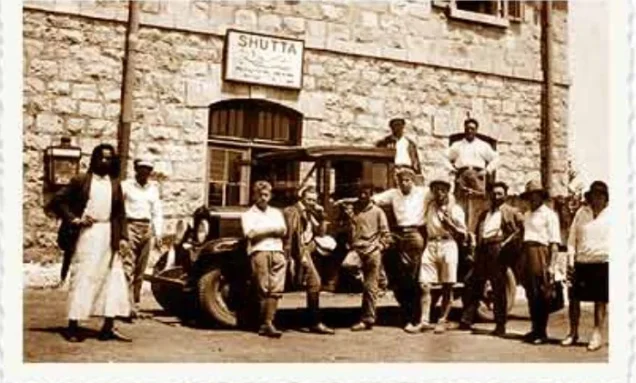
The name Shatta continued to be used in the area after the Palestinian village community had disappeared, notably for the railway station and the prison.
Palestine Remembered preserves community photographs labeled as the Shatta railway station, the railway line, and Shatta Prison in 1945.
These later facilities should be distinguished from the institutions and buildings of the original Palestinian village.
Shatta Today
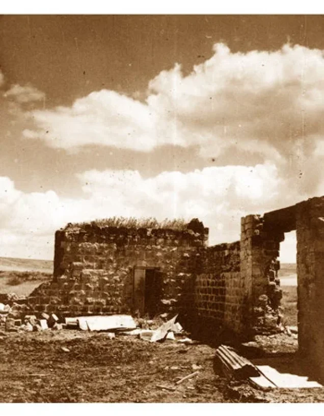
Shatta does not have a separate site description in Walid Khalidi's All That Remains comparable to villages depopulated during the 1948 war, because the Palestinian village was depopulated before the Nakba.
Palestinian sources indicate that the original village site became incorporated into the area associated with Beit HaShitta and later facilities, while the name Shatta continued through the railway station, prison, and local place names.
Palestine Remembered contains later community photographs of the site, railway station, and railway line, but these do not constitute an independent archaeological survey identifying every surviving element of the original Arab village as of 2026.
Sources
- Palestinian Encyclopedia – Shatta, drawing on Mustafa Murad al-Dabbagh
- Palestine Remembered – Shatta, Baysan District
- Palestine Remembered – Shatta in Brief
- Government of Palestine – Census of Palestine 1922, PCBS reproduction
- Government of Palestine – Census of Palestine 1931
- Village Statistics 1945 – Baysan Subdistrict population and land ownership table
- Sami Hadawi – Village Statistics 1945, land-use tables
- PalQuest – al-Murassas, documenting Beit HaShitta's establishment on land purchased from Shatta
- Institute for Palestine Studies – All That Remains, Walid Khalidi
Photo gallery
Photos from the village's people
Photos sent in by visitors and published after review.
Add a photo of this village
Log in to add photos of this village.
Other villages from Baysan
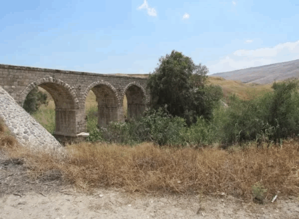
More from the archive
 Download Our Palestine App
The whole archive in the palm of your hand: depopulated villages, the Nakba, the massacres and Al-Aqsa — free, with no ads to erase the story.
Download Our Palestine App
The whole archive in the palm of your hand: depopulated villages, the Nakba, the massacres and Al-Aqsa — free, with no ads to erase the story.



Comments
No comments yet — be the first to write one.
Add your comment
Name and email are optional. Comments appear after review.