
The depopulated village of Al-Samiriyya / District of Baysan
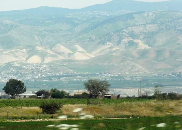
Al-Samiriyya
About the depopulated village of Al-Samiriyya
- District
- Baysan
- Date Al-Samiriyya was occupied
- 27 May 1948
- Population in 1948
- 290
- Military operation
- Operation Gideon
- Brigade that carried it out
- Golani Brigade
- Distance from the governorate centre
- 7 (km) Southeast of Baysan
- Elevation above sea level
- -135 (m)
- Cause of displacement
- Military assault by Zionist troops
- Extent of destruction
- al-Samiriyya was completely destroyed, and only house rubble left behind.
- Ethnic cleansing
- al-Samiriyya inhabitants were completely ethnically cleansed.
- Settlements built on the built-up area of Al-Samiriyya after 1948
- Bikura
Hover a dot to read the village name, or click to open its card.
Borders of the depopulated village of Al-Samiriyya
al-Samiriyya – Depopulated Palestinian Village of Baysan
Al-Samiriyya was a Palestinian village in the Baysan Subdistrict, located approximately 7 kilometers southeast of Baysan on level terrain in the Baysan Valley and about 135 meters below sea level.
The village stood east of the main road leading toward Baysan and at the junction of several routes, including the Baysan-Jericho highway. Its mosque stood at the intersection of two local roads, one leading to Qa'un and another connecting al-Samiriyya with 'Arab al-'Arida.
The village had a population of 250 in 1945, including 240 Muslims and 10 Christians, and a total land area of 3,873 dunums. Cereal agriculture formed the principal recorded land use.
Al-Samiriyya was depopulated following a military assault on 27 May 1948. Khalidi considers its capture likely connected with the late-May operations of the Golani Brigade's Fourth Battalion along the road toward Jenin, after the earlier conquest of the Baysan Valley.
Basic Information
| Field | Information |
|---|---|
| Name | al-Samiriyya |
| Arabic name | السامِرِيَّة |
| Subdistrict | Baysan |
| Location | Southeast of Baysan in the Baysan Valley |
| Distance from Baysan | Approximately 7 km |
| Average elevation | Approximately 135 m below sea level |
| Palestine Grid | 196/204 |
| Population in 1922 | 162, all Muslims |
| Population in 1931 | 181 |
| Houses in 1931 | 41 |
| Population in 1945 | 250: 240 Muslims and 10 Christians |
| Total land area | 3,873 dunums |
| Depopulation date | 27 May 1948 |
| Military context | Post-Operation Gideon Golani advance in preparation for the attack on Jenin |
| Probable military unit | Fourth Battalion, Golani Brigade – strongly supported by the operational chronology but indirectly documented for the village itself |
| Cause of depopulation | Military assault leading to evacuation of the village |
| Destruction | Most of the built environment was destroyed, with remnants of collapsed roofs surviving |
| Post-1948 settlement | Sde Terumot, established on village land in 1951 |
Name and Earlier Site History
The nineteenth-century Survey of Western Palestine recorded the locality as Khirbat al-Samiriyya and described ruined walls, traces of buildings, abundant water, and evidence that the site was ancient.
Some older literature associates the place-name with a “ruin of the Samaritans.” The principal Palestinian village sources used here do not independently establish a definitive linguistic derivation, so the etymology remains qualified rather than treated as certain.
The archaeological remains indicate earlier settlement at the site, but they do not by themselves demonstrate uninterrupted habitation into the twentieth-century Palestinian village.
Location and Geography
Al-Samiriyya stood on flat ground in the Baysan Valley, east of the principal road leading to Baysan.
Its location at a road junction included direct access to the Baysan-Jericho highway and local connections with Qa'un and 'Arab al-'Arida.
During the final years of the Mandate, new houses were constructed parallel to the main highway, extending the village's built-up area.
Population
- 1922162Official Government of Palestine census; all Muslims
- 1931181Official census; 41 occupied houses
- 1944/45250Official Mandate-period estimate; 240 Muslims and 10 Christians
- 1948290Later Palestine Remembered estimate, not an official census
- 19981,781Later estimate of refugees and descendants
Number of Houses
- 193141Official census figure
- 194865Later Palestine Remembered estimate, not an official house census
Land Ownership, 1944/45
- Palestinian2,851 dunums74%
- Transferred to Zionists0 dunums0%
- Public1,022 dunums26%
The original Government of Palestine categories were Arab, Jewish, and Public. No land was recorded in the Jewish ownership category.
The ownership figures balance exactly: 2,851 + 1,022 = 3,873 dunums.
Land Use, 1944/45
- Palestinian
- Public
- Cereals3,625 dunums
- Plantations and irrigable land11 dunums
- Built-up area21 dunums
- Non-cultivable land216 dunums
The table balances exactly: 3,625 + 11 + 21 + 216 = 3,873 dunums.
The full 3,625 dunums of cereals should not be described as Palestinian privately held land: 2,801 dunums were in the Arab category and 824 were Public. The same distinction applies to non-cultivable land, of which 18 dunums were Palestinian and 198 Public.
Economy and Agriculture
Cereal cultivation dominated the agricultural economy, covering 3,625 dunums across all ownership categories.
Only 11 dunums were recorded as plantations or irrigable land.
The village's location in the Baysan Valley and its position on important roads connected its agricultural economy with Baysan and neighboring rural communities.
Water
The Survey of Western Palestine described the older Khirbat al-Samiriyya site as well supplied with water, consistent with the broader hydrological environment of the Baysan Valley.
The principal Palestinian village sources reviewed do not provide sufficiently secure names for village-specific wells or springs, so no additional water-site names are introduced.
Education
No independently documented school, founding year, pupil enrollment, or teacher total was located for al-Samiriyya in the principal sources consulted.
No school is therefore asserted without direct evidence.
Mosque
Al-Samiriyya had a documented mosque located at the intersection of two roads, one leading toward Qa'un and another toward 'Arab al-'Arida.
The presence of ten Christians in the 1945 population does not by itself demonstrate that the village contained a church. Khalidi and PalQuest do not document one, so the automated church field found in some secondary pages is not treated as established.
Archaeological Sites
Three principal archaeological localities stood near al-Samiriyya.
Khirbat al-Humra: contained remains of a ruined mill.
Tulul al-Thawm: consisted of two adjacent or twin mounds.
Tall al-Khab: was another archaeological mound near the village.
The Survey of Western Palestine also recorded ruined walls at Khirbat al-Samiriyya itself and an ancient cemetery with rock-cut tombs nearby.
These remains are not assigned to a specific historical period unless explicitly dated by the archaeological source.
Operation Gideon and the Military Context
Operation Gideon was conducted by the Golani Brigade from 10 to 15 May 1948 and was directed at the conquest and depopulation of the Baysan Valley.
Baysan itself and several surrounding villages were captured during that operation.
Al-Samiriyya, however, was not depopulated until 27 May, approximately twelve days after Operation Gideon formally ended.
It is therefore chronologically inaccurate to describe the 27 May assault as taking place during Operation Gideon itself.
Occupation of al-Samiriyya – 27 May 1948
A military assault led to the evacuation of al-Samiriyya on 27 May 1948.
Khalidi places the event in the period following the conquest of the Baysan Valley, as Golani forces moved toward villages on the road to Jenin in preparation for an unsuccessful attack on the town.
The History of the War of Independence, cited by Khalidi, states that the Golani Brigade's Fourth Battalion captured a number of villages along the route to Jenin at the end of May.
Fourth Battalion, Golani Brigade
The Fourth Battalion of the Golani Brigade is the strongest military-unit attribution available for al-Samiriyya.
The same battalion captured Zir'in, Nuris, and al-Mazar between 28 and 30 May while preparing for the attack on Jenin, and Khalidi places al-Samiriyya's fall within the same operational sequence.
The evidence remains indirect, however: the al-Samiriyya entry does not reproduce a separate operational report explicitly stating that the Fourth Battalion entered the village itself.
Cause of Depopulation
Khalidi states that a military assault led to the evacuation of al-Samiriyya, making military attack the best-supported cause of depopulation.
The available village-specific account does not establish whether every household fled before troops entered, during the attack, or whether some inhabitants were removed after entry.
No unsupported village-level detail is therefore added.
Was al-Samiriyya Captured during Operation Gideon?
Palestine Remembered and several secondary sources label Operation Gideon as the village's military operation.
This is chronologically problematic because Operation Gideon ended on 15 May, while al-Samiriyya was depopulated on 27 May.
The more accurate description is that al-Samiriyya was depopulated in the aftermath of Operation Gideon, during the Golani Brigade's continued consolidation of southern Baysan and preparations for the attack on Jenin.
Destruction
Al-Samiriyya's built environment was extensively destroyed after the village was depopulated.
Descriptions of “complete destruction” require qualification because Khalidi's later field survey still recorded remnants of collapsed roofs.
The village was destroyed as a functioning residential community, but not every physical trace disappeared.
Ethnic Cleansing in Source Classification
Palestine Remembered classifies al-Samiriyya using the term “complete ethnic cleansing.” The phrase is retained here only as an attributed source classification.
The more specifically documented facts are the 27 May military assault, evacuation of the Palestinian population, absence of permanent collective return, and subsequent destruction of most of the village's built environment.
Occupation Chronology
| Date | Event |
|---|---|
| 10 May 1948 | Operation Gideon begins under the Golani Brigade in the Baysan Valley. |
| 12 May 1948 | Baysan falls during the offensive. |
| 15 May 1948 | Operation Gideon formally ends. |
| Second half of May 1948 | Golani forces continue expanding control over villages south of Baysan and toward the Jenin front. |
| 27 May 1948 | A military assault leads to the evacuation of al-Samiriyya. |
| 28 May 1948 | The Golani Fourth Battalion captures Zir'in while preparing for the attack on Jenin. |
| 29–30 May 1948 | The Fourth Battalion attacks Nuris and then al-Mazar; Khalidi considers al-Samiriyya's capture part of the same broader operational sequence. |
| After depopulation | Most village structures are demolished, although architectural remnants survive. |
| 1951 | Sde Terumot is established on village lands immediately north of the former village site. |
Israeli Settlements on al-Samiriyya's Lands
Sde Terumot was established in 1951 on al-Samiriyya's village lands, immediately north of the former village site.
This is the settlement directly identified by Walid Khalidi and PalQuest as standing on village land.
Some secondary Palestinian pages instead mention Bikura, but Khalidi's village-specific account does not support listing it as the settlement established on al-Samiriyya's lands. Sde Terumot is therefore the documented settlement used here.
al-Samiriyya Today
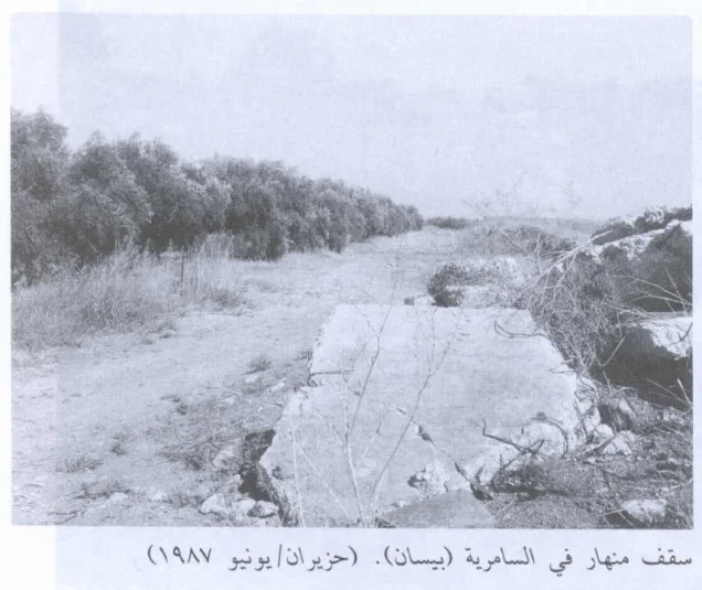
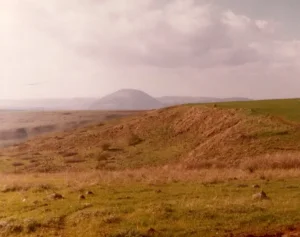
According to the field description used by Walid Khalidi before the publication of All That Remains in 1992, only remnants of collapsed house roofs remained from the Palestinian village.
These remains were located along the western edge of Sde Terumot.
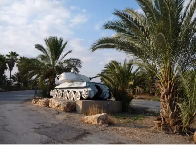
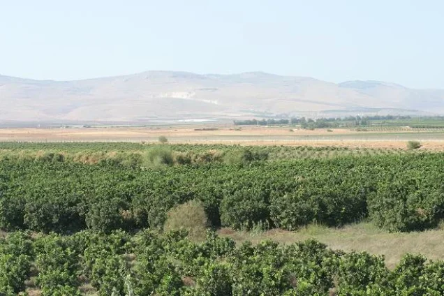
Palestine Remembered also contains the 1987 field photograph reproduced from Khalidi's project and later Palestinian community photographs, including documentation from 2007.
These later photographs are useful community documentation but do not constitute a comprehensive archaeological or cadastral survey. Khalidi's description likewise represents historical fieldwork conducted before 1992 rather than a complete direct survey of the site in 2026.
Sources
- PalQuest – Interactive Encyclopedia of the Palestine Question: al-Samiriyya
- PalQuest – Operation Gideon and its chronology
- Palestine Remembered – al-Samiriyya, Baysan Subdistrict
- Palestine Remembered – al-Samiriyya entry from Walid Khalidi's All That Remains
- Government of Palestine – Census of Palestine 1931: al-Samiriyya
- Government of Palestine – Census of Palestine 1922
- Survey of Western Palestine – Archaeological description of Khirbat al-Samiriyya
- Palestinian Villages Encyclopedia – al-Samiriyya
Photo gallery
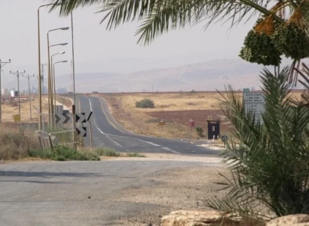
Photos from the village's people
Photos sent in by visitors and published after review.
Add a photo of this village
Log in to add photos of this village.
Other villages from Baysan
More from the archive



 Download Our Palestine App
The whole archive in the palm of your hand: depopulated villages, the Nakba, the massacres and Al-Aqsa — free, with no ads to erase the story.
Download Our Palestine App
The whole archive in the palm of your hand: depopulated villages, the Nakba, the massacres and Al-Aqsa — free, with no ads to erase the story.



Comments
No comments yet — be the first to write one.
Add your comment
Name and email are optional. Comments appear after review.