
The depopulated village of Bayt Daras / District of Gaza
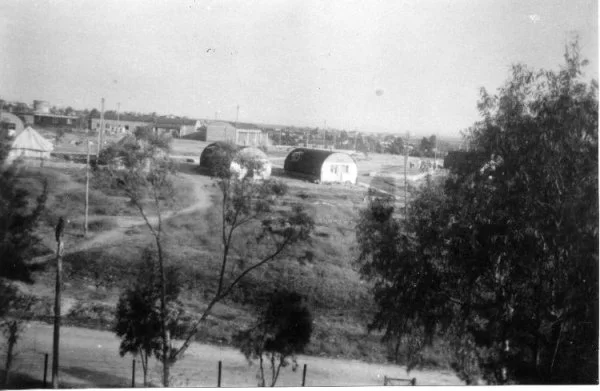
Bayt Daras
About the depopulated village of Bayt Daras
- District
- Gaza
- Date Bayt Daras was occupied
- 10 May 1948
- Population in 1948
- 3,190
- Military operation
- Operation Barak
- Brigade that carried it out
- Givati Brigade
- Who defended the village
- Sudanese Army soldiers.
- Distance from the governorate centre
- 32 km northeast of Gaza
- Elevation above sea level
- 50 m
- Cause of displacement
- Direct military assault by Zionist forces (the Givati Brigade): the inhabitants fled during the attack and their houses were blown up while 'clearing' the brigade's southern front before 15 May 1948 under Plan Dalet, according to Morris as cited by Khalidi
- Extent of destruction
- The village was completely destroyed, and only house rubble left behind.
- Ethnic cleansing
- Bayt Daras inhabitants were completely ethnically cleansed.
- Settlements built on the built-up area of Bayt Daras after 1948
- Azriqam, Emunim and Giv'ati (1950); the Zemorot farm (1950s) at Khirbat 'Awda, on village lands
Hover a dot to read the village name, or click to open its card.
Borders of the depopulated village of Bayt Daras
Bayt Daras – A Depopulated Palestinian Village in the Gaza Subdistrict
Subdistrict: Gaza
- Subdistrict
- Gaza
- Distance from district center
- 32 km northeast of Gaza
- Average Elevation
- 50 m above sea level
- Population in 1931
- 1,804
- Number of Houses in 1931
- 401
- Population in 1944/1945
- 2,750
- Estimated Population in 1948
- About 3,190 – a later demographic estimate, not an official census
- Total Land Area in 1945
- 16,357 dunams
- Attack and Depopulation
- Zionist forces first attacked the village with indiscriminate mortar bombardment on 27–28 March 1948, killing nine villagers, all noncombatants. The Givati Brigade then shelled it with mortars and occupied it in a ground assault on 10 May 1948, at the beginning of Operation Barak, the inhabitants fleeing during the attack and their houses being blown up, according to Morris as cited by Khalidi; Egyptian accounts, however, state that it was not occupied until shortly after the first truce began on 11 June 1948.
- Final Israeli Control
- Sources differ: 10 May 1948, at the beginning of Operation Barak, according to Morris as cited by Khalidi; or shortly after the first truce began on 11 June 1948, according to Egyptian accounts, including the memoirs of Gamal Abdel Nasser. A Sudanese and Egyptian attempt to recapture the village after the end of the first truce in July 1948 failed
- Military Operation
- Operation Barak, according to Morris's account dating the occupation of the village to 10 May 1948; PalQuest lists Bayt Daras among the villages affected by the operation
- Military Unit
- Givati Brigade, according to Morris as cited by Khalidi
- Cause of Depopulation
- Direct military assault by Zionist forces (the Givati Brigade): the inhabitants fled during the attack and their houses were blown up while 'clearing' the brigade's southern front before 15 May 1948 under Plan Dalet, according to Morris as cited by Khalidi
- Settlements Documented on Village Lands
- Azriqam, Emunim and Giv'ati, established in 1950 on village lands; and the Zemorot farm, built later in the 1950s at Khirbat 'Awda, also on village land
Distance from Gaza: approximately 32 km northeast.
Elevation: approximately 50 metres above sea level.
Population in 1945: 2,750 according to the Government of Palestine statistics.
Estimated population in 1948: approximately 3,190, according to Palestine Remembered.
Date of occupation and depopulation: disputed. Walid Khalidi's account, reproduced by PalQuest and citing Benny Morris, dates the Giv'ati Brigade's occupation of the village to 10 May 1948 at the beginning of Operation Barak. Other sources give different dates, as explained below.
Attacking unit: Giv'ati Brigade.
Military operation: Operation Barak, according to the account dating the occupation to 10 May 1948.
Settlements established on village lands before 1948: none recorded in the reviewed core sources.
Settlements established after 1948: Azriqam, Emunim, and Giv'ati in 1950; a farm named Zemorot was subsequently established during the 1950s at Khirbat 'Awda on village land.
Location of Bayt Daras
Bayt Daras was a Palestinian village in the Gaza Subdistrict, located approximately 32 km northeast of Gaza city and about 50 metres above sea level.
The village occupied generally flat terrain that gradually rose toward the west and southwest to form a hill. A network of dirt roads connected Bayt Daras with neighbouring villages and towns, particularly Isdud and Julis, helping make it an important rural centre.
Nearby localities included Isdud, al-Batani al-Gharbi, Julis, 'Abdis, and al-Sawafir al-Shamaliyya, as well as other villages of the southern Palestinian coastal plain.
Historical Background
Historical sources indicate that the Crusaders constructed a fortress on the hill overlooking Bayt Daras. During the Mamluk period, the village became one of the postal stations on the route between Gaza and Damascus, and a khan was established there for travellers.
In 1596, Bayt Daras was a village in the nahiya of Gaza within the liwa' of Gaza, with an estimated population of 319. Its inhabitants paid taxes on wheat and barley as well as goats, beehives, and vineyards.
Architecture and Village Development
By the late nineteenth century, Bayt Daras was surrounded by gardens and olive groves, with a pond situated to its north. Most village houses were constructed of adobe brick.
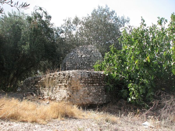
In the modern period, the built-up area expanded southwestward along the road leading to Julis. Bayt Daras also contained an archaeological site with stone foundations and vaulted rooms.
Public Facilities and Education
Bayt Daras had two mosques and an elementary school established in 1921. By the mid-1940s, the school had an enrollment of 234 pupils.
The village's location and road connections with surrounding communities contributed to its role as a rural centre in the area.
Economic Life in Bayt Daras
Agriculture formed the backbone of the village economy. The generally level terrain and availability of water made most of Bayt Daras's land cultivable. The inhabitants relied primarily on rain-fed agriculture, growing cereals, vegetables, and fruit, with citrus among the most important crops.
In 1944/45, 832 dunums were devoted to citrus and bananas. A total of 14,438 dunums were planted with cereals, consisting of 14,436 dunums of Arab-owned land and 2 dunums of public land. Another 472 dunums were irrigated or used for plantations.
The villagers also raised poultry and livestock, while some inhabitants worked in crafts, industry, and commerce. Local accounts also record the presence of a mechanized grain mill.
The total land area of Bayt Daras recorded in the 1945 Village Statistics was 16,357 dunums.
Land Ownership in Bayt Daras in 1945
Land ownership in Bayt Daras, 1944/45
- Palestinian / Arab15,896 dunums97%
- Jewish0 dunums0%
- Public461 dunums3%
The Government of Palestine's 1945 statistics recorded no Jewish-owned land in Bayt Daras.
Land Use in Bayt Daras in 1945
Land use in Bayt Daras, 1944/45
- Arab / Palestinian (dunums)
- Public (dunums)
- Citrus and bananas832 dunums
- Plantations and irrigable land472 dunums
- Cereals14,438 dunums
- Built-up land88 dunums
- Cultivable land15,742 dunums
- Non-cultivable land527 dunums
Population of Bayt Daras
Population figures for Bayt Daras
- 1596319Historical estimate based on Ottoman records
- 19221,670Official Mandate census
- 19311,804Official Mandate census
- 19452,750Government of Palestine statistics
- 19483,190Later estimate reported by Palestine Remembered
- Estimated refugees in 199819,590Estimate reported by Palestine Remembered
Number of Houses in Bayt Daras
Number of houses in Bayt Daras
- 1931401Official census figure
- 1948709Estimate reported by Palestine Remembered
Attacks on Bayt Daras before its Occupation
Bayt Daras was subjected to several attacks during the first months of 1948. According to Walid Khalidi's account reproduced by PalQuest, the commander of Arab fighters in the area, Tariq al-Ifriqi, described the attack of 27–28 March 1948 as involving mortar bombardment of the village.
According to the same account, nine noncombatant villagers were killed, while fires damaged crops and livestock. A further clash occurred around Bayt Daras on 29 March.
Occupation and Depopulation of Bayt Daras during the Nakba
The reviewed sources differ substantially over the exact date on which Bayt Daras was occupied, and this disagreement should be preserved rather than reduced to a single uncontested date.
Walid Khalidi, as reproduced by PalQuest, cites Israeli historian Benny Morris as stating that the Giv'ati Brigade bombarded Bayt Daras before launching a ground assault that resulted in its occupation on 10 May 1948, at the beginning of Operation Barak. The account attributed to Morris states that the villagers left during the assault and that houses were subsequently blown up as part of the implementation of Plan Dalet before 15 May.
Palestine Remembered's statistical summary instead lists 11 May 1948 as the occupation date.
A Palestinian source provides another date: Aref al-Aref's al-Nakba al-Filastiniyya wa-l-Firdaws al-Mafqud includes a section entitled “The Fall of Bayt Daras – 5 June 1948,” introducing an additional chronology.
Khalidi's account also reproduces a different Egyptian version, according to which Israeli forces did not consolidate their occupation of Bayt Daras until after the first truce began on 11 June 1948. Gamal Abdel Nasser, then a staff officer in the Egyptian Sixth Battalion, likewise recalled that Israeli forces used the truce to strengthen their positions and occupy Bayt Daras.
After the first truce ended on 9 July, Arab forces planned to recapture the village. A Sudanese force succeeded in entering Bayt Daras during a night attack and was supposed to fire a green signal to indicate success so that the Egyptian Seventh Battalion could advance. A red signal was mistakenly fired instead, causing Egyptian artillery to bombard the area and forcing the Sudanese force to withdraw from the positions it had taken.
Because of these conflicting accounts and the repeated fighting around the village, this article uses 10 May 1948 as the occupation date given in the Khalidi/PalQuest account citing Morris, while explicitly noting that the chronology of final Israeli control is disputed by Palestinian and Egyptian accounts reproduced in the consulted sources.
Occupation and Depopulation Chronology
- 27–28 March 1948
First attack on the village
The commander of Arab militia forces in the area, Tariq al-Ifriqi, described an attack by Zionist forces consisting of indiscriminate mortar bombardment, which left nine villagers dead, all noncombatants, and caused a fire that burned crops and livestock. Earlier in the day, a skirmish had broken out between Arab militiamen and a Jewish convoy in the area.
- 29 March 1948
Second attack
Another brief battle took place around the village following a new Zionist attack, as cited by Khalidi.
- 9 May 1948
Beginning of the military operation
The Haganah launched Operation Barak, mainly with the Givati Brigade and with the participation of the Palmach's Negev Brigade, to 'clear' the southern and western ends of its zone of control before 15 May; PalQuest lists Bayt Daras among the villages affected by the operation, and its chronology names it among the villages occupied by the Haganah in the first stage (9–14 May).
- 10 May 1948
Shelling of the village and ground assault
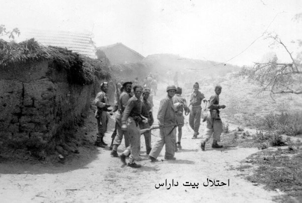
The Givati Brigade bombarded the village with mortar fire and then launched a ground assault on it at the beginning of Operation Barak, the inhabitants fleeing during the attack, according to Israeli historian Benny Morris as cited by Khalidi.
- 10 May 1948, or shortly after 11 June 1948 (sources differ)
Final occupation
Morris dates the Givati Brigade's occupation of the village to 10 May 1948, whereas Egyptian accounts state that Israeli forces did not occupy it until shortly after the first truce began on 11 June. Gamal Abdel Nasser, then staff officer of the Egyptian Sixth Battalion, recalled that Israeli forces used the truce as 'an opportunity for consolidation' in the area, occupying Bayt Daras.
- Before 15 May 1948 (according to Morris)
Destruction of the village
The houses of the village were blown up in the context of 'clearing' the Givati Brigade's southern front before 15 May, in accordance with Plan Dalet, according to Morris as cited by Khalidi.
- After 9 July 1948
Egyptian and Sudanese attempt to recapture the village
After the first truce ended, a Sudanese force occupied the village in a night attack, but the soldier charged with firing the green success signal fired the red one by mistake, so the Egyptian artillery began bombarding the area and forced the Sudanese from the positions they had taken in the village, according to Gamal Abdel Nasser as cited by Khalidi.
- 1950
Settlement on village lands
Three settlements were established on village lands: Azriqam, Emunim and Giv'ati.
- 1950s
Settlement on village lands
A farm called Zemorot was built on Khirbat 'Awda, which was also on village land.
Operation Barak and the Giv'ati Brigade
Operation Barak began on 9 May 1948 and continued until 13 May. Its objective was to seize villages and strategic positions in the southern area before the end of the British Mandate.
PalQuest records the Giv'ati and Negev brigades as participating in Operation Barak and lists Bayt Daras among the villages affected. The direct assault associated with the 10 May occupation account, however, is attributed specifically to the Giv'ati Brigade.
- Military operation: Operation Barak, according to the 10 May account.
- Unit directly associated with the assault on Bayt Daras: Giv'ati Brigade.
- Operation Barak began: 9 May 1948.
- Operation Barak ended: 13 May 1948.
- Exact date of Bayt Daras's occupation: disputed among the sources.
Fate of the Villagers and Village Buildings
The Palestinian inhabitants of Bayt Daras were displaced during the Nakba and the occupation of Palestine in 1948. Many moved southward through neighbouring towns and villages, and large numbers eventually became refugees in the Gaza Strip.
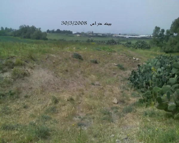
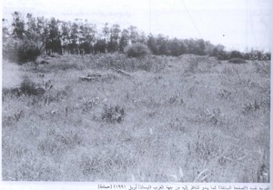
The village's buildings were demolished or blown up. According to the field description documented by Walid Khalidi, only the foundation of one house and scattered rubble remained from the built-up village.
Israeli Settlements on Bayt Daras Lands
The reviewed core sources do not record a Zionist settlement established on Bayt Daras lands before the Nakba.
In 1950, three Israeli settlements were established on village lands: Azriqam, Emunim, and Giv'ati.
Later in the 1950s, a farm called Zemorot was established at Khirbat 'Awda, which was also located on Bayt Daras land. Zemorot should therefore not be confused with the settlement of Giv'ati; the sources identify them as separate sites.
Bayt Daras Today
The reviewed core sources do not provide a recent textual field survey of Bayt Daras as of 2026. Walid Khalidi's documented field description states that the only surviving remains of village buildings consisted of the foundation of one house and scattered rubble.
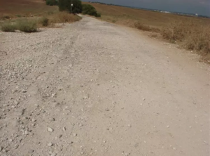
Wild vegetation, including cactuses and eucalyptus trees, covered parts of the site, while at least one of the old village streets remained clearly recognizable. The surrounding lands were cultivated by residents of the nearby settlements.
This description reflects the condition recorded during the field research used for All That Remains and should not be presented as a verified on-site description of Bayt Daras in 2026 without a newer documented field survey.
Sources
- PalQuestPalQuest – Interactive Encyclopedia of the Palestine Question: Bayt Daras
- PalQuestPalQuest – Operation Barak
- Palestine RememberedPalestine Remembered – Bayt Daras, Gaza District
- Palestine RememberedPalestine Remembered – Bayt Daras entry from Walid Khalidi's All That Remains
- Palestine RememberedAref al-Aref – “The Fall of Bayt Daras – 5 June 1948,” al-Nakba al-Filastiniyya wa-l-Firdaws al-Mafqud
- Institute for Palestine StudiesInstitute for Palestine Studies – Walid Khalidi, All That Remains
- Palestine RememberedGovernment of Palestine – Village Statistics of 1945
Photo gallery
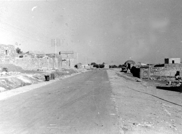
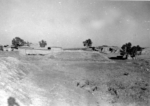

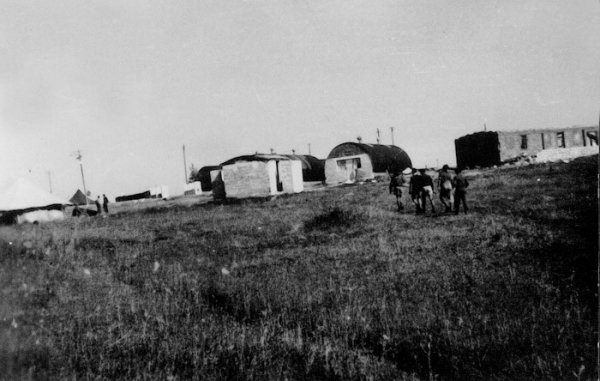

Photos from the village's people
Photos sent in by visitors and published after review.
Add a photo of this village
Log in to add photos of this village.
Other villages from Gaza

More from the archive

 Download Our Palestine App
The whole archive in the palm of your hand: depopulated villages, the Nakba, the massacres and Al-Aqsa — free, with no ads to erase the story.
Download Our Palestine App
The whole archive in the palm of your hand: depopulated villages, the Nakba, the massacres and Al-Aqsa — free, with no ads to erase the story.



Comments
No comments yet — be the first to write one.
Add your comment
Name and email are optional. Comments appear after review.