
The depopulated village of Dimra / District of Gaza
About the depopulated village of Dimra
- District
- Gaza
- Date Dimra was occupied
- 28 October 1948
- Population in 1948
- 603
- Distance from the governorate centre
- 11 (km) Northeast of Jaffa
- Elevation above sea level
- 50 m
- Cause of displacement
- Fear of Jewish attack, or of being caught in the fighting
- Extent of destruction
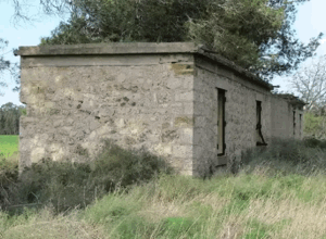
- al-Sawalima was completely obliterated with the exception of one school room still standing
- Ethnic cleansing
- al-Sawalima inhabitants were intimidated into fleeing by the Haganah and IZL (ETZEL) on March 30th 1948, especially after the IZL's kidnapping of al-Shaykh Muwannis notables.
Hover a dot to read the village name, or click to open its card.
Borders of the depopulated village of Dimra
Dimra – Gaza Subdistrict
Dimra was a depopulated Palestinian village in the Gaza subdistrict, situated on the southern coastal plain approximately 12 km northeast of Gaza at an average elevation of about 50 meters above sea level. The village stood on distinctive reddish-brown soil, while its agricultural lands were periodically threatened by the eastward movement of coastal sand dunes.
The official 1931 Census of Palestine recorded 324 inhabitants, and the 1944/45 statistics recorded 520. Dimra's registered lands totaled 8,492 dunums.
Military violence reached Dimra as early as February 1948, but the village remained outside final Israeli control through much of the Nakba. On 31 May, Palestinians expelled from neighboring Huj were sent to Dimra. The village's final occupation occurred only in the closing stages of Operation Yoav or immediately afterward. Walid Khalidi does not establish an exact date, suggesting either 28 October 1948, following the Egyptian withdrawal along the coastal road, or 4–5 November after the occupation of al-Majdal.
Location of Dimra
Dimra stood on the southern coastal plain on soil characterized by its reddish-brown color.
A short secondary road linked it to the main coastal highway, while other local roads connected it with neighboring villages. The coastal railway passed a short distance west of the village.
The Palestinian Encyclopedia places Dimra approximately 5 km northeast of Bayt Hanun, within an agricultural zone drained toward Wadi al-Hasi.
Neighboring Villages and Lands
Palestine Remembered identifies Najd, Simsim, Dayr Sunayd, Bayt Lahiya, and Bayt Hanun among the lands immediately surrounding Dimra.
Its village map shows the following wider geographical setting:
| Direction | Village / Area |
|---|---|
| Northwest | Dayr Sunayd |
| North | Bayt Jirja |
| Northeast | Simsim |
| East | Najd |
| Southeast | Huj |
| South | Bayt Hanun |
| Southwest | Bayt Lahiya |
These geographical relationships should be distinguished from exact cadastral boundaries, for which original Mandate land maps remain the strongest evidence.
Name and Earlier History
Archaeological and historical evidence indicates that the Dimra site had a long history of occupation.
Khalidi states that remains suggest settlement at least by the Crusader period.
The fifteenth-century writer al-Qalqashandi recorded Dimra as a dwelling place of Bani Jabir, an Arab tribe.
In 1838, American traveler Edward Robinson passed the village and described it as lying near a bend in a wadi.
Built Environment
The center of Dimra developed around the intersection of two principal roads.
During the British Mandate, the village expanded eastward and southward along roads leading toward neighboring communities.
The official 1944/45 statistics recorded 18 dunums of built-up land.
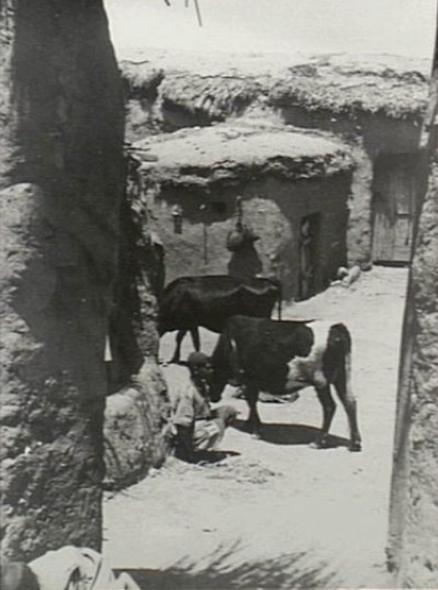
Earlier descriptions indicate that much of the village housing was constructed of adobe, a common building material in the southern coastal plain.
Population of Dimra
- 1922251Official Census of Palestine; all inhabitants were Muslims
- 1931324Official Census of Palestine; all inhabitants were Muslims
- 1944/45520Official Government of Palestine statistics; all were recorded as Arabs
- 1948603Later Palestine Remembered estimate; not an official census
- 19983,704 refugees and descendantsLater demographic estimate published by Palestine Remembered
The online Palestinian Encyclopedia gives 351 inhabitants for 1922, but this conflicts with the official 1922 figure of 251 reproduced in other Palestinian references. The official figure of 251 is therefore used here.
Number of Houses
- 1931100Official Census of Palestine
- 1948186Later Palestine Remembered estimate; not an official census figure
Land Ownership in 1944/45
Dimra's registered lands totaled 8,492 dunums.
Using Palestine Remembered's simplified terminology:
- Palestinian8,257 dunums97%
- Transferred to Zionists0 dunums0%
- Communal/Public235 dunums3%
The official categories record 8,257 Arab dunums and 235 Public dunums, with no land registered in the Jewish ownership category.
Land Use in 1944/45
- Arab
- Public
- Citrus and bananas96 dunums
- Plantations and irrigable land388 dunums
- Cereals7,412 dunums
- Built-up land18 dunums
- Non-cultivable land578 dunums
The land-use figures balance exactly with the official ownership totals.
Palestine Remembered's simplified table places 578 dunums of non-arable land in one Palestinian column. The official breakdown shows that 343 dunums were Arab and 235 were Public.
Economic Life in Dimra
Most villagers depended on agriculture.
Cereal cultivation dominated land use, occupying 7,412 dunums in 1944/45. Another 388 dunums were irrigated or used for orchards, and 96 dunums were planted with citrus and bananas.
The agricultural lands were periodically threatened by the movement of coastal sands from the west.
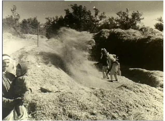
Palestinian photographs from the early 1940s also document village threshing floors, consistent with the central importance of grain cultivation.
Water Sources
Agricultural wells were located outside Dimra, especially in the bottoms of gullies draining toward Wadi al-Hasi.
These wells were generally between 20 and 25 meters deep.
Winter flooding in Wadi al-Hasi helped recharge underground water resources, and the wells supplied irrigation water for orchards and crops.
Education
An elementary school opened in Dimra in 1946.
Its initial enrollment was 47 pupils.
The school's establishment only two years before the Nakba reflects the expansion of formal education in the village during the final years of the British Mandate.
Religious Life
The inhabitants were Muslims according to the Mandate-era censuses and statistics.
Khalidi's core village entry does not provide securely documented information on a named mosque or shrine in Dimra, so none has been added without supporting evidence.
Archaeological Remains
Dimra occupied an archaeological site containing foundations of earlier buildings, a cemetery, columns, and severed column capitals.
Two additional archaeological sites containing varied remains were located on village land.
The Palestinian Encyclopedia also records carved stones, cisterns, and rock-cut tombs, indicating multiple periods of human occupation in the area.
The 16 February 1948 Incident
Military tension reached Dimra early in the Nakba.
On 16 February 1948, the Jaffa newspaper Filastin reported that a Jewish convoy passed through Dimra and opened fire on villagers.
The report stated that the villagers returned fire.
The Arrival of the People of Huj
On 31 May 1948, inhabitants expelled from neighboring Huj were sent to Dimra.
Khalidi relays that they were repeatedly prevented from returning to Huj, indicating that they remained in Dimra during this period.
This is significant because it demonstrates that Dimra had not yet been finally occupied or depopulated by the end of May 1948.
Operation Yoav
Operation Yoav began on 15 October 1948 and formally ended on 4 November.
Its principal objective was to break the Egyptian lines separating Israeli forces in the Negev from Israeli-held territory farther north and to bring as much of southern Palestine as possible under Israeli control.
The Giv'ati, Yiftach, Negev, and Har'el brigades participated at the broader operational level, while Egyptian forces were the principal Arab military formation on the southern front.
The Israeli occupation forces used intensive aerial bombardment, artillery, and ground assaults during the offensive, which resulted in the capture of most Gaza-district villages outside the shrinking Egyptian-held coastal zone.
Occupation and Depopulation of Dimra
The exact occupation date of Dimra cannot be established with certainty.
Palestine Remembered lists 28 October 1948 as the occupation date and associates the village with Operation Yoav.
Khalidi's detailed account is more cautious. He states that Dimra was probably occupied during the final stages of Operation Yoav and gives two possibilities:
First: 28 October 1948, following the withdrawal of Egyptian forces along the coastal road.
Second: 4–5 November 1948, following the occupation of al-Majdal.
The second possibility requires an important chronological qualification: PalQuest dates the formal end of Operation Yoav to 4 November, so an occupation on 5 November would have occurred immediately after the operation rather than within its formal dates.
The most accurate formulation is therefore that Dimra was occupied during the final stages of Operation Yoav or immediately afterward, within a likely window from 28 October to 4–5 November 1948.
Depopulation
From mid-October onward, the southern front was subjected to intensive aerial and artillery attacks, and Palestinian civilians increasingly moved southward toward the coastal strip that remained under Egyptian control.
Khalidi relays a contemporary report from 22 October describing one Palestinian village after another as deserted and civilians fleeing toward the Egyptian-held coastal zone.
The source does not establish the exact day on which the last inhabitants of Dimra left or provide a complete village-specific sequence of the departure.
It is therefore inappropriate to assume that every family left on one date or under identical circumstances.
Military Unit
Palestine Remembered identifies the Giv'ati Brigade as the attacking formation.
Operation Yoav as a whole, however, involved the Giv'ati, Yiftach, Negev, and Har'el brigades.
Khalidi's Dimra-specific entry does not independently identify one brigade as the unit that physically entered the village.
The most cautious formulation is therefore that Dimra was occupied by Israeli occupation forces during the final stages of Operation Yoav, with Palestine Remembered attributing the village's capture to the Giv'ati Brigade but without independent village-specific confirmation in Khalidi's detailed text.
Occupation Chronology
- 16 February 1948
Exchange of fire
Filastin reported that a Jewish convoy fired on villagers and that the inhabitants returned fire.
- 31 May 1948
Expellees from Huj arrive
Residents expelled from Huj were sent to Dimra, demonstrating that Dimra remained outside final Israeli control at that time.
- 15 October 1948
Beginning of Operation Yoav
Israeli occupation forces launched the major offensive against Egyptian positions in southern Palestine.
- 15–22 October 1948
Heavy bombardment and regional displacement
Air and artillery attacks intensified, while Palestinian civilians increasingly fled toward the Egyptian-held coastal strip.
- 28 October 1948
First possible occupation date
Khalidi suggests that Dimra may have been taken following the Egyptian withdrawal along the coastal road; this is the date indexed by Palestine Remembered.
- 4 November 1948
Occupation of al-Majdal
The fall of al-Majdal further weakened Egyptian control of the northern Gaza coastal area.
- 4–5 November 1948
Second possible occupation date
Khalidi allows for the possibility that Dimra was taken in the wake of al-Majdal; an occupation on 5 November would have been immediately after Operation Yoav's formal end.
- Later; exact date not established
Destruction of the village
Most of the built-up village was demolished, leaving limited traces of houses, walls, a basin, and a well.
Refugees from Dimra
Palestine Remembered estimates Dimra's population in 1948 at approximately 603. This is a later demographic estimate rather than an official Government of Palestine census figure.
The same source estimates that refugees from Dimra and their descendants numbered approximately 3,704 in 1998.
The broader Operation Yoav record indicates that large numbers of Palestinian civilians from southern Palestine fled toward Gaza and the Egyptian-held coastal zone, but the core sources do not provide a complete later distribution of every Dimra refugee family.
Israeli Settlements on Dimra Village Lands
In 1949, the Israeli settlement of Erez was established on part of the former Dimra village site.
This relationship is explicitly stated by Khalidi and PalQuest and is therefore more secure than descriptions that merely place Erez in the general vicinity.
Dimra Today
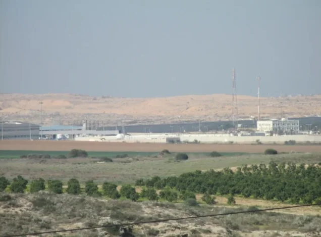
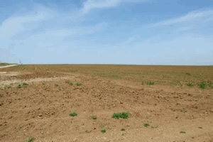
In Walid Khalidi's field description, most of the village site was fenced and used as pasture.
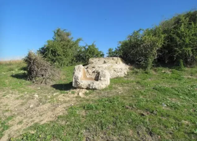
Almost nothing remained of the built-up village except a crumbling stone water basin, concrete house rubble, a ruined wall, and a well topped by an old non-operating pump.
Additional rubble lay in a wooded section of the site, while cactus formerly used as fencing, shrubs, and thorny vegetation grew on surrounding land.
This description does not constitute direct field verification of conditions in 2026. Field research for All That Remains was carried out between 1987 and 1990, before the book's publication in 1992.
Palestine Remembered contains later photographs and community documentation of the site. These sources are useful for tracing surviving remains but do not constitute a comprehensive contemporary field and cadastral survey of all former Dimra lands.
Sources
- PalQuestPalQuest – Dimra
- PalQuestPalQuest – Operation Yoav
- Palestine RememberedPalestine Remembered – Dimra, Gaza District
- Palestine RememberedPalestine Remembered – Dimra entry from Walid Khalidi's All That Remains
- Institute for Palestine StudiesInstitute for Palestine Studies – Walid Khalidi, All That Remains
- pcbs.gov.psGovernment of Palestine – Census of Palestine 1922
- pcbs.gov.psGovernment of Palestine – Census of Palestine 1931
- sabil.meVillage Statistics 1945 – Official population and land statistics
- palestinapedia.psPalestinian Encyclopedia – Dimra
- palqura.comPalestinian Villages Encyclopedia – Dimra; supplementary documentation on boundaries and education
- PalQuestPalQuest – All That Remains: Methodology and Field Research
Photo gallery



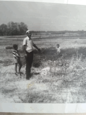
Photos from the village's people
Photos sent in by visitors and published after review.
Add a photo of this village
Log in to add photos of this village.
Other villages from Gaza
More from the archive


 Download Our Palestine App
The whole archive in the palm of your hand: depopulated villages, the Nakba, the massacres and Al-Aqsa — free, with no ads to erase the story.
Download Our Palestine App
The whole archive in the palm of your hand: depopulated villages, the Nakba, the massacres and Al-Aqsa — free, with no ads to erase the story.



Comments
No comments yet — be the first to write one.
Add your comment
Name and email are optional. Comments appear after review.