
The depopulated village of Al-Na'ima / District of Safed

Al-Na'ima
About the depopulated village of Al-Na'ima
- District
- Safed
- Date Al-Na'ima was occupied
- 14 May 1948
- Population in 1948
- 1,200
- Military operation
- Operation Yiftach
- Brigade that carried it out
- Palmach
- Distance from the governorate centre
- 26 (km) North East of Safad
- Elevation above sea level
- 75 m
- Cause of displacement
- Influence of fall of, or exoduce from, neighboring town
- Extent of destruction
- The village has been completely destroyed, and only house rubble left behind.
- Ethnic cleansing
- al-Na'ima was ethnically cleansed as a result of psychological warfare conducted on early May 1948.
- Settlements built on the land of Al-Na'ima before 1948
- Ne’ot Mordekhay , Beyt Hillel, Kefar Blum
Hover a dot to read the village name, or click to open its card.
Borders of the depopulated village of Al-Na'ima
Al-Na‘ima: A Depopulated Palestinian Village
Al-Na‘ima was a Palestinian village in the Safad District, located in the northwestern part of the al-Hula Plain. Its Palestinian inhabitants were displaced on 14 May 1948 during Operation Yiftach, which sought to occupy eastern Galilee and depopulate its Palestinian communities.
Location and Geography of Al-Na‘ima
Al-Na‘ima stood on flat land in the northwestern part of the al-Hula Plain, between the villages of al-Khalisa and al-Salihiyya. Qaytiyya was among the closest villages to it.
The village was located between the Hasbani River to the east and Wadi al-Burayghith, also known as Wadi al-Dardara, to the west. A secondary road connected it with al-Khalisa and with the main road leading to Safad and Tiberias.
Its location within the fertile plain and its proximity to water sources supported extensive agriculture, particularly irrigated orchards.
Architecture and Housing
The built-up area of al-Na‘ima covered approximately 112 dunums in 1945. Its houses stood on level ground and were surrounded by orchards and cultivated fields.
The 1931 census recorded 174 houses in the village. The number of houses shortly before the 1948 displacement has been estimated at approximately 242.
Population of Al-Na‘ima
Most of al-Na‘ima’s Palestinian inhabitants were Muslims. The village had a population of 858 in the official census of 1931.
In the 1945 statistics, the village had 1,030 Palestinian Arab inhabitants. An additional 210 Jewish residents were included within the statistical unit, bringing the recorded total to 1,240.
The population figures for 1948 and the number of refugees and their descendants in 1998 are estimates rather than official census figures.
| Year | Palestinian Arabs | Jews | Total | Status |
|---|---|---|---|---|
| 1931 | 858 | — | 858 | Official census |
| 1945 | 1,030 | 210 | 1,240 | Official statistics |
| 1948 | 985 | 210 | 1,195 | Estimate; the Arab figure is inferred from the stated total |
| Refugees and descendants in 1998 | 7,337 | — | 7,337 | Estimate |
Number of Houses
Number of houses in Al-Na‘ima
- 1931174Official census
- 1948242Estimate
Education
Al-Na‘ima had an elementary school for boys. Local accounts indicate that the school provided education up to the fourth elementary grade.
Economic Life
The village economy depended primarily on agriculture and livestock breeding. Its location in the al-Hula Plain and proximity to rivers and irrigation channels provided water for agriculture and domestic use.
Irrigated orchards represented the largest category of cultivated land. In 1944–1945, Palestinian villagers used 4,122 dunums for irrigated agriculture and orchards, while 156 dunums were allocated to cereal cultivation.
Land Ownership in 1945
Ownership of Al-Na‘ima’s land in dunums
- Palestinian Arab ownership4,450 dunums62%
- Jewish ownership2,414 dunums34%
- Public land291 dunums4%
Land Use in 1945
Use of Al-Na‘ima’s land in dunums
- Palestinian Arab
- Jewish
- Public
- Irrigated land and orchards6,319 dunums
- Cereal cultivation373 dunums
- Built-up land112 dunums
- Non-cultivable land351 dunums
Historical and Archaeological Remains
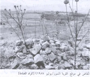
Local accounts refer to basalt stone mounds and old Muslim graves at the village site and in its surroundings. Further specialised archaeological documentation is required before these remains can be attributed to a specific historical period.
Occupation and Depopulation of Al-Na‘ima
Al-Na‘ima was depopulated during Operation Yiftach, which was carried out by Palmach forces in eastern Galilee between 15 April and 25 May 1948.
The capture of Safad was one of the operation’s principal objectives. Following the final assault on the city on 10–11 May 1948, fear spread among the inhabitants of surrounding Palestinian villages, whose morale had already been weakened by psychological warfare and mortar bombardment.
According to an Israeli military intelligence report, the Palestinian inhabitants of al-Na‘ima left their village on 14 May 1948. Zionist forces probably entered it shortly afterwards, although the available sources provide no detailed account of their entry or of the village’s immediate fate after occupation.
Israeli Settlements on the Village’s Land and in Its Vicinity
- Ne’ot Mordekhay: Established in 1946 on village land, south of the village site.
- Beyt Hillel: Established in 1940, north of the village site.
- Kefar Blum: Established in 1943, approximately two kilometres southeast of the site.
Al-Na‘ima Today
Nearly all visible traces of the village have disappeared. Apart from a few trees, the former village site is difficult to identify and has become part of the cultivated agricultural land of the al-Hula Plain.
Photo gallery


Photos from the village's people
Photos sent in by visitors and published after review.
Add a photo of this village
Log in to add photos of this village.
Other villages from Safed
More from the archive



 Download Our Palestine App
The whole archive in the palm of your hand: depopulated villages, the Nakba, the massacres and Al-Aqsa — free, with no ads to erase the story.
Download Our Palestine App
The whole archive in the palm of your hand: depopulated villages, the Nakba, the massacres and Al-Aqsa — free, with no ads to erase the story.



Comments
No comments yet — be the first to write one.
Add your comment
Name and email are optional. Comments appear after review.