
The depopulated village of Fara / District of Safed

About the depopulated village of Fara
- District
- Safed
- Date Fara was occupied
- 30 October 1948
- Population in 1948
- 370
- Military operation
- Operation Hiram
- Brigade that carried it out
- The Seventh Brigade
- Distance from the governorate centre
- 11.5 (km) North of Safad
- Elevation above sea level
- 675 m
- Cause of displacement
- Military assault by Zionist troops
- Extent of destruction
- The village has been completely destroyed with the exception of the village mosque.
- Ethnic cleansing
- The village has been mostly terrorized by the news of the massacre committed by the Sheva' (Seventh) Brigade in the nearby villages of Safsaf and Jish.
Hover a dot to read the village name, or click to open its card.
Borders of the depopulated village of Fara
Fara was a Palestinian village in the Safad Subdistrict, situated 11.5 kilometres north of Safad.
- Subdistrict
- Safed
- Distance from district center
- 11.5 km North of Safad
- Average Elevation
- 675 meters above sea level
- Population in 1931
- 229 inhabitants
- Population in 1944/1945
- 320 inhabitants
- Estimated Population in 1948
- 371 (estimate) inhabitants - a later demographic estimate, not an official census
- Attack and Depopulation
- Israeli forces occupied Fara on 30 October 1948 during the final phase of Operation Hiram. The village lay along the route taken by units of the Seventh Brigade as they advanced from Sa‘sa‘ toward al-Malikiyya near the Lebanese border.
- Final Israeli Control
- 30 October 1948
- Military Operation
- Hiram
- Military Unit
- The Seventh Brigade
- Cause of Depopulation
- Military assault by Zionist troops
The village stood on a relatively high rocky hill facing southeast and overlooking Wadi Fara. Its inhabitants were Muslims who earned their livelihoods primarily through agriculture and animal husbandry. Grain was the principal crop, while fruit trees were cultivated in orchards west and southwest of the village.
The Built Environment of Fara
Fara had a compact, roughly rectangular plan extending from northeast to southwest. Its built-up area covered 38 dunams, and the 1931 census recorded 42 inhabited houses.
Population of Fara
The official 1922 census recorded 218 inhabitants: 217 Muslims and one Christian. In 1931, the village had 229 residents, all Muslim, living in 42 houses. Its population was estimated at 320 in 1945 and 371 in 1948. A later demographic projection estimated the number of refugees from Fara and their descendants at 2,280 in 1998.
Landownership in Fara
- Palestinian Arab7,225 dunums100%
- Jewish0 dunums0%
- Public land4 dunums<1%
Land Use in Fara, 1944/45
- Palestinian Arab area (dunams)
- Plantations and irrigable land173 dunums
- Olive groves (included within cultivated land)86 dunums
- Cereals3,738 dunums
- Built-up area38 dunums
- Total cultivable land3,911 dunums
- Non-cultivable land3,276 dunums
* One dunam equals 1,000 square metres (approximately 0.247 acres). The village total also included four dunams of public land; accordingly, total non-cultivable land across all ownership categories was 3,280 dunams.
Population of Fara by Year
- 1596281 (estimated from Ottoman tax records)
- Late nineteenth centuryAbout 100
- 1922218
- 1931229
- 1945320
- 1948371 (estimate)
- Refugees and descendants, 19982,280 (estimate)
Economic Life in Fara
Agriculture formed the basis of the village economy. In 1944/45, 3,911 dunams were classified as cultivable: 173 dunams consisted of plantations and irrigable land, while 3,738 dunams were devoted to cereal crops such as wheat and barley. Olive trees occupied 86 dunams within the cultivated area. Residents also raised sheep, goats, cattle, and poultry.
The Occupation of Fara
Israeli forces occupied Fara on 30 October 1948 during the final phase of Operation Hiram. The village lay along the route taken by units of the Seventh Brigade as they advanced from Sa‘sa‘ toward al-Malikiyya near the Lebanese border. The surviving record does not establish the precise sequence of the villagers’ departure. They were probably expelled or fled as Israeli forces approached; reports of killings in nearby villages during Operation Hiram may also have contributed to their flight.
Occupation and Depopulation Chronology
- 30 October 1948
The Occupation of Fara
Israeli forces occupied Fara on 30 October 1948 during the final phase of Operation Hiram.
Fara Today
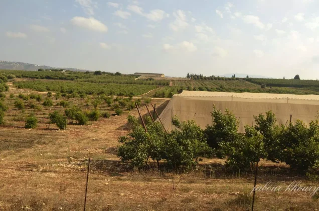
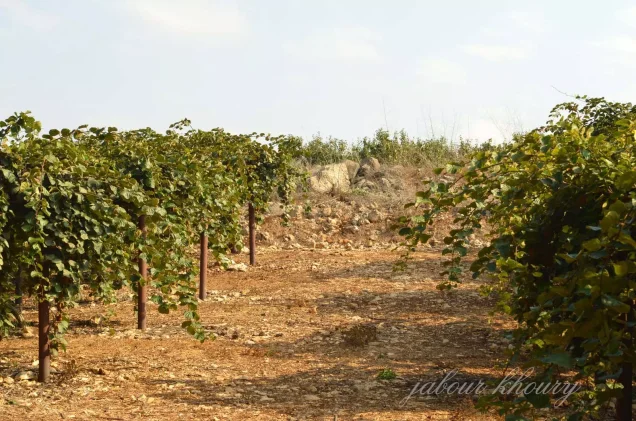
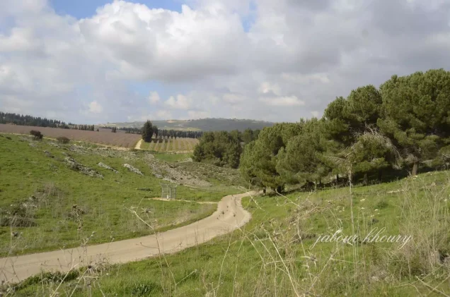
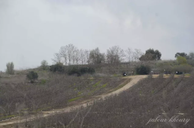
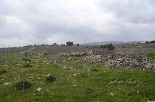
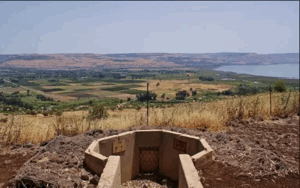
Most of the village was destroyed after its occupation. A stone structure, probably the former mosque, and several stone terraces remain. Grass, fig trees, and other wild vegetation cover parts of the site, while some surrounding land is cultivated with fruit trees.
Editorial and Factual Corrections
- The 1922 population was corrected from 217 to the official census total of 218: 217 Muslims and one Christian.
- The unsupported statement that part of Bar‘am was established on Fara’s land was removed. Standard village references list no Israeli settlement on Fara’s land; nearby Yir’on lies outside it.
- The likely military formation was identified cautiously as units of the Seventh Brigade within Operation Hiram, because the exact unit entering Fara is not conclusively documented.
- The account of displacement was qualified because available sources do not establish whether every resident fled or was directly expelled.
- The land-use figures were clarified to avoid double-counting olive groves and to distinguish Palestinian-owned non-cultivable land from the four dunams of public land.
Sources
- Institute for Palestine Studies, All That Remains: The Palestinian Villages Occupied and Depopulated by Israel in 1948, village entry for Fara.
- PalQuest, “Fara,” Interactive Encyclopedia of the Palestine Question.
- Government of Palestine, Census of Palestine, 1922 and Census of Palestine, 1931.
- Government of Palestine, Department of Statistics, Village Statistics, April 1945.
- PalestineRemembered.com, “Fara, Safad.”
Photo gallery



Photos from the village's people
Photos sent in by visitors and published after review.
Add a photo of this village
Log in to add photos of this village.
Other villages from Safed


More from the archive

 Download Our Palestine App
The whole archive in the palm of your hand: depopulated villages, the Nakba, the massacres and Al-Aqsa — free, with no ads to erase the story.
Download Our Palestine App
The whole archive in the palm of your hand: depopulated villages, the Nakba, the massacres and Al-Aqsa — free, with no ads to erase the story.



Comments
No comments yet — be the first to write one.
Add your comment
Name and email are optional. Comments appear after review.