
The depopulated village of Al-Sammu'i / District of Safed

Al-Sammu'i
About the depopulated village of Al-Sammu'i
- District
- Safed
- Date Al-Sammu'i was occupied
- 28 October 1948
- Population in 1948
- 360
- Military operation
- Operation Yiftach
- Distance from the governorate centre
- 4 (km) West of Safad
- Elevation above sea level
- 675 m
- Cause of displacement
- Influence of fall of, or exoduce from, neighboring town
- Extent of destruction
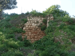
- The village has been completely destroyed, with the exception of some sections of stone walls, a well, and a canal
- Ethnic cleansing
- The village has been mostly ethnically cleansed on 12th of May 1948
- Settlements built on the built-up area of Al-Sammu'i after 1948
- Kfar Shamai, Amirim
Hover a dot to read the village name, or click to open its card.
Borders of the depopulated village of Al-Sammu'i
Al-Sammu'i – Depopulated Palestinian Village of the Safad Subdistrict
Al-Sammu'i was a Palestinian village in the Safad Subdistrict. It stood on the eastern slope of Mount Zabud, overlooking Safad to the east, approximately 4 km west of the city and at an average elevation of about 675 metres above sea level. The Safad–Acre highway passed roughly 100 metres east of the village.
Al-Sammu'i had an official population of 310 in 1944/45 and a registered land area of 15,135 dunums. Agriculture formed the principal basis of village life, especially cereals, olives, and fruit trees. The village also had springs, a mosque, and a school documented in administrative correspondence from the 1940s.
Name of Al-Sammu'i
The village is recorded in the principal sources as al-Sammu'i. Palestine Remembered offers an interpretation linking the name to “Ishtamu'” and the meaning “obedience.” This derivation is not established as a linguistic fact in Walid Khalidi's detailed entry and is therefore treated as a secondary interpretation rather than a proven etymology.
Location
Al-Sammu'i stood on the eastern slope of Mount Zabud and overlooked Safad from the west. Its average elevation was approximately 675 metres above sea level.
The village was about 4 km west of Safad and approximately 100 metres west of the Safad–Acre highway. The Palestinian Encyclopedia places it southwest of Safad in the area between Mirun and al-Farradiyya.
Village lands bordered those of 'Ayn al-Zaytun, Mirun, Bayt Jann, al-Farradiyya, and al-Zahiriyya al-Tahta. Bedouin from 'Arab al-Madariba periodically pitched their tents southeast of the village during their annual migration cycle.
Al-Sammu'i Through History
In 1596, al-Sammu'i was part of the nahiya of Jira in the Ottoman district of Safad, with an estimated population of approximately 308. Villagers paid taxes on wheat, barley, olives, goats, beehives, vineyards, and a press used for processing olives or grapes.
In 1852, Victor Guérin estimated the village population at about 100 Muslims. When the Survey of Western Palestine reached al-Sammu'i in 1877, it recorded approximately 200 inhabitants and described the village as standing on a hill.
Village Layout
Al-Sammu'i had the form of a narrow rectangle. Its houses were constructed mainly from stone, and a number appeared to incorporate reused ancient building material.
The built-up area covered approximately 27 dunums in the 1944/45 statistics.
Population of Al-Sammu'i
- 1596Approx. 308Estimate derived from Ottoman fiscal records rather than a modern census.
- 1852Approx. 100Estimate recorded by Victor Guérin.
- 1877Approx. 200Estimate recorded by the Survey of Western Palestine.
- 1922173Official British Mandate census.
- 1931213Official census; 39 occupied houses were recorded.
- 1944/45310Official Government of Palestine statistics.
- 1948360Later Palestine Remembered estimate, not an official census.
- 19982,208 refugeesLater Palestine Remembered estimate of the village refugee population and descendants.
Number of Houses
- 193139Official Government of Palestine census.
- 194865Later Palestine Remembered estimate, not an official count.
Land Ownership in Al-Sammu'i
The registered lands of al-Sammu'i totalled 15,135 dunums in the 1944/45 statistics. Using the ownership terminology employed by Palestine Remembered, the distribution was:
- Palestinian9,713 dunums64%
- Transferred to Zionists0 dunums0%
- Communal/Public5,422 dunums36%
These figures correspond to the official categories of 9,713 Arab dunums and 5,422 Public dunums, with no land recorded in the Jewish ownership category.
Land Use in 1944/45
The following table keeps Public land separate from Arab land rather than folding it into the Palestinian non-cultivable total:
- Arab
- Public
- Cereals4,204 dunums
- Plantations and Irrigable Land422 dunums
- Built-up Area27 dunums
- Non-Cultivable Land10,482 dunums
A total of 4,626 dunums was therefore classified as cultivated or cultivable, while built-up and non-cultivable land amounted to 10,509 dunums.
In the 1942/43 season, approximately 170 dunums were planted with olive trees. This is a crop-specific figure within the agricultural land and should not be added again to the village total.
Economic Life in Al-Sammu'i
Agriculture was the principal economic activity. In 1944/45, 4,204 dunums were devoted to cereals and 422 dunums to plantations and irrigable cultivation.
Olive cultivation was particularly important, covering approximately 170 dunums in 1942/43. Fruit trees were also planted on lands south of the village.
Sixteenth-century records additionally document wheat, barley, olives, vineyards, goats, beekeeping, and a press used for olives or grapes.
Water Resources
Al-Sammu'i had several freshwater springs. A spring on the northern side of the village supplied drinking water, which the inhabitants stored in three tanks they had constructed.
The Palestinian Encyclopedia identifies 'Ayn al-Tina north of the village as a principal water source and notes the abundance of springs west of al-Sammu'i.
The Mosque and the Shrine of Shaykh Muhammad al-'Ajami
The population of al-Sammu'i was predominantly Muslim and the village had a mosque.
A local shrine dedicated to Shaykh Muhammad al-'Ajami also stood in the village according to Khalidi's detailed account. An automated Palestine Remembered field gives the name as Shaykh Ahmad al-'Ajami, but this article follows the name found in the detailed historical narrative.
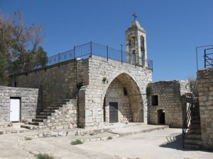
Khalidi's principal village account does not document a church, so an automated reference to one on Palestine Remembered is not treated here as established evidence of a church in the village.
Education
Administrative documents hosted by Palestine Remembered establish the existence of a school in al-Sammu'i during the 1940s. A letter from an education inspector dated 11 September 1945 concerned the need to register the village school, while another document dated 26 October 1945 listed prices for school furniture.
A further 1947 correspondence concerns the possible transfer of a teacher to al-Sammu'i. The available documents reviewed here do not provide a securely established foundation year or enrolment figure, so no unsupported numbers are added.
Archaeological Remains
Antiquities inspectors recorded a ruined columned building at al-Sammu'i together with other architectural fragments, indicating earlier occupation of the site.
Later Palestinian documentation also records wall foundations, rock-cut tombs, caves, column fragments, and cut stones. Khirbat Ra's al-Fawwar lay northwest of the village.
The available evidence does not securely date all of these remains, so they are not assigned to a specific historical period without further archaeological documentation.
Depopulation and Occupation of Al-Sammu'i
The depopulation and final occupation of al-Sammu'i occurred in two distinct stages and should not be reduced to a single date.
Walid Khalidi, discussing Israeli historian Benny Morris, states that al-Sammu'i was wholly or partially evacuated in May 1948. The initial flight probably occurred on 12 May, following the fall of Safad on 10–11 May.
The fall of Safad, combined with the Haganah's psychological-warfare campaign and mortar attacks on surrounding villages, produced a wider exodus from Palestinian communities in Upper Galilee. These events occurred during Operation Yiftach.
Al-Sammu'i, however, was not finally occupied in May. Khalidi states that the village was not taken militarily until late October 1948 during Operation Hiram.
Operation Yiftach and the Initial Exodus
Operation Yiftach ran from 15 April to 25 May 1948 and was carried out by Palmach forces with the objective of seizing eastern Galilee. The occupation of Safad on 10–11 May was followed by extensive population flight from surrounding Palestinian villages.
Palestine Remembered lists 12 May as al-Sammu'i's “occupation date” and associates the village with Operation Yiftach. Khalidi's more detailed account makes an important distinction: 12 May is best understood as the probable date of the initial exodus, not the final military occupation of the village.
Operation Hiram and the Final Occupation
In late October, al-Sammu'i lay within the remaining Upper Galilee pocket attacked by Israeli occupation forces during Operation Hiram, which ran from 28 to 31 October 1948.
Khalidi records, through the account he discusses, that al-Sammu'i offered resistance to the Israeli assault. The Israeli Minority Affairs Ministry was cited as referring to al-Sammu'i as an example of a village that resisted and was consequently depopulated through flight or a combination of partial flight and expulsion.
The village-specific source does not establish the precise day on which al-Sammu'i fell during Operation Hiram, nor does it identify the specific brigade that entered the village.
Military Units
Operation Yiftach was carried out principally by Palmach forces, with the Palmach First Battalion serving as the spearhead of the operation as a whole. This stage, however, relates mainly to the May exodus rather than al-Sammu'i's final occupation.
Operation Hiram involved units from the Sheva', Carmeli, Golani, and Oded brigades. The principal al-Sammu'i entry does not identify which of these formations actually entered the village.
The most precise formulation is therefore: initial exodus: during the context of Operation Yiftach; final occupation: during Operation Hiram; village-specific occupying unit: not independently established in the principal source.
Occupation Chronology
- 15 April 1948
Beginning of Operation Yiftach
Palmach forces began Operation Yiftach to seize eastern Galilee.
- 10–11 May 1948
Fall of Safad
Safad was occupied, producing widespread fear and population flight in surrounding Palestinian villages.
- Probably 12 May 1948
Initial exodus from al-Sammu'i
Khalidi considers it likely that the village was wholly or partially evacuated after the fall of Safad. This was not the final military occupation of al-Sammu'i.
- May–October 1948
Village remained outside final occupation
The available account states that al-Sammu'i was not militarily occupied in May despite the partial or complete population flight.
- 28 October 1948
Beginning of Operation Hiram
Israeli occupation forces launched their major offensive against the remaining Upper Galilee pocket.
- 28–31 October 1948
Final occupation and resistance
Al-Sammu'i fell during Operation Hiram. The village reportedly offered resistance, and final depopulation occurred through flight or a combination of flight and expulsion.
Israeli Settlements on Al-Sammu'i Village Lands
Kefar Shammay was established in 1949 on al-Sammu'i village land, immediately east of the former village site.
Amirim was established in 1950 on al-Sammu'i land farther south of the village site.
The Palestinian Encyclopedia gives 1961 as the establishment date of Kefar Shammay, but Khalidi and PalQuest date it to 1949. This article follows the 1949 date given in the principal village reference while noting the discrepancy.
Al-Sammu'i Today
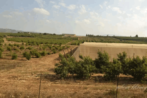
In the field description published by Walid Khalidi in All That Remains, the village site was deserted. Only sections of stone walls, a well, and a canal remained from the former built environment.
A number of fig and olive trees grew across the site, while most of the surrounding land was being used by Israeli farmers for grazing.
Palestine Remembered also contains later community documentation of the ruins, including material dated February 2005. Such material can document the survival of features at that time, but it does not constitute a comprehensive field survey of the site in 2026.
Khalidi's own description derives from fieldwork conducted before the publication of All That Remains in 1992 and likewise should not be represented as direct current verification.
Sources
- PalQuest – Al-Sammu'i
- PalQuest – Operation Yiftach
- PalQuest – Operation Hiram
- Palestine Remembered – Al-Sammu'i, Safad
- Palestine Remembered – Al-Sammu'i entry from Walid Khalidi's All That Remains
- Palestine Remembered – Administrative document on registering Al-Sammu'i School, 11 September 1945
- Palestinian Encyclopedia – Al-Sammu'i
- Institute for Palestine Studies – Walid Khalidi, All That Remains
- Government of Palestine – Village Statistics 1944/45, digital reference
Photo gallery


Photos from the village's people
Photos sent in by visitors and published after review.
Add a photo of this village
Log in to add photos of this village.
Other villages from Safed

More from the archive



 Download Our Palestine App
The whole archive in the palm of your hand: depopulated villages, the Nakba, the massacres and Al-Aqsa — free, with no ads to erase the story.
Download Our Palestine App
The whole archive in the palm of your hand: depopulated villages, the Nakba, the massacres and Al-Aqsa — free, with no ads to erase the story.



Comments
No comments yet — be the first to write one.
Add your comment
Name and email are optional. Comments appear after review.